By the time you read this post, this will all seem like distant past.
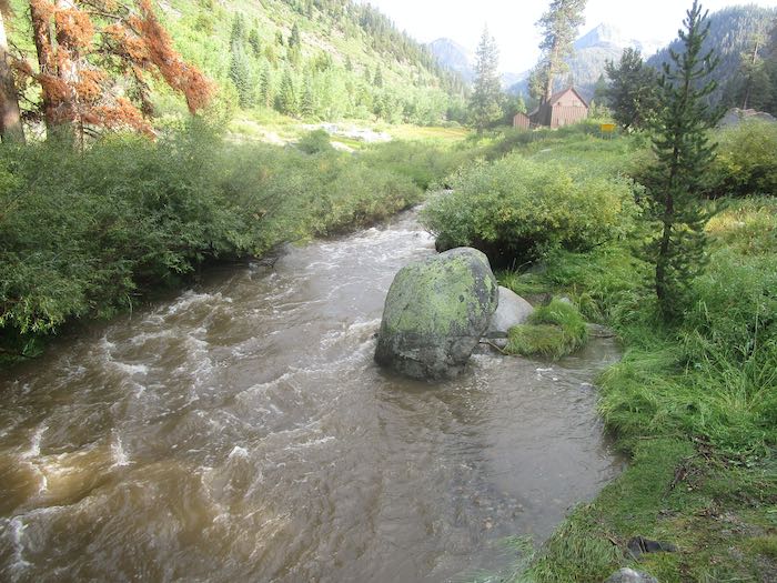
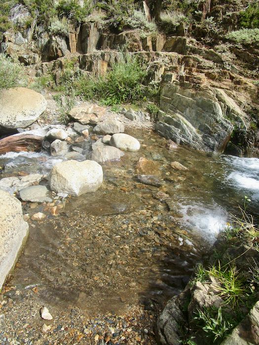
These photos are from the evening of K and my exciting Mineral King hike. I was pretty beat, but stumbled down to the bridge to see the muddy raging stream and to look up at Farewell Gap, with its sprinklings of hail from the day’s storm.
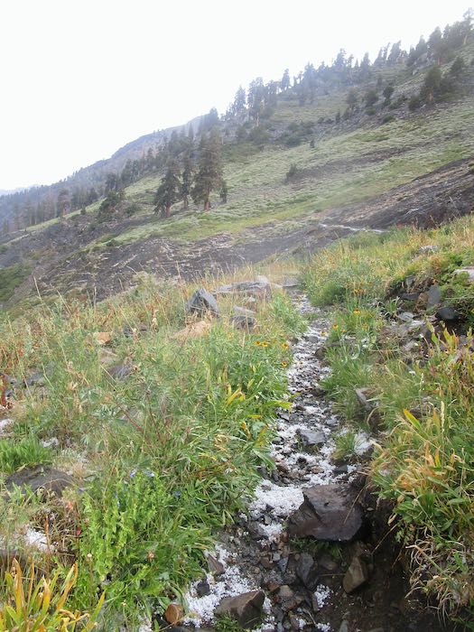
There was still some hail left the next morning, but the stream had subsided and was clear. (No water photos, so you’ll just have to believe me.)
On the way home, there was one of those alert messages on the radio, saying that there were severe thundershowers in Mineral King (along with a number of other places nearby.) The sky was ominous back toward Mineral King.
Even though it was in the 100s at home, I was quite happy to settle into the air conditioned house. I love air conditioning.
Tomorrow we will look at the Learned List for August.
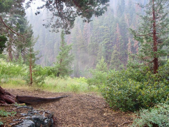
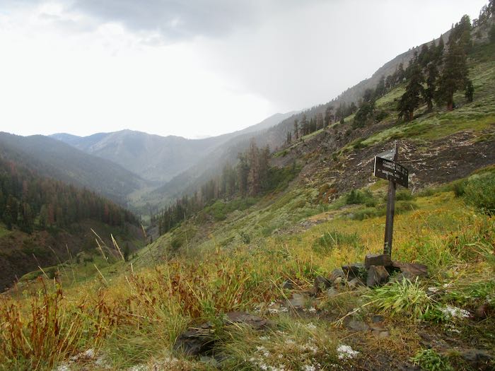
Just a few days ago I told you about Trail Guy hiking to the Franklin/Farewell junction and lamented my lack of hiking this summer. Last Sunday a friend and I decided to go to the Franklin/Farewell junction, because I really wanted to see it at least one more time in my life. (yes, being a bit dramatic here). I figured I could turn around if my feet started objecting too loudly (or perhaps wear ear plugs?)
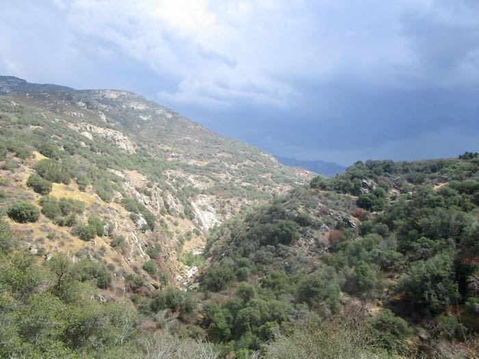
The previous day had a terrific storm, but looking toward Farewell seemed clear, so K and I took off, (along with Trail Guy for the first mile or so.)
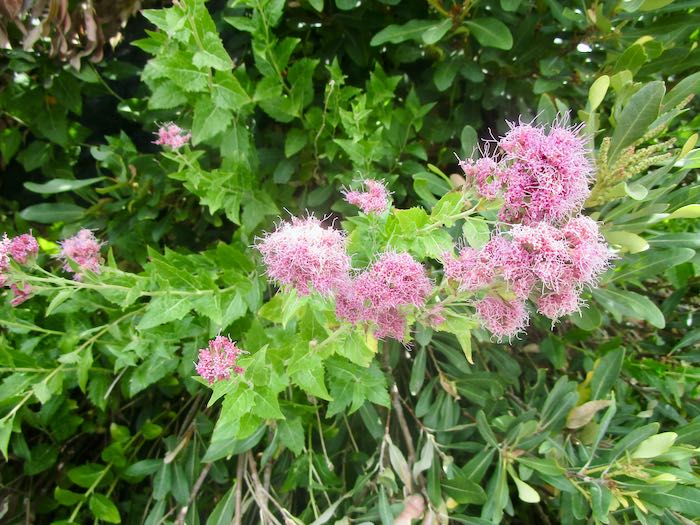
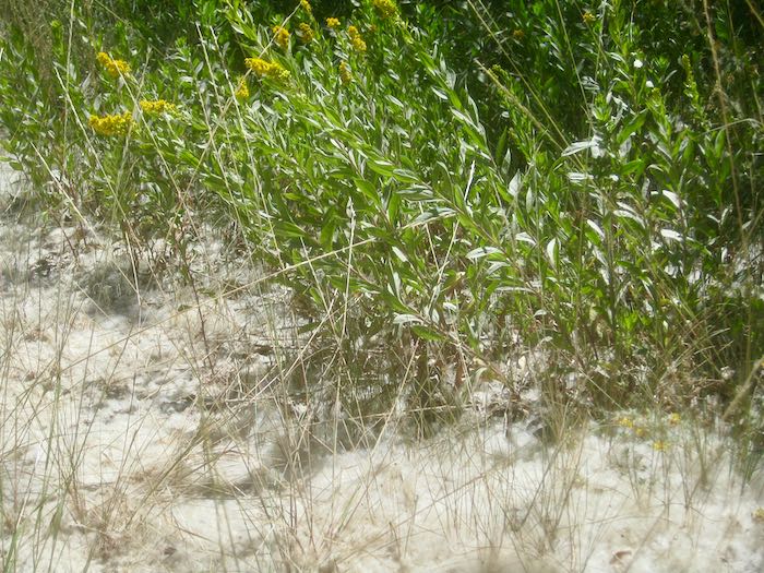
We saw Western Eupatorium, a flowering shrub I’ve only seen up near Franklin Lake.
We crossed Franklin Creek without trouble; K hopped the rocks and I simply walked through the water, which was shallow and clear, making it easy to see good foot placement.
Shortly after crossing, we felt a few raindrops. No problem: we each had a parka AND a poncho.
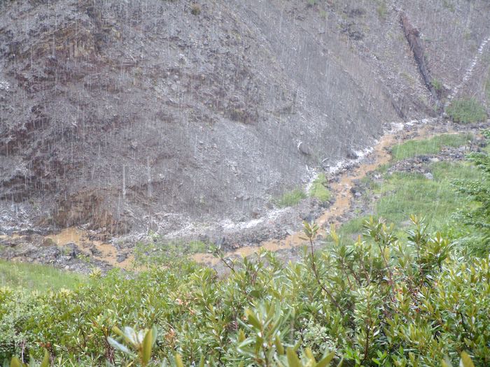
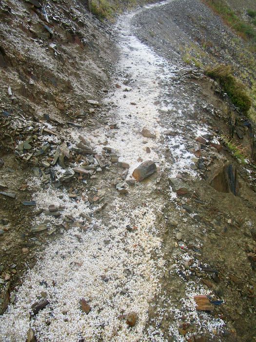
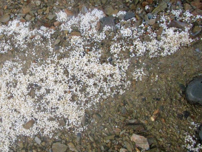
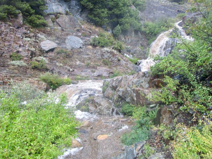
Good thing. Thunder, lightning, rain, and hail, but we just marched ourselves onward up the trail with only one break to stand under some trees (yes, risky with lightning) when the hail got too strong.
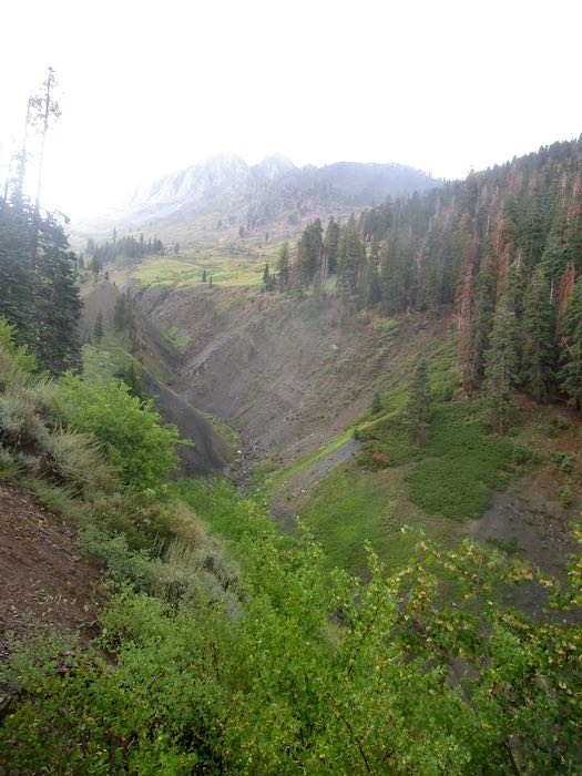
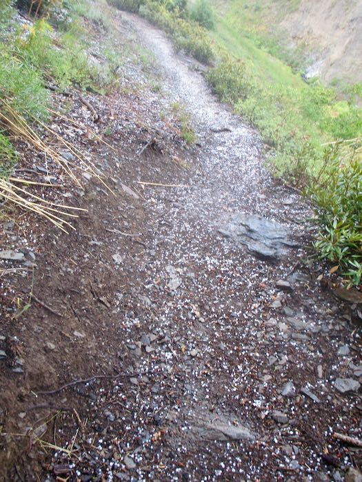
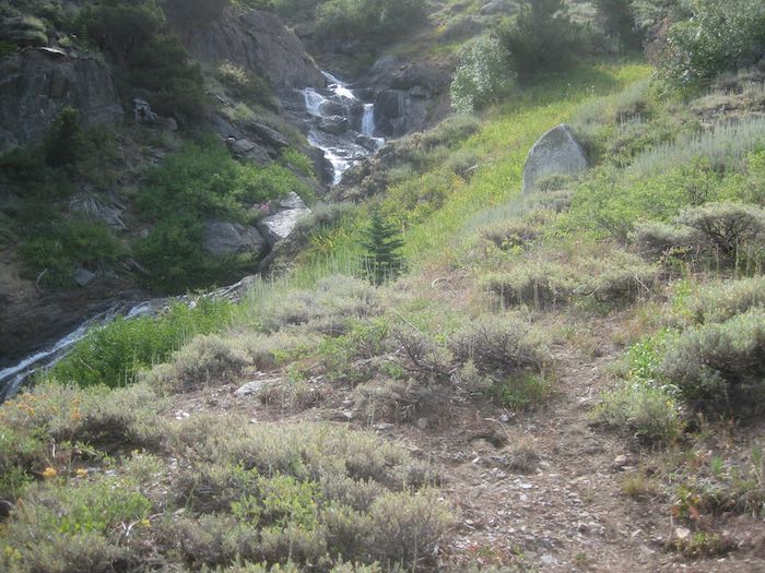
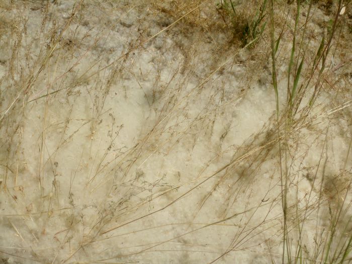
The white line is hail; the brown line is the very muddy stream.
When we reached the junction, the storm seemed to be letting up, so we stopped for a bit to see if any flowers remained and to eat something. (This was a hike, not a walk, so we carried food and water, and needed ponchos to keep our packs dry.)
Feeling hopeful, but cautious, we cut our break short and headed back down the trail. Two men had just passed us on their way down from Forrester Lake, cutting their backpack trip short by a day because the weather was a bit much.
Not long after heading back down, it all started again, with pouring rain that turned to hail, and steady thunder and lightning. We caught up to the men, sheltering under some trees because the hail was just so strong again. After a little conversation about how our ponchos were fairly ineffective, we headed down again. The trail turned to a flowing stream of mud, making it difficult impossible to see foot placement. I gave up pretending that the combination of parka and poncho were keeping me dry, accepting cold and wet as reality. (Ever get hail in your Crocs? It feels like a pebble, but eventually it melts.)
We took a couple of breaks beneath the few groups of trees, just to assess ourselves and one another. K is tough as nails, resourceful, always cheerful, and game for almost anything as long as it is in Mineral King, making her an excellent hiking partner. So, we mushed ahead and then. . .
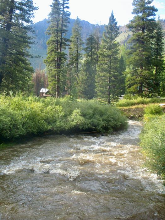
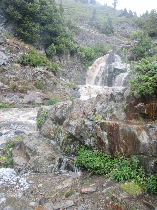
. . . Franklin Creek!! Completely uncrossable. Raging, muddy, scary.
I took two photos, then packed my camera into its case (knit and felted by me, of course), then the poncho bag, and then buried it in my pack under the non-effective poncho. No more photos—the hike’s focus became solely about getting home in one piece.
NO MORE PHOTOS
K and I thought about our choices:
Wait for the two men to arrive and cross in a human chain, holding to one another for support. (K did this downstream on Franklin Creek many years prior).
Get comfortable and wait for the stream flow to subside.
Find another way home.
Option one still felt too risky; option two was too unknown and could take hours; option three was the best.
We went back up the trail to where we could bushwhack our way down to the East Fork of the Kaweah, which begins up at Farewell Gap. I guess you could call this “Farewell Creek”, or “Farewell Drainage”. Whatever its real name, we made our way to the stream, which was very muddy but not raging. The challenge was clambering up the bank after crossing, and somehow we made it up the other side without actually falling in, with apologies to the willows and other shrubs that we stomped on.
Then what? We knew that there was an old “trail” (just a route, because the trail is not visible in most places) up that side of the canyon to Farewell Gap. When we were on the trail, I led; when we were off trail, K led. I did my best to keep up, and she was very kind in waiting when she saw I was struggling—she is quite tall compared to me, and used to this sort of scramble-hiking, whereas I usually avoid this off-trail stuff.
We went over wet grass, through scratchy shrubs, over fallen logs, through a bear sleeping area (he wasn’t home), through some soggy little drainages, and over a zillion slippery branches, one of which knocked me to the ground, but only one, so there.
THOUGHTS, EXPRESSED AND NOT EXPRESSED
If anyone had shown me a video of the day’s hike, I would have said, “I’ll pass—just leave me here by the wood stove with my knitting.”
I know this is wacko, but I’m kind of having fun!
Unless one of us gets dementia, we’d NEVER forget this day. (We’ve been friends for 40 years, and this was definitely a memory maker.)
Trail Guy would hate this!
ONWARD
We knew we’d have to cross White Chief Creek, and because K was familiar with that side of the canyon, she knew that it flattens out where it enters the East Fork, which was also a raging muddy force of wetness. After crossing White Chief, we continued down canyon, aiming to connect with the trail which the pack station used to use for crossing the East Fork.
Just as we hoped, K led us directly to that trail, which she referred to as “Davis Camp”, and we huffed and puffed our way up to the real trail, the one that leads to White Chief, where we had considered going. I pushed for the Franklin/Farewell junction, since I’ve been to White Chief twice this summer.
MEANWHILE, BACK AT THE RANCH
(WHERE did that saying come from??) Trail Guy was getting mighty worried. He went to a neighbor to apprise him of the situation, and together they began discussing a plan, correctly thinking that the Franklin crossing would be impossible.
While they were formulating a plan, we made it home. Trail Guy asked what I would have done if the situation was in the reverse. I said that I would have assumed he’d know to cross the East Fork and bushwhack his way home on the other side of the canyon, just as K and I did. He said that was exactly what he would have done, validating K and my decision making.
In thinking over the situation, K was the perfect partner for the adventure. Her cool head, optimistic attitude, knowledge of the area, stamina, and general toughness were just the right combination.
Meanwhile, we will never know how those two men made it across Franklin Creek.
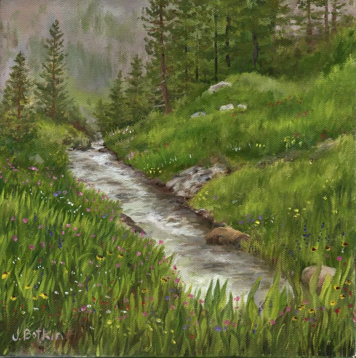
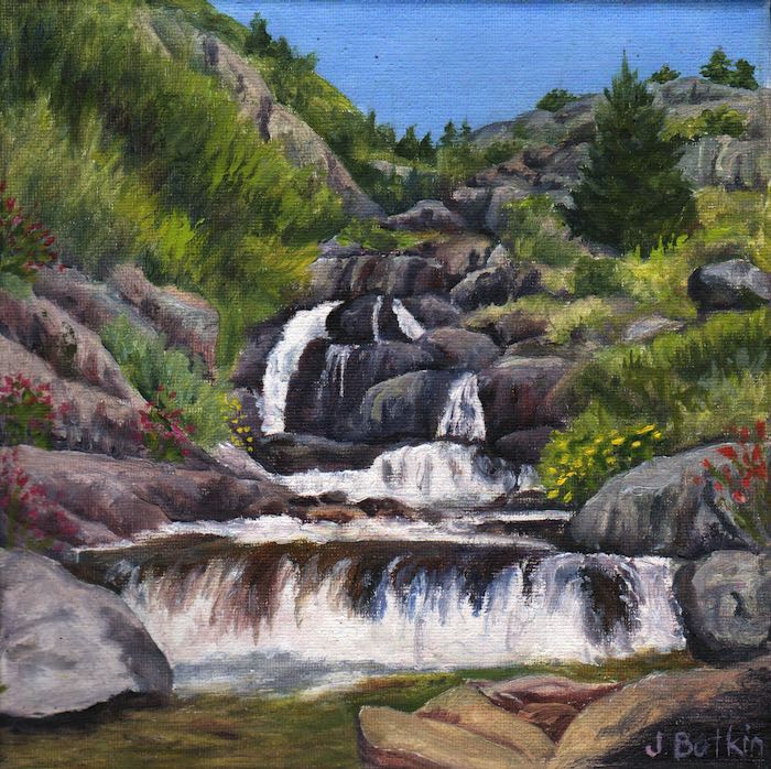
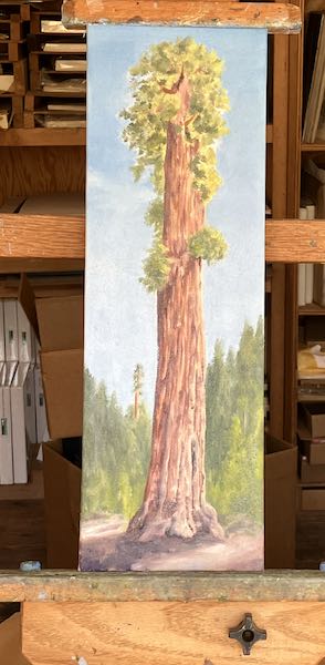
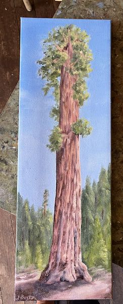
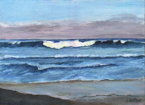
Oh yeah. This is supposed to be a business blog. Have a look at a couple of oil paintings of Franklin Creek (both sold, but I can paint either scene again.)
Looking downstream, not too far below the Franklin Lake dam.
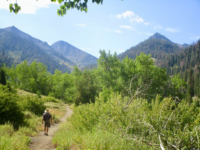
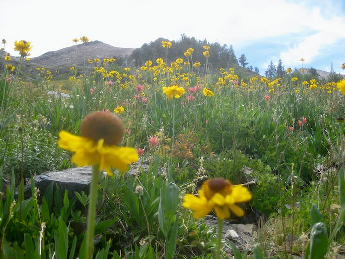
I was in Gilroy. Trail Guy hiked anyway. I’m glad that my feet aren’t sidelining him. It has been a couple of years since I made it to the Franklin/Farewell junction, a place we refer to as the Wildflower Cafe, since it is a nice destination for lunch, particularly in early July when the wildflowers are at their peak there.
Never mind. Let’s just enjoy Trail Guy’s photos, hmmm?
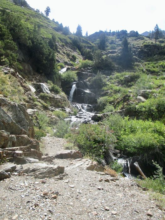
He crossed Franklin Creek without any trouble. (I would have waded in my Crocs—he rock-hops.) There is still decent water flow, considering it is August.
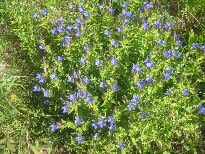
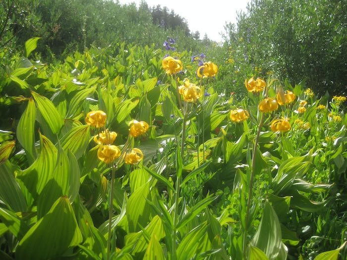
Explorer’s Gentian is my favorite wildflower. Trail Guy likes it too, although Leopard lilies are his favorite.
See? Leopard lilies. Some people call them “tiger lilies”, but they have spots, not stripes.
The peak on the left is Vandever, the one that lives on the right side of Farewell Gap. (Don’t be confused here.)
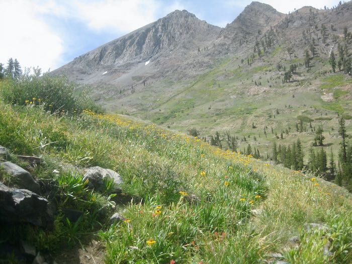
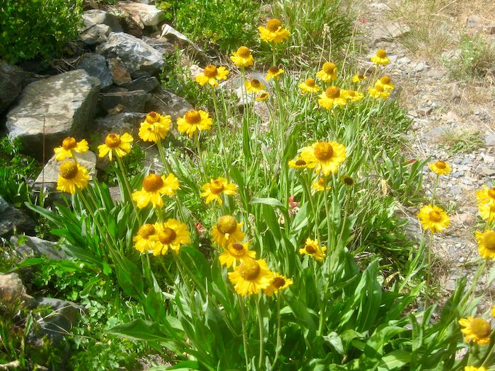
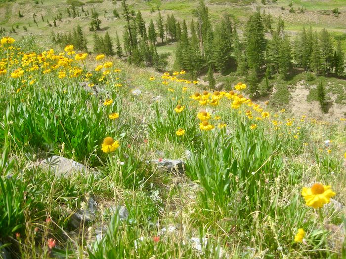
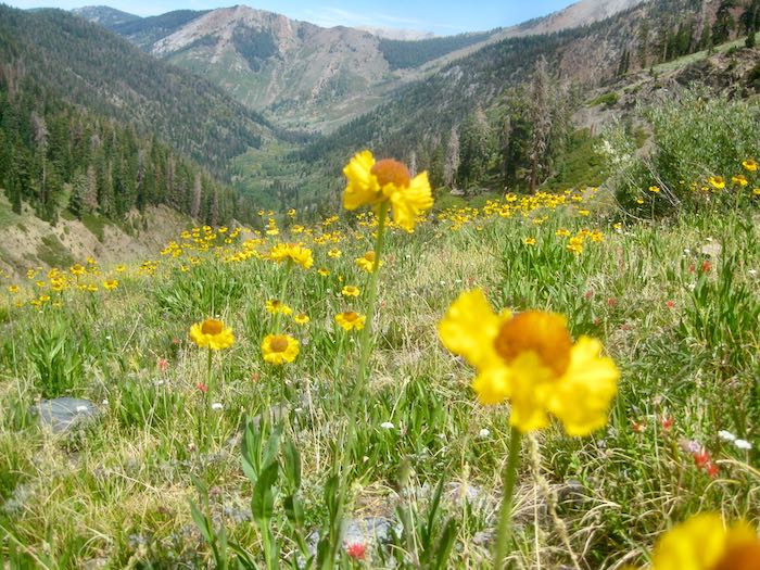
The Bigelow Sneezeweed were abundant. That’s my favorite yellow flower.
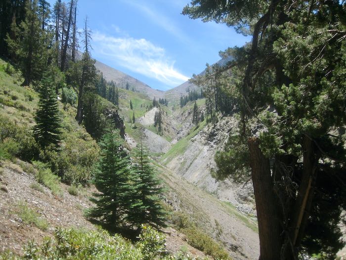
That’s Timber Gap in the distance, and Trail Guy was higher than Timber Gap because you can see a ridge beyond.
This is such an odd view—all those overlapping mini canyons with Farewell Gap in the distance.
Really and truly, I am glad that Trail Guy can still hike. In the seventeen years I’ve been blogging, he has been Road Guy, Ski Guy, and now Trail Guy; I don’t want to rename him as Deck Guy.
Posted by Deck Chick (AKA Central California Artist)
You may have noticed I haven’t done much hiking this year. Guess you’ll have to be getting most of your trail information from other sources. I’m sorry; I would like to hike more. (Take up the subject with my feet.)
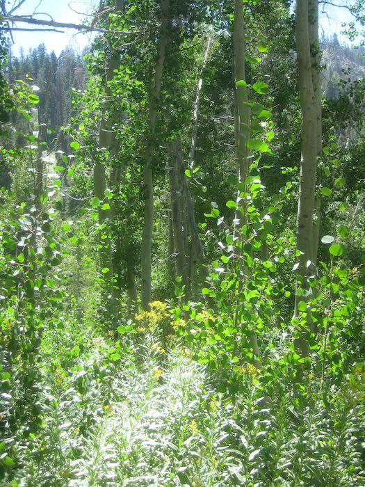
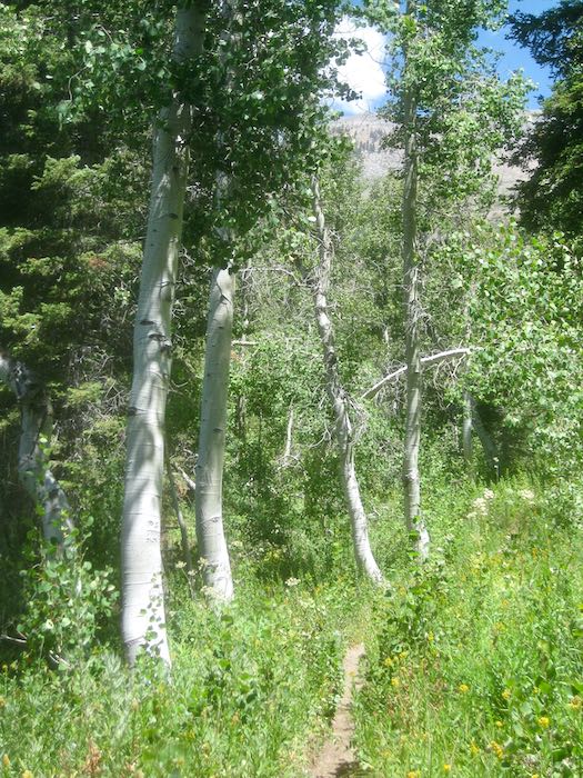
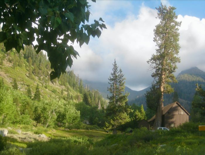
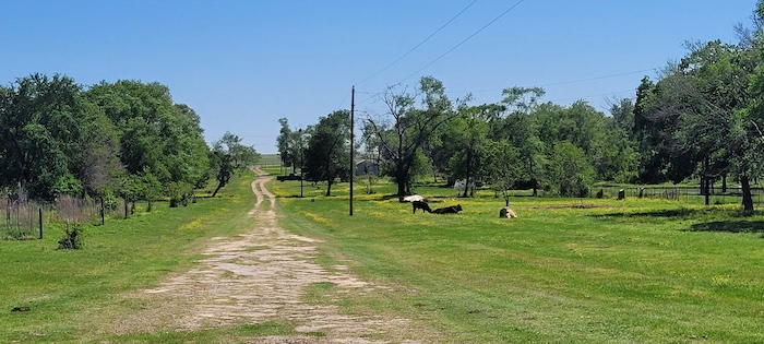
So, we walk. Down the road to Cold Springs Campground, through the campground to the Nature Trail (which no longer has a sign to let visitors know about it because the Park is and has been very understaffed for several years—take up the subject with your congressman, perhaps?) —it takes us to the Mineral King valley.
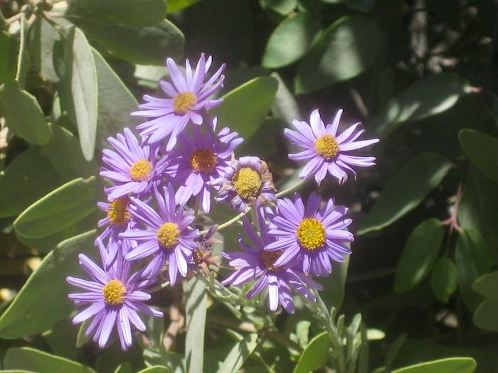
These asters were very vivid right along the road.
Look at the cotton from the cottonwood trees along the road.
These are aspen, which resemble cottonwoods, but the leaves are rounder and they “quake” in the breeze.
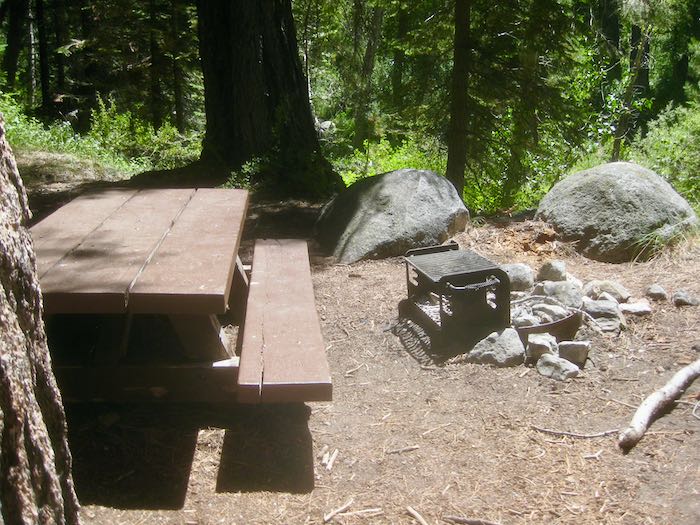
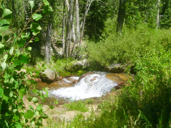
There is a turnout for day use above the campground. This is the first time I have noticed the BBQ device. I’ve never seen anyone cooking here. Interesting. We just walked into the day use area to see if the log for crossing the river is still intact. (It is.)
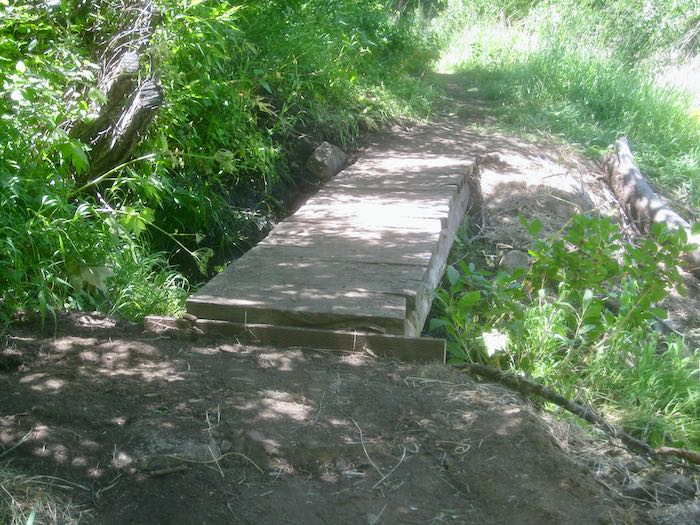
The trail crew worked on this little footbridge so there isn’t such a giant step off it any more (or on, if you are heading downhill).
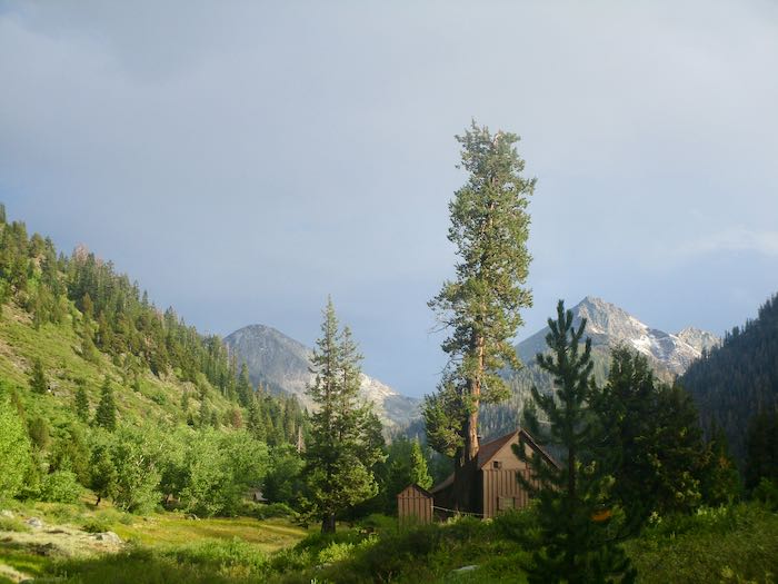
Trail Guy still hikes some (but stays on the trails these days). I’ll show you tomorrow.
When I first worked at the Silver City Store (4 miles below Mineral King) in 1985, at the end of the summer my car stereo fell out whenever I drove uphill because the rough road vibrated the screws loose. (1977 Honda Accord, my first car, because I know you care about such things.)
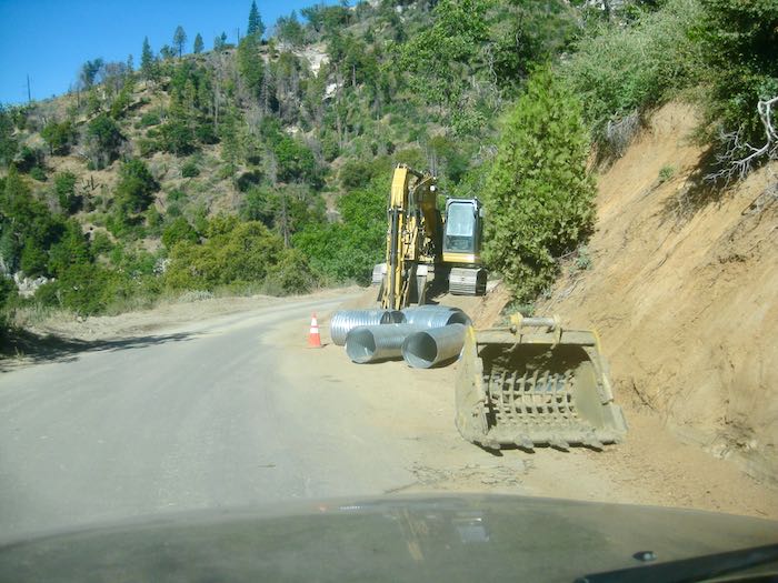
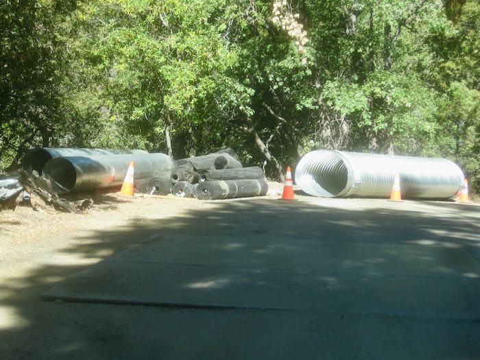
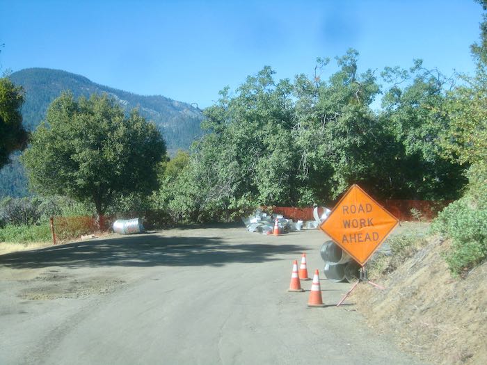
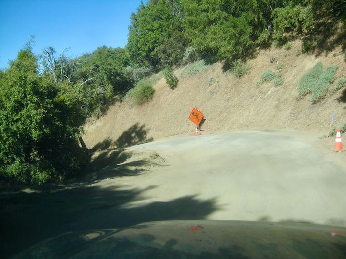
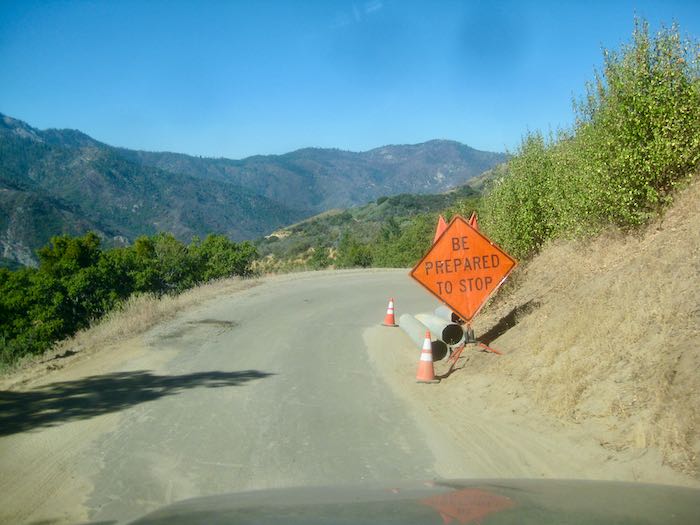
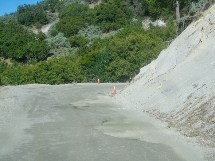
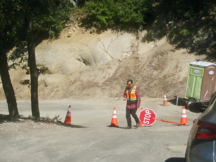
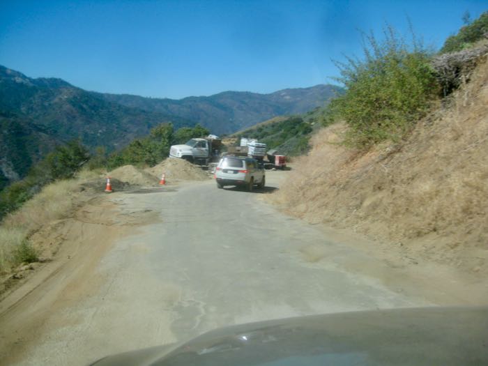
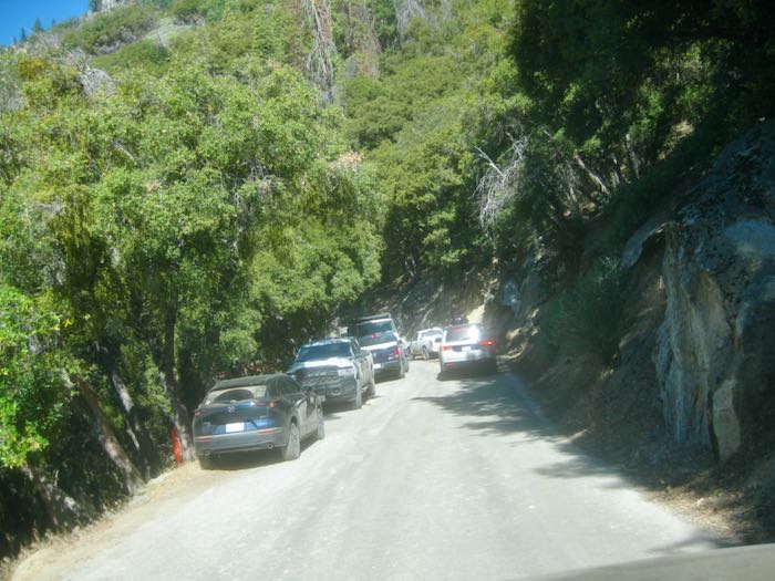
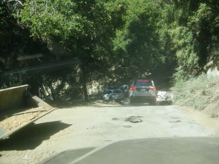
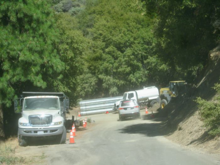
The road is much much worse now. Driving down the other morning, I took some photos in the construction zone. I didn’t take any photos in the unpaved upper areas because those sections require 2 hands on the wheel, 2 eyes on the road, and 2 halves of one’s brain fully engaged in crawling through the hogwallows, washboard, potholes, and deep ruts, some created by springs, some by run-off.
The plan is that the road will have 145 new culverts and be repaired after fall of 2027. This means 2 more years of road construction. The company is very accommodating, pleasant, and communicative. We can do this.
P.S. At the beginning of the summer, Trail Guy told me to NOT drive Fernando (’96 Accord with 255,000 miles and a wearing-out exhaust system) on the MK Road. Then I sold Fernando (sob) and got Mom’s Car (yep, that’s the name). Trail Guy told me to NOT drive Mom’s Car on the MK Road. So, I hitchhike with neighbors up the hill if I go on a different day from Trail Guy and then ride down in the Botmobile with him. However, no one was going up when I did, so I took The Good Pickup, AKA known as “my truck” (although it is a pick-‘em-up, not a real truck.) And I don’t consider a vehicle to be mine unless I have a hairbrush and gloves in the glove apartment (because gloves are supposed to live there.)
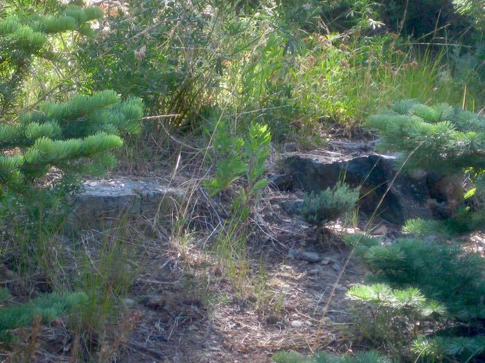
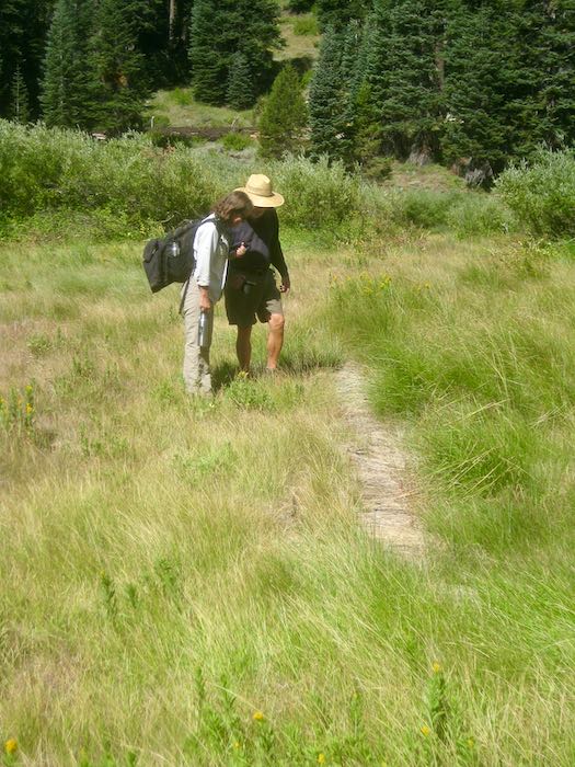
Trail Guy and I accompanied Laile, who is an archaeologist/historian (I think those are her titles) to show her something we found. She cleared up a mystery about a rock platform that we always thought was a cabin foundation. Nope, it was a ride-by bar! George Thurman and his wife Hattie had a bar for miners riding past, who could hold out their cup and get it filled with whiskey without dismounting. (I think it was for miners but now I have forgotten the years. I am NOT a historian.)
We headed up the trail.
Thurman’s Bar! (Calm yourself – they weren’t open and I don’t drink alcohol anyway.)
Laile explained that the grass-covered log with some metal spikes used to be a dam on the creek, which obviously has changed course.
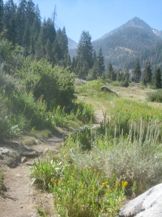
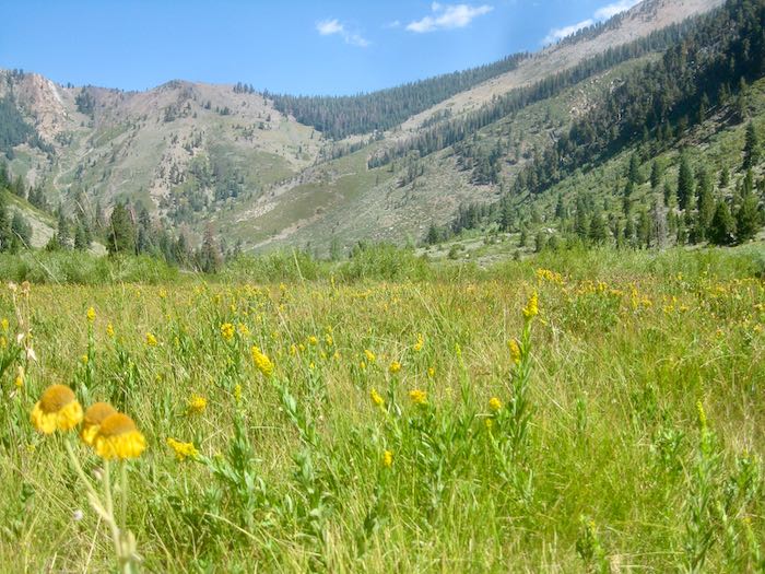
It was so beautiful out in that meadow.
Working
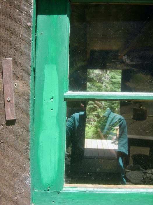
I spent some time caulking and painting our windows. Look at the extreme difference between wet and dry paint. It was alarming at first stroke, but then as it dried, everything was okay. There is more to be done, but things are looking better.
Hanging Out
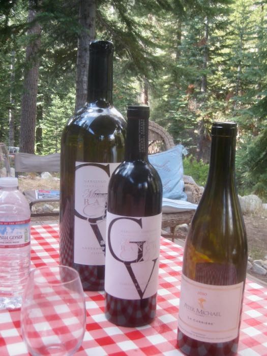
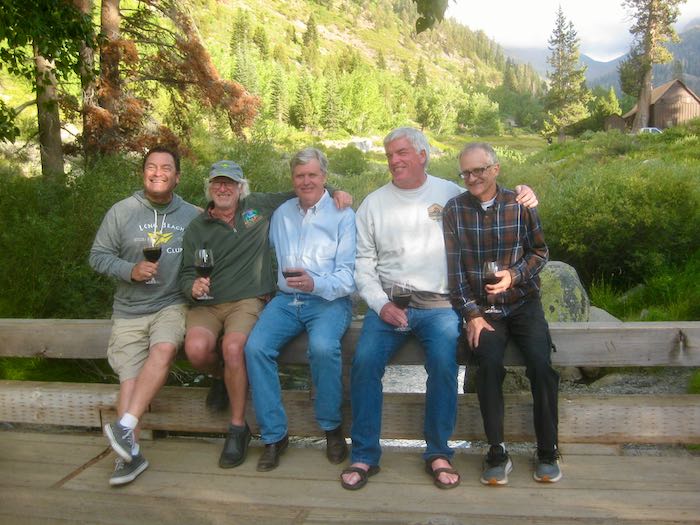
We hung out with our very dear annual neighbors, the Sawtooth Six (now there are only five, but the name remains, and we miss Ted something fierce).
Yeah, I said I don’t drink alcohol, but other people do. The “little” bottles are normal sized; the huge one looks like a joke. (This opinion almost got me banned from the neighbors’ deck.)
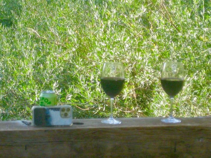
It is a tradition to hang out on the bridge in the evenings.
The Olipop can won the competition to become a tripod.
I left early one morning because I have actual work to do (as you might have read on yesterday’s blog post.)
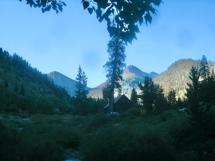
Farewell, Farewell. (The weird darker spots in the sky are because I borrowed Trail Guy’s camera. Mine was temporarily missing, because I have too many homes, too many buildings, too many vehicles, and too many briefcases and totebags. This contributes to me being a loser in the true sense of the word.)
In case you were wondering if all I do is yammer on about the beach or Mineral King, let me remind you that I am a working artist. Sure, maybe I’m only working part time these days, but I AM working. Here’s a list of upcoming projects (remembering that until money exchanges hands, it is only conversation):
I bid a mural which I did not get.
I won a competition for a mural that was initially promised to me, turned into a competition in which my design was chosen, delayed, and now, three years later, it might actually happen.
Some folks want a pencil drawing of the view from their parents’ front porch in Texas. This will be a very challenging commission. Maybe they’ll send me to Texas. . . probably not.
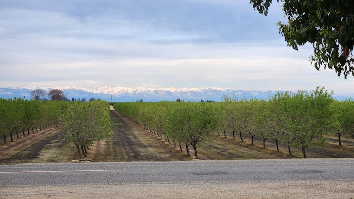
The same folks want another pencil drawing of the view from their other parents’ home with a vineyard and the Sierra in the distance.
Someone I’ve never met in person but am getting acquainted with on The Frugal Girl blog wants an oil painting of his house, somewhere on the east coast.
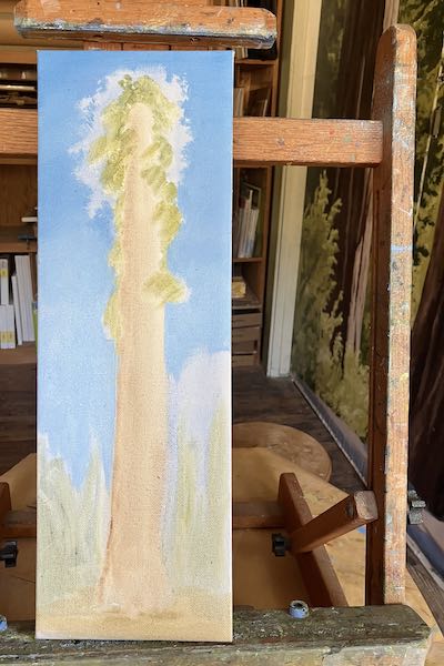
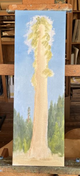
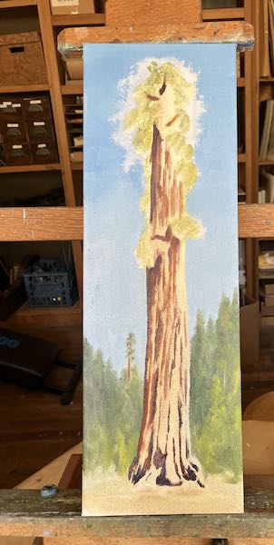
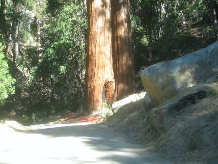
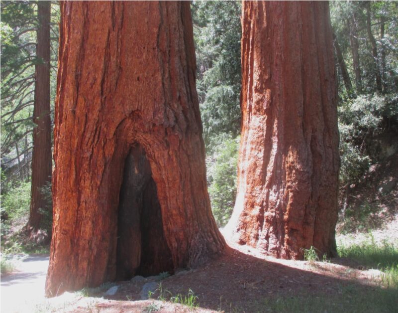
A friend and I are discussing a painting of the 2 sequoia trees in Redwood Canyon (on the Mineral King Road), which she calls “Two Sisters” and I learned as “Aunt Tillie and Uncle Pete”.
My show continues in Tulare, so here is a reminder of the dates, days and hours.
The list format doesn’t allow for photos to be inserted, so here are a few to keep you from thinking TLDR, which means Too Long, Didn’t Read.
#1 —I didn’t waste time doing sketches when the potential customer hadn’t come up with a budget. I’ve learned that lesson the hard way.
#2 This is the mural that I designed, submitted to the competition, was chosen, then put on hold. I sure do hope I get to paint it!
#3 Texas porch view photo to be turned into a 14×17” pencil drawing
#4 Front porch view (but change the trees to a vineyard)
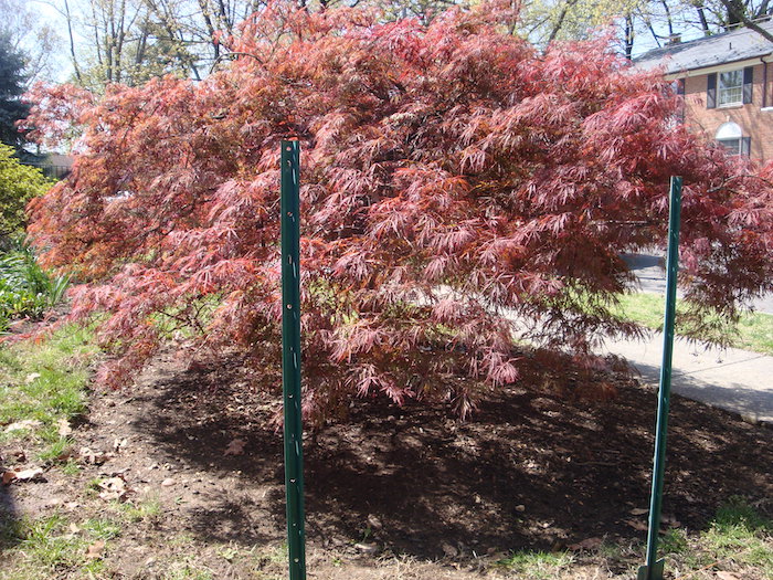
#5 This is just a photo of his amazing Japanese maple. This will be a very challenging painting but I’m up for it!!
#6 After photographing them countless times, I could only find one shot, which is horizontal rather than the desired vertical format. For now it is just conversation, so there is time to get new photos.
Finally, here are the specifics about the show AROUND HERE in Tulare.
AROUND HERE will be at the Heritage Gallery in the Tulare Historical Museum through August 30. Days/hours are Thursday, Friday, and Saturdays, 10-4. (444 W. Tulare Ave.)
QUICKETY CORRECTION: Yesterday’s flowers were NOT zinnias; they were dahlias. I couldn’t remember the name so made a substitution. Thank you, Jane, for setting me straight!
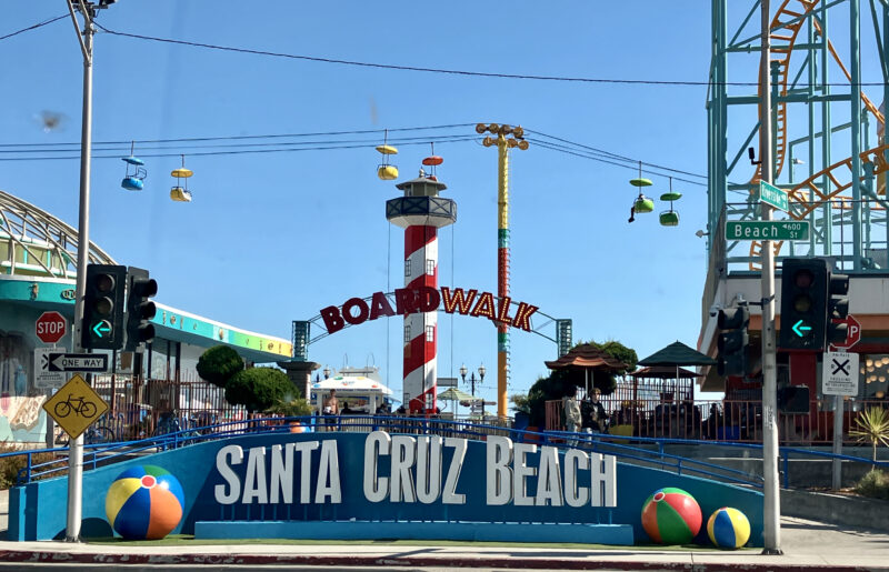
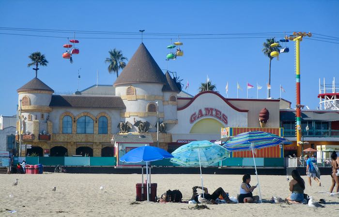
After finding lunch on our beach day (easy drive from Gilroy to the beach), we thought about heading back to Gilroy, but there was way too much traffic heading that direction. We made the very prudent decision to do our waiting in Santa Cruz rather than on a freeway. I’d never been there before. Wow, so much noise and color and crowds and distraction from the ocean.
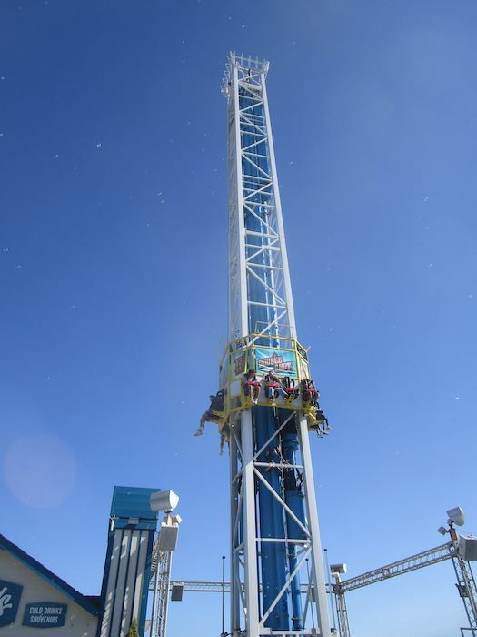
Why do people want to pay for all that fake stuff when the ocean is right there??
Those rides actually compete with the beach?? Incomprehensible to my simple, easily-satisfied, easily entertained rural self.
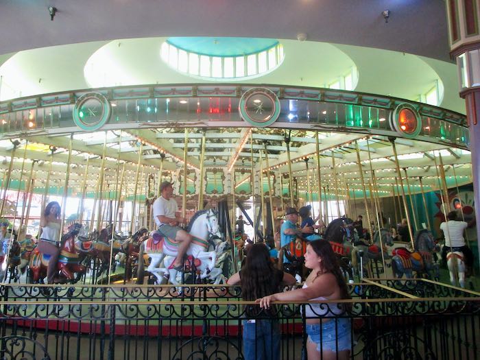
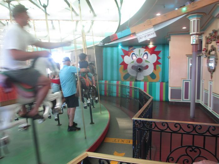
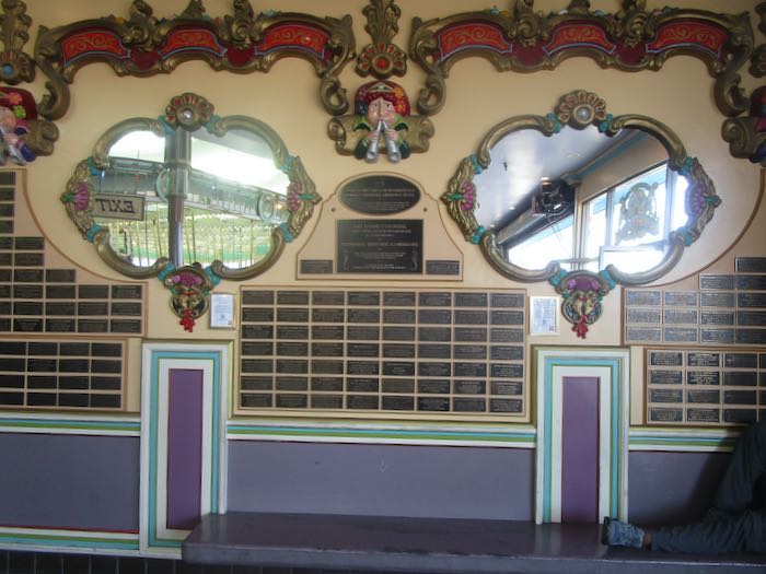
The carousel was too loud for me but the displays were really well done and interesting. So much history! We watched riders try to grab a ring on each round and toss it into the clown’s mouth. If I had grabbed a ring, I might have been tempted to keep it. I wonder how many they lose that way.
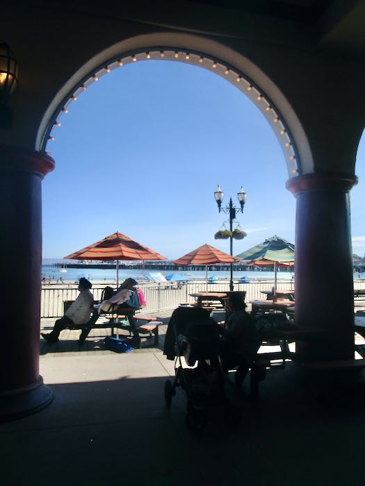
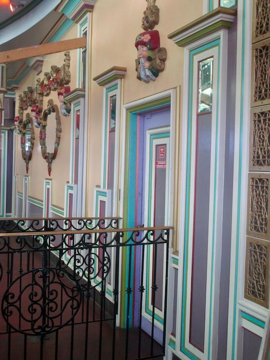
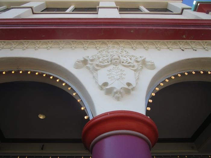
It was very well maintained, quite impressive. I love beautiful architecture, so I was very fascinated by how it looked, rather than the whole arcade/carnival/entertainment aspect.
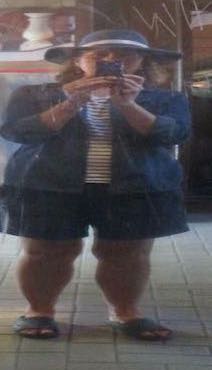
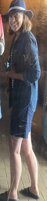
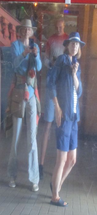
We laughed ourselves silly with the funhouse mirrors. My mental image of myself is like the one on the left; the way I want to look is like the other images.
Someday I might finally find some sort of self-acceptance. Meanwhile, I’m heading to the beach.
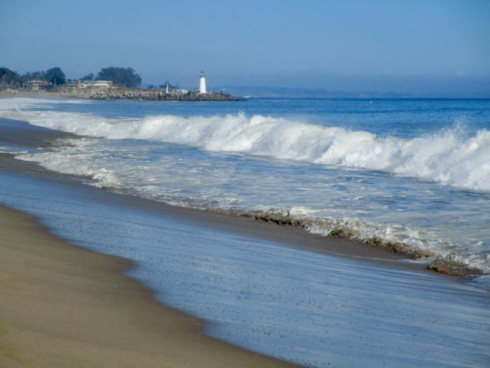
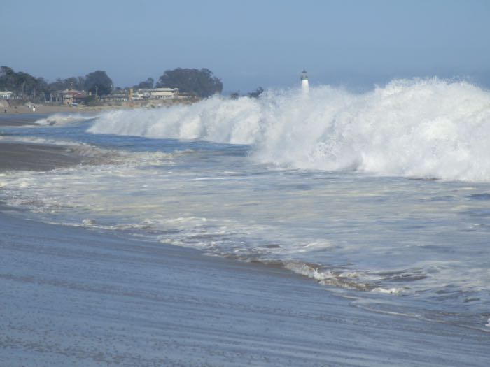
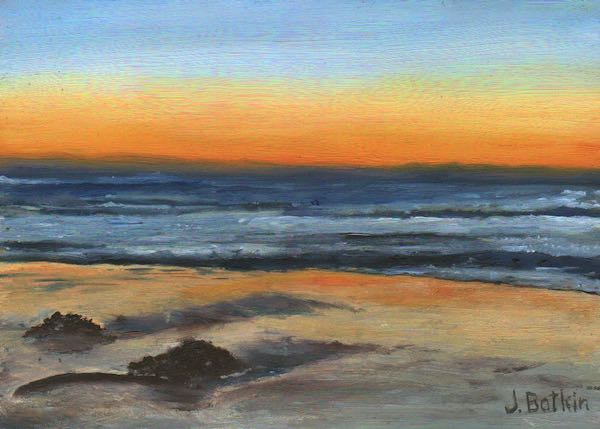
A lighthouse!! Too far to walk, particularly with the tide rising, and the parking meter might run out of those quarters. I am NEVER too tired to keep going on the beach. It’s a sickness. A weird deficit or disorder or syndrome.
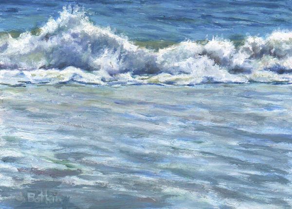
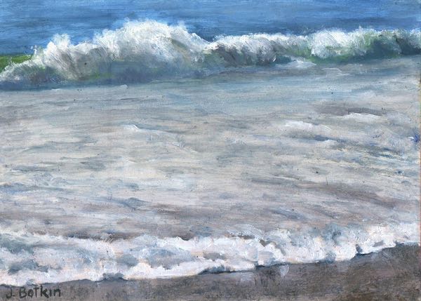
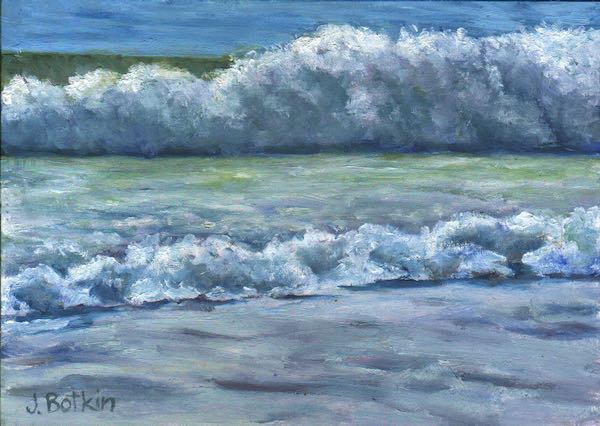
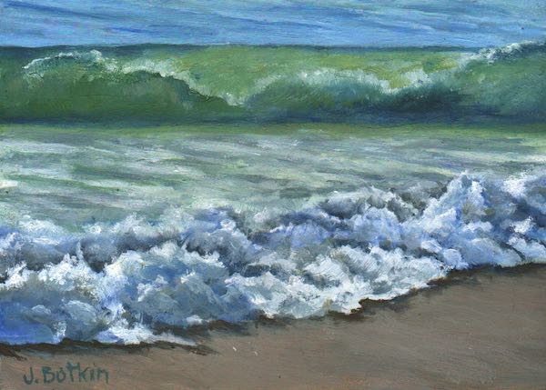
LOOK AT THESE WAVES!!
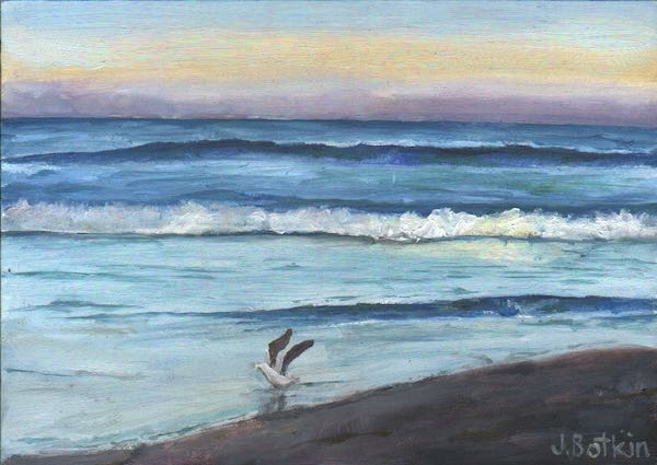
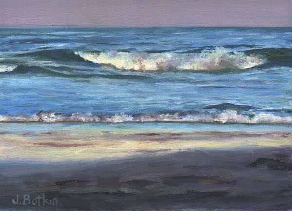
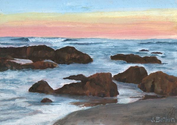
Since this is supposed to be a blog for my business, we interrupt this program for a commercial break. AROUND HERE, my show in Tulare at the museum/gallery, is open Thursday-Sunday, 10-4, through August 30 at 444 Tulare Avenue. Besides Tulare County scenery, there are beach paintings so this is an appropriate interruption. These paintings are each 5×7”, $100, on panels that sit on tiny wooden easels. (Take three—they’re small!)
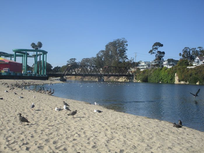
Finally, we cut back to the boardwalk, walking along the spit that separated the river from the beach. We didn’t find out the name of this river (the Santa Cruz River, perhaps? San Lorenzo River), but hustled back (that parking meter).
Maybe tomorrow I will get back to the business of art on my blog. I’m supposed to be. . .:
…using pencils, oil paint and murals to make art that you can understand, of places and things you love, for prices that won’t scare you.