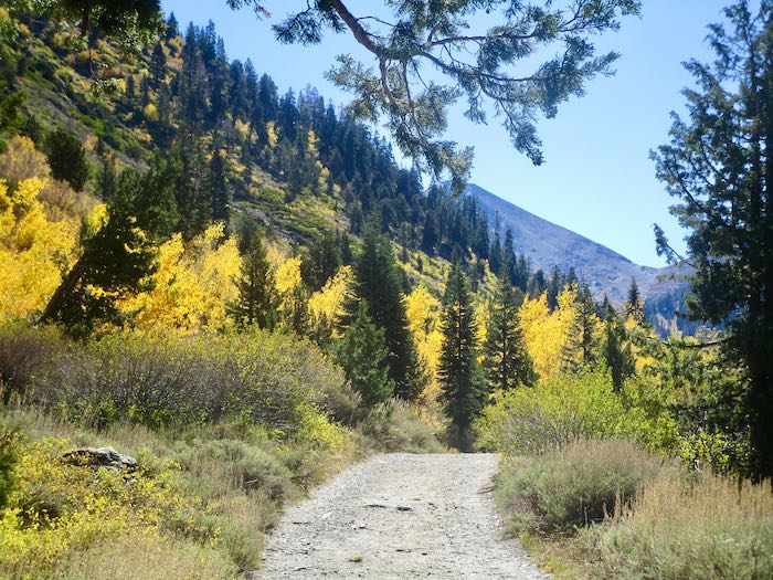
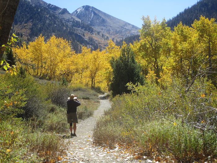
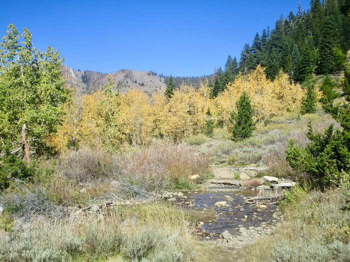
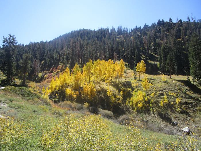
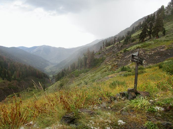
We went walking up the Mineral King valley in search of brilliant fall color. This was easy to find, so many yellows, but of course we wanted oranges and reds too.
The cottonwoods are yellow; it is the aspen which turn orange and red, so for stronger colors one must walk farther up the trail than rather just hanging out near the pack station.
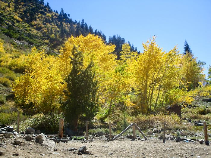
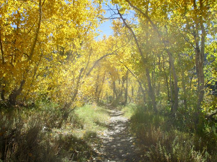
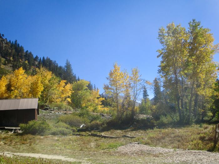
We call this the Yellow Tunnel.
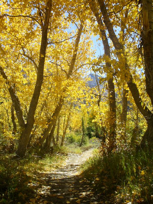
The cottonwoods look so faded when viewed from the other side.
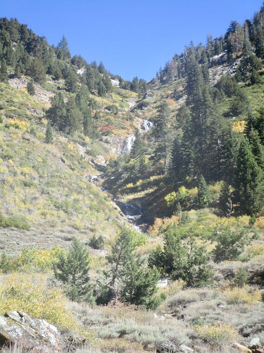
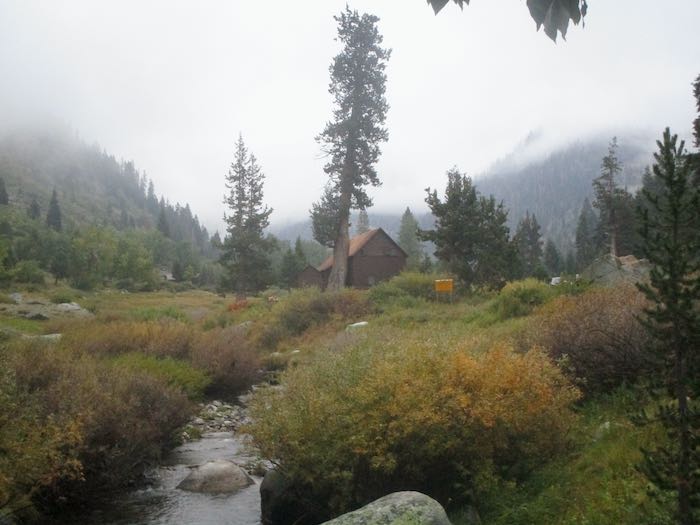
Crystal Creek is still flowing. The colors are very subtle looking up the ravine.
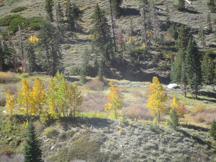
We spotted some orange through the cottonwoods, so Hiking Buddy and I continued on up the trail while the men turned back to begin tackling the chores of cabin closing. Not only do they close our cabins, they also close cabins for neighbors and are responsible for the water system for our little neighborhood, which they take very seriously.
That orange turned out to be a little disappointing. It was only the very edges of these few trees. (You might have to squint to see it here.)
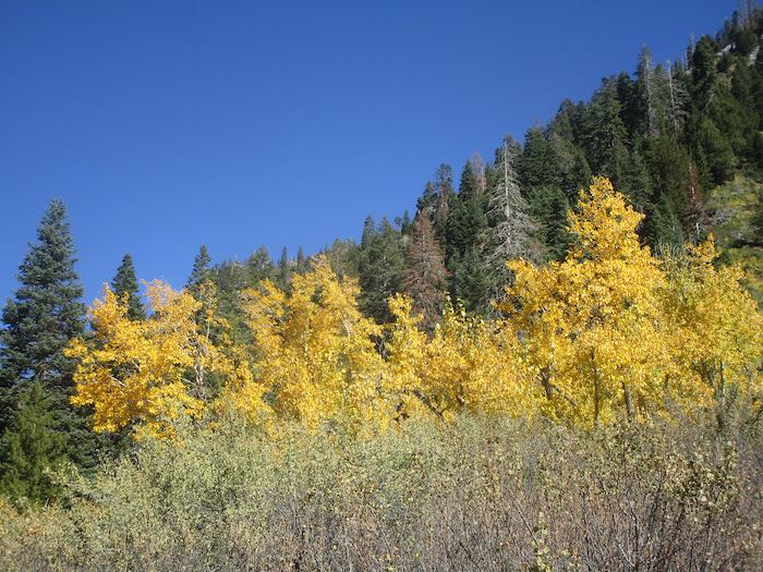
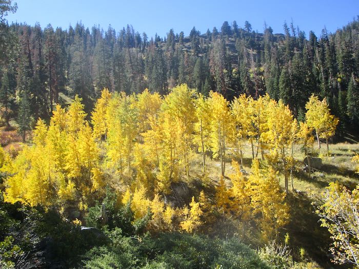
But these trees were electric!
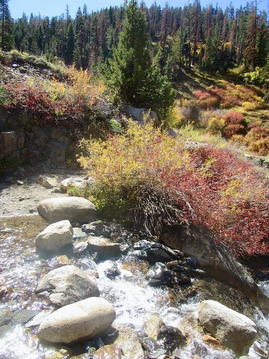
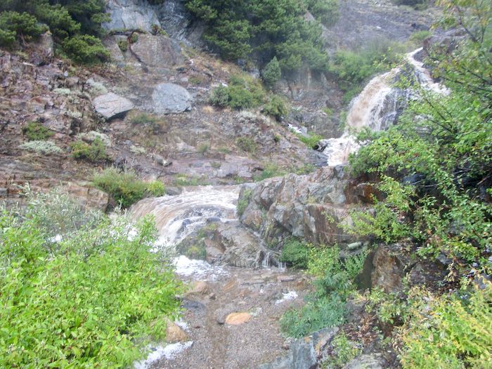
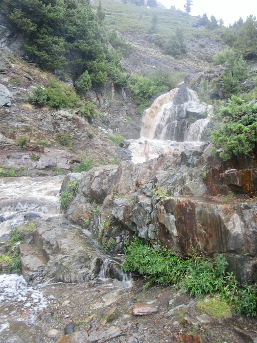
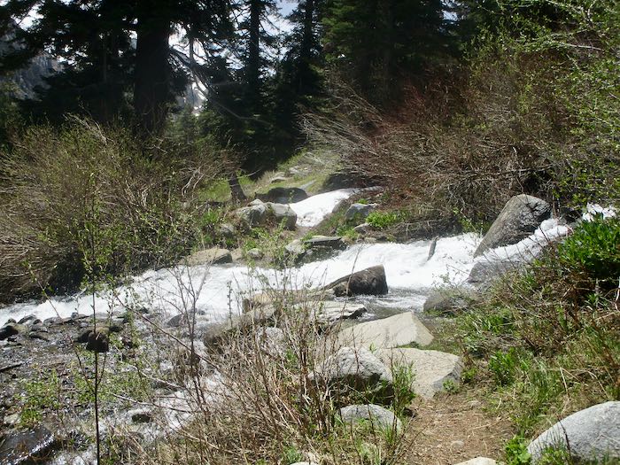
Franklin Creek was so tame, especially compared to my August adventure with K.
Each year in the fall I am determined to learn what shrub turns red. In the summer when it is green, I don’t notice it and don’t remember my annual autumnal intention.
Somewhere over there is where K and I were scrambling through the rain, cold, and hail to find our way home. We knew where we were going but not our exact route.
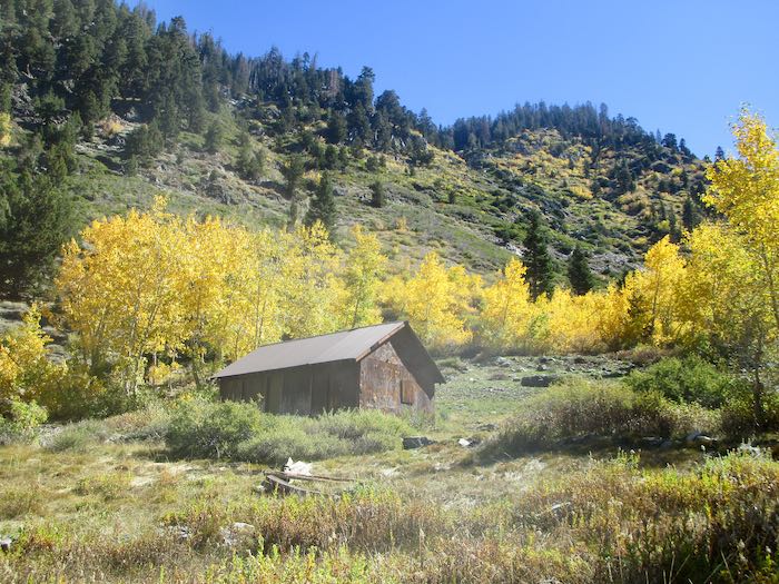
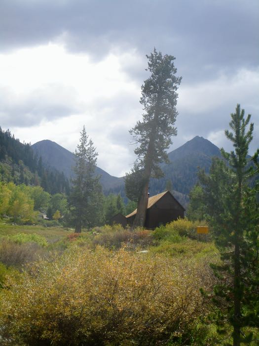
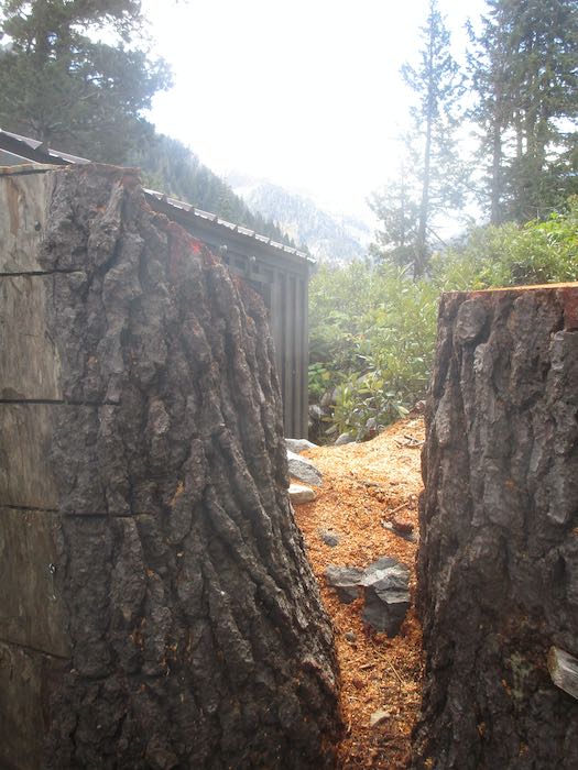
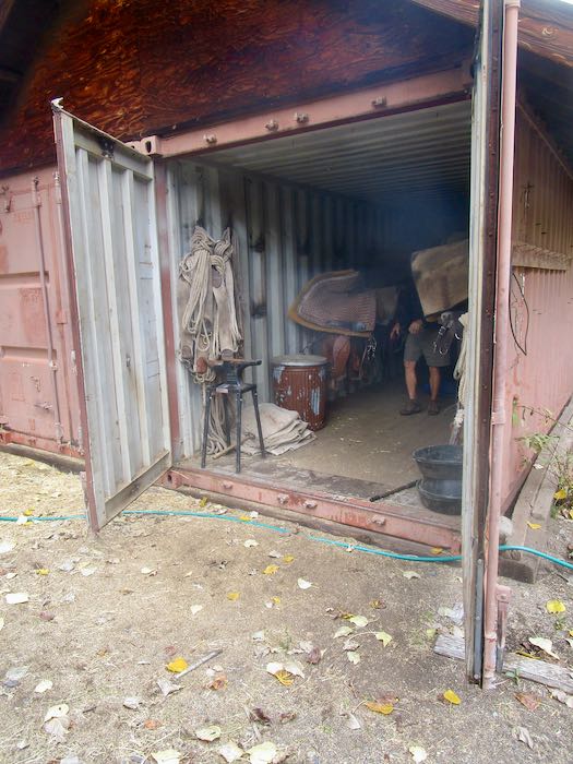
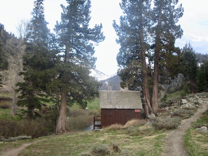
One last look at the Park’s packing shed.
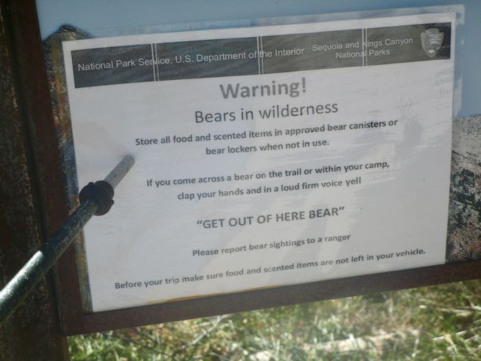
WHAT? How did I miss this piece of brilliant advice all summer??
What I want to know is this: will a bear leave if I simply shout “BEAT IT, BOZO!” or do I have to say “GET OUT OF HERE BEAR!”? Who taught the bears to obey this command?
The next day was closing day. It was very cold, low 40s while we completed our chores and buttoned it all up for the season.
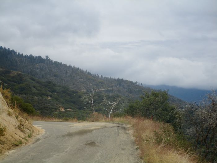
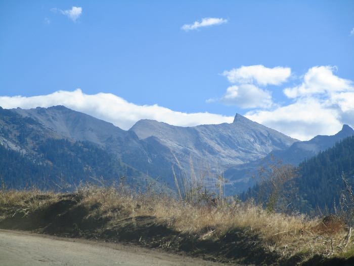
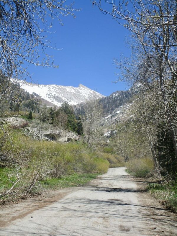
This is how it looked back toward Mineral King from partway down the road. Snow was expected up there. We closed in the nick of time. (Who is this “nick”?
Just for fun, this is the scenic spot where we stopped for some lunch on the way home.
It is always a bittersweet time. While we believe that summer goes way too fast, it is always a relief to be home, to stop driving that wretched road, to be able to go to church on the weekends, to keep up with emails and texts, to not be continually living in flux with duffle bags in plain sight, and to not worry/wonder about the water system or bear break-ins (in both locations.) Besides, we miss our cats.
The weekend began with a surprise visit by a childhood friend. I knew she might be coming in the fall, but so many people tell me their potential visit dates that I don’t even try to keep track. That meant it was a wonderful surprise, and I got to spend an hour or so with her and her offspring. Since this is the World Wide Web, and because I want to experience and value life even when it isn’t documented and publicized, I took no photos (except for asking her daughter to take one of us together, which I HOPE her mom will send to me!)
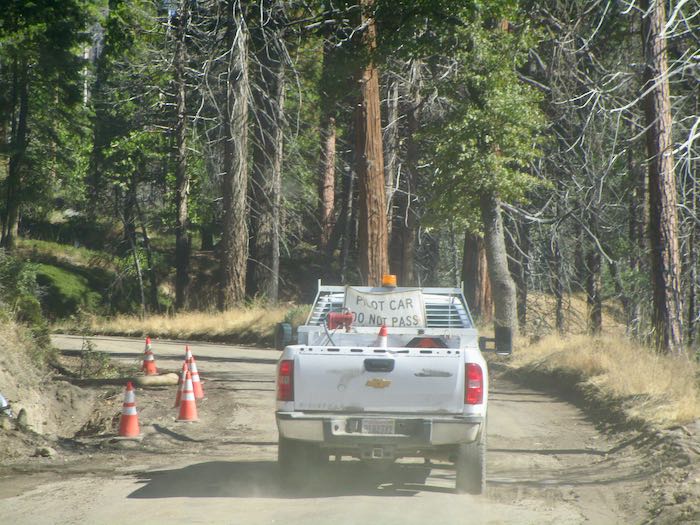
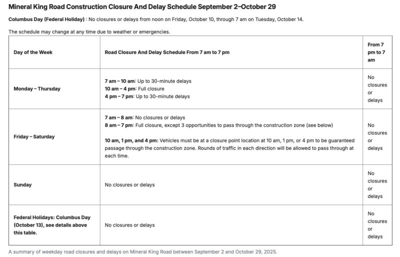
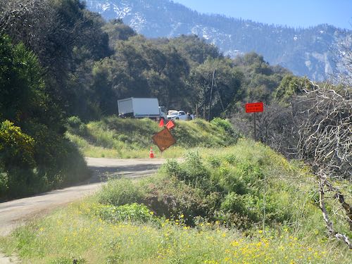
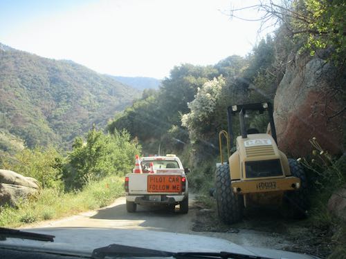
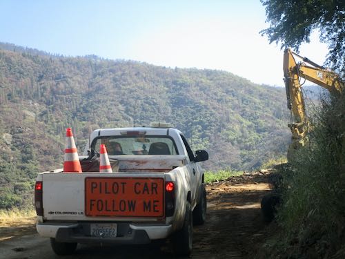
The road construction continues. We waited just below Wolverton Point for about 45 minutes for the 10 o’clock pilot car shuttle which we followed to Silver City. SEE THE NEW SCHEDULE BELOW.
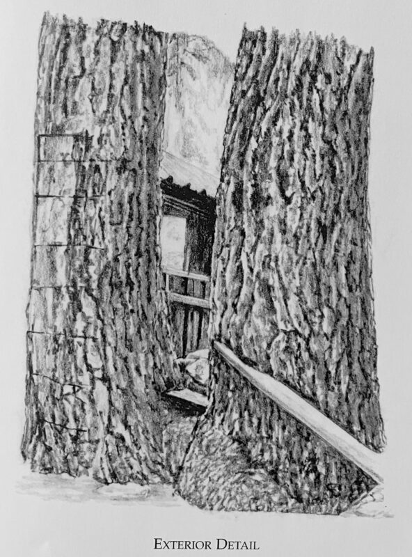
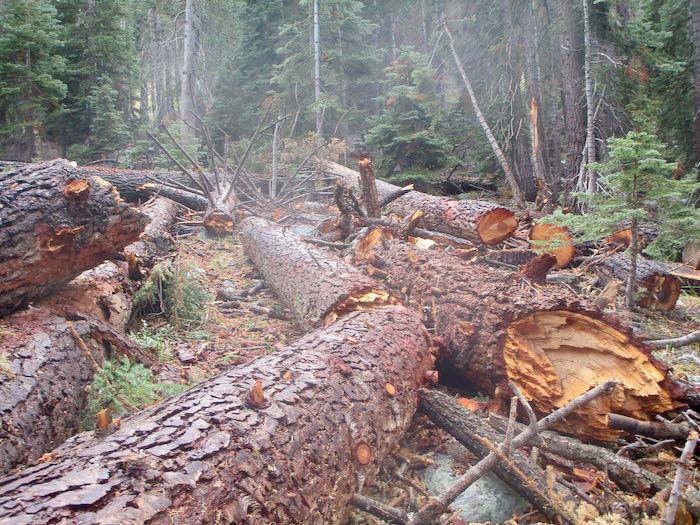
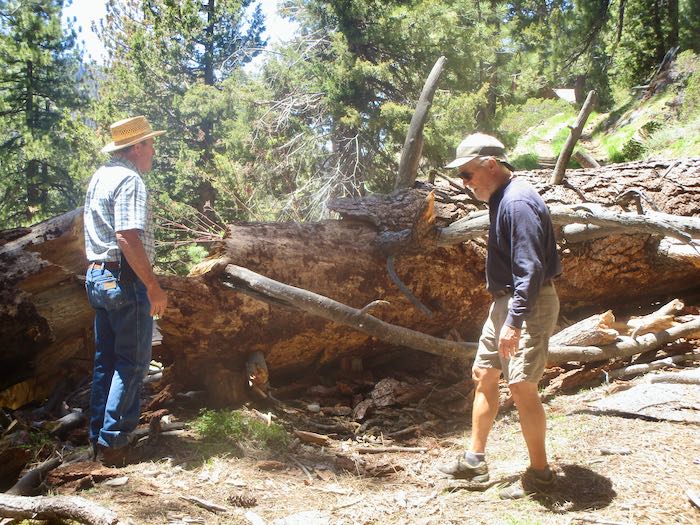
A neighboring cabin had 8-10 hazard trees threatening their place. We went snooping, and all is safe now (but the cabin is exposed), and there is a boatload of downed wood, a real mess. Here is how part of it looked as drawn for The Cabins of Mineral King and how it looks now in real life.
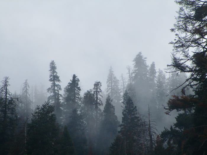
It rained several times and was overcast. We did not hike. People who live in Mineral King just hang out sometimes. Instead of being on vacation, we are simply experiencing cabin life.
We thoroughly enjoyed the warmth from the wood stove, trying but not succeeding to keep a fire going all day. That stove wants feeding fairly often. I would have split more wood, but we kept covering the woodstack due to the rain.
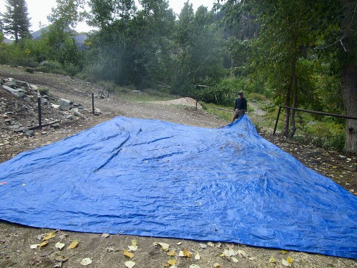
We walked to the pack station and found an enormous tarp all wadded up, and the stock was gone. Couldn’t just waste that tarp, because chances are we paid for it with our tax dollars. So we folded it up and then put it in the storage container.
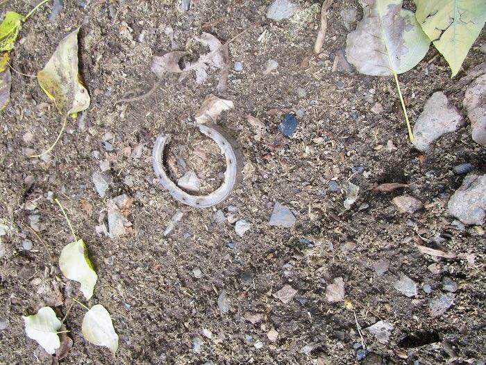
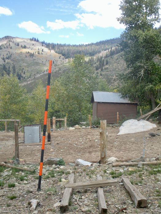
I saw this trimmed mule hoof on the ground, and the snow stake is now installed for viewing on the winter webcam.
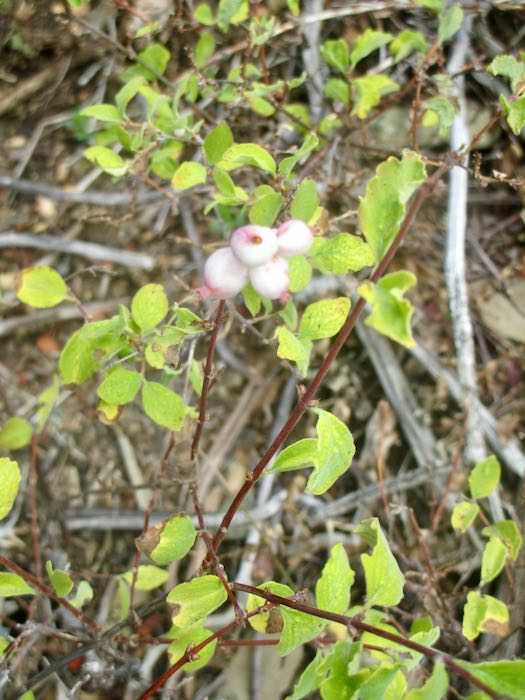
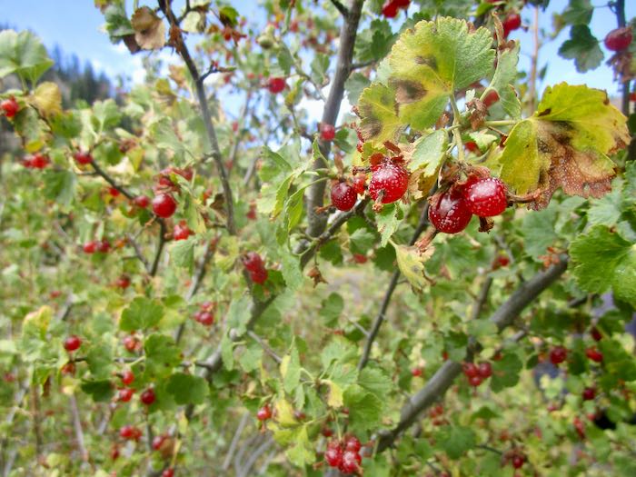
Berries are ripe in the fall. Don’t eat the white ones. Trail Guy loves the red ones, Wax Currant.
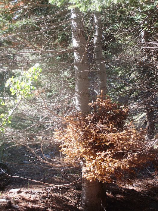
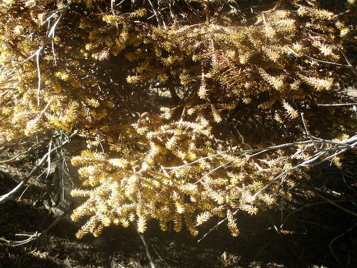
There is a specific type of mistletoe which grows in red fir trees. It is weird stuff.
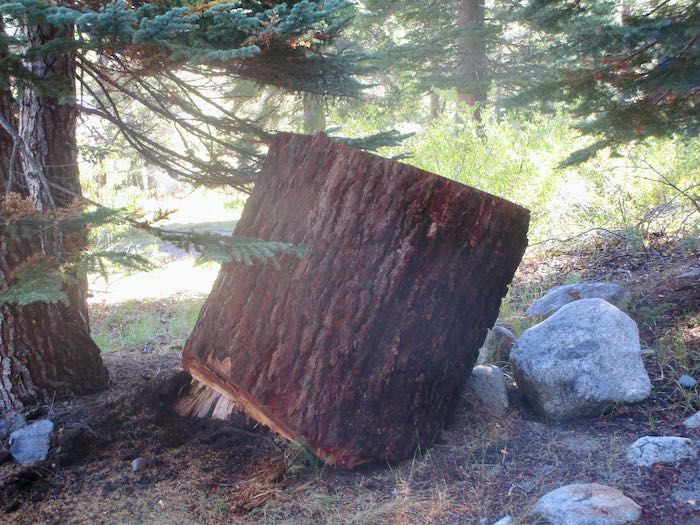
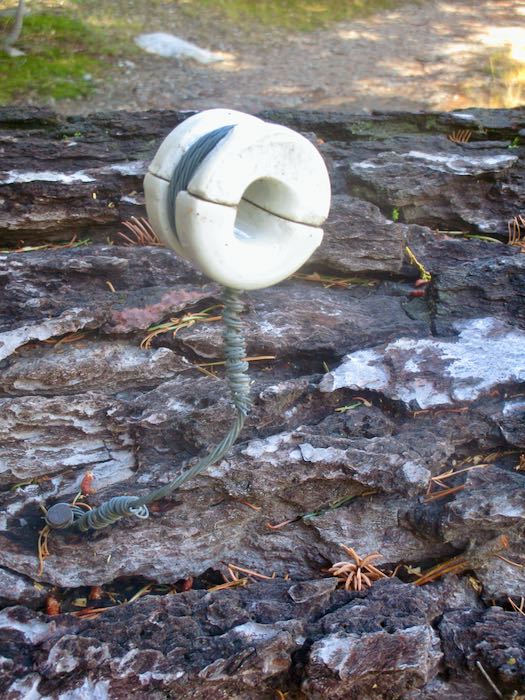
Look at these two huge chunks of the red fir that got dropped a few weeks ago. They got randomly placed in our neighborhood after being moved from the road. One has a thing attached that had something to do with phone lines. I didn’t photograph the messes from the dropped trees, but know I will be dragging brush and sawing limbs for a long time coming.
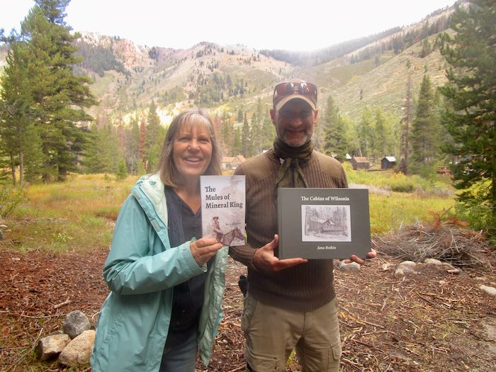
Now, the funnest of the fun things: I FINALLY* met Kevin Alltucker, author of The Mules of Mineral King, a book that I told you about back in August. He graciously accepted a gift of my Wilsonia book, and then his brother said that he (the brother) is one of my tens of blog readers. This gave me the idea to do this dorky photo (me dorky-looking, clearly too thrilled to think about posing better or controlling my grin) and remind you all who like Mineral King to BUY THE BOOK! It is so well-written. It was also fun to talk about the logistics of writing, publishing and (not) marketing one’s own books with a fellow self-published author.
The Mules of Mineral King is available through Riverfeet Press, (also at that big online store which begins with A and takes a large bite out of an author’s profits.)
A recent weekend in Mineral King in photos with commentary, as usual, from your Central California artist.
The hazard tree crew returned to our neighborhood.
We had rain, both up and down the hill. It was overcast for a day or so after the rain. I wonder if this would make a good pencil drawing.
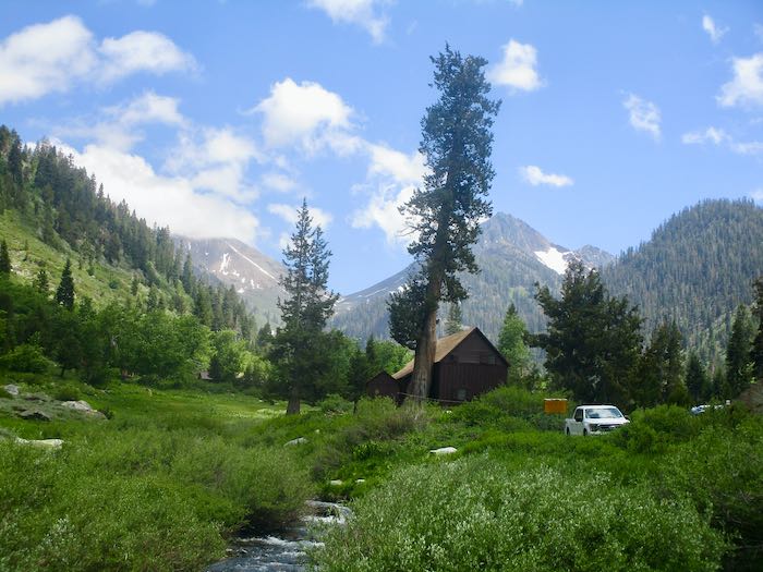
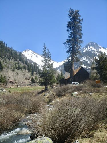
The classic view from the bridge, with Farewell Gap obstructed by the clouds.
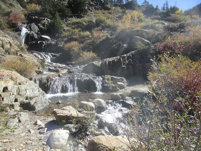
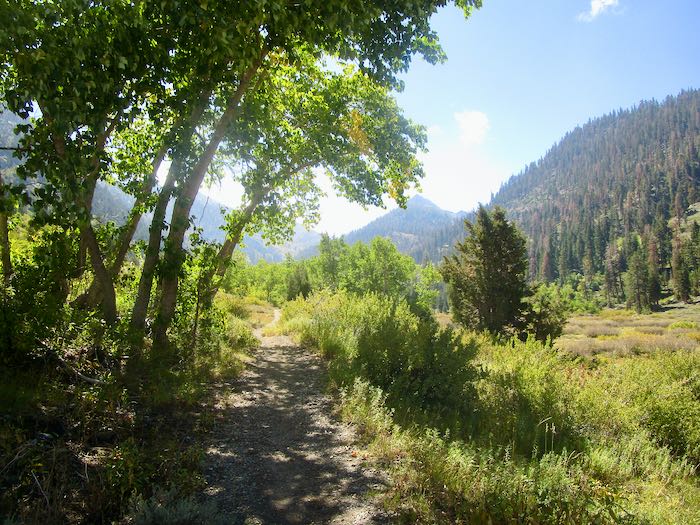
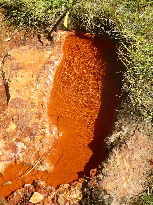
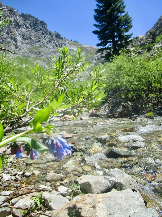
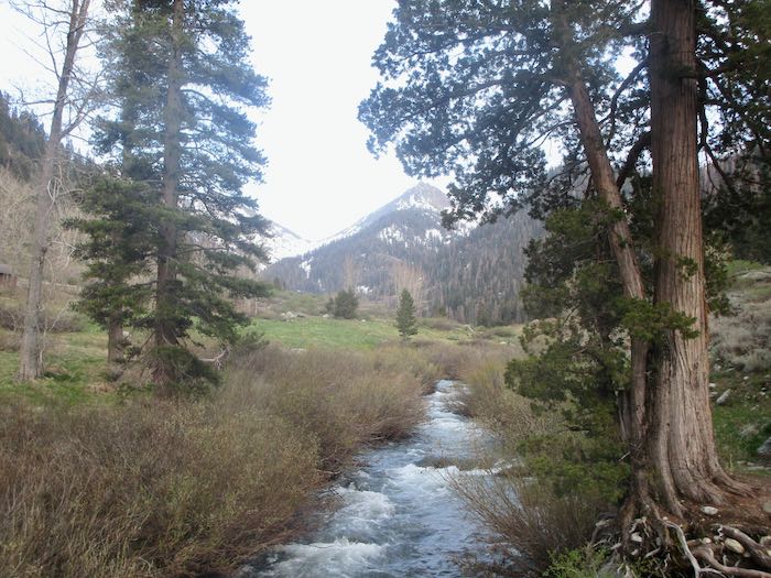
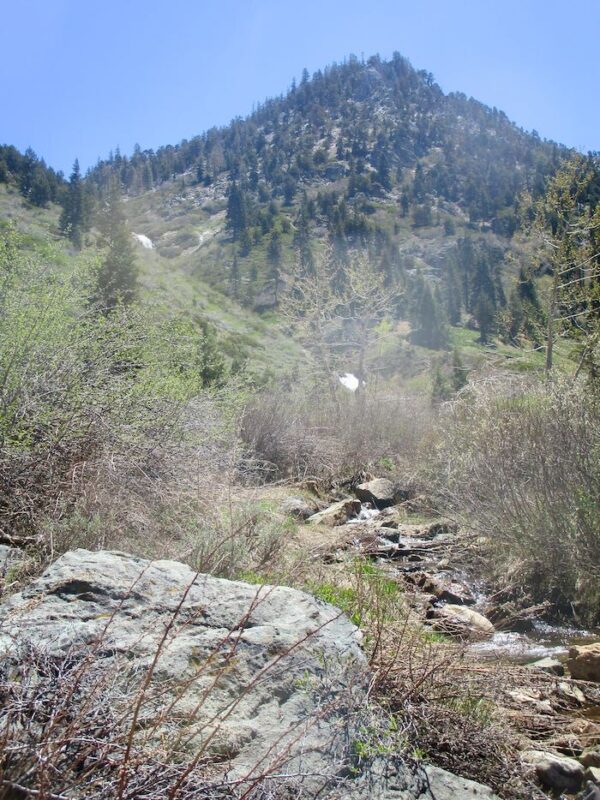
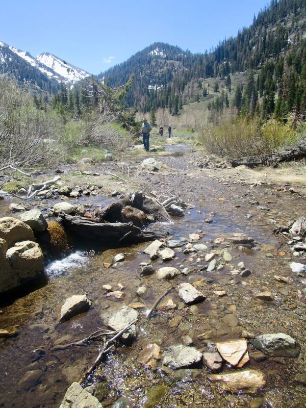
The sun shone the next day, so Hiking Buddy, K, and I walked to Soda Springs.
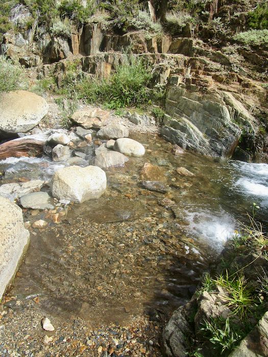
Crystal Creek is still running.
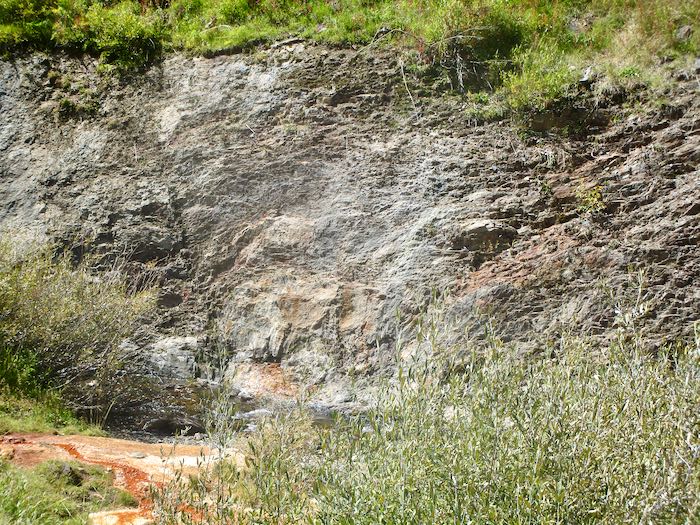
See the orange? That’s where Soda Springs runs down into the creek.
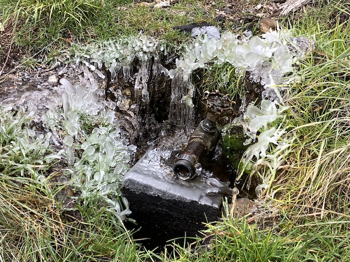
It bubbles out of the ground.
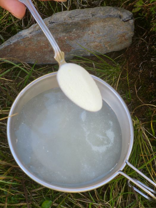
Many cabin folks have a tradition of adding lemonade powder to the water, swearing that it is fizzy and delicious. It tastes like metal to me, reminding me of the drinking fountains at church camp as a kid. Ick, no thanks. K is very traditional, complete with a Sierra cup hanging on her daypack.
Here is the classic view in sunshine.
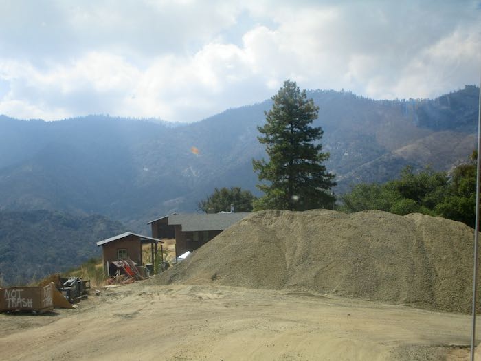
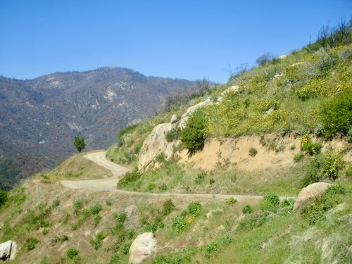
On the drive home, we were amazed by the ENORMOUS pile of road base collecting at Lookout Point for the ongoing road construction project.
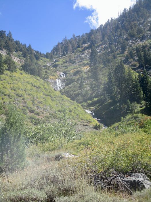
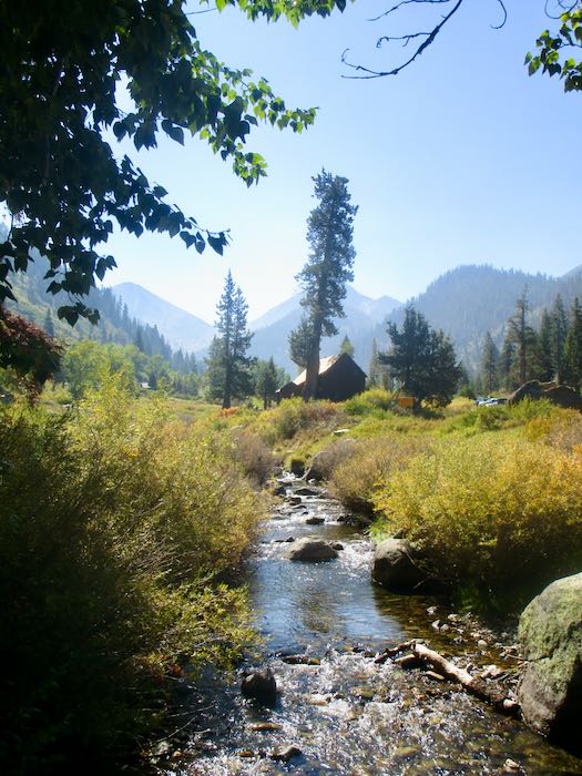
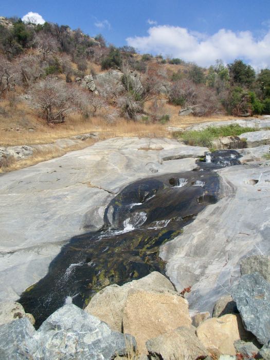
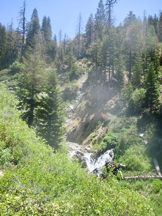
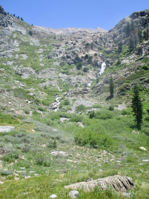
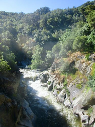
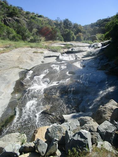
Finally, here are The Potholes, still running steady and strong in September. My theory is that all the trees which used to take up water above this stream (called Squirrel Creek) burned up, so there is more water to continue flowing throughout the season.
And thus we conclude another tour of Mineral King. I’ll get back to work next week.
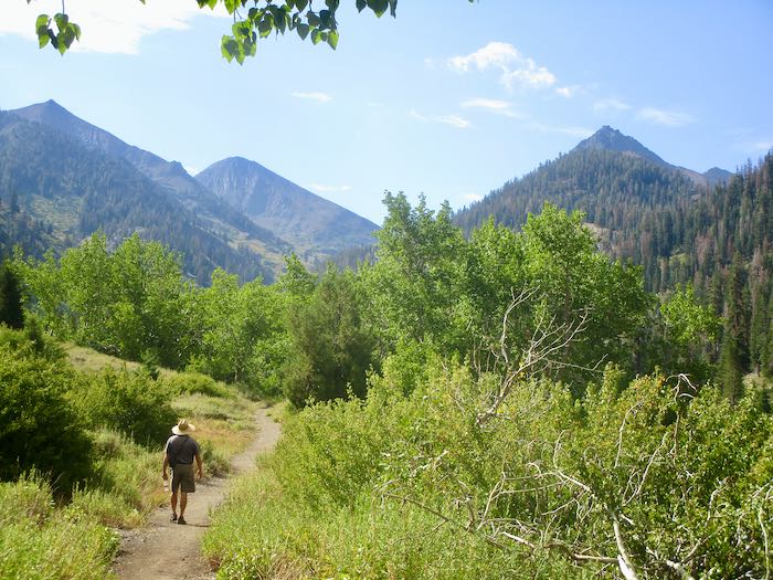
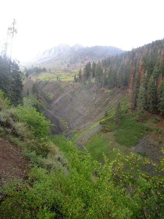
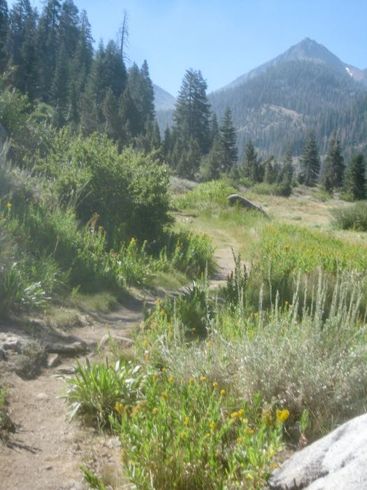
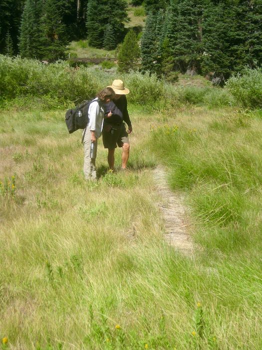
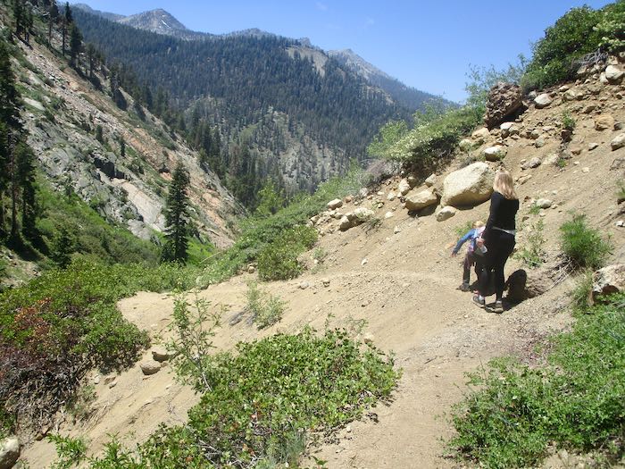
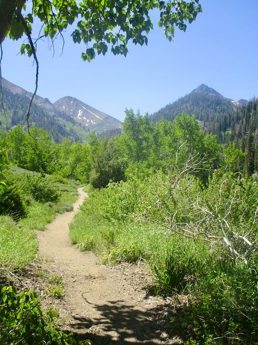
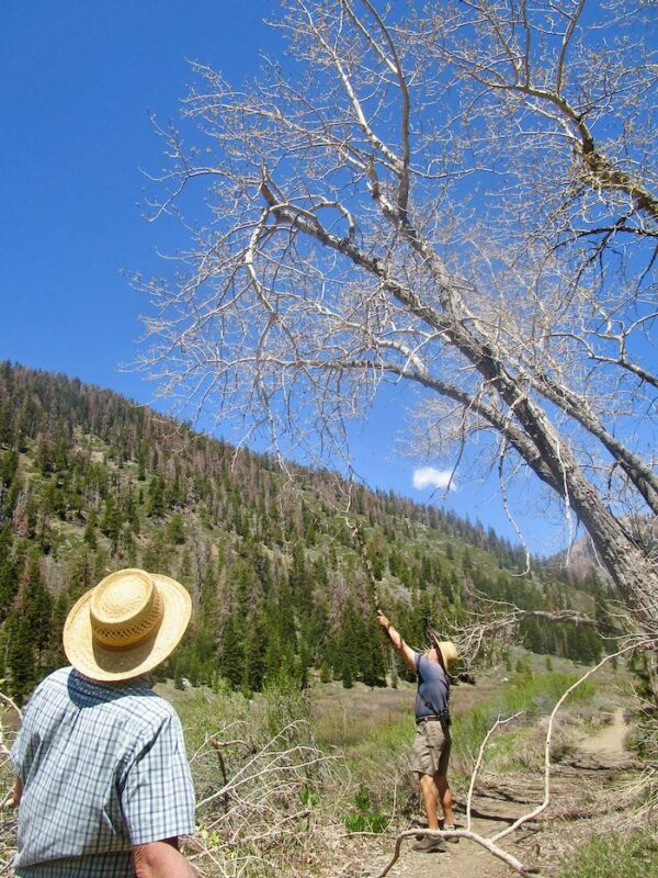
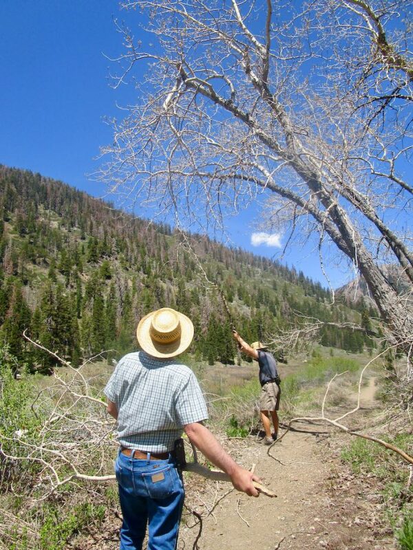
Just a few days ago I told you about Trail Guy hiking to the Franklin/Farewell junction and lamented my lack of hiking this summer. Last Sunday a friend and I decided to go to the Franklin/Farewell junction, because I really wanted to see it at least one more time in my life. (yes, being a bit dramatic here). I figured I could turn around if my feet started objecting too loudly (or perhaps wear ear plugs?)
The previous day had a terrific storm, but looking toward Farewell seemed clear, so K and I took off, (along with Trail Guy for the first mile or so.)
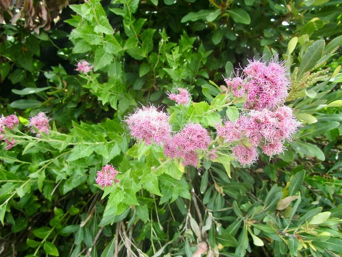
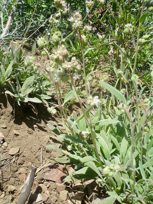
We saw Western Eupatorium, a flowering shrub I’ve only seen up near Franklin Lake.
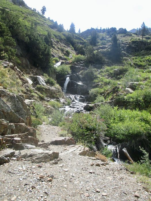
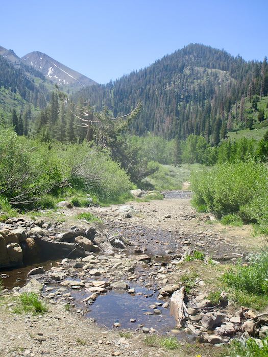
We crossed Franklin Creek without trouble; K hopped the rocks and I simply walked through the water, which was shallow and clear, making it easy to see good foot placement.
Shortly after crossing, we felt a few raindrops. No problem: we each had a parka AND a poncho.
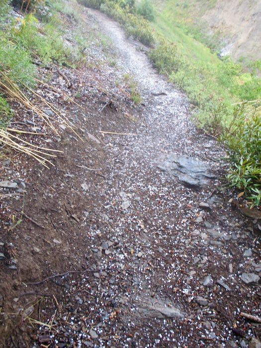
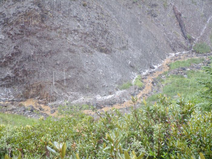
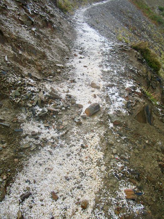
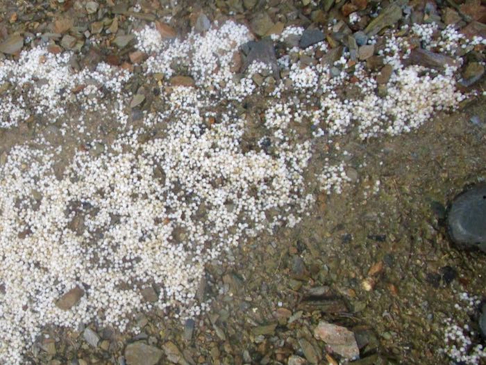
Good thing. Thunder, lightning, rain, and hail, but we just marched ourselves onward up the trail with only one break to stand under some trees (yes, risky with lightning) when the hail got too strong.
The white line is hail; the brown line is the very muddy stream.
When we reached the junction, the storm seemed to be letting up, so we stopped for a bit to see if any flowers remained and to eat something. (This was a hike, not a walk, so we carried food and water, and needed ponchos to keep our packs dry.)
Feeling hopeful, but cautious, we cut our break short and headed back down the trail. Two men had just passed us on their way down from Forrester Lake, cutting their backpack trip short by a day because the weather was a bit much.
Not long after heading back down, it all started again, with pouring rain that turned to hail, and steady thunder and lightning. We caught up to the men, sheltering under some trees because the hail was just so strong again. After a little conversation about how our ponchos were fairly ineffective, we headed down again. The trail turned to a flowing stream of mud, making it difficult impossible to see foot placement. I gave up pretending that the combination of parka and poncho were keeping me dry, accepting cold and wet as reality. (Ever get hail in your Crocs? It feels like a pebble, but eventually it melts.)
We took a couple of breaks beneath the few groups of trees, just to assess ourselves and one another. K is tough as nails, resourceful, always cheerful, and game for almost anything as long as it is in Mineral King, making her an excellent hiking partner. So, we mushed ahead and then. . .
. . . Franklin Creek!! Completely uncrossable. Raging, muddy, scary.
I took two photos, then packed my camera into its case (knit and felted by me, of course), then the poncho bag, and then buried it in my pack under the non-effective poncho. No more photos—the hike’s focus became solely about getting home in one piece.
NO MORE PHOTOS
K and I thought about our choices:
Wait for the two men to arrive and cross in a human chain, holding to one another for support. (K did this downstream on Franklin Creek many years prior).
Get comfortable and wait for the stream flow to subside.
Find another way home.
Option one still felt too risky; option two was too unknown and could take hours; option three was the best.
We went back up the trail to where we could bushwhack our way down to the East Fork of the Kaweah, which begins up at Farewell Gap. I guess you could call this “Farewell Creek”, or “Farewell Drainage”. Whatever its real name, we made our way to the stream, which was very muddy but not raging. The challenge was clambering up the bank after crossing, and somehow we made it up the other side without actually falling in, with apologies to the willows and other shrubs that we stomped on.
Then what? We knew that there was an old “trail” (just a route, because the trail is not visible in most places) up that side of the canyon to Farewell Gap. When we were on the trail, I led; when we were off trail, K led. I did my best to keep up, and she was very kind in waiting when she saw I was struggling—she is quite tall compared to me, and used to this sort of scramble-hiking, whereas I usually avoid this off-trail stuff.
We went over wet grass, through scratchy shrubs, over fallen logs, through a bear sleeping area (he wasn’t home), through some soggy little drainages, and over a zillion slippery branches, one of which knocked me to the ground, but only one, so there.
THOUGHTS, EXPRESSED AND NOT EXPRESSED
If anyone had shown me a video of the day’s hike, I would have said, “I’ll pass—just leave me here by the wood stove with my knitting.”
I know this is wacko, but I’m kind of having fun!
Unless one of us gets dementia, we’d NEVER forget this day. (We’ve been friends for 40 years, and this was definitely a memory maker.)
Trail Guy would hate this!
ONWARD
We knew we’d have to cross White Chief Creek, and because K was familiar with that side of the canyon, she knew that it flattens out where it enters the East Fork, which was also a raging muddy force of wetness. After crossing White Chief, we continued down canyon, aiming to connect with the trail which the pack station used to use for crossing the East Fork.
Just as we hoped, K led us directly to that trail, which she referred to as “Davis Camp”, and we huffed and puffed our way up to the real trail, the one that leads to White Chief, where we had considered going. I pushed for the Franklin/Farewell junction, since I’ve been to White Chief twice this summer.
MEANWHILE, BACK AT THE RANCH
(WHERE did that saying come from??) Trail Guy was getting mighty worried. He went to a neighbor to apprise him of the situation, and together they began discussing a plan, correctly thinking that the Franklin crossing would be impossible.
While they were formulating a plan, we made it home. Trail Guy asked what I would have done if the situation was in the reverse. I said that I would have assumed he’d know to cross the East Fork and bushwhack his way home on the other side of the canyon, just as K and I did. He said that was exactly what he would have done, validating K and my decision making.
In thinking over the situation, K was the perfect partner for the adventure. Her cool head, optimistic attitude, knowledge of the area, stamina, and general toughness were just the right combination.
Meanwhile, we will never know how those two men made it across Franklin Creek.
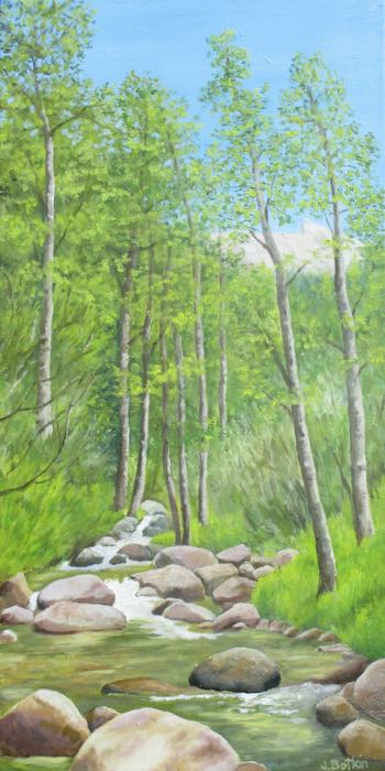
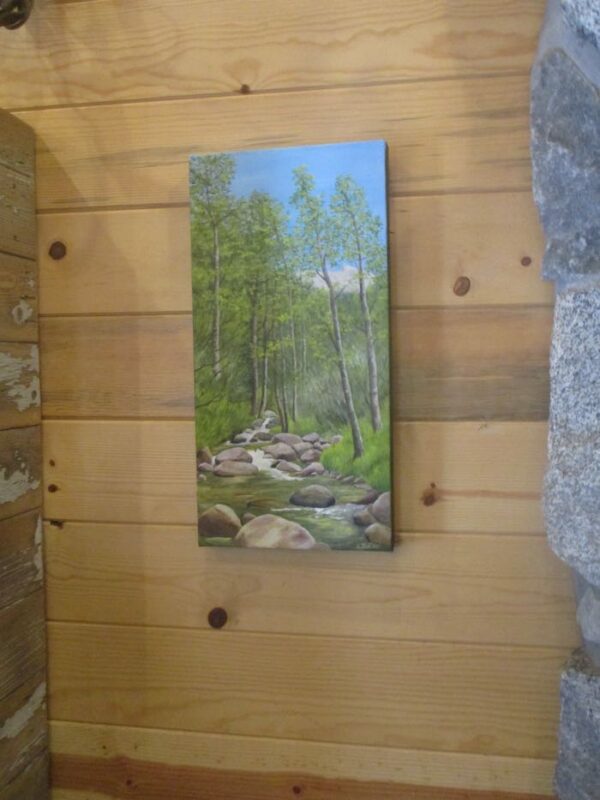
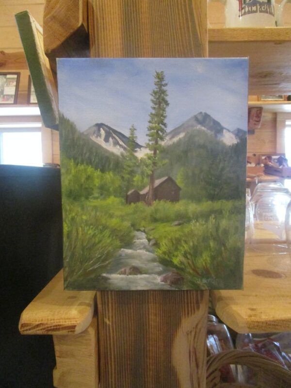
Oh yeah. This is supposed to be a business blog. Have a look at a couple of oil paintings of Franklin Creek (both sold, but I can paint either scene again.)
Looking downstream, not too far below the Franklin Lake dam.
Trail Guy and I accompanied Laile, who is an archaeologist/historian (I think those are her titles) to show her something we found. She cleared up a mystery about a rock platform that we always thought was a cabin foundation. Nope, it was a ride-by bar! George Thurman and his wife Hattie had a bar for miners riding past, who could hold out their cup and get it filled with whiskey without dismounting. (I think it was for miners but now I have forgotten the years. I am NOT a historian.)
We headed up the trail.
Thurman’s Bar! (Calm yourself – they weren’t open and I don’t drink alcohol anyway.)
Laile explained that the grass-covered log with some metal spikes used to be a dam on the creek, which obviously has changed course.
It was so beautiful out in that meadow.
Working
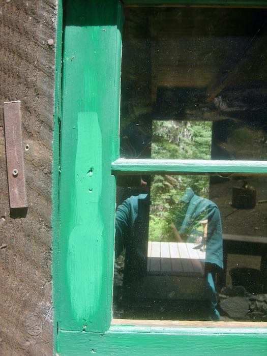
I spent some time caulking and painting our windows. Look at the extreme difference between wet and dry paint. It was alarming at first stroke, but then as it dried, everything was okay. There is more to be done, but things are looking better.
Hanging Out
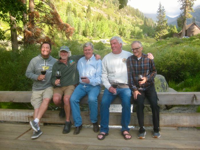
We hung out with our very dear annual neighbors, the Sawtooth Six (now there are only five, but the name remains, and we miss Ted something fierce).
Yeah, I said I don’t drink alcohol, but other people do. The “little” bottles are normal sized; the huge one looks like a joke. (This opinion almost got me banned from the neighbors’ deck.)
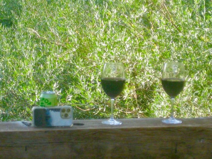
It is a tradition to hang out on the bridge in the evenings.
The Olipop can won the competition to become a tripod.
I left early one morning because I have actual work to do (as you might have read on yesterday’s blog post.)
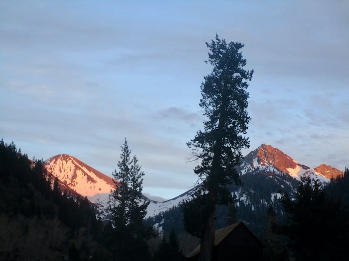
Farewell, Farewell. (The weird darker spots in the sky are because I borrowed Trail Guy’s camera. Mine was temporarily missing, because I have too many homes, too many buildings, too many vehicles, and too many briefcases and totebags. This contributes to me being a loser in the true sense of the word.)
Some weekends in Mineral King are just action packed, all about the people. Who has time to hike? Or just sit quietly while contemplating matters of consequence? Go home if you want solitude, you delusional creature!
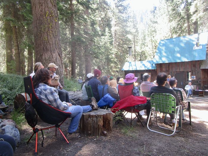
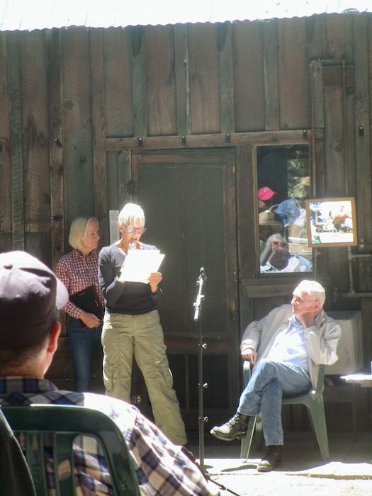
It was the annual cabin owners meeting, which is traditionally the weekend when we see the most cabin folks. (Yes, I know, duh.) This year’s meeting was the most energetic, enthusiastic, and optimistic that I remember. The president of the board for the last umpteen years has stepped down, and a dynamic rock-‘em-sock-‘em git-‘er-dun woman is stepping into the role.
I walked down to the meeting, but accepted a ride for the final stretch because I was late. I left on time, but so many people stopped me to ask a question about this or that or something else that time got away.
Here’s only a few of the folks present. I chose this photo because it shows almost no faces, and I am a respecter of privacy.
Sarah read a beautiful tribute to the retiring president that made many of our eyes leak.John has served us well. He wanted a plaque. (Please, NEVER give me a plaque for anything, please!!)
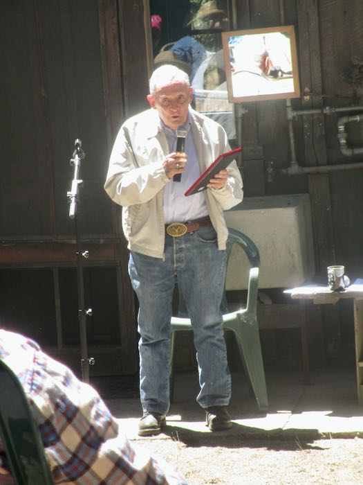
This is Eddie, our county supervisor. Three years ago, he told me that I could paint a mural on the Ivanhoe library. Then the bureaucracy kicked in, and after jumping through all the hoops, meeting all the deadlines, returning all the emails, and counting my chickens before they hatch, I gave up. After the meeting, without my prompting, he told me that it is almost time for the mural to happen. It began with a conversation about one, ballooned to a competition to paint two (which I was told that I won), and apparently is now back down to one. Until there is a signed contract or money exchanges hands, it is simply conversation. (Links to the posts about the library are below.)
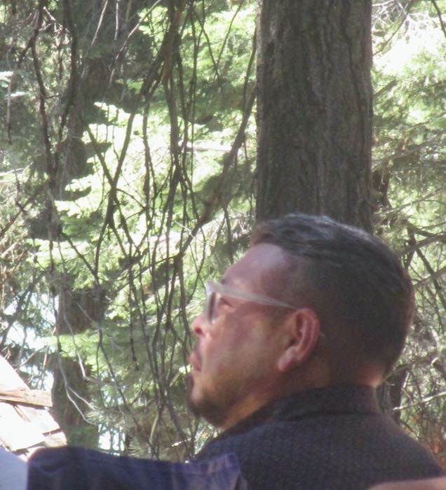
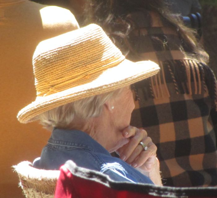
This is a friend whom I have admired for many years. It was because of this hat that I went searching until I found my own version. I would like to draw this photo.
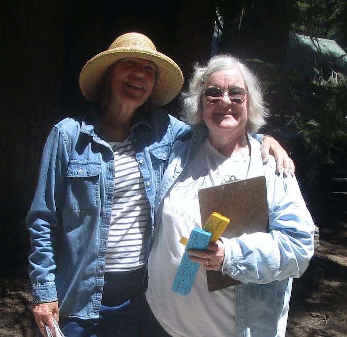
And this is me (wearing the straw hat based on my friend’s hat above) with my good friend Sharon, my most faithful blog commenter!!
Two different people approached me separately to say how much they enjoy my blog. That was my highlight of the day. (Hi Eliza, one of my tens of readers! Thank you, Glenn, you faithful reader!)
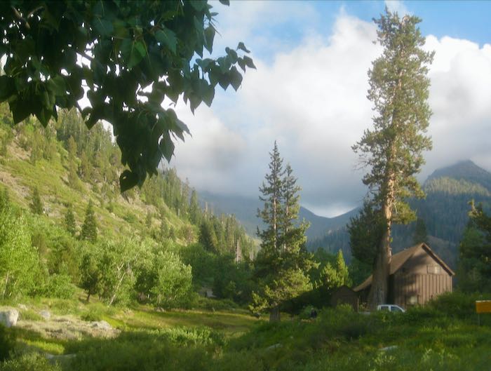
Here is some token scenery from an after-dinner walk to the bridge. I don’t think Bearskin will make it through the summer. (That’s the snow patch in the shade on the right side of the right-hand peak.)
Sunday morning’s temperature at our cabin was 33°. This was on the second day of SUMMER! My 7 year old neighbor and I discussed the fact that the seasons don’t always follow the calendar.
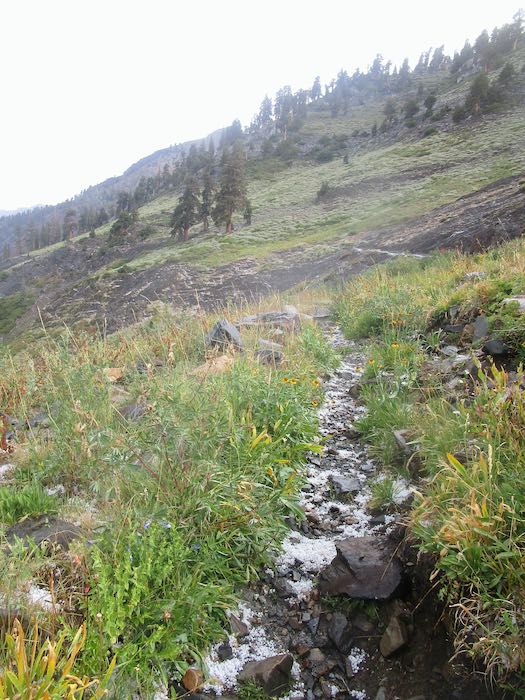
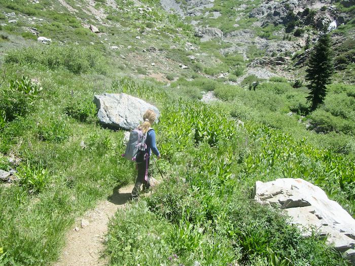
Because it was unseasonably cool, we opted to walk up the usually hot and dusty trail toward Timber Gap, Monarch Lake, Crystal Lake, and Sawtooth. Nope, those were not our destinations; we chose to go to Groundhog Meadow. It was just a walk, not a hike. (Hikes have backpacks with food and water; walks are just walks.)
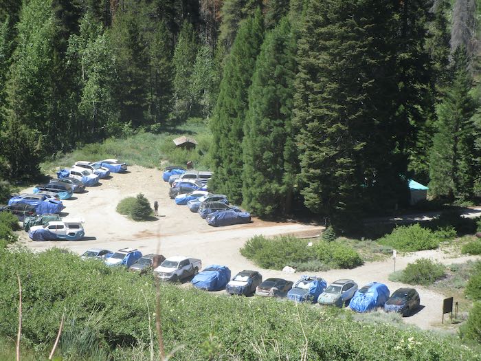
The parking lot was full of cars protected from marmots by blue tarps. Usually the marmots have ceased their automotive destruction by this date, but most people don’t know this and aren’t willing to take chances.
The trail is steep with giant steps for the first 1/4 mile or so. After passing the turn to Timber, you eventually come across this funny little spring, just shooting directly out of the side of the mountain.
I remembered the trail wrong: I thought there was a long straight section, with more steep steps to the so-called meadow. Instead, it was more steep steps to a long straight section that led to Groundhog Meadow. Our little friend viewed it as a hike and carried a pack in spite of my explanations. This girl makes up her own mind.
Groundhog Meadow is a weird name to me. What meadow? And aren’t they marmots, not groundhogs? Who named this place? This is Groundhog Meadow, which to me is simply a stream crossing.
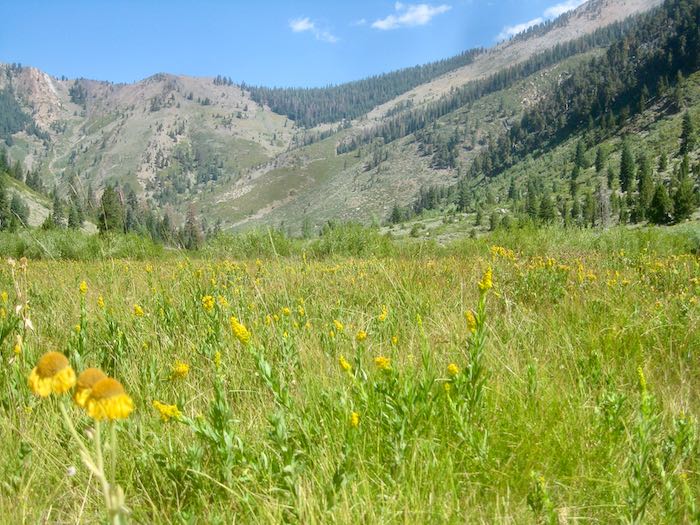
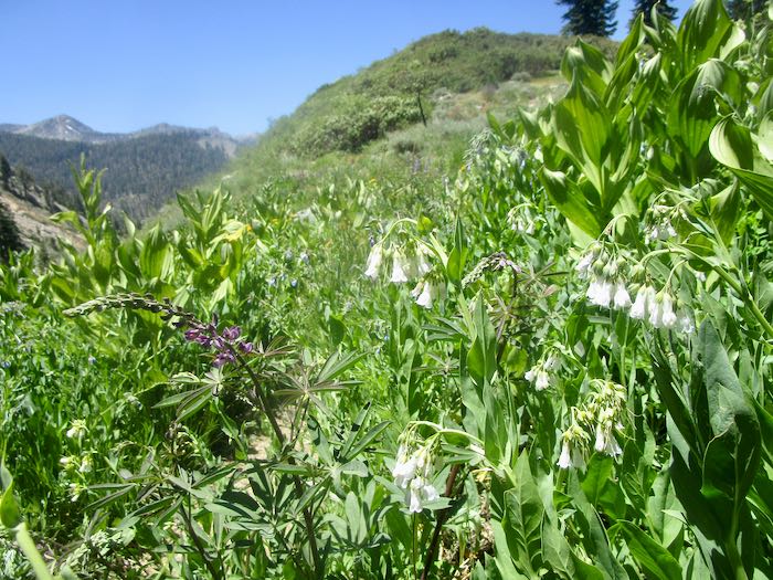
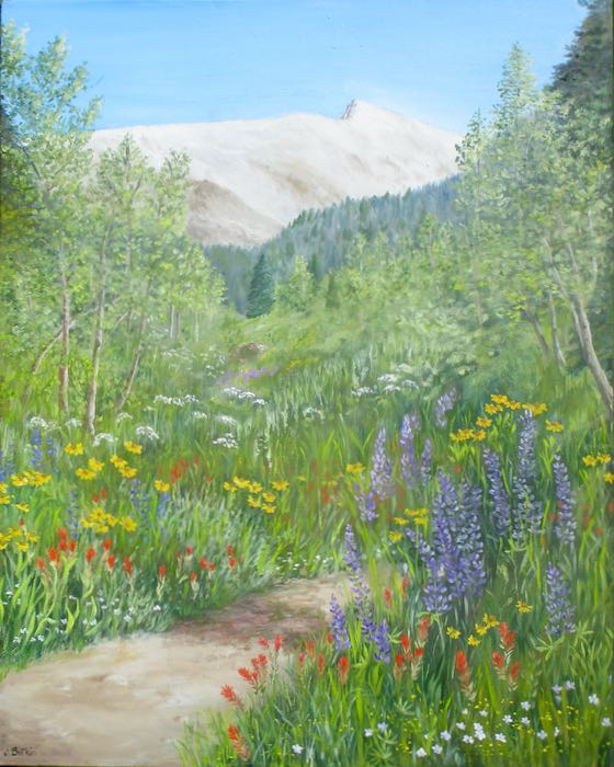
Being close to the beginning of July, which I view as the peak wildflower season, there were good wildflowers.
If you take the old Sawtooth trail, it leads to a nearby meadow; maybe this is Groundhog. Sure has a good view of Sawtooth!
There is one dicey part of the trail pretty close to the stream crossing on the way up. Here it is on the way back down.
Boring unknown white flower. . . if I do a second edition of Mineral King Wildflowers, will this make it into the book?
Hiking Buddy and I walked up to Crystal Creek. It has all gotten so lush and green in just the 3 weeks since I was last in Mineral King. Some of the ferns might croak due to the low temperatures, and a few of the lupine looked droopy.
Crystal Creek looks low, but it is because after the wet winter of 2023, its course changed to three spread-out sections across the trail instead of one charging stream.
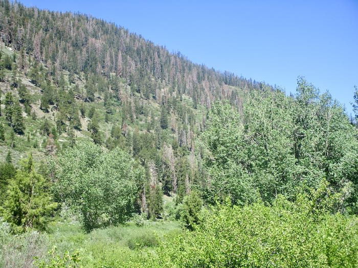
Ugh. So many dead trees. Drought? Some sort of beetle that takes advantage of a weakened state? We’ve had some decent winters, but the preceeding dry winters have taken their toll.
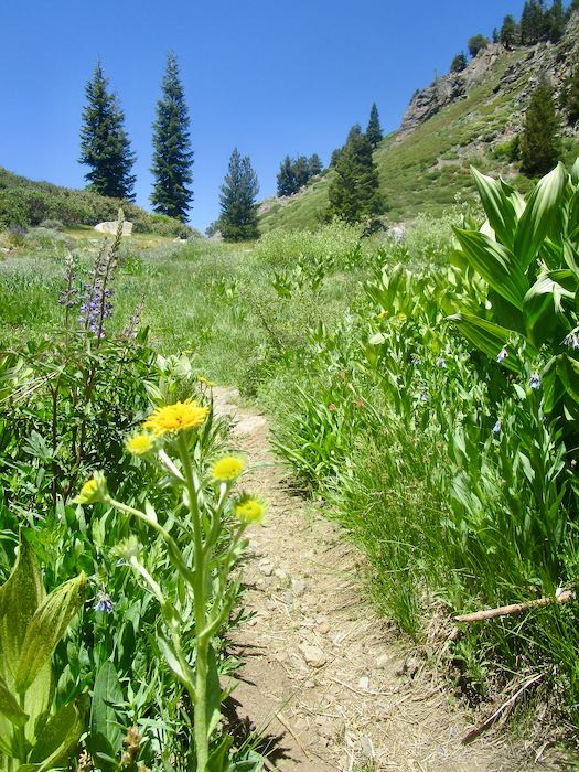
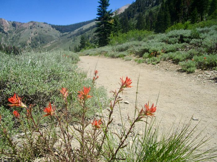
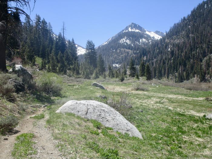
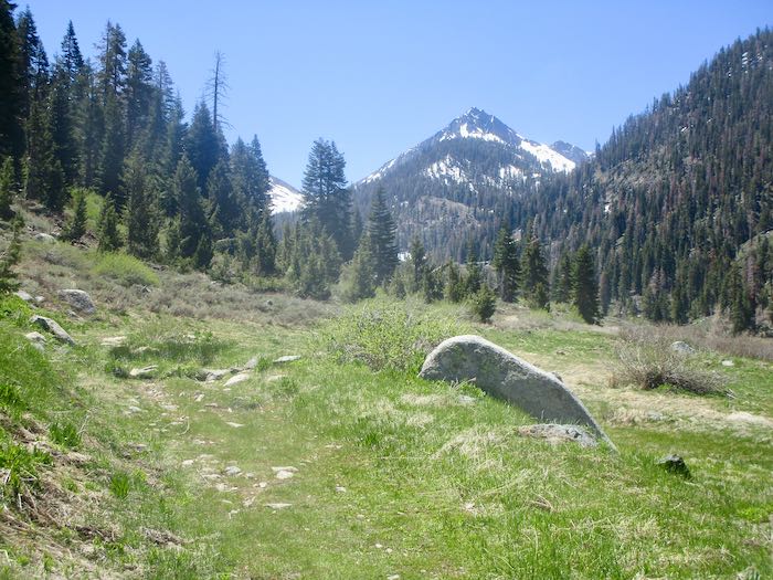
Indian Paintbrush was the dominant flower on this walk. That’s Timber Gap in the distance, in case you need help getting oriented.
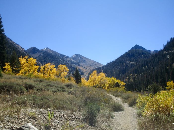
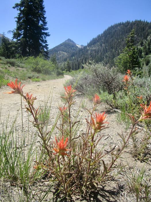
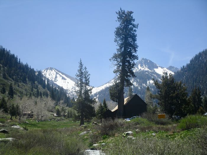
This is looking up the trail toward Farewell Gap, Vandever in the distance.
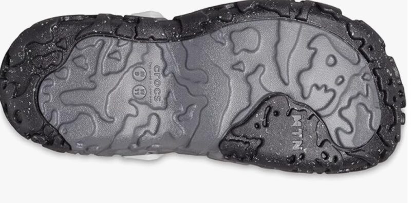
Thus we conclude another Mineral King report—walks, not hikes, grateful to be able to walk, wearing my latest hiking Crocs, called All Terrain Atlas Clogs. These have thick soles and I think they’ll last awhile.
(Take that, stupid Peripheral Neuropathy! You can’t stop me from walking on trails, so there.)
I have some new friends, acquaintances really, because we haven’t met in real life, but we are learning to know each other. They are bloggers like me, but with much bigger audiences, so I feel honored that they show up here from time to time. They don’t know about Mineral King so here is a little introductory information.
Heading to Eagle Lake, 16×20”, $650
Mineral King is an area of Sequoia National Park, accessible by a gnarly dead-end road. It is the most beautiful part of Sequoia and only open seasonally—Memorial Day through the end of October, weather depending. There is a community of private cabins, and I am fortunate enough to have married in 39 years ago.
Sawtooth #65, 24×30”, $2000
Cabin communities are a real treasure, with their own unique culture. Because I have lived most of my life at the base of the Sierra Nevada mountain range, I have had the privilege of spending time in four different cabin communities in the mountains. My business is called Cabin Art because when I started, I lived in a cabin and I drew people’s cabins. I have published two books of of pencil drawings on two different cabin communities—one sold out a long time ago and the other still available.
Honeymoon Cabin, sold
Because Mineral King is such a beloved place, I write about it frequently during cabin season. I try to incorporate some art**, because this blog is supposed to be about my business. Frankly speaking, people are more interested in cabin life, the trails, wildflowers, the road, and Mineral King in general than in my art.
Sawtooth #66, 12×24, $650
*I won’t be writing about Mineral King every Friday at the beginning of this summer because I have a handful of situations that will prevent me from going quite as often as normal.
**Yes, this time a lot of art. I came here to earn a living.
P.S. I’ve included links to the first four “chapters” (posts) that I wrote about cabin life back in 2023. If you want more, you can follow the prompts at the bottom of each “chapter” (in quotes because it is more like a picture book than a chapter book) that will lead you to the next posts. There are twenty-two.
For those new to my blog, Mineral King is an area of Sequoia National Park where I spend copious amounts of time in the summer. Next Friday I will provide a more in depth explanation.
Today’s post is a long one. You’ve been warned. . .
The road is under construction, so it is a mess, and there is a schedule to follow. This is what we saw at the bottom of the road.
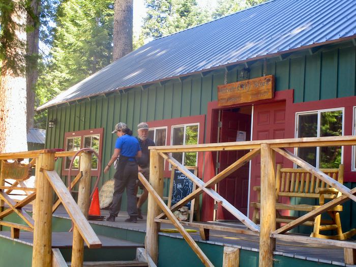
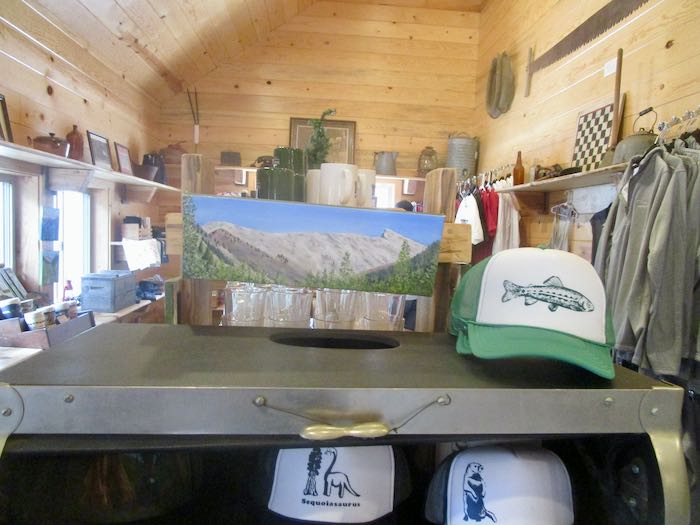
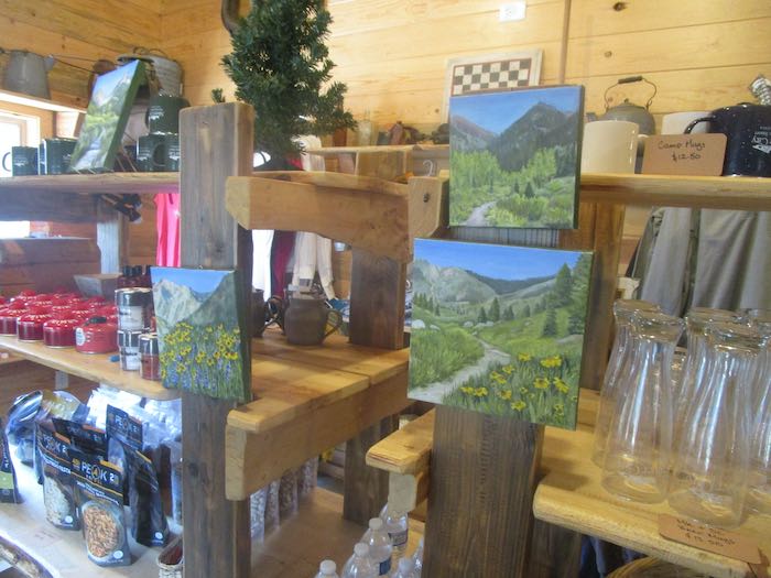
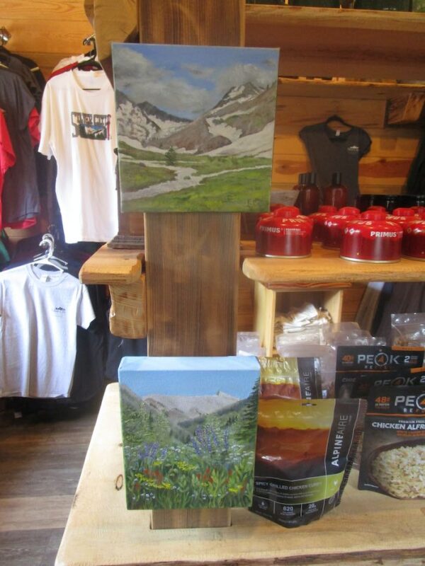
We stopped by Silver City to deliver paintings and cards.
I’m given quite a bit of leeway in placing the pieces and actually took my own nails, easels, and hammer.
That’s my design on the tee shirt in the background.This is that tall narrow space for which I paint something tall and narrow each season.The most popular subject—sold a 6×6” version of it on the weekend.
Shortly after arriving at the cabin, we headed back to a friend’s cabin with an enormous tree blocking her driveway. The men didn’t have big enough chainsaws but eliminated some parts to create a path around, carried some of her gear up to the cabin for her, and supplied a hand-truck so she could get things back down to her car later. “Did you see Tracy’s tree?” was a question we heard many times over our stay.
She had some good flowers in her driveway.
Very very tiny unknowns.Five spot is the name of these cuties. Those leaves in the center look like a cactus. What in the world??
Hiking Buddy and I hoofed it back up the road to our cabins.
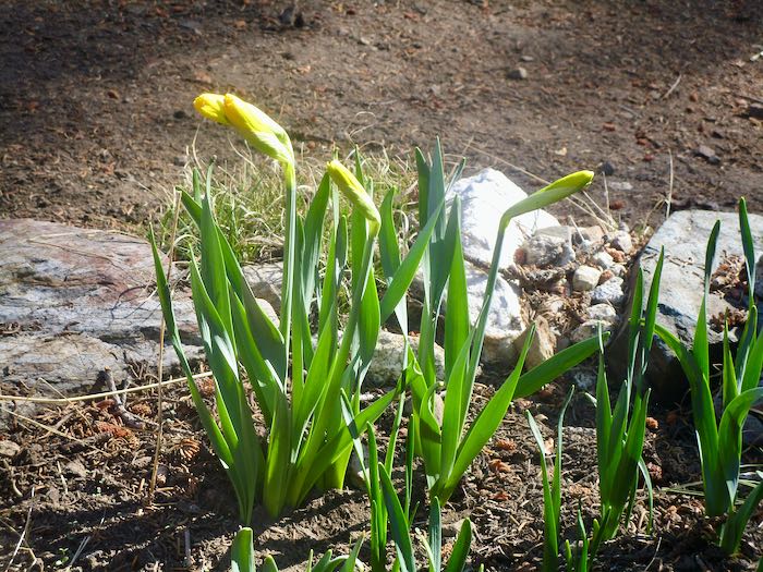
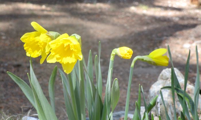
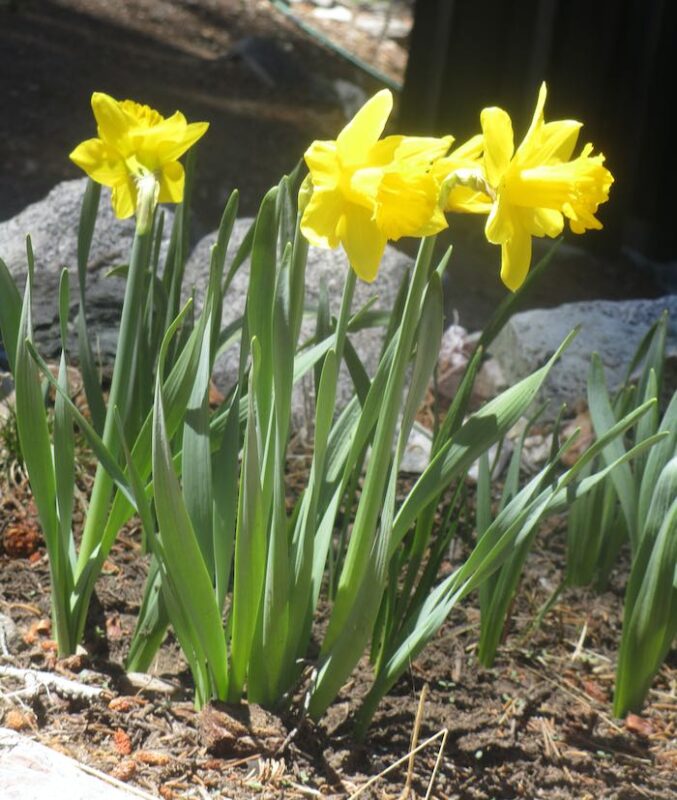
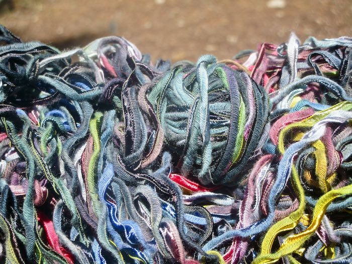
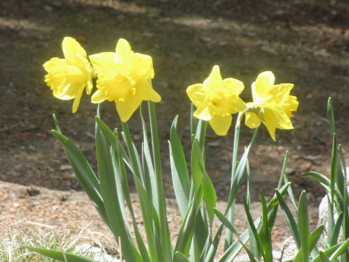
I had a nice afternoon of watching the daffodils and untangling yarn from a sweater that fit me wrong.
Our after-dinner walk was beautiful, but my camera is fairly inadequate for this sort of lighting.
However, it is perfectly fine for this sort.
The next day was busy for the men as they assisted cabin neighbors in various opening tasks. However, I had time to continue watching daffodils bloom.
Hiking Buddy and I ventured up to Spring Creek to see if the bridge had been installed yet. Nope.
When the men were available, we took a walk together.
Some of the cottonwoods had quite a few broken branches, and one was swinging precariously. The guys tried to dislodge the widow-maker, but it survived (and so did the guys—no widows were made.)
Crystal Creek is running well, very wide and shallow (sort of like Facebook).
There was more time in the afternoon for unraveling that sweater and watching the daffodils.
More walks (I am unsure about hiking with my peripheral neuropathy this year. . . more will be revealed, but for now, walks are fine with me.)
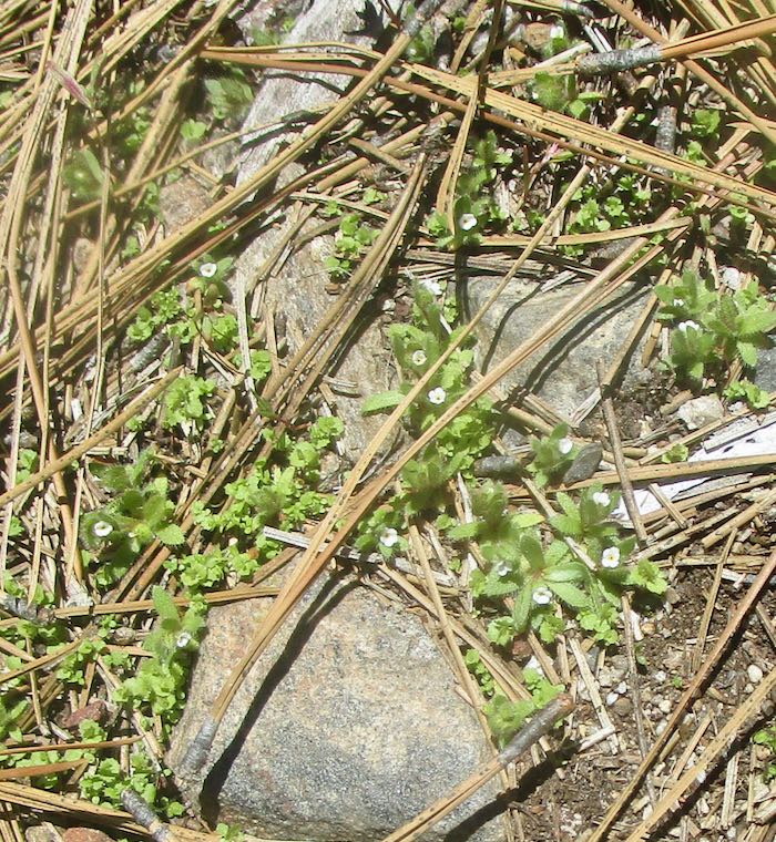
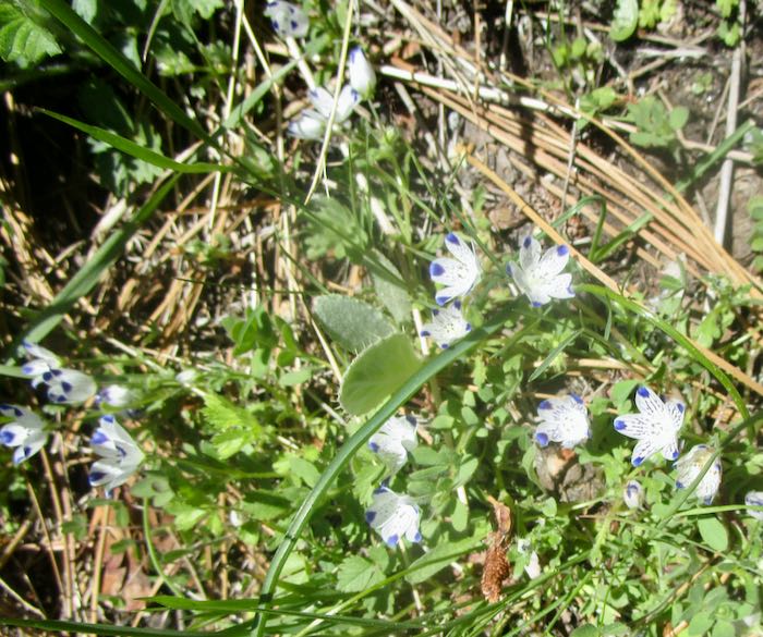
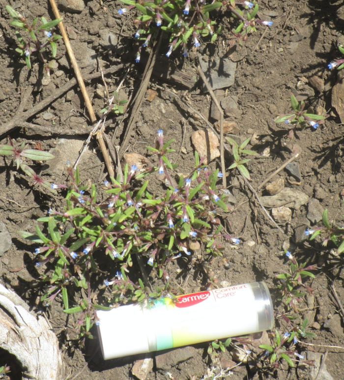
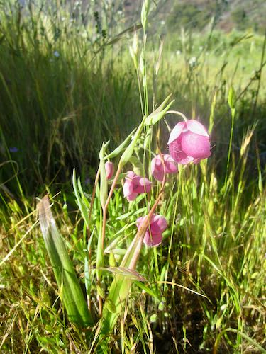
These are the tiniest blue lips I’ve ever seen! All I had so that you can appreciate the size is this chapstick (okay, Carmex, but who knows what that is?) in my pocket.
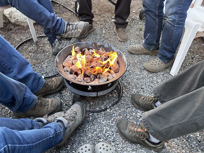
It was chilly in the evenings so we gathered with friends around this ring of fire. (Someone besides me was wearing Crocs—mine show at the bottom).
Look at the daffodils just 3 days later. Yellow wildflowers are a little bit boring to me, but daffodils are neither wild nor boring.
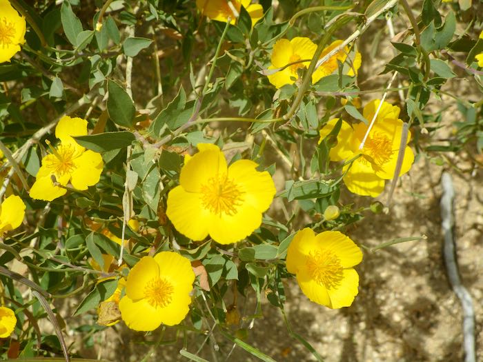
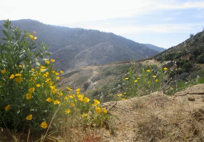
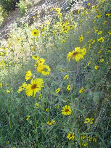
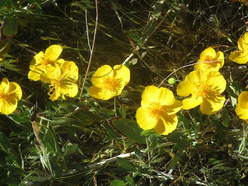
It wasn’t a hot weekend, and the drive down was quite beautiful. Almost all the wildflowers were yellow, and I wasn’t bored. Bush poppy, flannel bush, blazing star, monkey flowers—all yellow. The bush poppies are prolific and abundant. I didn’t photograph the areas where they cover the hillside, because it isn’t prudent to stop the Botmobile on steep slopes or blind corners or when the road is just one lane or if someone is on our six and there is no turnout.
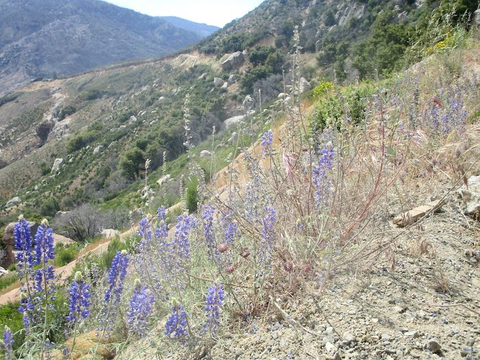
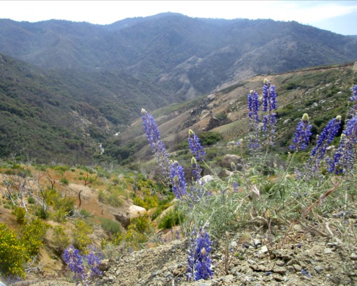
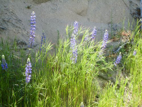
The lupine are hanging on too.
Thus we conclude our very long post about Mineral King. Next week I will show some Mineral King art (because this is my business blog and I came here to earn a living—any questions?) and explain for my new far-away friends a little bit about this place we locals love so dearly.
For many years, there has been talk of repairing the Mineral King road. Talk talk talk, yadda yadda yadda, blah blah blah. Surveys, public meetings, emails. Fires, floods, emergency repairs, road closures.
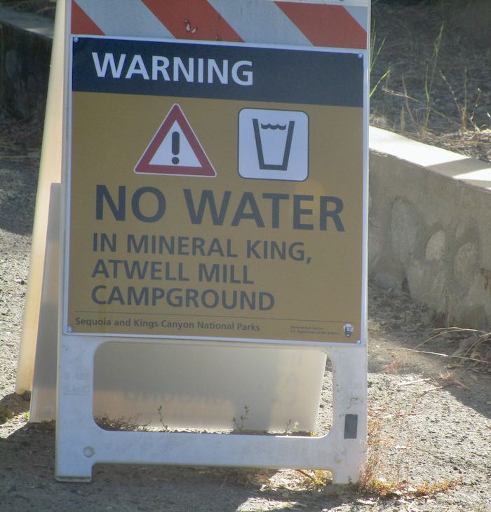
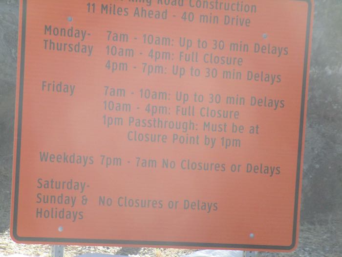
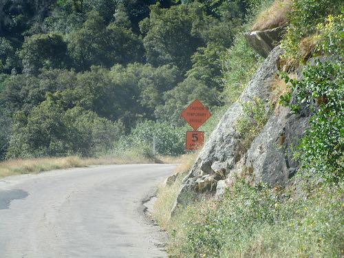
Finally, the work has begun. The road won’t be open to the public until the Wednesday before Memorial Day weekend, and there is a very rigid schedule about when you can pass through the work zone and when you will have to just wait.
I was happy to see all the green and the wildflowers, along with the reassurance that the temporary bridge made it through the winter. (I’m always relieved to see the sign on the way back home too, because if it is temporary, maybe it will vanish while we are up the hill.)
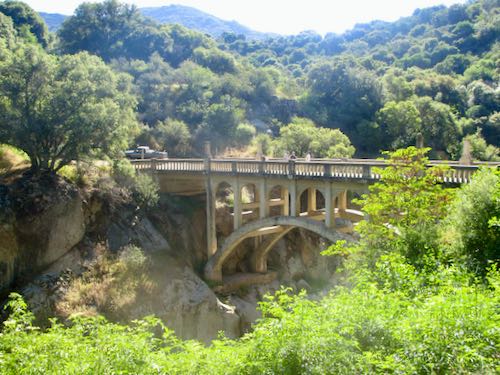
Here’s my old friend the Oak Grove Bridge. During all the public meetings about the road, it was voted to simply repair the bridge. Then Those Who Know More determined that it isn’t repairable and there is talk of converting this bridge to a foot bridge and putting a new driving bridge upstream. I don’t expect this to happen in my lifetime. This is on the county portion of the road, and the construction is only on Sequoia National Park’s portion, ending about 4 miles below the end of the road. Yeppers, the very rough upper dirt portions will remain and the threatened fancy-pants parking lots aren’t part of the plan.
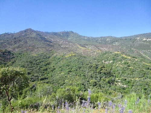
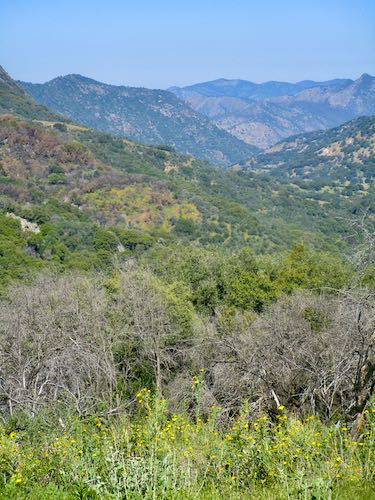
That’s Case Mountain over there. It is very green, and there are new roads carved in because of the wildfire last fall.
This is Squirrel Creek, just above the Sweet Ranch and below the park boundary, now with a mysterious road-construction-generated load of rocks by the turnout.
We pulled over to wait for the pilot car, and enjoyed some wildflowers and a view.
This is looking back at the road, still green. The wildfires (in 2020, 2021, 2024) required much brush clearing so it is a lot easier to see traffic ahead now. (Looking for a silver lining. . .)
Because Mineral King isn’t open to the public just yet, I didn’t want to rub it in that cabin folks can go. Right now it is rather colorless, because the green is barely beginning and there is a lot of snow. Here is the classic view from the bridge on the way out, which was a bit of a hustle in order to meet the pilot car*.
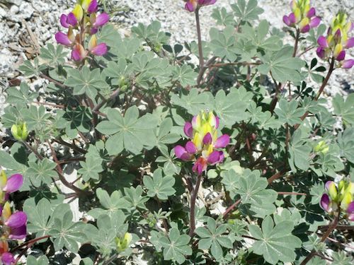
We got to the waiting area (just above Slapjack) with enough time to see some harlequin lupine.
It is going to be a summer of disruption, waits in the sun, and a much longer drive to Mineral King. (We left home at 8:30 and arrived at the cabin at 11:30. . . sing with me “a three hour tour, a three hour tour”)
*Someone reported being 10 minutes late to the pilot car area and he had to wait 3 hours for the next pass-through time. Do not mess with these construction workers and their schedule!