“Buckling down” is a weird expression. It reminds me of sayings such as “nose to the grindstone”, “shoulder to the wheel”, “eye on the ball”. . . How can a person accomplish anything in that awkward pose?
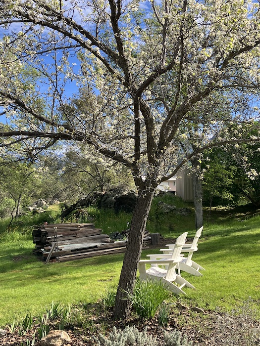
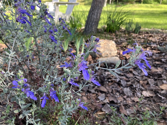
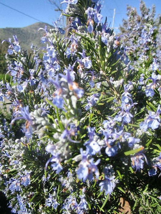
It was a beautiful early spring day (Yeppers, February is spring in Three Rivers).
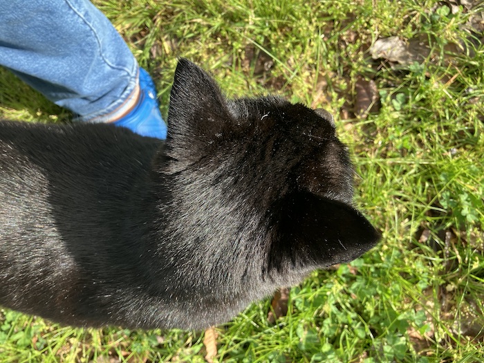
Tucker wanted me to stay outside with him.
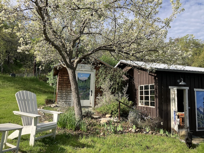
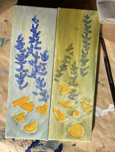
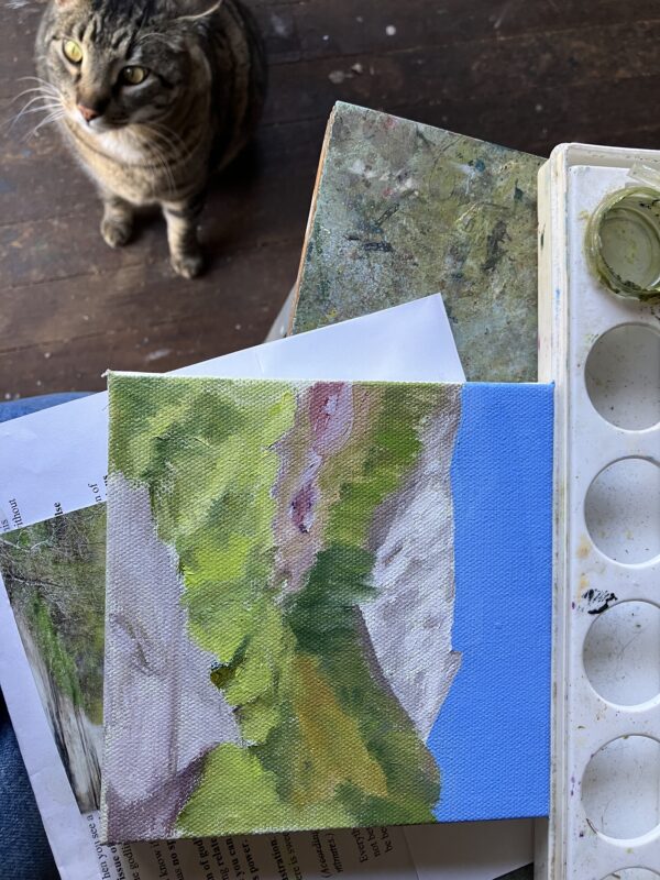
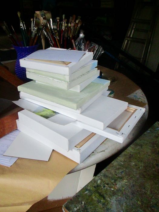
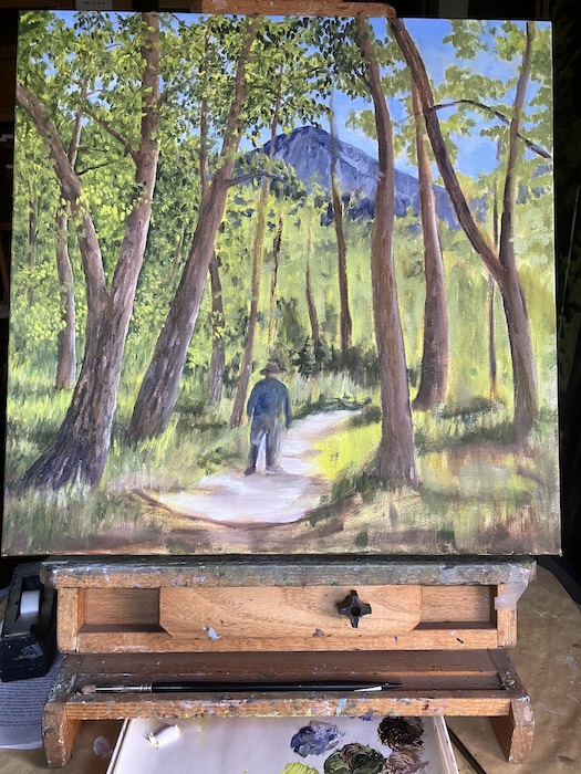
After a fair amount of procrastination (all productive, of course), I finally moved myself into the painting workshop (the open door to the right of the studio, which appears to be leaning, but that was actually me who was leaning.)
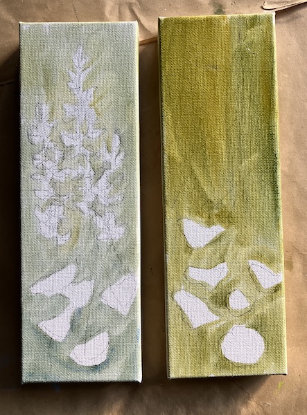
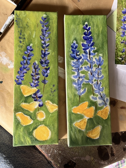
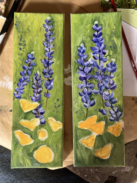
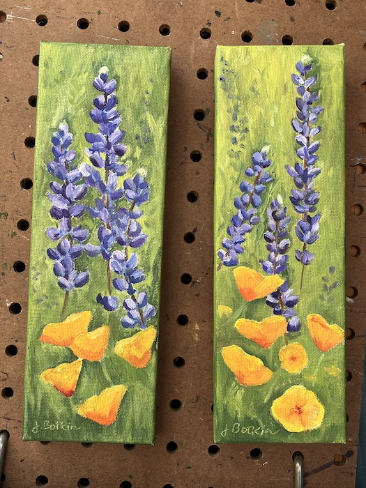
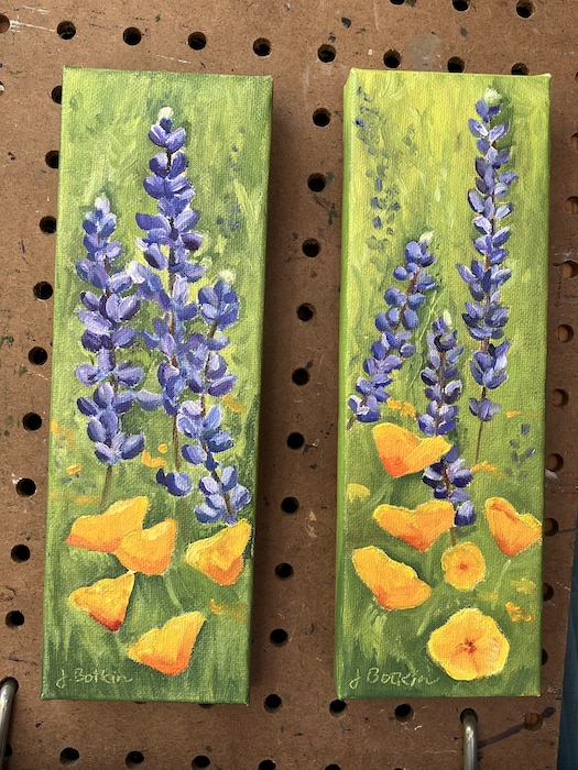
Because these are so small (3×9”), I did my best to make them as realistic as possible without spending endless hours trying to copy the exact look of each flower. We’ll price them at $75 each and see what happens.
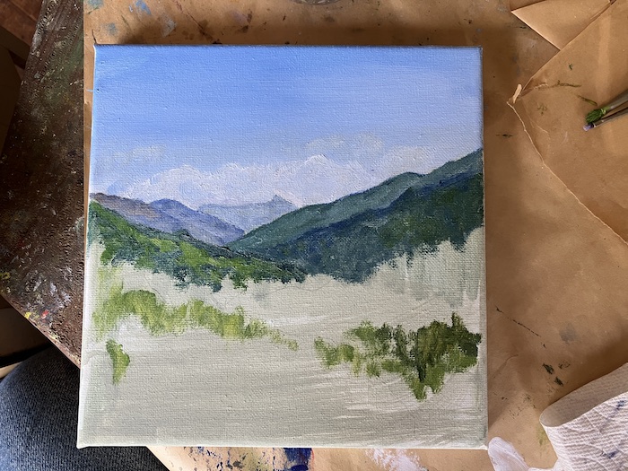
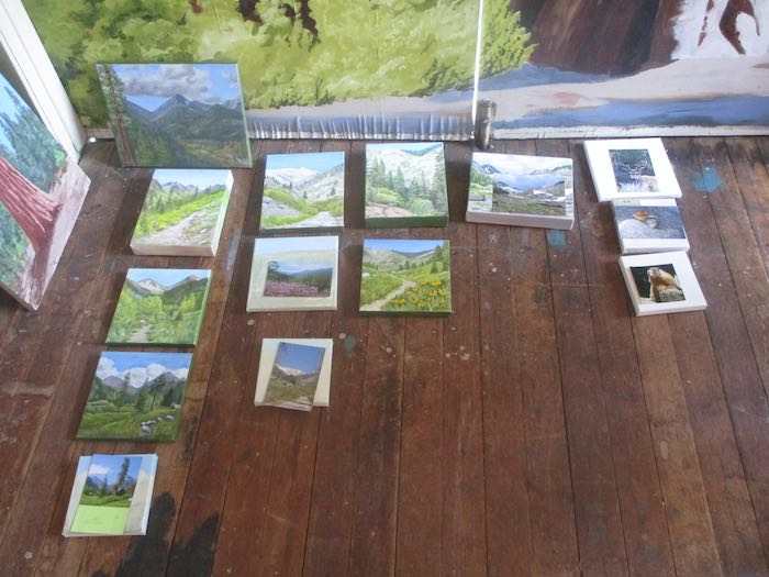
Then I finally returned to the Mineral King scenes that need to be completed by Memorial Weekend. I tried to be a bit looser than normal, and after I finish all 10 paintings, it will be interesting to see if I go back and tighten up the detail.
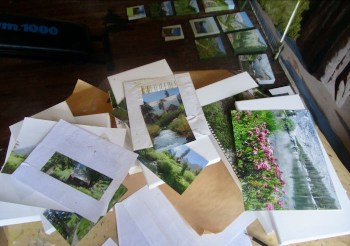
Deciding what to paint for the Silver City Store this coming summer felt like a daunting task. There is no excuse for procrastination, and the better I plan, the better the sales. So, suck it up, Buttercup.
The first step in planning is to look at the available Mineral King paintings. (For my out-of-the-area readers, Mineral King is a beautiful alpine valley in Sequoia National Park; each summer I sell art 4 miles below the valley at a resort in a little cabin community called “Silver City”.)
It also involves evaluating how many paintings sold, both by subject and by size. I am painting to satisfy a clientele, rather than just doing whatever “moves” me. Thank goodness it is all very beautiful.
This planning part isn’t so beautiful. It’s methodical, tedious, and would be easier if I had a crystal ball. Instead, I have records, intuition, common sense, and piles and piles of photos, both the paper variety and on the laptop.
It is helpful to line them out by subject and size.
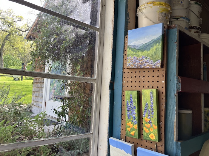
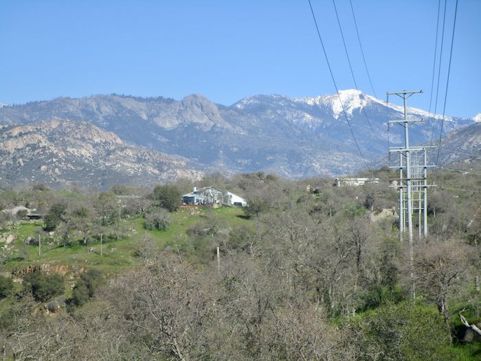
It is also helpful to take a break and walk somewhere. (No powerlines in Mineral King or Silver City to clutter the views up there, because it is remote, the Land of No Electricity.)
Rosemary in bloom. . . so far this year, February has been impersonating spring.
Now I have ten new paintings to produce, ranging in size from 6×6” to 8×16” and 10×10”.
I’ve attached hanging hardware and assigned inventory numbers. Next I need to give them titles, such as “Sawtooth #209”.
Not really; I think it is only somewhere in the 60s.
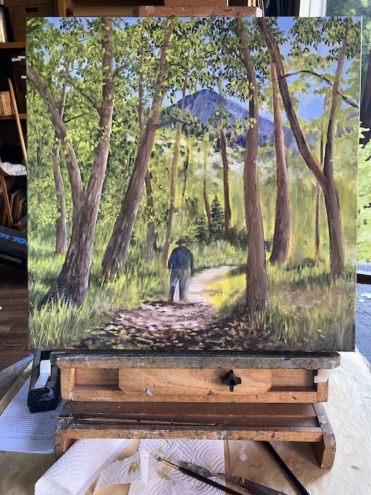
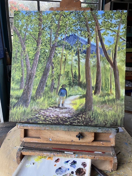
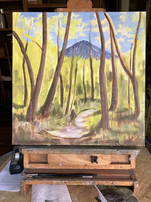
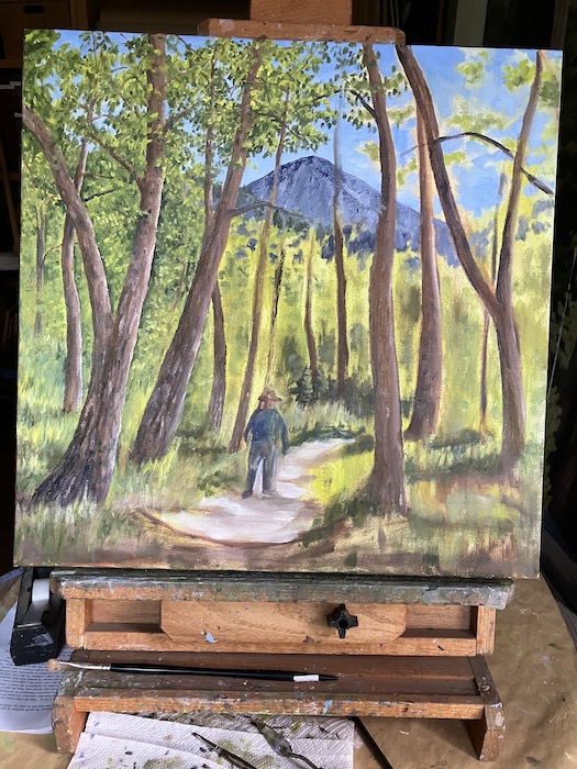
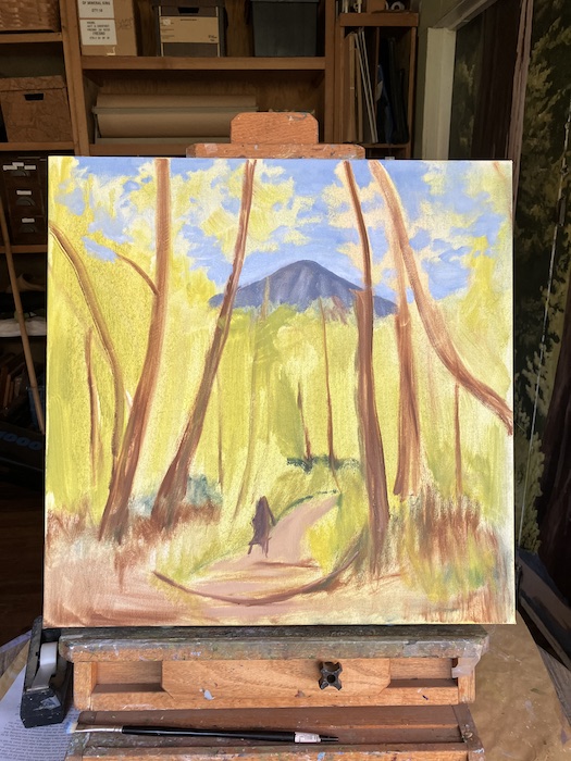
Before I finished layering the background things, I blew off any discipline about painting, ignored conventional wisdom about The Way You Are Supposed to Paint, and I launched into detailing.
When I draw, I work from top to bottom, left to right. This way I don’t rest my hand on finished parts, thus not smearing graphite around. So, in spite of generally painting from back to front (the farthest away thing like the sky first, moving forward toward the closest objects), sometimes I resort to drawing with my paintbrush in places where there are enough layers to warrant the detail. This means the left side of the canvas might start looking pretty good while the middle and the right side still resembles a dog’s breakfast.
I couldn’t see very well with the doors open and bright light behind the canvas, so I rotated it. Hence, the colors appear to have changed. (Did anyone notice this?)
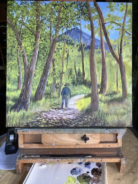
Bark on trees, more branches, better grasses, humanoid becoming more human (and now wearing shorts), more leaves, more this, that, and the other thing.
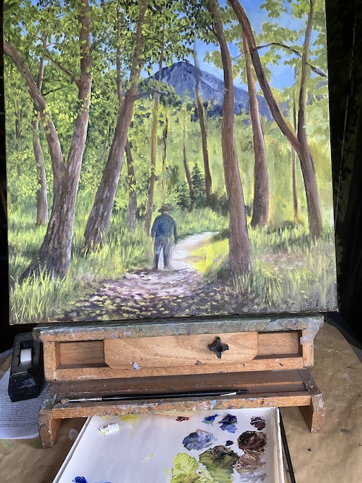
It was a very satisfying afternoon of painting (and only a little mosquito slapping.)
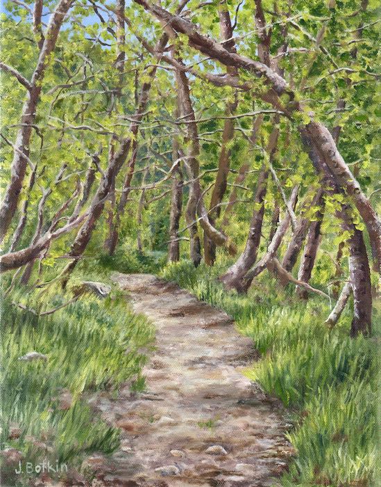
HEY, SEARCH ENGINES, IN CASE YOU ARE LISTENING, THIS IS A PIECE OF CUSTOM ART, AN OIL PAINTING OF A MINERAL KING SCENE. (Just in case there are a handful of folks who wish to join my tens of readers and see how a painting is built by this regional artist, this self-trained, user of a paintbrush like a pencil.)
WHAP, SLAP!! WHY are there mosquitos still plaguing me in November, for Pete’s sake?!
The threat of rain prevented me from beginning on Friday. More relevant:the powers that be did not offer me a key to their building, which means I can only paint on Fridays. This coming Friday I will be setting up for the Holiday Bazaar, and the following Friday is part of Thanksgiving weekend, with no idea if the library will be open. So, why start and then wait 4 weeks before continuing??
Commissioned Mineral King Oil Painting
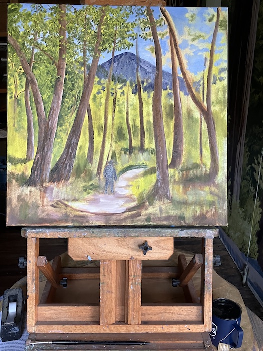
This custom piece of art, a commissioned oil painting of a Mineral King scene for a customer we will call Mister while not assigning any pronouns in order to protect anonymity, is starting to come together enough that I am no longer questioning the wisdom of accepting the job.
You can see the difference in color below because the sun was behind the hill. The inferior camera phone makes adjustments for low light, while changing the color. I sat down to work on the foreground, to get the darks and lights in the right places, hoping the colors were good (are shadows blue? purple? or just darker dirt and darker grass colors?). Tricky stuff to paint in low light.
I got tired of slapping mosquitos so I stopped after here. (Stopped painting, in hopes that I could stop slapping.)
I am still somewhat apprehensive about my ability to create a humanoid which is not only believable, but recognizable.
But it is too soon to worry about this. Actually, why worry at all? Instead, I’ll continue to paint.
I considered making a list of everything remaining, but it is too soon for that too.
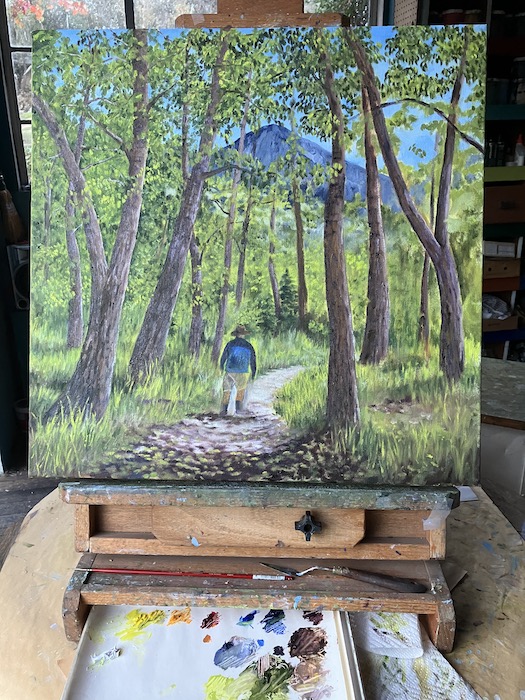
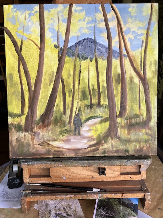
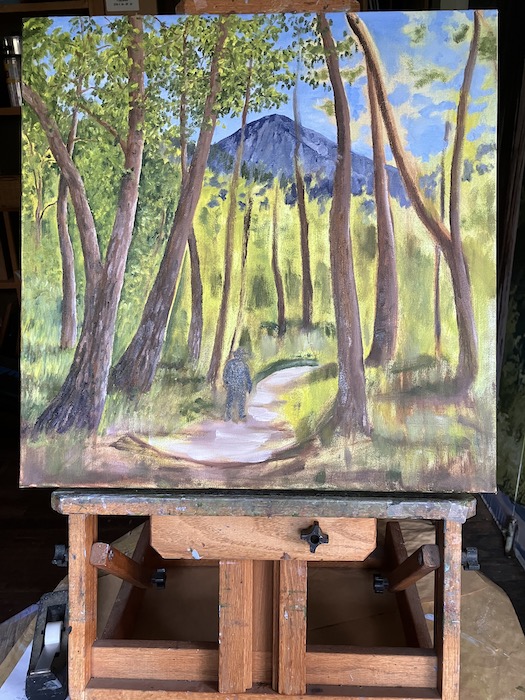
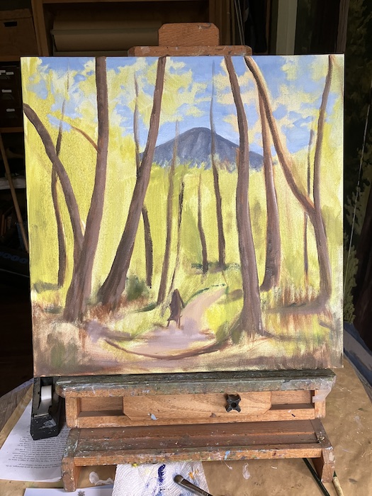
On Monday, you saw this version of the custom oil painting of a Mineral King scene.
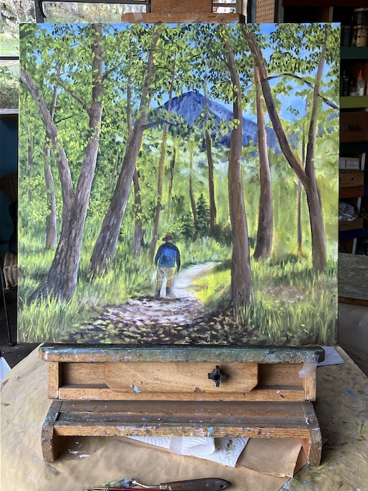
Next, I put more paint on the sky and worked more carefully on West Florence. (The humanoid is still a mess.)
Time to rescue the humanoid from embarrassing me. Wait, time to rescue me from the embarrassment of the humanoid. Something. . .
What’s different here? A little more background spots, using dark green and the grayish blue/bluish gray of West Florence.
Let’s make like a tree and leaf.
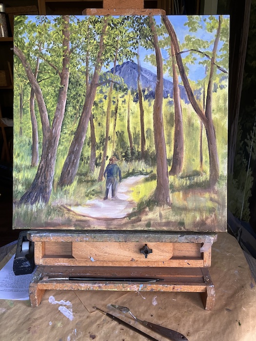
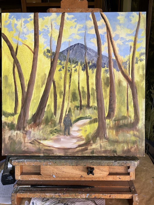
More color and texture on the tree trunks.
Something… Oh. I moved the tree on the left closer to the viewer.
In spite of using Trail Guy as a human-size model in the scene, I’ve decided to make the human larger in the painting.
Many more leaves, branches, trunks, grasses, and trail work to go before getting into the nitty-gritty of putting the correct human in the painting. That is going to stretch my skill to the nth degree.
Here is my usual collection of thoughts about custom art: This is too hard, I’m a washed-up has-been, why does anyone think I am qualified? And: These people are counting on me and I’d better get started because it is going to be hard and take a very long time. Finally: Just paint, you Goober! You know how to do this!
This is what you saw at the end of Monday’s post:
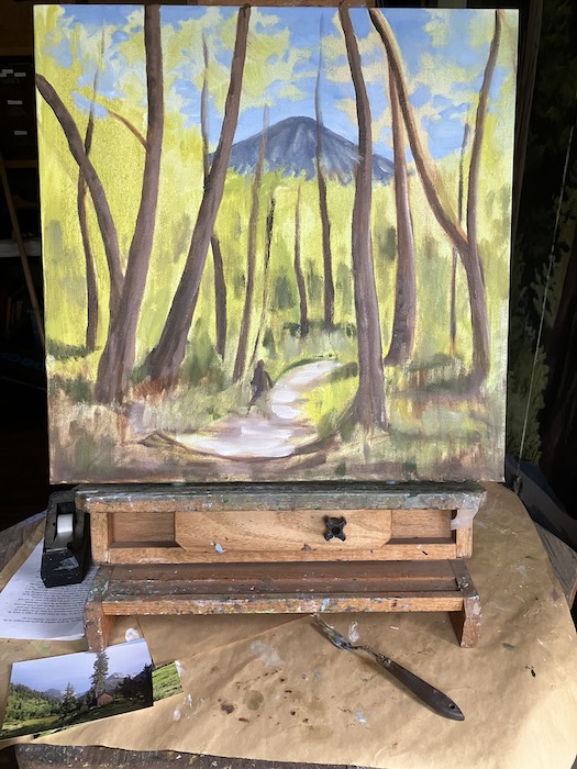
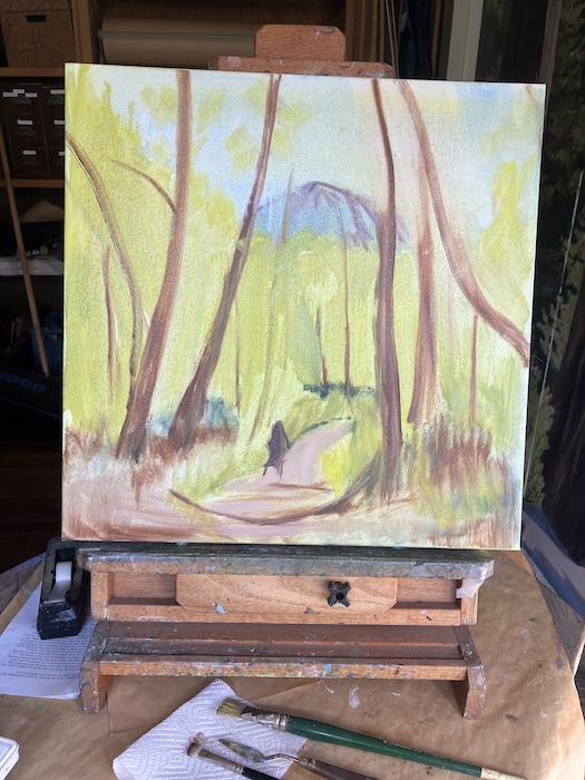
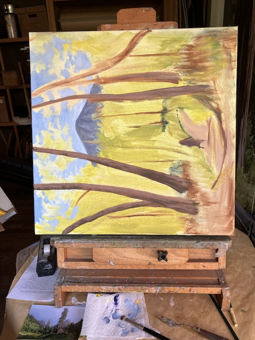
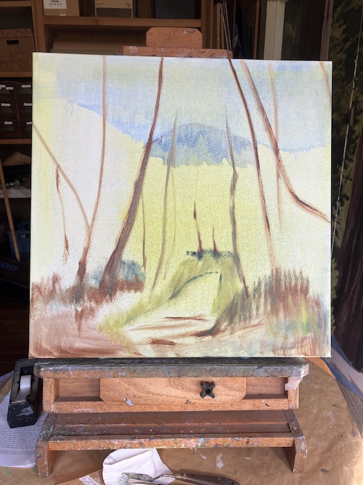
I started with sky because it is the farthest away, then put another layer on West Florence.
Sometimes I turn the canvas sideways because I can better control the brush and see it better for certain areas.
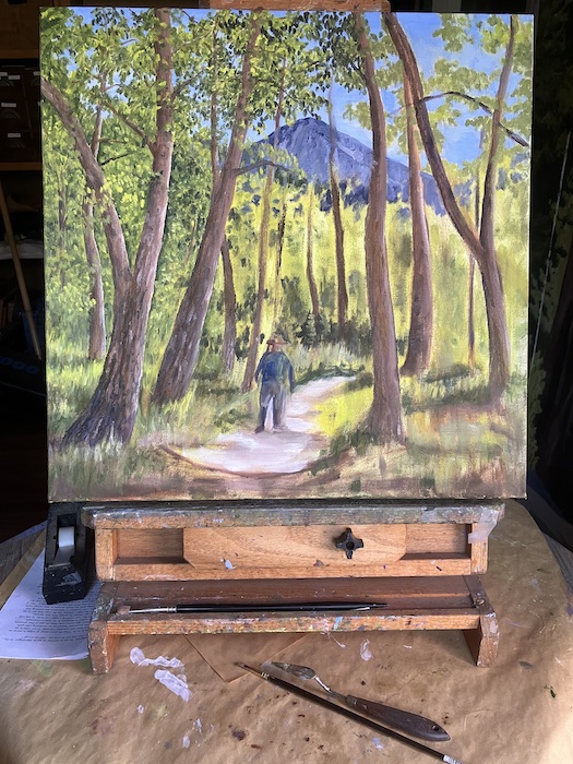
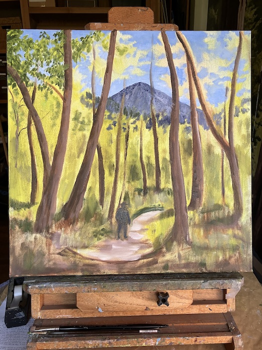
Here I started putting more paint on the trees. I’m also just planting them where they look right to me. The actual tunnel is kind of a mess, hard to find individual trees. If I painted more loosely, I could just slap on spots of various shades of green and then put in hints of blue sky beyond along with hints of tree trunks. But then I wouldn’t have gotten this job, because Mister likes my style of painting, not that loosey-goosey style.
This must have something changed for me to have taken another photo. Oh, I see that I tried to take some of the ridiculousness away from the humanoid-like figure.
“Commission” means someone is paying me to paint custom art for him. Them. Her. Shhhh, I think it will be a Christmas present.
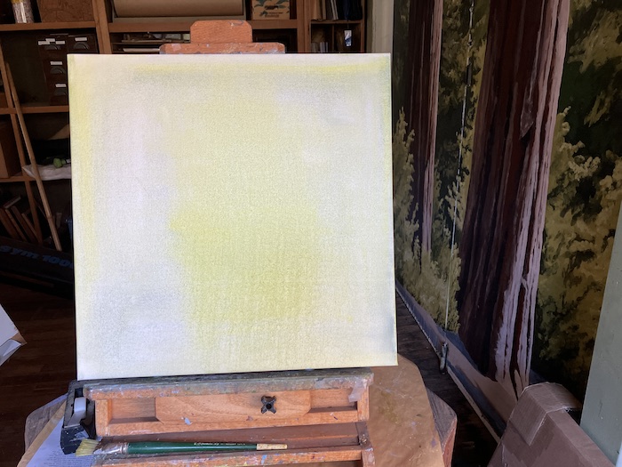
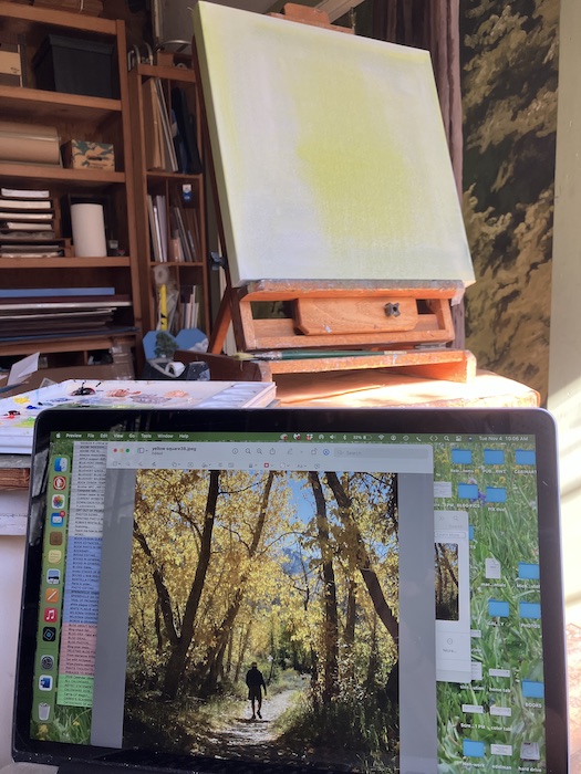
Let’s call the customer Mister. You can decide if it is a man, a woman, or several humans. Mister decided on 20×20”, a square format. The canvas arrived, and I put a very thin coat of paint on it.
This is the version of the requested scene. Yes, it is Mineral King, and that is Trail Guy for size reference.
No wonder my laptop gets splatters on the screen.
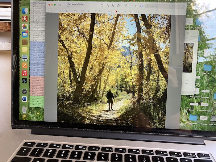
Here is the beginning. The photo says “Yellow Tunnel” but Mister is requesting the tunnel to be green.
That’s as far as I got. When it dries, I’ll put in a better sky and a better West Florence (that’s the peak on the left side of Farewell Gap.)
In case you are curious, I painted the tunnel in the green season several years ago. (If it feels like three years, it was probably six.)
Heh-heh, it was actually just five years ago. I think I paint better now. Sure hope so, otherwise I am One Stuck Central California artist. Gotta keep improving. . . always. And don’t give me this “your own worst critic” stuff either, because if I’m not, how will I get better?
And that’s all I’ve got to say about that. For now.
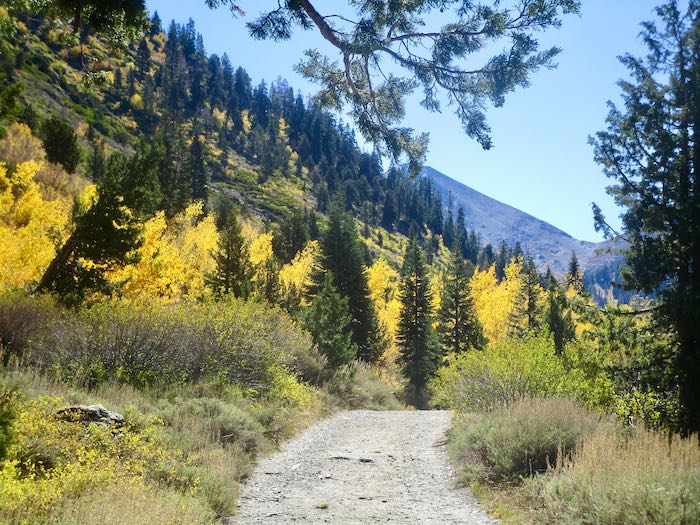
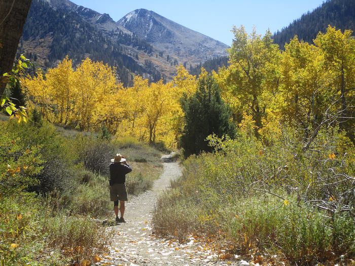
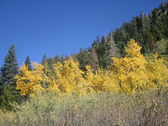
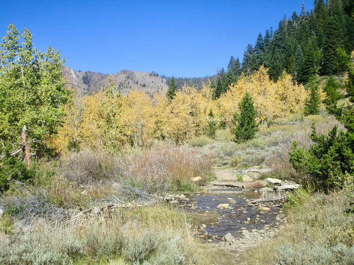
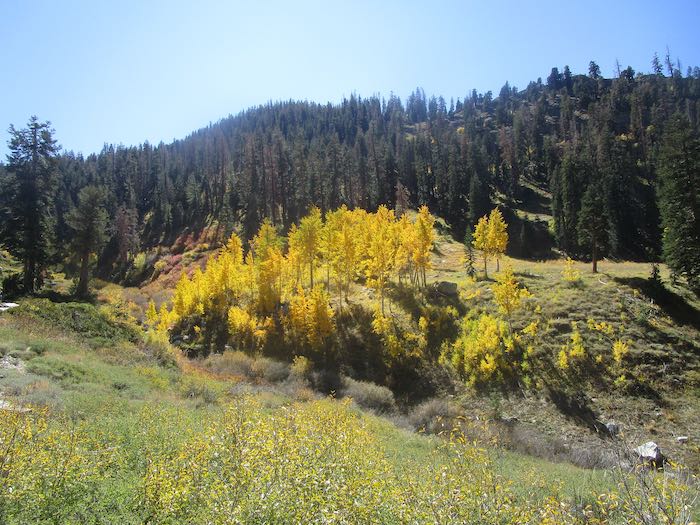
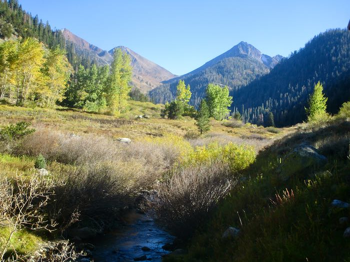
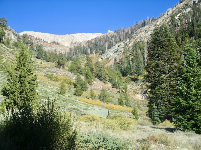
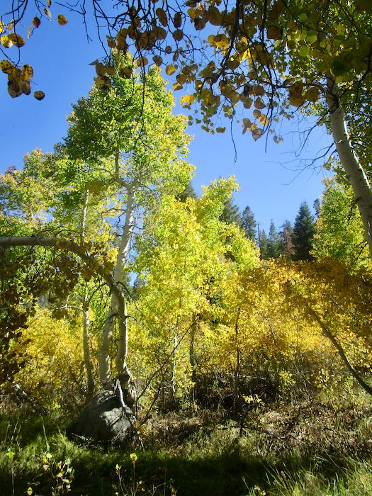
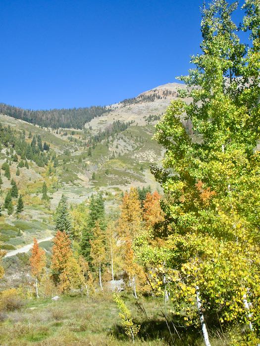
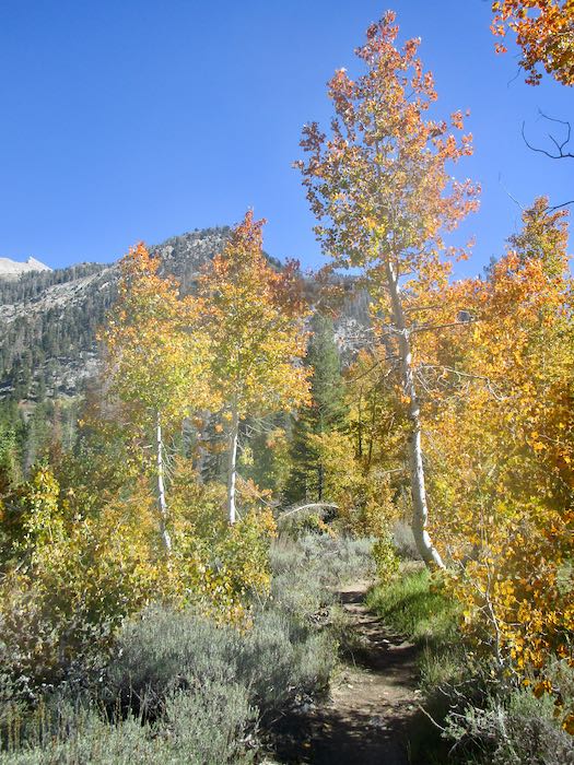
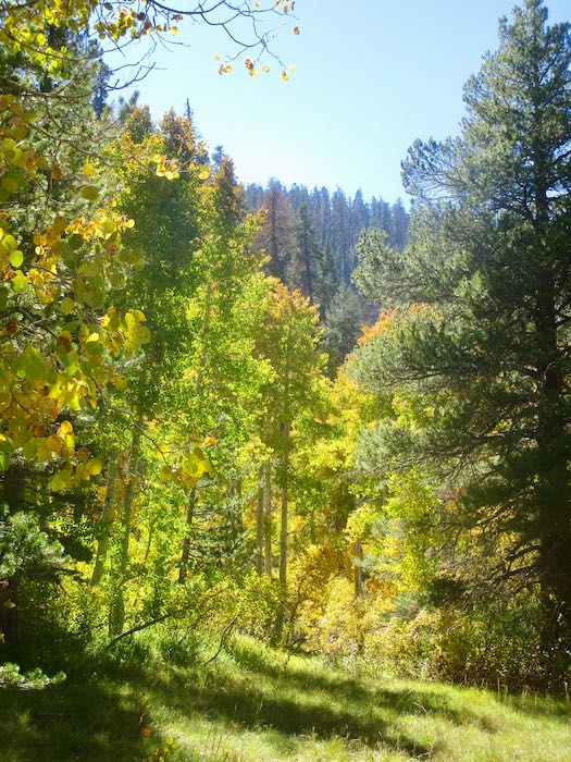
We went walking up the Mineral King valley in search of brilliant fall color. This was easy to find, so many yellows, but of course we wanted oranges and reds too.
The cottonwoods are yellow; it is the aspen which turn orange and red, so for stronger colors one must walk farther up the trail than rather just hanging out near the pack station.
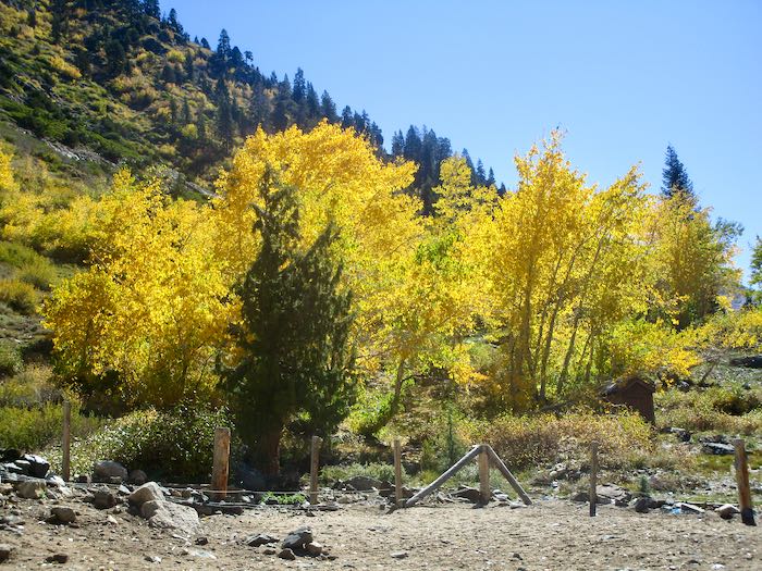
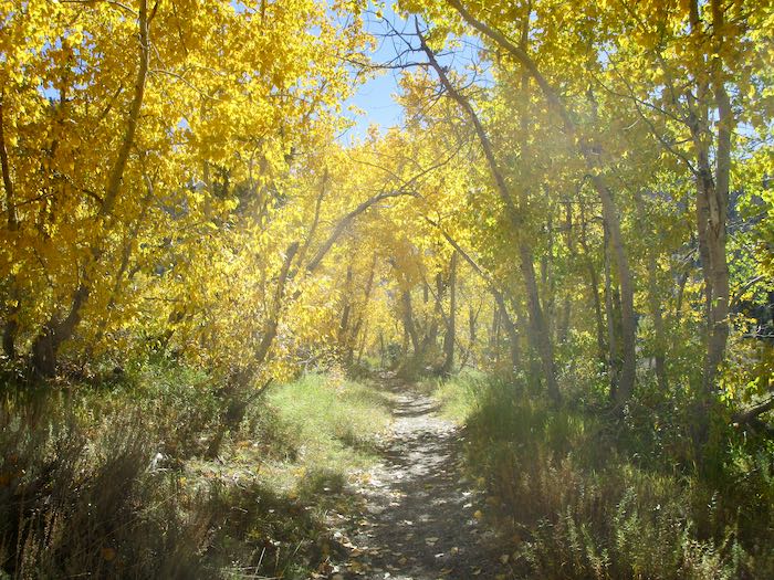
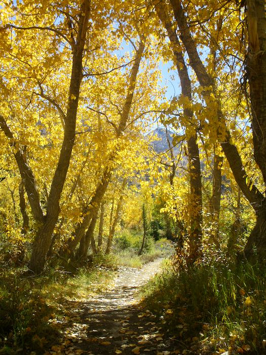
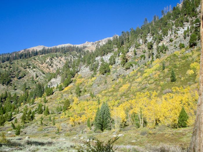
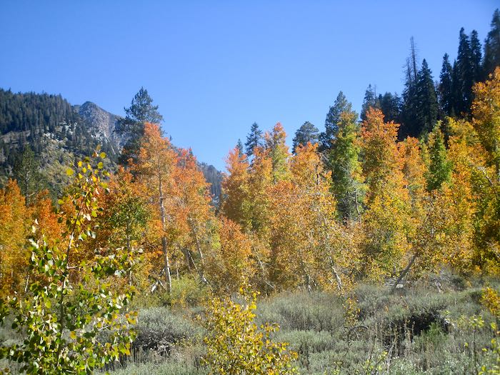
We call this the Yellow Tunnel.
The cottonwoods look so faded when viewed from the other side.
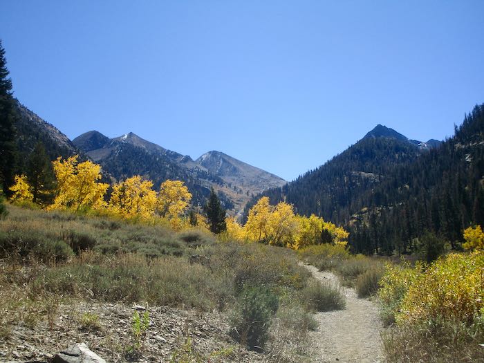
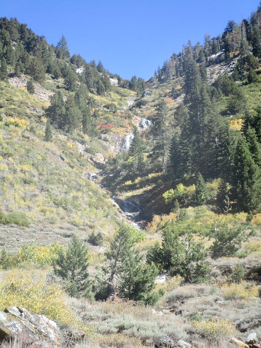
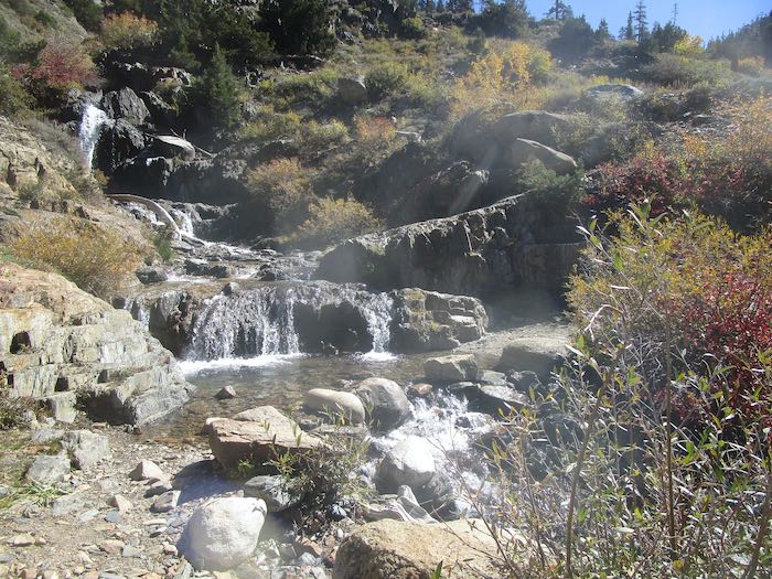
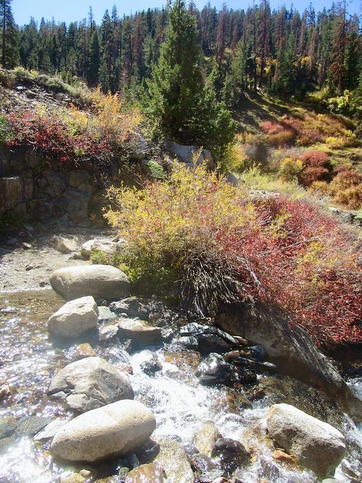
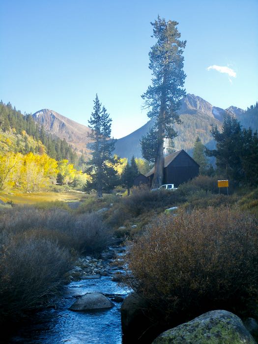
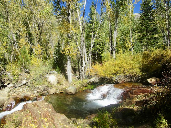
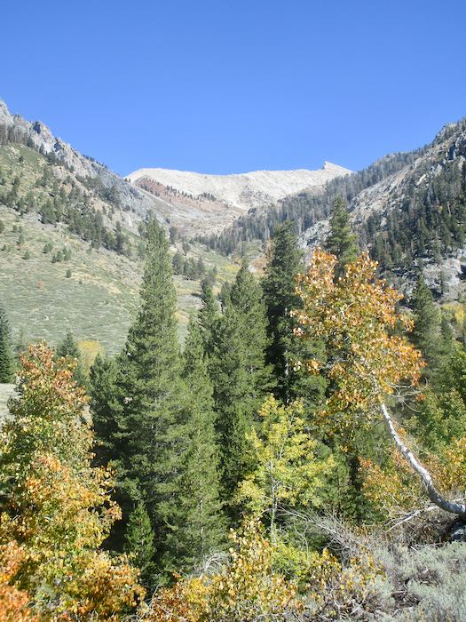
Crystal Creek is still flowing. The colors are very subtle looking up the ravine.
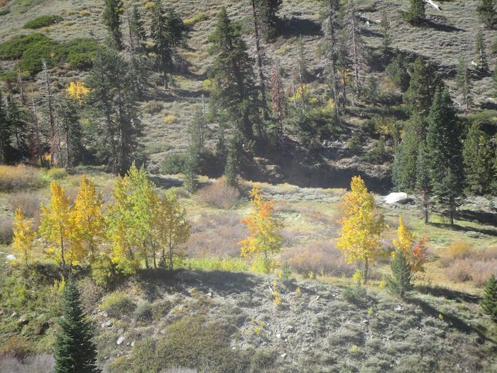
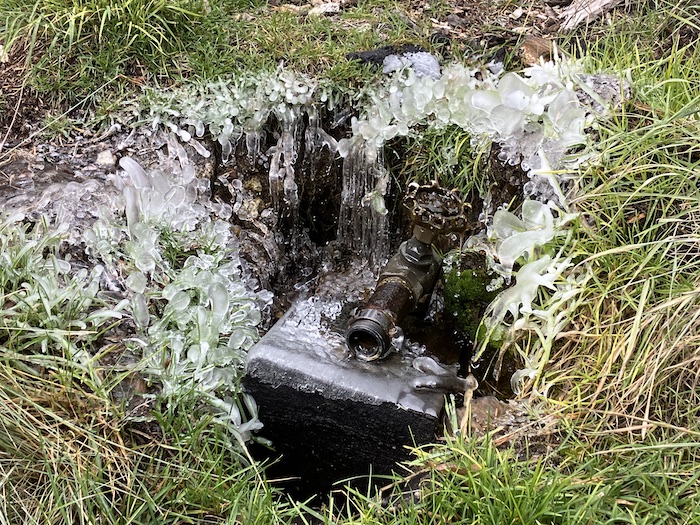
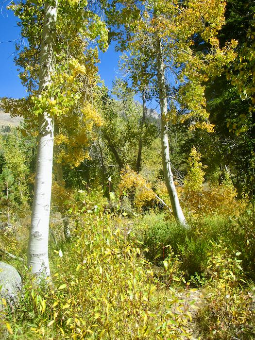
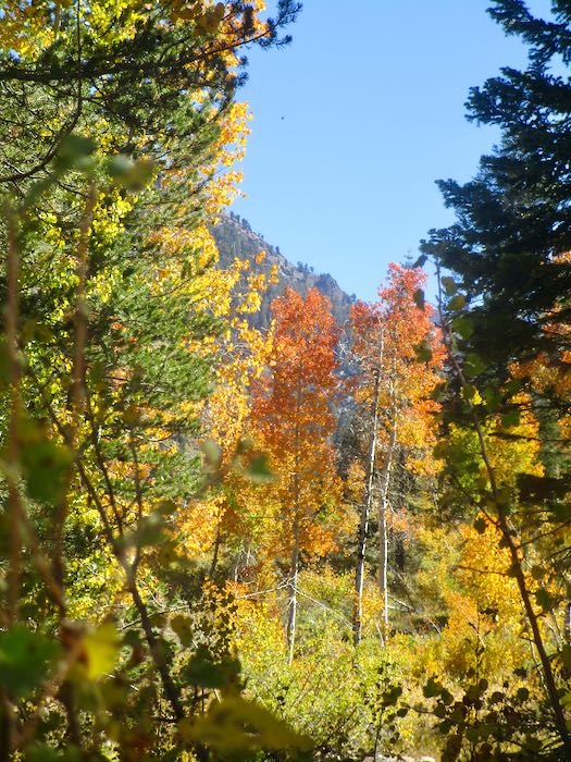
We spotted some orange through the cottonwoods, so Hiking Buddy and I continued on up the trail while the men turned back to begin tackling the chores of cabin closing. Not only do they close our cabins, they also close cabins for neighbors and are responsible for the water system for our little neighborhood, which they take very seriously.
That orange turned out to be a little disappointing. It was only the very edges of these few trees. (You might have to squint to see it here.)
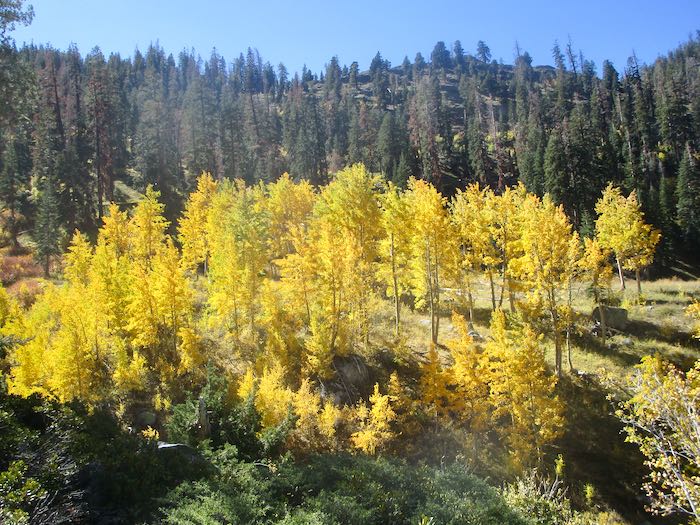
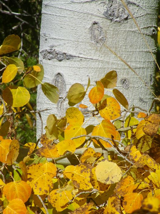
But these trees were electric!
Franklin Creek was so tame, especially compared to my August adventure with K.
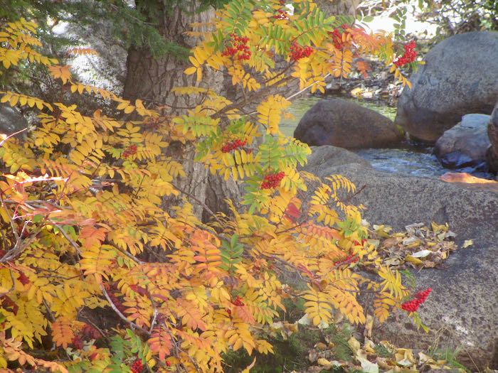
Each year in the fall I am determined to learn what shrub turns red. In the summer when it is green, I don’t notice it and don’t remember my annual autumnal intention.
Somewhere over there is where K and I were scrambling through the rain, cold, and hail to find our way home. We knew where we were going but not our exact route.
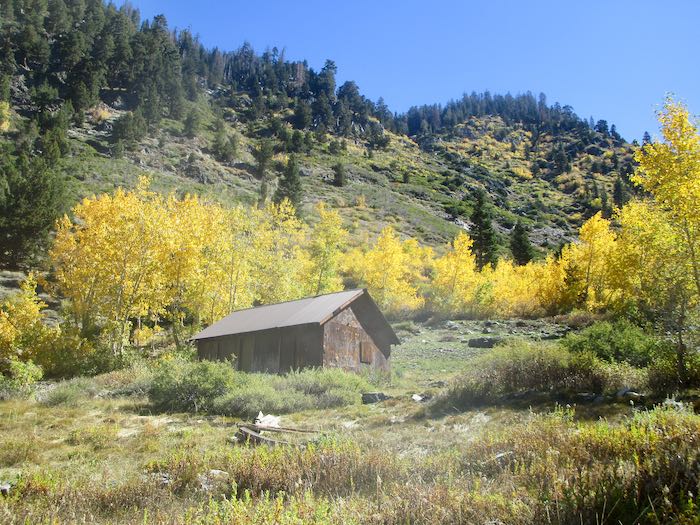
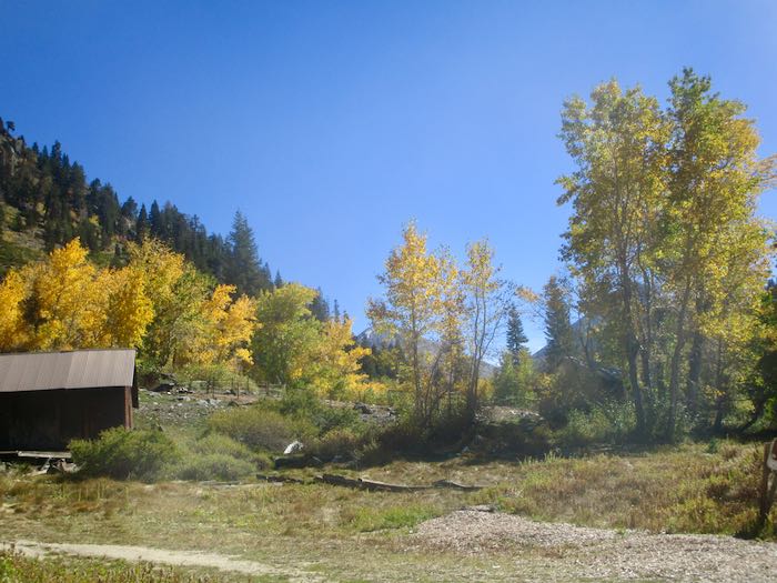
One last look at the Park’s packing shed.
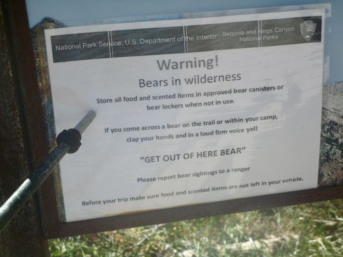
WHAT? How did I miss this piece of brilliant advice all summer??
What I want to know is this: will a bear leave if I simply shout “BEAT IT, BOZO!” or do I have to say “GET OUT OF HERE BEAR!”? Who taught the bears to obey this command?
The next day was closing day. It was very cold, low 40s while we completed our chores and buttoned it all up for the season.
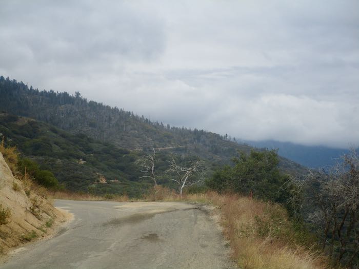
This is how it looked back toward Mineral King from partway down the road. Snow was expected up there. We closed in the nick of time. (Who is this “nick”?
Just for fun, this is the scenic spot where we stopped for some lunch on the way home.
It is always a bittersweet time. While we believe that summer goes way too fast, it is always a relief to be home, to stop driving that wretched road, to be able to go to church on the weekends, to keep up with emails and texts, to not be continually living in flux with duffle bags in plain sight, and to not worry/wonder about the water system or bear break-ins (in both locations.) Besides, we miss our cats.
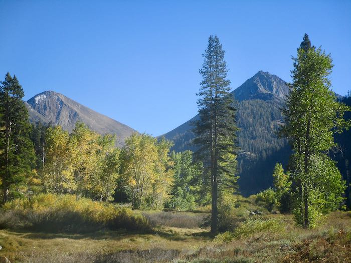
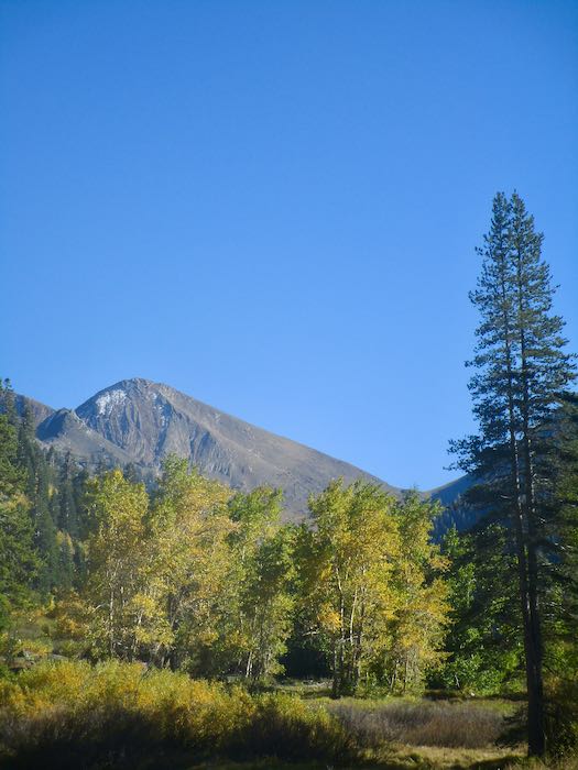
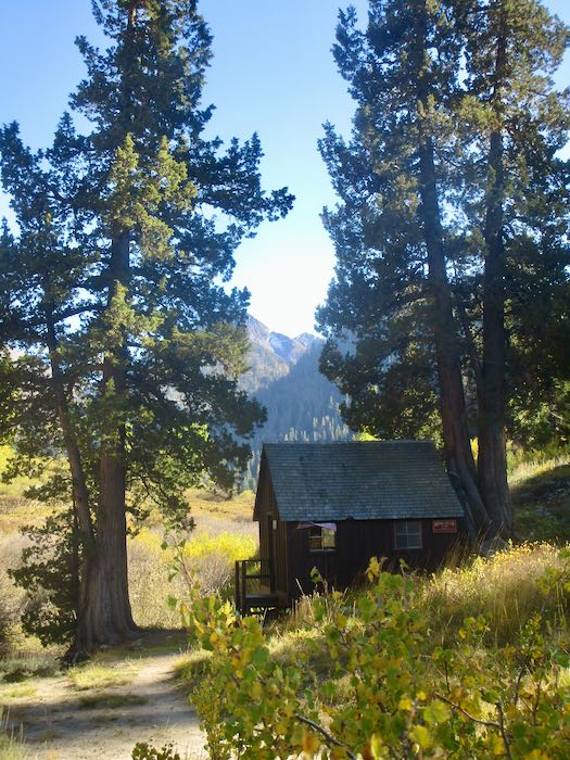
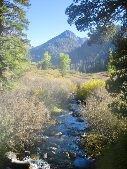
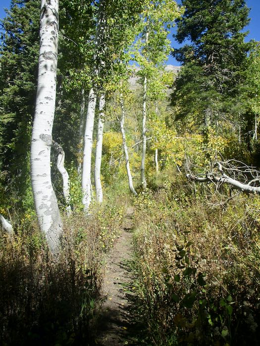
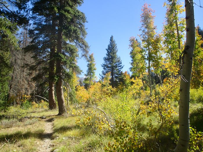
If you read my posts last week, you saw the variety of fall color in Mineral King from year to year. This week I will show you all 2025, mid-October. Not much chit-chat, just some photos. Today is a walk up the Nature Trail, which originates at the upper end of Cold Springs campground.
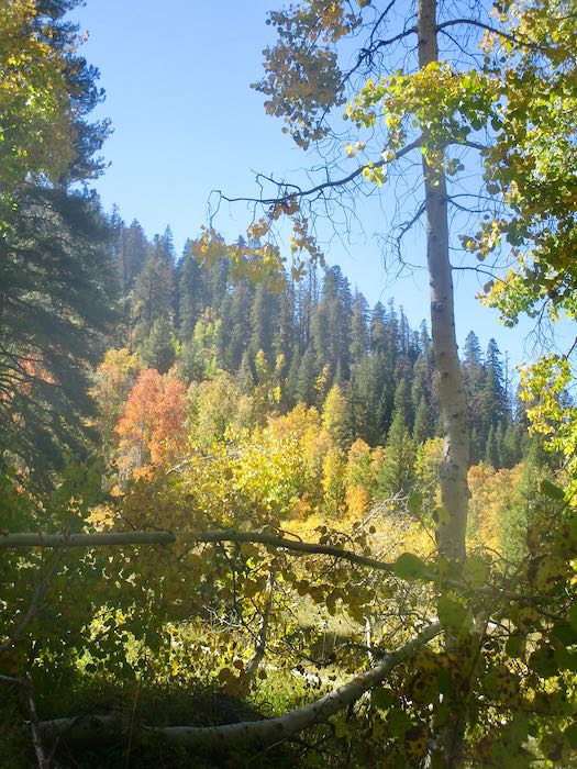
The trees weren’t all brilliant yellow, but it was a brilliant clear sunny afternoon.
I don’t know what this shrub/tree is nor if the berries are edible. This is the only place I’ve ever noticed this in Mineral King. This just in: Greene’s Mountain Ash—THANK YOU, GC AND PICTURETHIS!