Sometimes I can’t believe how lucky I am to live in such a gorgeous place as Three Rivers. As a California artist, how could I possibly want any better location??


Sometimes I can’t believe how lucky I am to live in such a gorgeous place as Three Rivers. As a California artist, how could I possibly want any better location??
Maybe March is my favorite month instead of February. It is so green and the redbud are in bloom, along with lupine, poppies and a great variety of other wildflowers. Michael and I drove up South Fork Road, which follows the South Fork of the Kaweah River (hence, the name). Something that always just twists my sense of geography is the clear view of Homer’s Nose from the upper end of that road.

We stopped 4 miles from the end of the road and unloaded our bicycles. It was a long slow pull to the campground, but oh so very pretty.

There were lots of choices.


We stashed our bikes and headed toward the water.

Clough’s Cave is on the other side of the river and used to be open to the public. I had never seen it, and Michael had described its location to me at some time in the past. We followed our noses (and a trail of litter), which led to getting sort of bluffed-up and no cave. We slid back down, thought it out, and found the abandoned trail to the cave. It is slippery with oak leaves and acorns, and several places made me question the wisdom of following it to a closed-off cave. A few cave-wreckers have caused the Park to seal the cave off from the public.

If you climb some rocks and then lie on the ground, this is what is visible. If you turn around, this is what you see:

Lots of textures, snow on the peaks, the canyon winding its way upward, and even a belt of black oaks still without leaves. Tulare County is so large in acreage, so vast in its variety of terrains, with far more to explore than I have days off!
It isn’t popular in the artworld to admit that one works from photos. In fact, the closest you’ll get to reading that someone works from photos is “I use them for reference”. Brings to mind something Jack White, my painting inspiration/guru/mentor said – “All realistic painters either work from photos or they lie about it”. Me? I TOTALLY work from photos – if I just use them for reference, it is because the scene was so complicated that I just started making things up!
The other JB and I visited the Buckeye campground in Sequoia National Park over the weekend. There is a mellow little trail that leads to a picturesque footbridge over the main fork of the Kaweah River. (You can read about it in the January 17 blog post.) When JB saw the view, she burst forth with the declaration, “If you paint that, I will buy it!” Being a hard-nosed business tycoon (snort, guffaw), I said, “Okay, I will show you some sketches first so you can see if you like it and after I paint it, I won’t hold you to buying it.” (Jack White would not be pleased with me for that!)
Here is the main view that JB was so taken with; you can barely see the bridge in the photo! This is why I will have to sketch things in advance of painting – how large can I make the bridge without distorting reality? How much rock, if any, in the foreground is actually necessary? Can I “grow” the river, because in our memories, it is The Main Event?

All these photos will be useful to create a small (“thumbnail” in Artspeak) sketch that will determine what size and where each part should be in proportion to the other parts. If I was carrying a backpack that day, a sketchbook would have been a helpful item. But I am a modern chick who uses a digital camera with tremendous gratitude for the technology.


In what passes for winter in Tulare County, sometimes it gets cold and gray. Count on it in the flatlands. Moan and complain about it in Three Rivers. If you’re smart, you’ll just drive up a ways and voila! Sunshine! That is what Michael and I did on Saturday. Ever been to Hospital Rock? I had, but only to the upper parts and not to the river. The interesting thing is this: I recognized the rocks because I have drawn them! As always, I was looking for light but seriously distracted by the lovely old rockwork. Under the photos, I will put my opinion of how each photo would be useful to an artist.

There was a bridge across the river (middle fork of the Kaweah) until it washed out in the ’55 flood and a wall was added for a viewing platform. This has the clear detail necessary for a pencil drawing, but probably not the best choice of subjects because it is sort of an odd structure. Those sorts of things make sense in photos but cause an art viewer to wonder what the heck it is!

There are inexplicable stairs all around. Clearly this was constructed in an earlier era before evidence of humanity was forbidden (except signs with cautions and warnings.) This has good clear detail for a pencil drawing, but not a great one because there is no visible sunlight. The person could be included or left out, depending on how much fiddly detail one wanted to do. If the face was showing, I’d say FORGET IT – NO FACES SMALLER THAN AN EGG! (ok, I might not shout, but I’d be very adamant on this point.)

I recognized this little waterfall – it had my friend’s parents standing to the left in the picture that I drew. This would make a nice pencil drawing – great contrast but not enough color for a painting.

Would the Park allow a trail to be built beneath a rock like this now?? Would they even allow the rock to remain? There are no warning signs – amazing! This photo is good for documentation only – the subject is too weird for art.

This is the kind of light I look for. It would make an excellent painting. Also good for drawing but it would be hard to render the textures unless artist is very experienced.

The Paradise Bridge was replaced in the early ’90s (Michael worked on that project) and it washed out in the ’97 flood, which was only about 1/4 of the water experienced in the flood of ’55! I wasn’t born yet. (Just had to throw that in in case you were wondering.) This would make a drawing and maybe a painting but I’d have to think about what to do with that heavy-looking tree leaning out to the right.

Hard to imagine it washing out. This photo is good for documentation only.Too much texture and the main subject is too small for a good drawing. In case you are wondering, I learned this the hard way.

Rockwork, light, this would make a nice pencil drawing. Maybe even colored pencil. Maybe a combo! I’d mess with the composition a tad to get the edge of the wall off dead-center.
What do you think?
Michael and I hiked to the upper Monarch Lake. It is about 5.5 miles – the first mile and a quarter is steep and hot and dusty with giant steps up that just suck the juice right out of your legs. 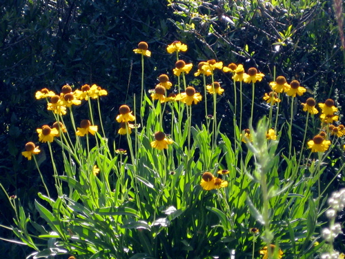 The Bigelow Sneezeweed are at their peak in August, as are the Gentian.
 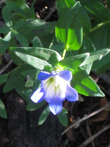 The next 4 miles are on a beautifully graded trail with a flat trailbed; the trail actually has a few too many (unnecessary) switchbacks. It takes you well above Timber Gap, and it was a bit smoky from the California wildfires.
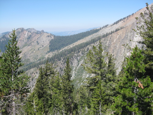 The last 3/4 mile is Find-Your-Own-Way.
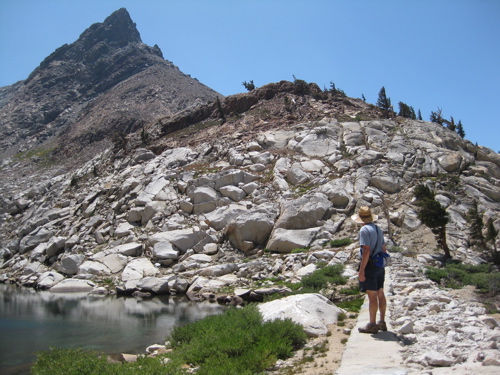 Upper Monarch Lake is one of the four lakes out of Mineral King with a dam on it. It was constructed in 1905, well before the well-graded trail was ever built (but you can bet it was thought of with great longing by those hard-working men!) The peak is Mineral Peak; it is the one some guy kept trying to convince me was Homer’s Nose while I was painting the mural.
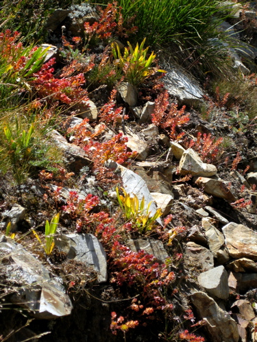 We went up one way from lower Monarch to upper Monarch; it wasn’t very easy. We came down a different way that included quite a bit of meandering and backtracking; it was much easier and rather interesting.
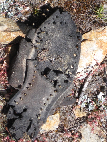 See what we found? We left it there. Pity the guy who had to hike down on a non-trail missing a sole!