If you receive these posts in email and the pictures in the post don’t show for you, tap here janabotkin.net. It will take you to the blog on the internet for a rain report.
Thursday night brought 4-1/2″ of rain.
My neighbor asked if I wanted to go looky-looing on Friday morning. Her car is higher than mine, and I immediately replied YES.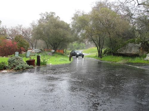
She manages a vacation rental on the North Fork. This is the view from the backyard at the normally mild fork that often dries up in the summer.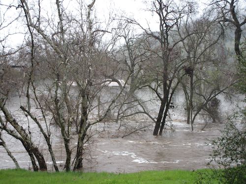
This is the North Fork flowing over the top of the Airport Bridge (there used to be an airport nearby). The whitewater is where the water hits the railing that the county used to remove when floods were predicted. Now they prefer to leave the railings up, which causes the water to flow around and wash out the approaches. This happened in January. Here we go again.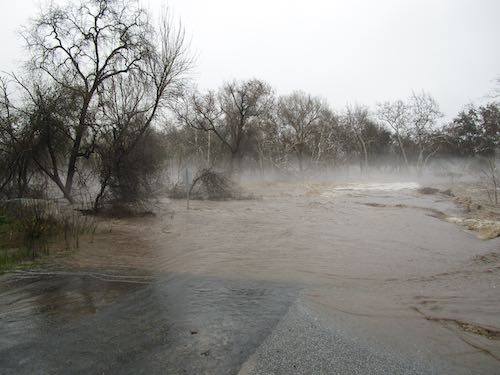
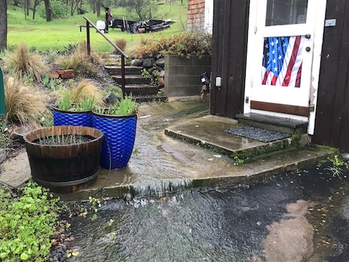
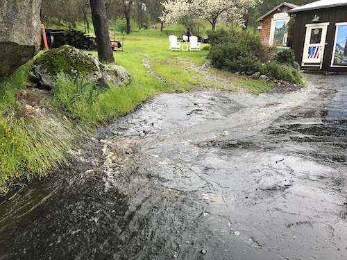
This is by my studio and workshop.
Later in the afternoon I went walking with another neighbor to survey the ongoing excitement and damages. This usually dry drainage was roaring over the road by her house, so we went another direction.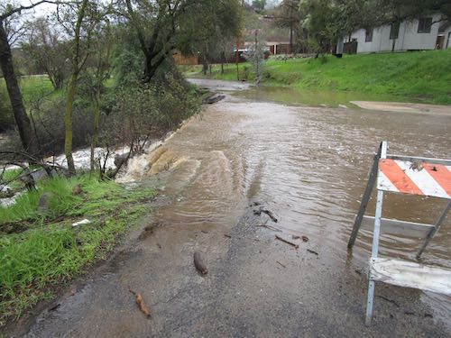
Same drainage, farther down, closer to the river.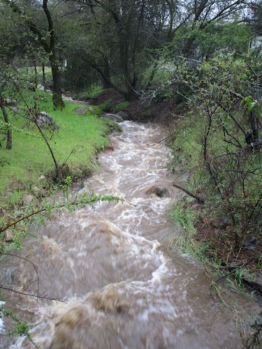
Looking upstream from the Dinely Bridge.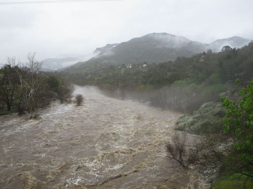
Looking downstream on the Dinely Bridge.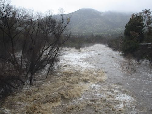
No, really, LOOK AT THIS!!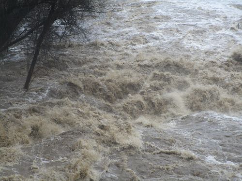
Pretty little drainage coming off Edison Road.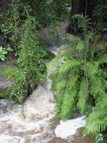
In a friend’s yard, where the water is usually a bit of a distance away. Not so today.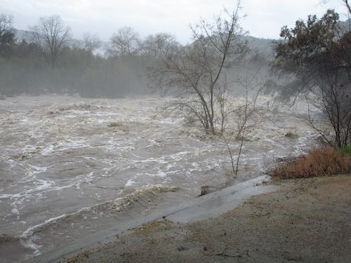
This is a spot where lots of people trespass at the river on this little beach. We could hear boulders banging around beneath the current.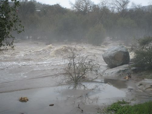
Another little drainage along Kaweah River Drive. This is where overflow from the flume occasionally flows.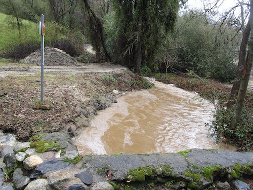
A yard where the flume flows is very exciting right now.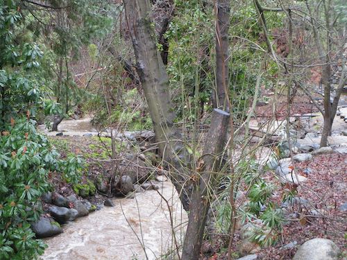
Well, oops. This is where we turned around. There was a roaring stream across the road. I tested it with a stick, and it was about a foot and a half deep.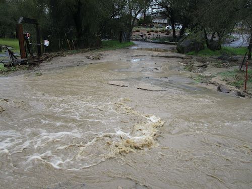
Looking upstream at this drainage, wondering where it came from. A man who lived above was out walking and explained that someone built a pond incorrectly, the dam on it broke, and the result is that many people are trapped on the other side.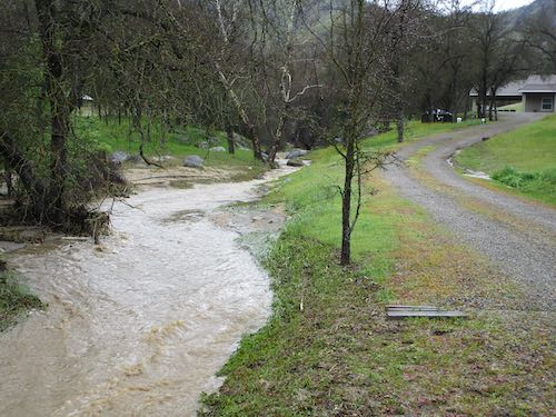
Walking back, you can see that the water is very close to the road. In the early 2000s, I saw it closer. I was scared then, and I shouted at my neighbor who was driving, “GO FORWARD, GO BACK, OR LET ME OUT, BUT DON’T JUST STOP HERE!”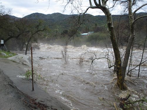
What’s this??
Mandatory evacuations.
This is the view upcanyon from the Remorial Building. I said “Remorial” because another neighbor thought that was the correct pronunciation when she was a child. She is getting married in 21 days, but we still pronounce it that way.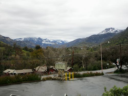
A sheriff was going through the neighborhood around 7 p.m. last night to tell us about evacuation orders. But Trail Guy met him at the bottom of the driveway and said no, we aren’t going anywhere. The sheriff gathered our name, phone numbers, address, and went on his way. Our house was built before the ’55 flood, so we feel fine.
7 Comments
Great pics. UTrail Guy will watch over you and make sure you’re safe. Love that guy. Well…. You too. ?
Welcome to my blog, Bob! We are fine, and we love you!
Any area that was high and safe in 1955,57, 66, ,67, 68, and 69 are probably safe if you have enough provisions. Roads will be gone etc. But what we’re seeing is what we saw during those years. People just forgot and didn’t pay attention to past history when they built or bought. Good luck and be safe.
Hello Deismans! You are exactly right about all this. We were stocked up and had thought about the age of our house which gave us confidence to stay. The evacuation order was made when the forecast predicted 5 more inches last night.
Wow, amazing photos! I hope everyone is staying safe. Any loss of buildings, bridges, vehicles, etc.?
I get the concept of “We’re staying put” but mandatory evacuations are mandatory for a reason. I would be more worried if I were closer to the riverbank, but stuff comes down from the mountain, too. How are the cats taking this? Staying inside where it’s dry and (relatively) warm?
I don’t remember the flood of ’55 as I was just a toddler back then, but I know it took out a couple of MK cabins, and maybe a bridge or two in 3R.
Sharon, we first heard it was mandatory for folks above some of the bridges and right along the middle fork. Then we heard it was for the whole town, and sure enough, it is/was. We surmised that authorities had to notify because the decision had been made and couldn’t be changed after the forecast got better. We only got 1/2″ last night. Maybe evacuation was chosen because there is only one way out of town, since the Park is closed and has been for awhile. But most people think and plan ahead around here. Big water is easier to deal with than big fire.
True; you can always clean gunk out of a culvert, but you can’t outrun a wildfire!
Comments are closed for this article!