If you receive these posts in email and the pictures in the post don’t show for you, tap here janabotkin.net. It will take you to the blog on the internet where the photos will show.
When there is an event, everyone is a photojournalist. I am your photojournalist reporting from the middle fork of the Kaweah River in Three Rivers. There is a lot of action in other parts of town, but it is fairly sane in our neighborhood. I continue to be thankful that we couldn’t afford riverfront property when we moved here, and thankful to have a house that was here pre-1955 when The Big Flood happened.
Middle Fork
This is also known as the main fork of the Kaweah. We live about 1/2 mile above it and often walk to the Dinely Bridge to see how it looks.
Lots of snow is still hanging in there, in spite of the warm rain.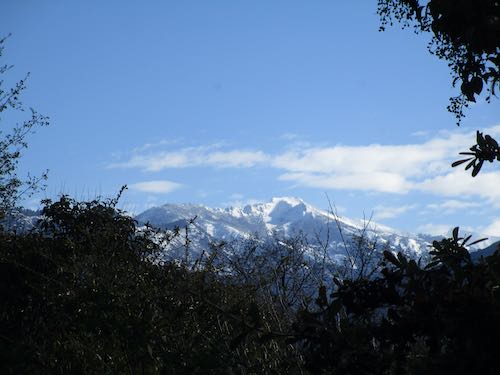
We took a walk, and Trail Guy carried a big rake. He tried to free up some gunk clogging a culvert so that mud stops flowing across our road.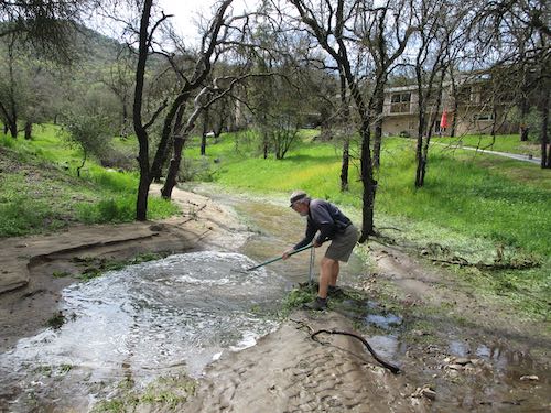
Moro Rock is visible up the canyon while the Alta Peak elephant hides behind clouds.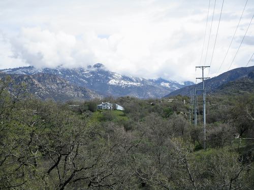
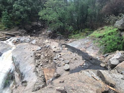
Back to the Dinely Bridge, looking upstream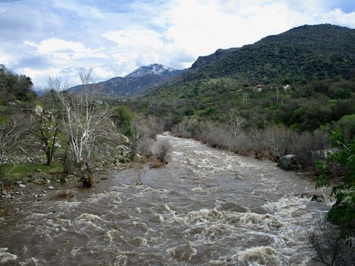
Looking upstream to the Dinely side of the bridge (makes me think of Olivia Newton John’s song “The river’s too wide now for crossing. . .”)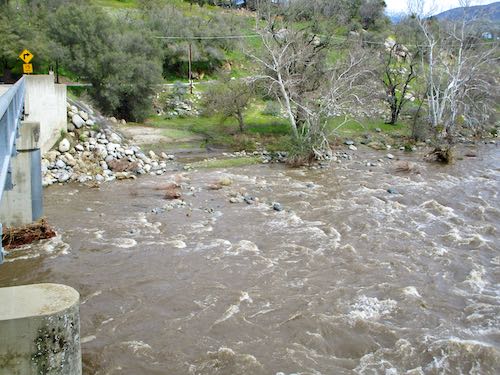
Looking upstream to the Sierra (Hwy. 198) side of the bridge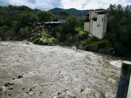
Looking downstream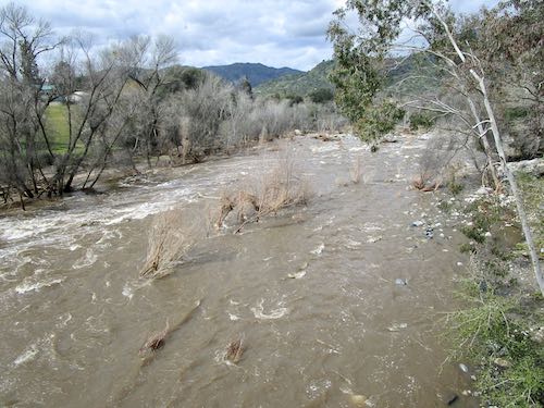
Looking downstream toward the highway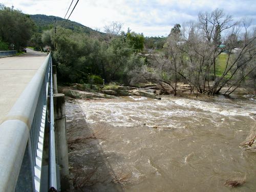
Looking downstream with Comb Rocks in the distance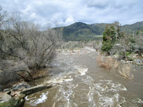
Back home for a brief moment of sunshine (hi Pippin!)
East Fork (also known as the Mineral King Road)
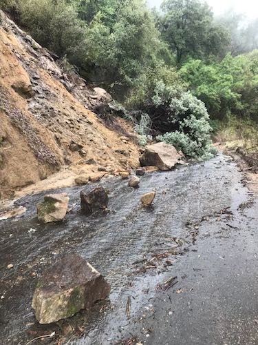
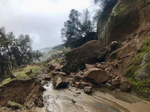
We got a call from an adventurous friend who rode his bike up the Mineral King Road. (He likes to do things like that. . .ride to Mineral King, run to Eagle Lake, and ride home in the summer). He took many photos for us where the road is “gone-zo” (his term) about 4.5 miles up.
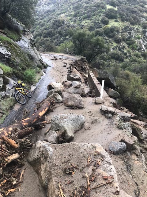
These are some of his photos of various washouts and blowouts and gone-zo-outs. I’m not sure where each one is, but know that the county has a ton of work ahead.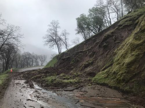
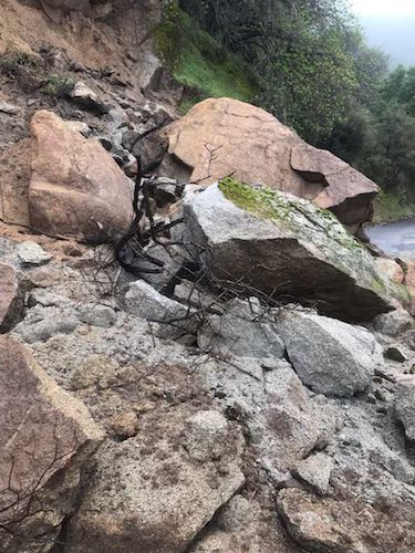
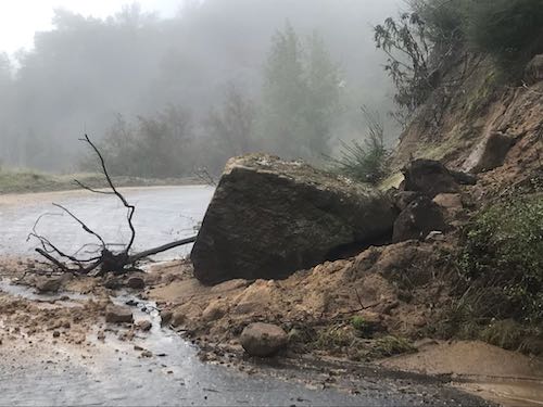
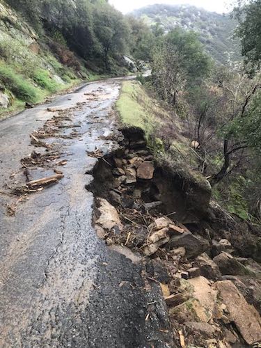
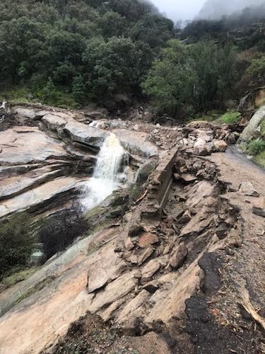
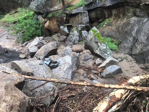
He also sent videos, but those don’t work here. Many similar photos were posted on the Book of Faces by one of his traveling companions, and several friends sent me screen shots. Our friend called us before they went public. Thank you, Dennis V!!
2 Comments
Culverts do tend to get clogged with gunk! Manual labor is about the only solution. Good for Trail Guy!
That’s a lotta water in the river! Has there been any loss of structures? And yes, I’m glad our cabin is on the uphill side of the road, but I still wonder about its–and the other cabins’–conditions. We always install snow posts to brace the roof, but with this much snow . . . !
The MK Road photos are astounding! Would the photographer grant permission for me to post a few on our blog and website? Credit, gladly given.
Stay safe!
Sharon, I have sent a message to our adventuresome photographer and will let you know.
Comments are closed for this article!