Yesterday we turned around at Lookout Point after walking up the steepest section of the Mineral King Road, and headed back downhill.
Trail Guy, formerly known as Road Guy, explained that the old road above sloughed off and caused the disturbance that stopped our forward progress. This spot is ABOVE the gate and BELOW Lookout Point.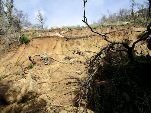
While he was puttering in the water and mud, I photographed these bay leaves. Too bad we can’t do scratch-and-sniff here.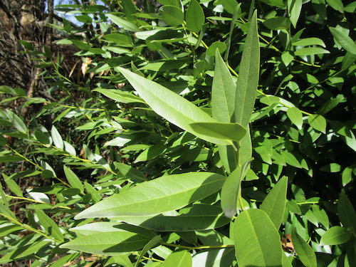
This weird boulder with its odd indentations is just below where we stopped driving. AGAIN: Above the gate and below Lookout.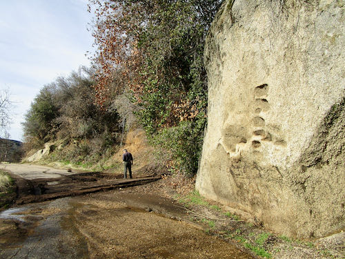
I walked down to White Rock, formerly known as Bird Poop Rock, which I explained at the beginning of this post.
Still ABOVE the gate and BELOW Lookout.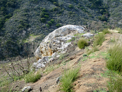
We encountered some folks along the way back, and while the dudes were shooting the breeze, I photographed this tree with peculiar bark clusters. (I have no idea. . .)
Ahead is a typical slump of a saturated bank, and beyond that are “the potholes”. This is BELOW the gate.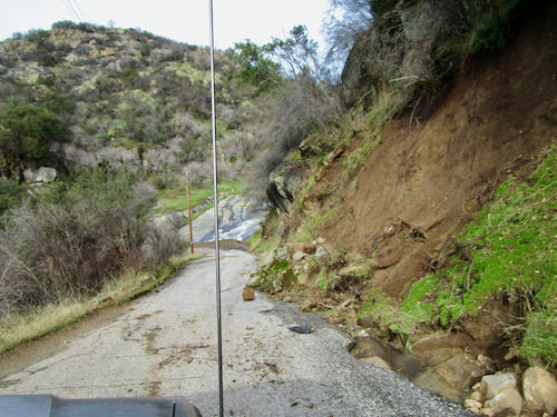
This is Squirrel Creek, AKA “The Potholes” in this location; it has big holes in the slippery rock face, normally visible and very enticing to folks driving down the hill. Fantastic water flow!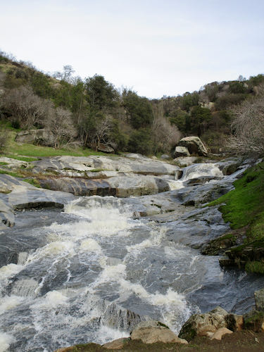
This section of road could be a bit of a problem for a HumVee or other wide vehicle. The county road department certainly has its work cut out for next few weeks (months?). This is BELOW the potholes.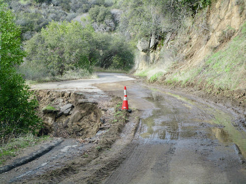 Here is another mess. Also below the potholes.
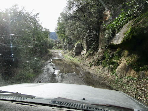
Look at what is happening along the gutter side of the road. I wanted to get out and play in the water, but we’d been gone long enough.
All the rest of these photos are below the potholes above the Oak Grove Bridge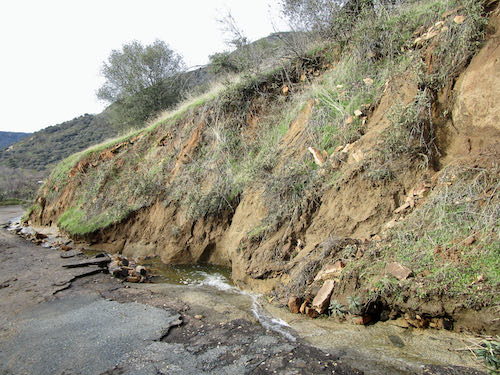
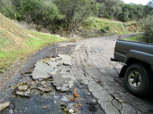
These folks will have some difficulty accessing their driveway for awhile. It isn’t a primary residence, the owners live far away, and I doubt if they will be too troubled or even know about it. “Whose drive this is, I think I know; his house is in the city though. He will not see us stopping here to watch his drive slide down the road.” (With apologies to Robert Frost)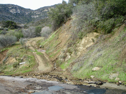
What is going on here? That plant is shooting up out of the pavement. And so much for last summer’s pothole patching efforts.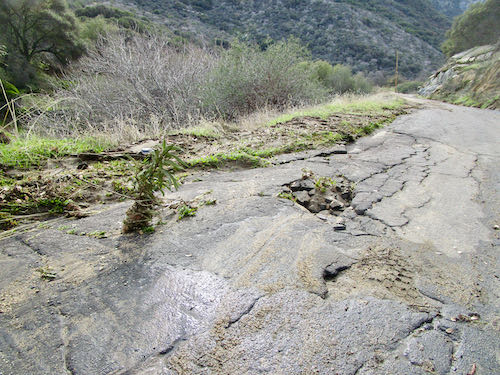
Messy, messy, messy.
Let’s conclude this weird little road trip with a look at my favorite bridge. It has been quite a few years since I have been able to see the water because of all the growth obstructing the view. 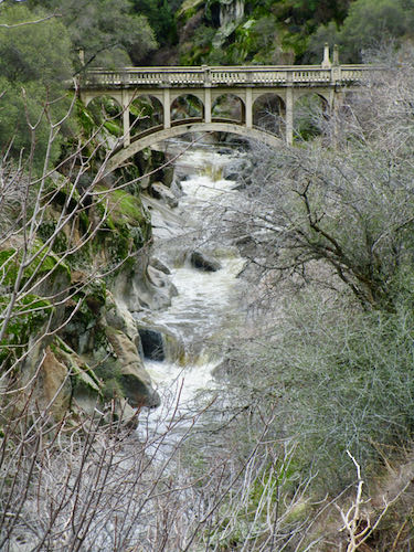
Thank you for joining us on this tour. Maybe next week I’ll get some work done and show it to you.
FOR CLARIFICATION: WE DID THIS LITTLE ROAD TRIP THE DAY BEFORE THE PARK ISSUED THEIR ROAD CLOSED DECREE.
6 Comments
Thank you so much, Jana and Trail guy! Looks like it will be very long time before anyone can access those upper regions!
Sophie, so nice to hear from you! All I can say regarding access to MK is that more will be revealed in the fullness of time. I would be happy to hear gratitude for snow instead of complaints about the road, the park, the county, etc. . . (not on this blog but in phone calls and emails)
We have similar mudslide damage and cleanup going on in Ventura County. Most of the two-lane roads around me are open, but we still need to drive them with care. I had to laugh yesterday seeing a police car stuck in the mud off the highway going to Ventura, and a tow truck backing up to pull it out. There is still rain water standing in the orchards, so it will take some weeks before it really dries out. People don’t realize how deep the mud is!
Marjie, I find the water flow and the effects of it to be fascinating. We live in an era when people think that they have the smarts, tech, and solutions to any inconvenience. It is good to be reminded that people are not all that and a bag of chips.
Comments are closed for this article!