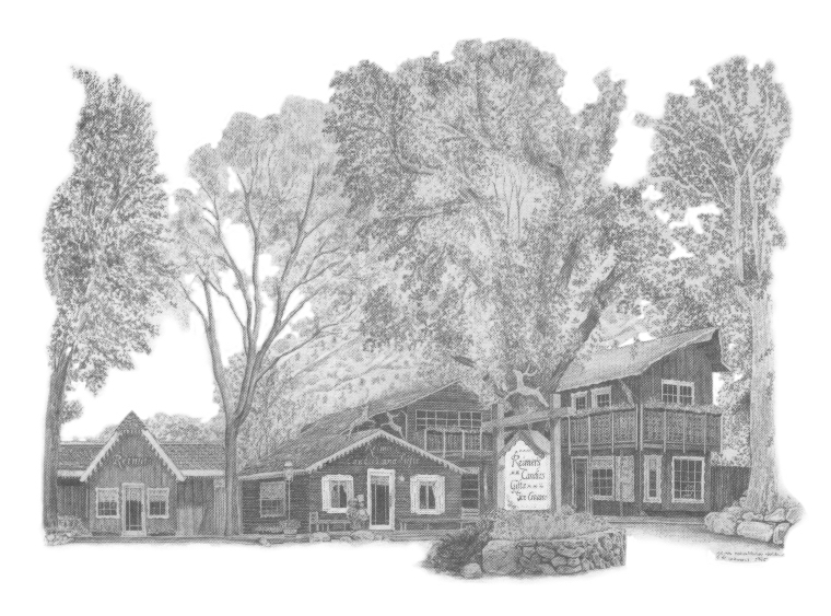
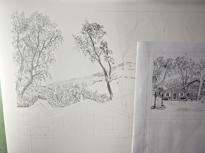
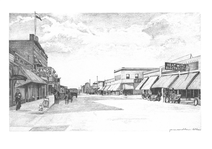
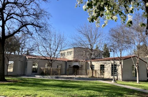
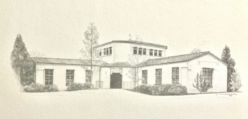
Reimer’s Candies and Ice Cream is a destination and a landmark in Three Rivers, California. It is now on its fourth owner in my lifetime, and it is just as busy as ever, just as popular, just as magnetic.
I drew it for the second owners, people with the name of Reimer, who bought it from the Huffakers, the folks who started the business. The Reimers commissioned me and then used my drawing on a thank you card to include in every box of candy that they shipped out. Owners #3 did the same.
By the time owner #4 came along, the drawing was too many generations away from the original to look good any more, and the printer I used to use is most likely out of business.
We tried to foof it up, to make it good enough to use, but alas, not even Photoshop was up to the pixelation and moray patterns that resulted in printing from a print that had been printed from a print. . .
When owner #4 asked me how to get more cards printed, I suggested that he hire me to draw it again. He agreed, saying that some changes have been made to the property, so I took photos from as many angles as I could manage, trying to arrive when the light was decent but before the crowds.
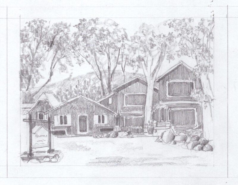
After studying the photos, I decided a new angle would give it a new look, and did this sketch.
The owner understood that it was just a rough sketch and knows that I can actually draw, so once he approved the sketch, I began.
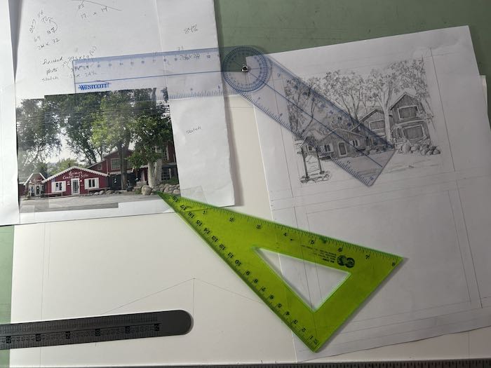
First, I figured out the main dimensions, which is lots of math and measuring.
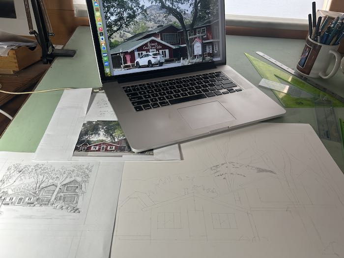
Then I moved into getting it laid out on the paper. (This is 14×17”.)
Finally, I began shading in the upper left hand corner so that my hand won’t drag the graphite all over the paper.
Then I schlepped my self back to the house to collapse in a chair and wait for the most totally excellent husband, AKA Trail Guy, to tell me that dinner was ready. As is often the case, I spent the evening questioning my ability to accomplish this drawing, to capture all the detail, to do as good a job as when I could see without a magnifying glass over the table.
As is often the case, I also questioned my pricing, but this is Tulare County, and I’m not about to “gouge” my customers! What constitutes gouging? I dunno. Locals say my prices are high; people from far away say they are low.
Maybe owner #4 will provide some dark chocolate with the final payment.
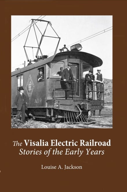
In 2018, Louise Jackson and I worked together on a second edition of her book, The Visalia Electric Railroad: Stories of the Early Years. We published it with a printer that may or may not still be in business.
Very occasionally, folks have contacted me for a copy of this sold out book. Since learning how Lulu.com works, Louise and I decided to make the book available again, this time through their bookstore so that she and I aren’t shuffling inventory and dollars.
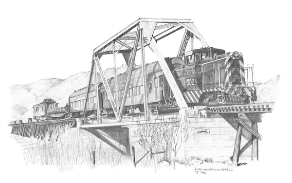
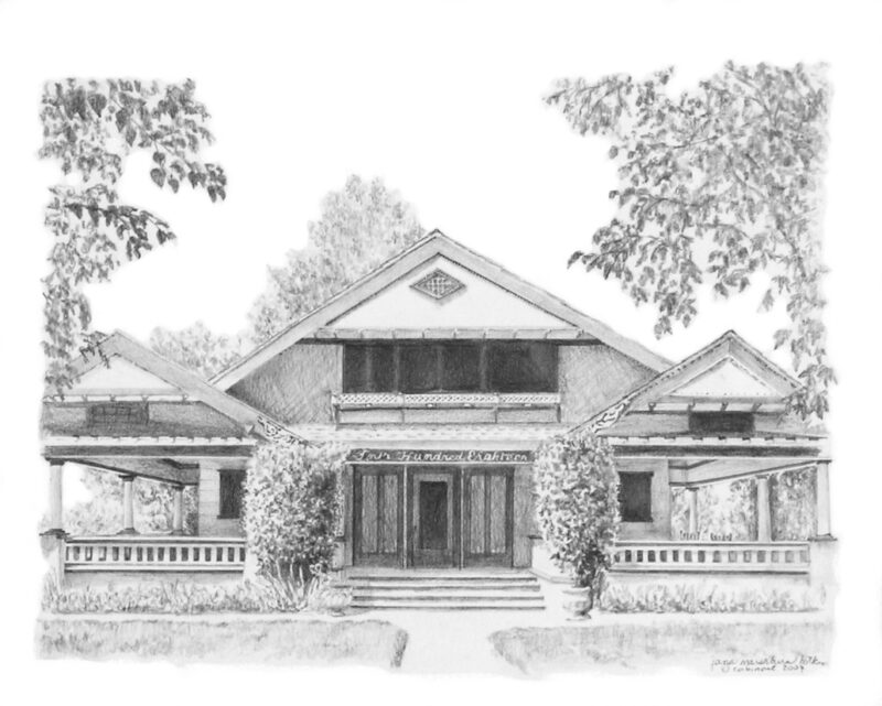
In case you were wondering, the book contains three of my pencil drawings. (Louise made me, because you know I am just so shy and hate promoting my own work… fall down laughing)
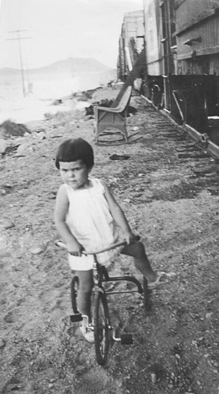
And in case you were wondering, this photo is my mom, whose dad worked for the Atchison, Topeka, and Santa Fe Railway, which was also known simply as “the Santa Fe”.
Honestly, I believe the book is worth it just for the photos!
Notice I said the photos, not the drawings. Just want to be clear that I came here today to sell books for Louise.
It is also now listed here on my website page OTHER PEOPLE’S BOOKS, also with the link to the Lulu.com bookstore.
After the tour of Terminus Dam, I had questions. Ranger Tim’s answers were posted yesterday. And as is usually the case, questions and answers beget more questions.
Here are my further questions and Ranger Tim’s answers.
1. What is a “stilling basin”?
Stilling Basins Behind Dams — USACE Design and Function
A stilling basin is a critical energy-dissipating structure located downstream of a dam’s spillway or outlet. Its purpose is to absorb and dissipate the kinetic energy of high-velocity water discharging from the dam, thereby protecting the spillway, outlet works, and downstream channel from erosion and undermining Association of State Dam Safety. – At Terminus Dam / Lake Kaweah it’s the area behind the dam that looks like a big pond. Its shallow, full of birds and wildlife, and slows the water before it heads downstream and gets split into the St. Johns and Kaweah Rivers.
The “pond” down there must be a stilling basin.
2. Those red bootprints—are they also for photographic accuracy?
Yes, the footprints are for photographic accuracy. An employee would stand in the boot prints and hold a camera to their chest at breast height so that every picture each year would be facing the same direction and be at a similar height. Very similar to how Giant Sequoias are measured – an employee would stand at their base and measure the circumference at breast height with a measuring device.
THANK YOU, RANGER TIM!
One more thing: he said the hydroelectric plant is operated by Eagle Creek. Here is a link to their website: Eagle Creek Renewable Energy.
Ranger Tim replied to the questions I asked after our dam tour. You can see that blog post here: Terminus Dam and Lake Kaweah.
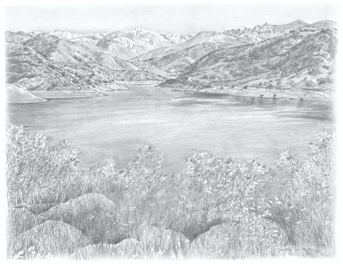
Lake Kaweah, pencil, 9×12, $300, unframed
Great Questions!
Thank you, Ranger Tim!
In big storm years the Lake has jumped 50 vertical feet in 24 hours so it can fill very quickly but they can also drain it very quickly if they open the gates all the way.
The radioactive symbol on the tower is leftover from the cold war era when the dam/tower were being constructed in the late 1950s. When the tower was completed in 1962 it was an official bomb shelter. We can’t find any records of who would have been invited, how many people it could hold, or how long they could stay. Its no longer used as a functioning bomb shelter but they thought the sign was historic, so it’s been left on the building.
The tower is the control center for releasing water out of the reservoir. It goes all the way to the bottom of the lake where there are 3 – 36” pipes that feed into a 12’9” pipe that runs through the dam to outlet near the stilling basin behind the dam. There are valves or “gates” on each of the pipes that a dam operator can open or close as needed to release or store water.
The wooden platform on the dam was specifically built to be an osprey nest.
Yes, just south of the tower there is another pipe that carries water to generate hydroelectricity. The power plant is operated by Eagle Creek Hydropower.
The footprints in the concrete are survey landmarks and are throughout the spillway complex. Each year someone goes out and stands in the impressions and takes a picture. The engineers can then use the pictures to see if the landscape has moved over time. Or, if there was an earthquake they would be able to look for changes in the area.
This was my view for about 15 minutes while waiting at a construction stop by the lake yesterday.
We love the pencil drawing! That is down at the outlet where the water comes out of the 12’9” pipe and flows into the stilling basin.
Thank you, Ranger Tim!
Release, pencil, matted and framed to approximately 14×17”, $400
After I got the answers from Ranger Tim, I had more questions. I’ll put those in a blog post tomorrow.
Painting #38 of Tulare County’s best bridge (according by your Central California artist) is inching forward into excellence. Can you see the incremental improvements?
We can probably consider it all finished now, EXCEPT FOR THE BRIDGE ITSELF!
Ahem. Excuse me for shouting. It just surprises me that after I put an enormous amount of concentration and effort into the painting that the most important part remains to be detailed.
Maybe it would be fun if I did a series of posts with all the different versions I’ve painted of this bridge.
But first, this one needs to be finished.
Here is a photo taken with my real camera instead of the inferior phone camera; the colors aren’t as strong, but neither is it as pixelated, which doesn’t matter here on the interwebs.
We call this the Oak Grove Bridge; people who don’t know it very well might call it the Kaweah River Bridge or the Mineral King Road Bridge or the East Fork Bridge. Those names sort of work.
Not that bridge
There are folks who, when they see my paintings or drawings of the bridge, say, “I’ve eaten at that restaurant”. They are wrong—the only eatery at the Oak Grove bridge might be the tailgate of one’s pick-em-up truck. The Pumpkin Hollow (“Gateway”) bridge is at the confluence of the East and Middle Forks of the Kaweah River. It isn’t over a deep canyon, just one lane wide, and with a single arch.
See the difference?
Maybe it is time to draw the bridge again in pencil. I’ve lost track of how many times I’ve done that; there are only 2 versions in my computer, because so many drawings didn’t get scanned or reproduced or even photographed in my early days.
Eagle Lake (a painting formerly known as a dog’s breakfast), 7×14”, oil on wrapped canvas, $200, currently drying, destined for the Silver City Store, unless it sells first from this little spot on the interwebs.
Oak Grove Bridge
The Oak Grove Bridge is a bit more challenging. I started with the attitude of “close enough” and as usual when drawing or painting architectural subjects, I ended up measuring and redoing several things.
The width of each arch needed to be the same, and the top of the bridge was too thick.
So I measured, redrew the arches (yes, with my paintbrush—anyone here have a problem with that?), lowered the top of the bridge, and then planted some manzanita on the lower left. I also started locating various rocks.
You’d think that after painting this forty-eleven* times, I’d have all the rocks and the arch proportions memorized. You’d be wrong in that thinking. I could make it up, but I’d also be wrong.
Such a grand little bridge for our slightly down-at-the-heels Tulare County. There are plans to turn it into a pedestrian-only bridge with a stout replacement safe for driving upstream of this classic one. The county had to do the eminent domain thing to acquire the land, and I have a feeling this will be a long, disruptive, and messy construction project.
Change can be so difficult.
Thus, for now we must enjoy the bridge as it was and as it is, and not think about as it shall be.
*This is actually #38, if I kept count correctly, which is doubtful.
No more confusion* over “Lake Kaweah” or Kaweah Lake: here is an official sign.
The Mineral King Preservation Society organized a tour of the dam that creates Lake Kaweah. I have been there, but it was before the new fusegates were built in 2004. The purpose of that previous trip was to get photos for this drawing. That’s story for another blog post sometime. Maybe.
We met in the parking lot at the Lemon Hill Visitor Center. The name must be a nod to Lemon Cove, since the dam is closer to Lemon Cove than to Three Rivers. This photo looks over the marina where all the houseboats live, toward the dam. As usual, the lake is very full this time of year.
We drove back to the highway, headed downhill, then turned below the dam and went through a couple of security gates with cameras, to park near the tower.
We all loved the views in spite of the hazy quality of the air. Haze? Smog? Don’t ask, don’t tell.
Looking north up Greasy Cove.
Looking southeast toward the marina
Our guide was very very new and didn’t know a whole lot. We were all very curious about the bootprints imprinted on 4 concrete pads below us, and the 4 red bootprints under shallow water on the lake side and the 2 red bootprints on the spillway side.
These are the fusegates. Each of the six is a little different level, so that in the case of a giant flood, only one gate at a time will open and get pushed aside. This ensures that the water flooding downstream will go in a somewhat regulated fashion rather than all at once. (I learned this from a knowledgeable fellow tourist.) The guide thought that the gates get tested every so often to be sure that they will open if there is a catastrophic flood.
There was a hawk with a nest on something that looked as if it was constructed for that purpose.
I loved the views on the downstream side of the dam. Dry Creek Road is over there, heading up into the hills and eventually into the mountains.
Here are 2 more photos of the tower. I don’t know what purpose it serves; it has a radioactive symbol on it by the door, which we were not invited to go through. Maybe it is a place for a couple of people to hide in the event of a nuclear bomb. I don’t know who those 2 unlucky people would be.
After the tour, our MKPS organizer invited us to send her any questions that she will pass along to the normal tour guide. OF COURSE I HAD QUESTIONS!! (Are you surprised by this?)
QUESTIONS
1. How long would it take to go from minimum pool to full, if there was a huge storm? Maybe a better way to phrase this is: What is the shortest amount of time it has taken in the past for the lake to fill?
2. Why is there a radioactive symbol on the tower?
3. What purpose does the tower serve?
4. Was that round wooden platform near the tower built specifically for a hawk to build its nest?
5. Is the water ever used to generate electricity?
6. Why the red footprints (4 on the lake side and 2 on the spillway side) and the ones pressed into the concrete squares??
More will be revealed in the fullness of time. Maybe…. it seems that the more ways there are to communicate, the less likely that responses appear. I do feel quite hopeful about this set of questions.
*Provided I can remember because it is possible that the confusion is embedded too deeply in my memory.
This might take more time to read than you want to spend. You also might not find it interesting. You can skip it today—I’ll still be your friend.
In thinking about all the distractions and how long it has been since I last painted, I realized several things, the most glaring that. . .
. . . I missed several important selling opportunities here in Three Rivers this spring.
What a Slacker
(1) The Studio Tour weekend: Did it include Three Rivers this year? This event alternates areas each year. It used to be an exclusive Three Rivers event, but I stopped after it grew to involve the entire county. It eats up an entire weekend and involves many strangers coming to my home. No thanks.
(2) First Saturday —haven’t participated in that for many years because I don’t like waiting in my studio all day, jumping up every time I hear a car go past to see if they are pulling into my driveway, helping tottery people up my steps, and then being squished with strangers in my little shed of a studio. No thanks.
(3) A busy Easter weekend in the local shops. Oops, didn’t have anything new to take.
(4) I’m skipping the Redbud Festival too. Lots of work to set up, poor attendance in the last handful of years I’ve been there, standing around on numb feet (because when a vendor sits, it appears as if he is disinterested) and not wanting to work on Sunday all add up to No Thanks to festivals, bazaars, boutiques and all such events.
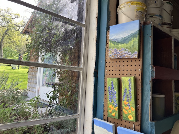
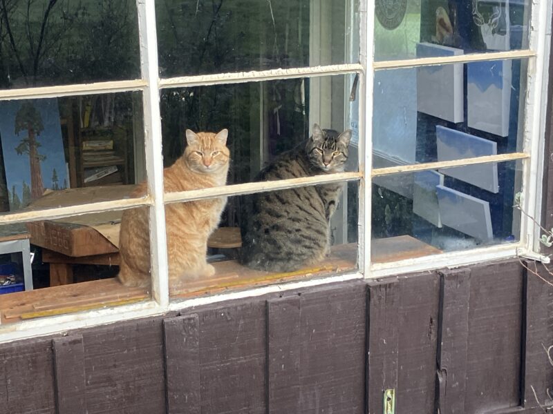
These guys would HATE having strangers invade their space—my painting workshop doubles as their home.
Good grief, it’s a wonder that I can stay in business as a local artist.
After 33 years of full time artisting, arting, scratching out a living with paintbrushes and pencils, I seem to have developed enough ways of earning a living that I can be a little pickier.
But then again, when I had a solo show in Tulare last August, I thought I had it all figured out and almost didn’t bring any pencil drawings. Boy was I wrong—pencil drawings were all that sold!
Such is the business of art. The best I can do is return phone calls and emails, finish work on time, keep improving old skills and learning new ones.
What I do
Editing, proofreading, book design, drawing in pencil, oil painting, painting murals, teaching regular group and private drawing lessons, giving talks about drawing, publishing books (coloring, cabins, and wildflowers for me; a variety of topics for other people), printing and selling notecards and calendars, designing and painting signs, logo design, teaching drawing and oil painting workshops, an occasional solo show, accepting commissions, selling through local shops, selling from my website and to people who call or ask to visit my studio—it all provides great variety, and continues to hold my interest.
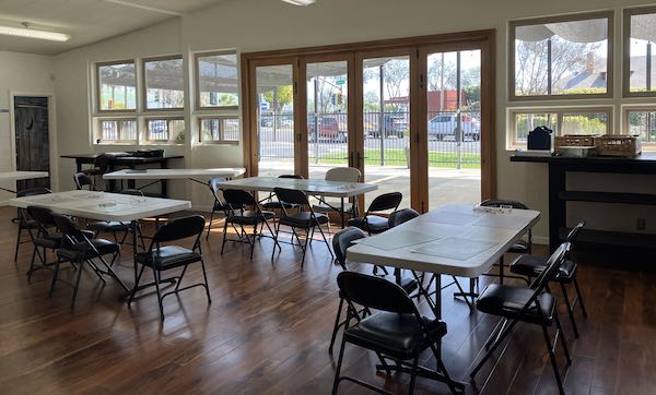
This is a fantastic place to teach drawing lessons and workshops.
What I don’t do
Notice that the above list doesn’t include the aforementioned boutiques/bazaars/festivals, or lending my work to places of business so that they don’t have to buy it but can pretend that it is actually going to sell while people are in their offices for other purposes. It doesn’t include giving art to fund raisers or annual beg-a-thons (hint: I will give many charities who ask a free Wilsonia book, or even a certificate for a free private drawing lesson). There’s nothing on the list about participating in shows with entry fees, joining in themed group shows, or schlepping my art to decorate someone’s annual banquet to give people something to do while they are waiting for dinner to begin. I have done all of these things in the past and am thankful to be able to decline such “opportunities for exposure”. The beginners and youngsters can do those things, but I learned that a person can die of exposure. (Yes, I do make exceptions from time to time.)
Why would I ever want to leave here if I didn’t have to?
What About The Internet?
I also don’t sell via Facebook, Instagram, or Etsy. These platforms require copious amounts of time online, building up a following, participating in discussions and commenting and “liking”, being visible, staying connected. I try to keep my connections real rather than virtual, and as much as I try to limit screen time, I’m still on the computer way more than I want to be: photos, communications, photo editing, blogging, more photos, book editing, book design, and even more photos for many reasons and uses, plus reading and commenting regularly on a handful of blogs, which have brought a handful of sales and new friendships.
This was a fun place to give a talk about earning a living with art and how I got to where I am, which really, isn’t anything to brag about. It came with lunch, which we all needed after a very stressful hour before the meeting began of trying to make the powerpoint projector work. (Next time I’ll bring my trusty laptop.)
P.S. Notice also that the list doesn’t include showing in galleries: this means for-profit galleries. There are none in Tulare County, only non-profits, run by volunteers, where I have had my solo shows.
Conclusion
Using pencils, oil paint, and murals, I make art that you can understand, of places and things you love, for prices that won’t scare you.
P.S. I happily accept commissions, which means I make custom art for people. I hope you know that!
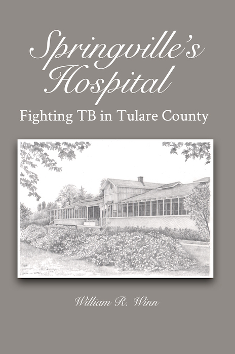
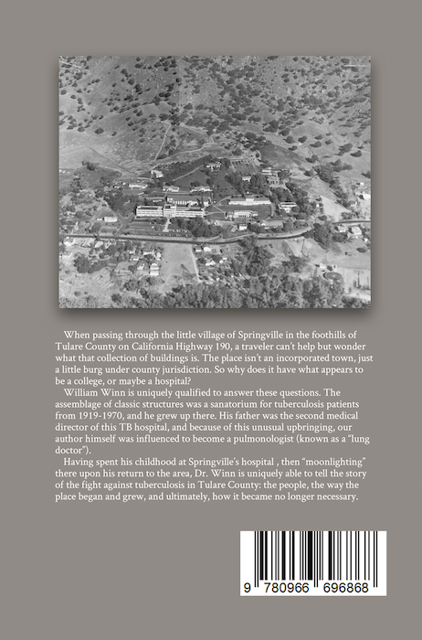
THE BOOK IS FINISHED! It was a ten-year project, with a giant distraction of a different book getting written and published first—Tales of TB: White Plague of the North, available through BookBaby. Here’s the link: Tales of TB
But that was last year.
This year, the book is Springville’s Hospital: Fighting TB in Tulare County.
Dr. William Winn, a (now retired) pulmonologist (that means lung doctor), hired me to illustrate a few things for this book that he’d been wanting to write. I asked if he had an editor, and after I explained the role, he hired me for that, in addition to three illustrations.
He clearly loves research, and the Springville book got pushed aside when we realized he was accidentally accumulating enough material for a different book about tuberculosis. After FINALLY finishing Tales of TB, I urged him to write about Springville’s TB hospital, a place that ignited my curiosity back when I first saw it in about 5th or 6th grade. (I’ve always loved old buildings, always always always. Am I being unclear?)
Bill encountered some serious health set-backs, and I finally accepted the fact that he would not be able to complete the book to his satisfaction. (Perfectionism can be a real obstacle to progress, but you can bet that he was a fabulous doctor.) I told him that he had enough chapters for a good book, not the one he had hoped for, but still a good and important book.
The Big Push
He gave me the go-ahead, so I gathered all those chapters (multiple versions of them, sigh) and arranged them into order, finally reading it as a book instead of little bits and pieces, dividing some into two chapters, turning some into appendices, rearranging paragraphs (yeppers, still editing), cobbling enough together for an afterword. Then re-editing and proofreading, gathering and scanning many photos, doing the Photoshop Junior thing, finding captions, and figuring out where each photo belonged in the book. After that came formatting, which I promise you don’t want to hear about. Then oops, what is the title? Bill hadn’t looked that far ahead, so I wrote a list, and he chose one in a phone conversation we had. Oh, oops, I needed to design the cover, and OH NO, he didn’t write a “blurb” for the back. Alrighty then, after some prayer and a night or two lying awake staring at the ceiling, I was able to complete that. I even learned how to turn an ISBN into a bar code, and the final step was to set it up to be sold through the Lulu bookstore.
Now, I am waiting for my copy.
Here is a link to a post I wrote about one of the illustrations back in 2017: Edythe
Good sunlit photo but before it was quite finished.
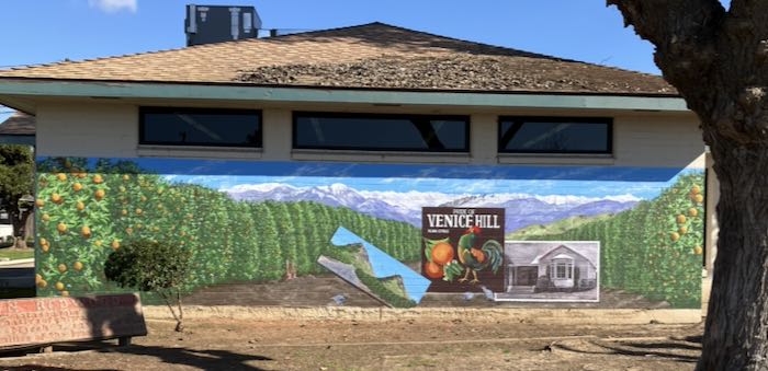
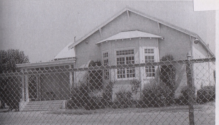
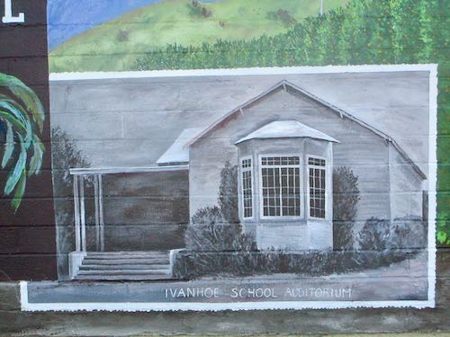
When I was designing the Ivanhoe Library mural, I dug around for photos of a building that is cemented in my memory as a beautiful old structure. (Apparently, I’ve loved old buildings all my life.) I found a photo of the Ivanhoe School auditorium in Laura Spalding’s book Ivanhoe—the Town with Three Names: Klink, Venice Hill, Ivanhoe. I was confused that her book identified it as “Ivanhoe Community Hall”, but I recognized it instantly as the building where I learned to play the clarinet*, gave my campaign speech to be the school president**, checked out books, and played the piano for the jazz band.
When I finished painting it, I added “Ivanhoe School Auditorium” and then thought it would be nice to provide the year it was built along with the year it went away.
Like most things in life, that was easier said than done. The librarian called the History Room at the main library branch, and was told it was built in 1932 and demolished in 1948.
Nope and nope. Architecturally speaking, it is clearly older than 1932, and since I graduated from Ivanhoe in 1973, I KNEW it was standing past 1948.
So, I went to Visalia (had to go anyway to retrieve Momscar with its new starter) and visited the History Room. Library Historian Hunter and I pulled three thick folders from a filing cabinet and started flipping through all sorts of old papers.
Like much in life, the building’s dates are complicated, far too complicated to simply put as “19XX – 19??” on the mural.
Here’s what we learned in two different places, along with Spalding’s book:
It was built around 1926 as a community hall. Then, maybe in 1932, or maybe 1937, “the community, who being unable to meet the indebtedness gladly disposed of it to the school.” One source says it was moved in 1932, another says it was moved in 1937; a third source says it was moved in spring of 1939.
Nowhere have I found the year that the building was demolished. Maybe demolition records aren’t kept, because the demolishers are embarrassed to be part of destroying history, or maybe because it is viewed as a hazard or junk to be gotten rid of, rather than something old and beautiful that has reached the end of its functional life.
So, the painting of the old school auditorium will not have dates, only its title as I recall it: Ivanhoe School Auditorium.
When I was a regular patron of the Ivanhoe library, sometimes we had to go to the main library in Visalia in order to find enough good material to write a term paper or do a report. What is now the children’s library used to be the entire Visalia library, which I found to be stunning and overwhelming. I also thought the building was beautiful, because it is. The architectural style is like the house my dad grew up in, built in 1932. (The house—the library was completed in 1936, so it was clearly the same era.)
P.S. I drew the library in 1989 before the new one got built.
P.P.S. I also stopped by a retail store in Visalia to see a childhood friend from Ivanhoe who told me the school library wasn’t in the bay window but was in a door off the porch. That’s why I added a hint of a door on the otherwise dark and bland front porch. I sure would like to find more photos of the building, both in and out, but those were the days before everyone carried a camera.