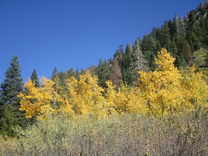
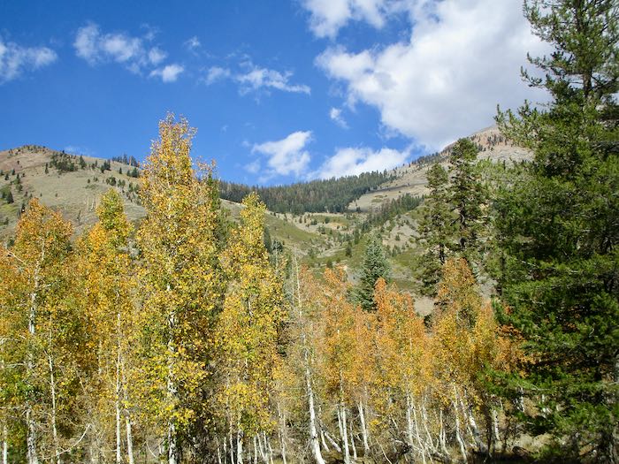
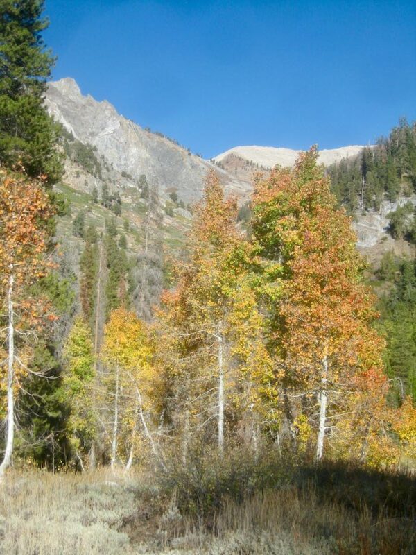
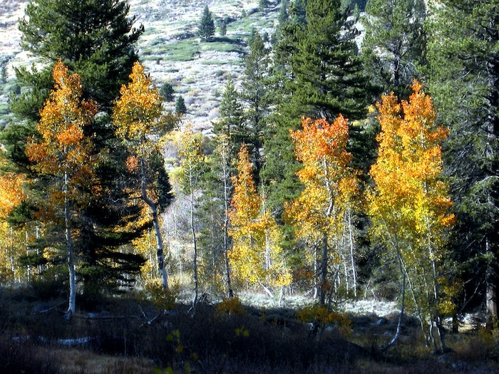
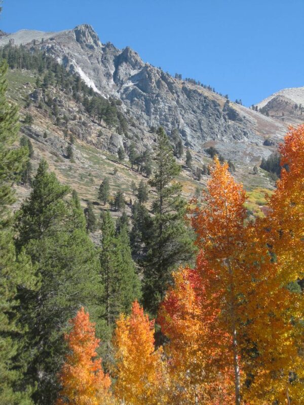
We went walking up the Mineral King valley in search of brilliant fall color. This was easy to find, so many yellows, but of course we wanted oranges and reds too.
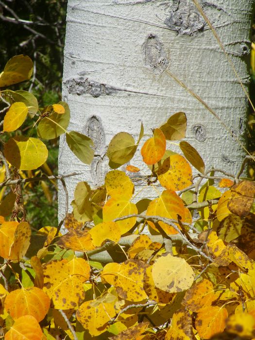
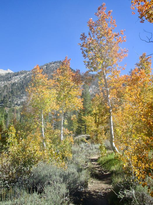
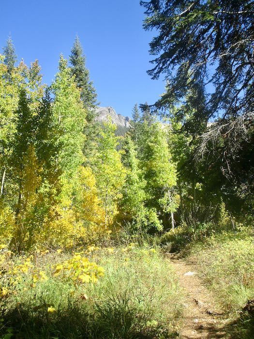
The cottonwoods are yellow; it is the aspen which turn orange and red, so for stronger colors one must walk farther up the trail than rather just hanging out near the pack station.
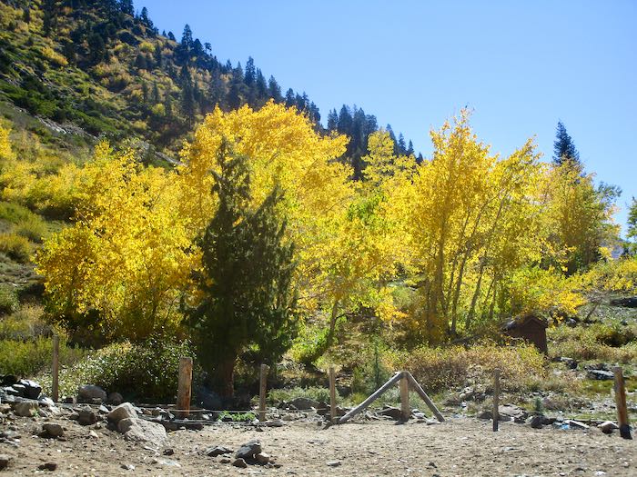
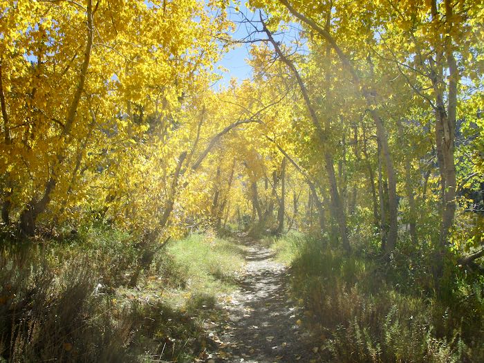
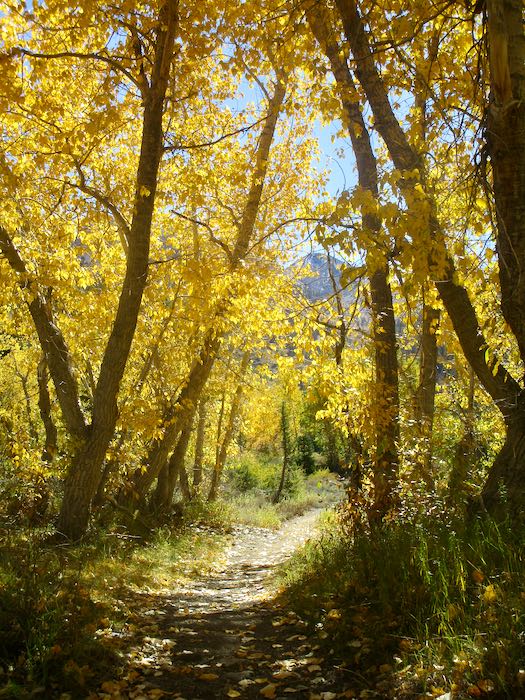
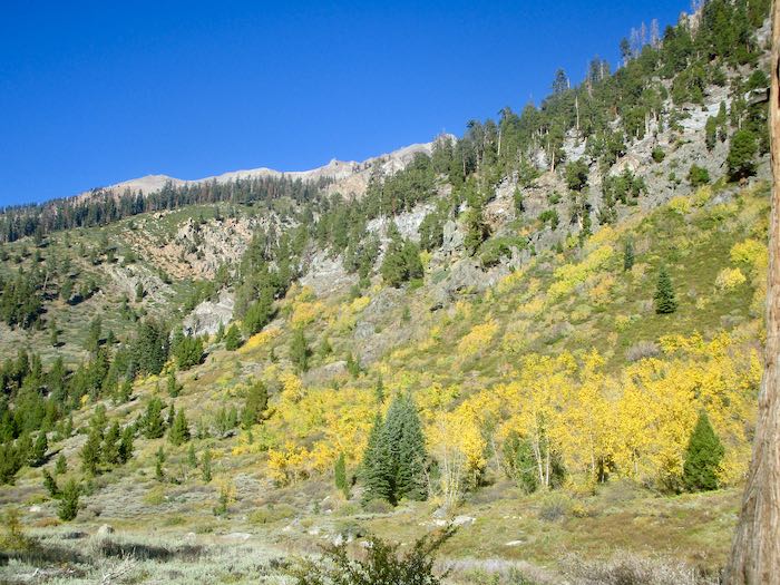
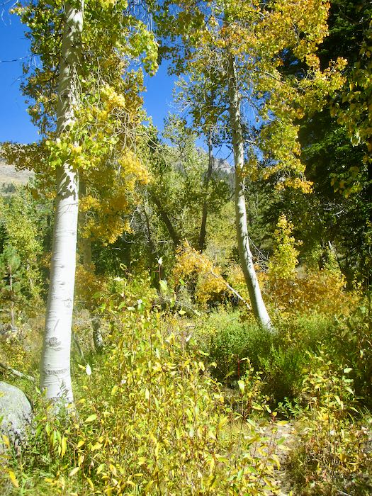
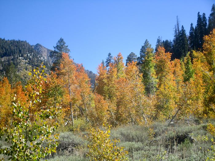
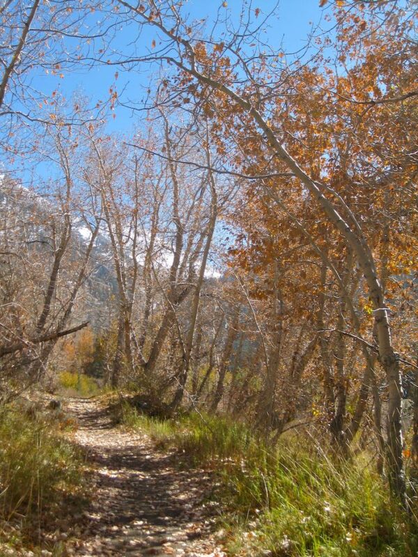
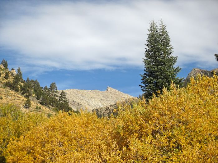
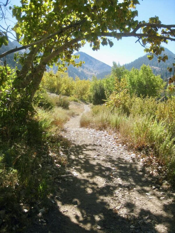
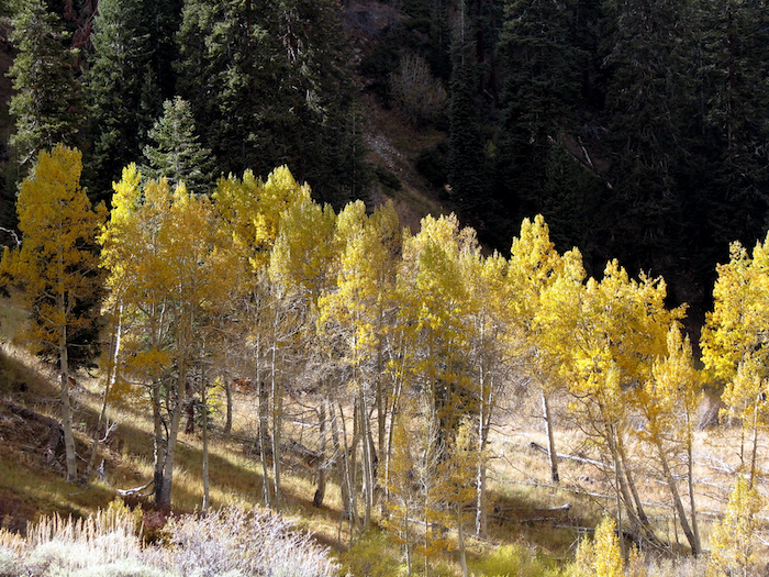
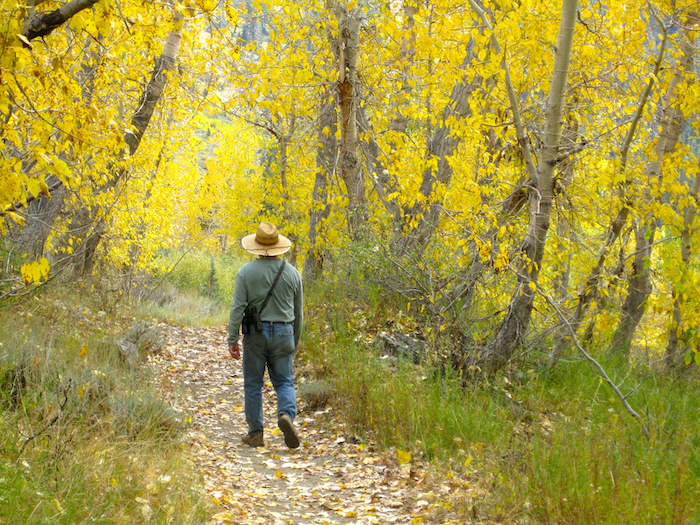
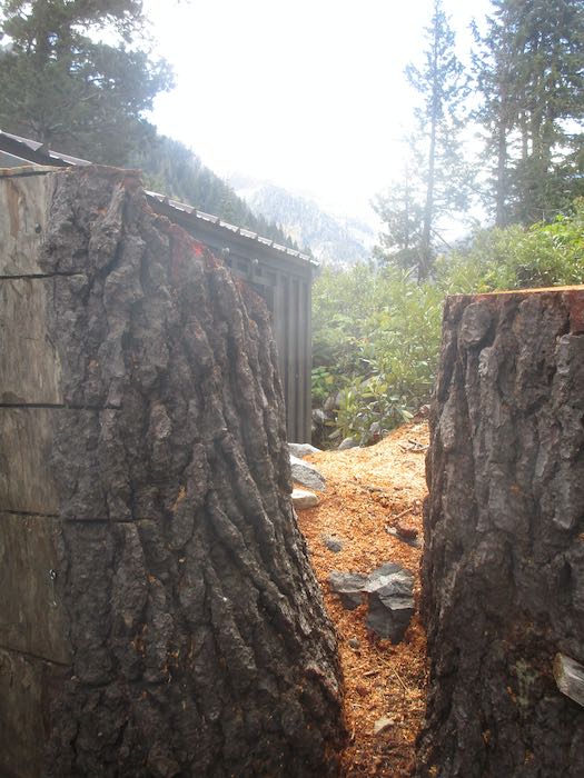
We call this the Yellow Tunnel.
The cottonwoods look so faded when viewed from the other side.
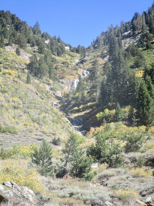
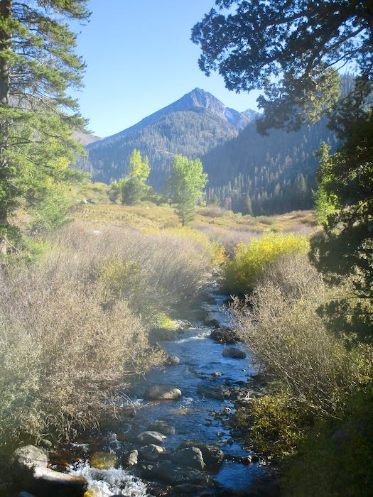
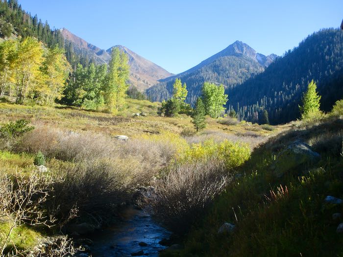
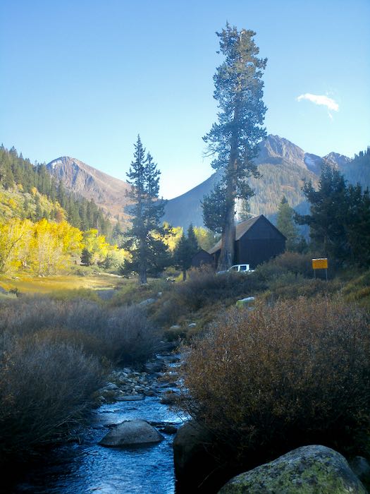
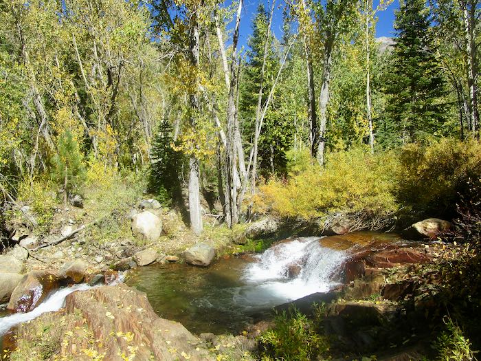
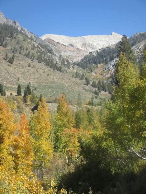
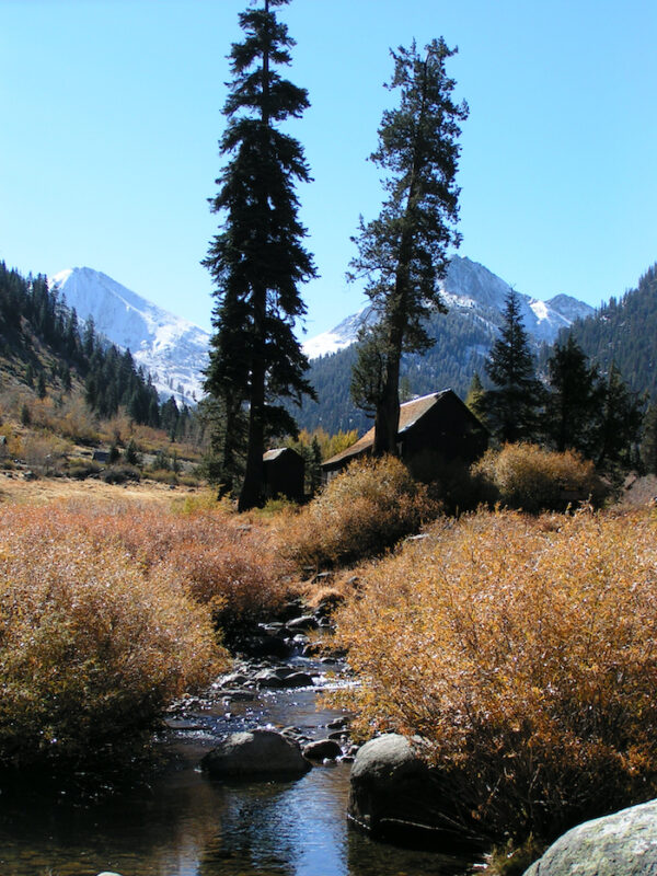
Crystal Creek is still flowing. The colors are very subtle looking up the ravine.
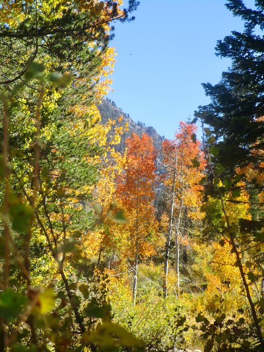
We spotted some orange through the cottonwoods, so Hiking Buddy and I continued on up the trail while the men turned back to begin tackling the chores of cabin closing. Not only do they close our cabins, they also close cabins for neighbors and are responsible for the water system for our little neighborhood, which they take very seriously.
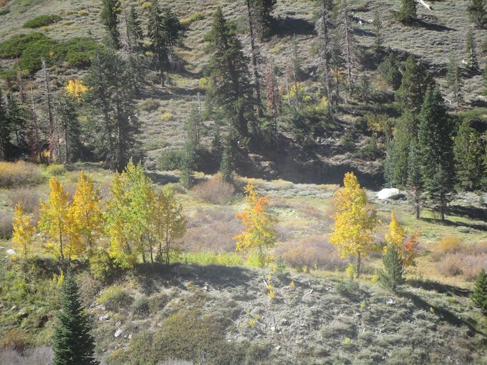
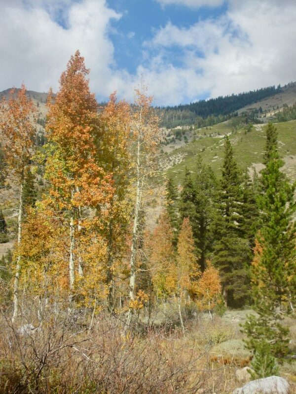
That orange turned out to be a little disappointing. It was only the very edges of these few trees. (You might have to squint to see it here.)
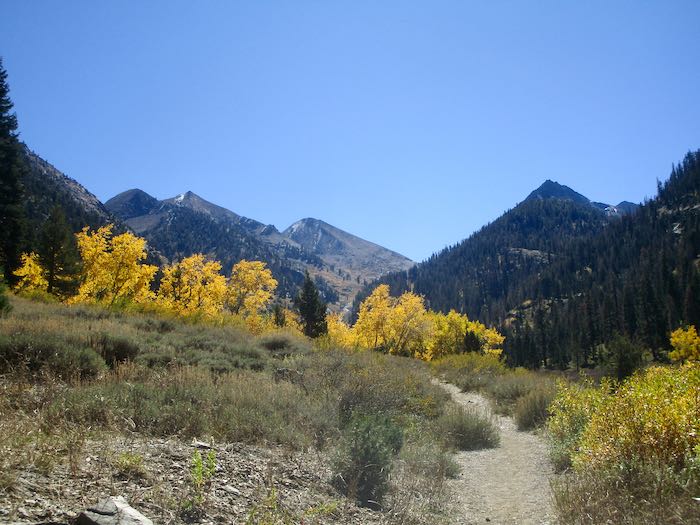
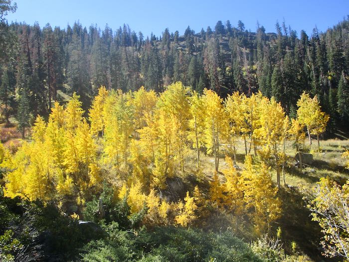
But these trees were electric!
Franklin Creek was so tame, especially compared to my August adventure with K.
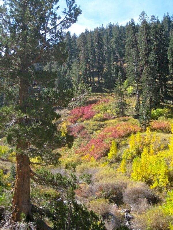
Each year in the fall I am determined to learn what shrub turns red. In the summer when it is green, I don’t notice it and don’t remember my annual autumnal intention.
Somewhere over there is where K and I were scrambling through the rain, cold, and hail to find our way home. We knew where we were going but not our exact route.
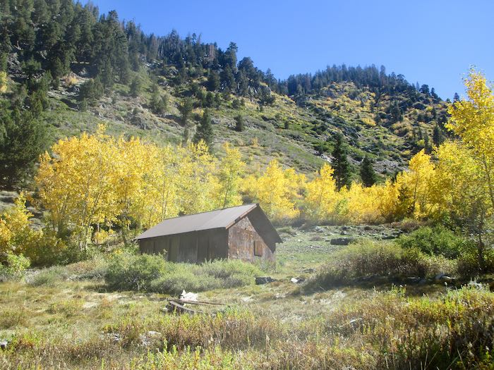
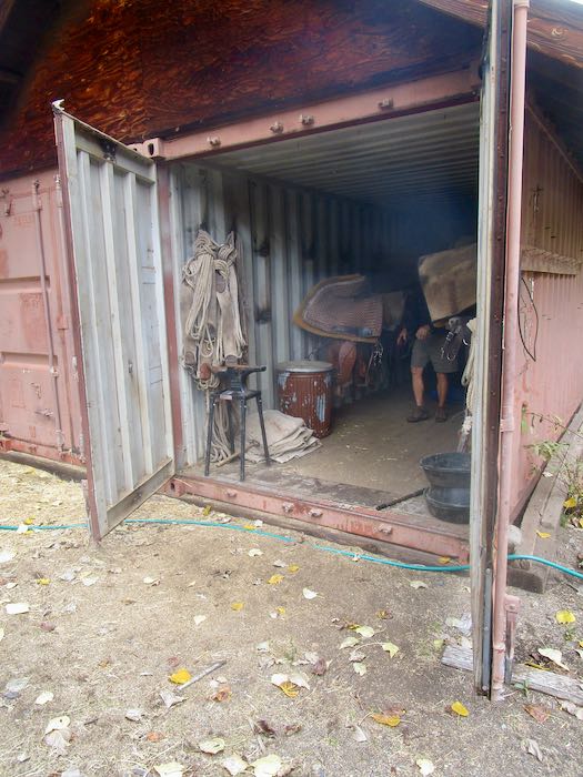
One last look at the Park’s packing shed.
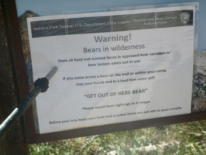
WHAT? How did I miss this piece of brilliant advice all summer??
What I want to know is this: will a bear leave if I simply shout “BEAT IT, BOZO!” or do I have to say “GET OUT OF HERE BEAR!”? Who taught the bears to obey this command?
The next day was closing day. It was very cold, low 40s while we completed our chores and buttoned it all up for the season.
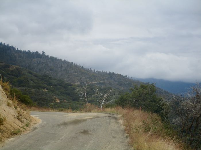
This is how it looked back toward Mineral King from partway down the road. Snow was expected up there. We closed in the nick of time. (Who is this “nick”?
Just for fun, this is the scenic spot where we stopped for some lunch on the way home.
It is always a bittersweet time. While we believe that summer goes way too fast, it is always a relief to be home, to stop driving that wretched road, to be able to go to church on the weekends, to keep up with emails and texts, to not be continually living in flux with duffle bags in plain sight, and to not worry/wonder about the water system or bear break-ins (in both locations.) Besides, we miss our cats.
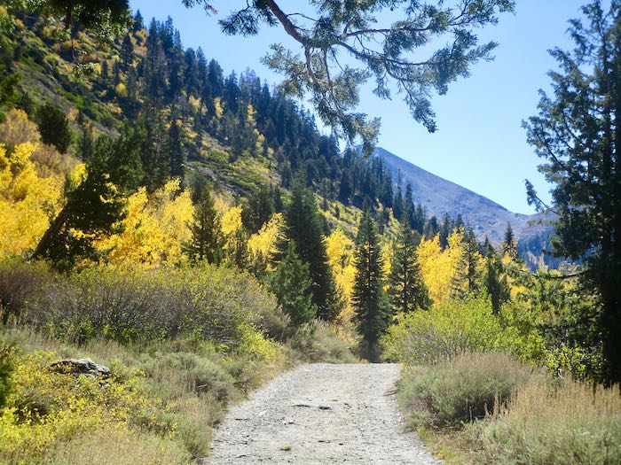
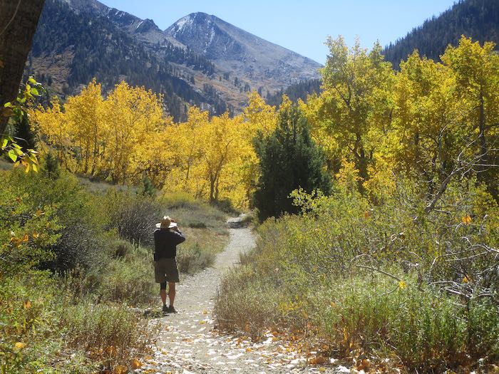
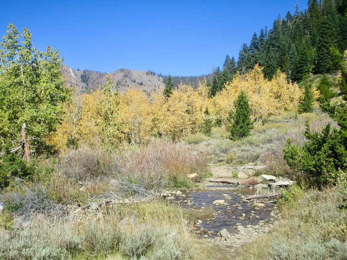
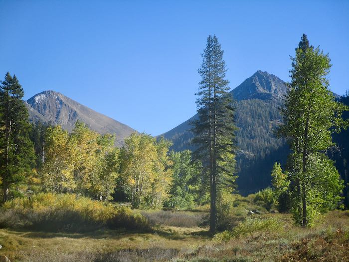
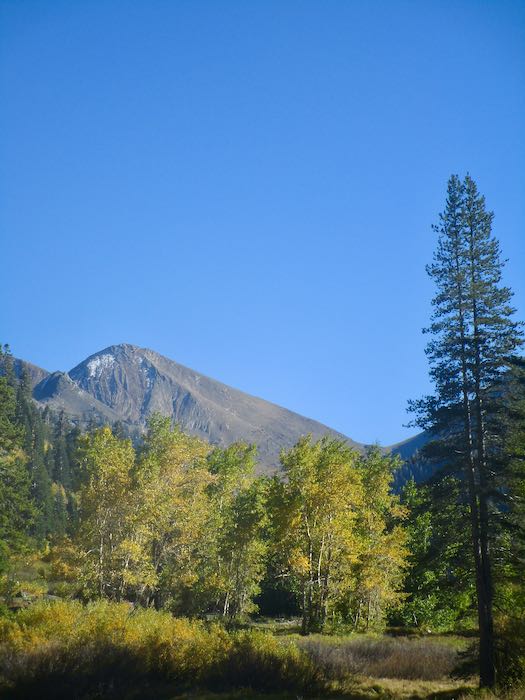
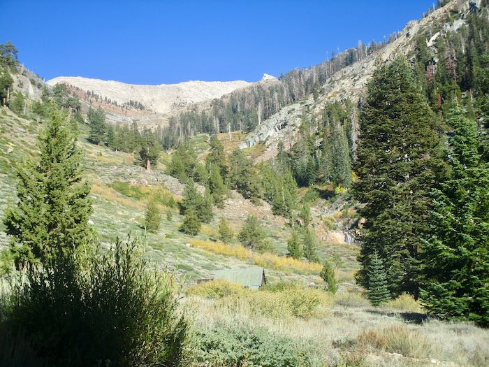
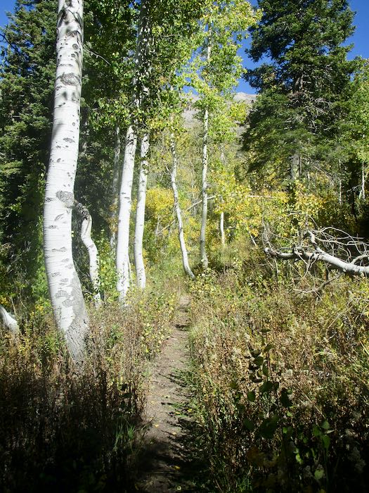
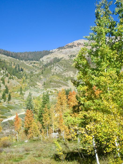
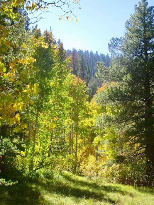
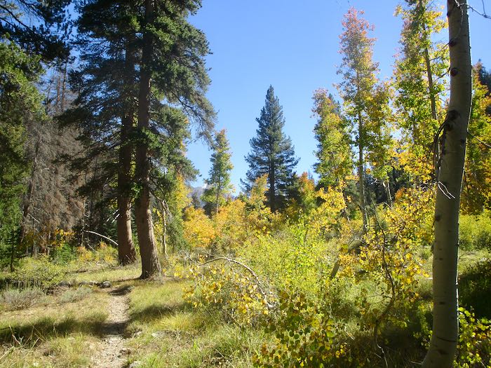
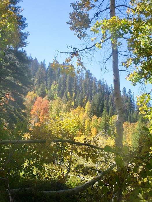
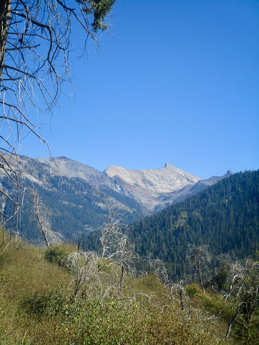
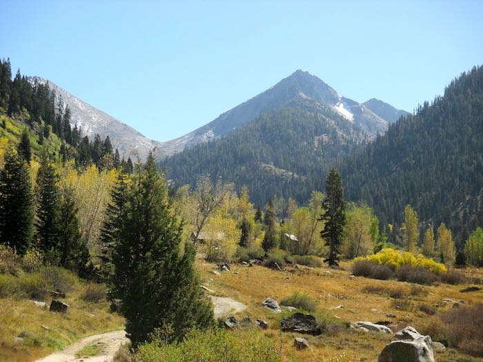
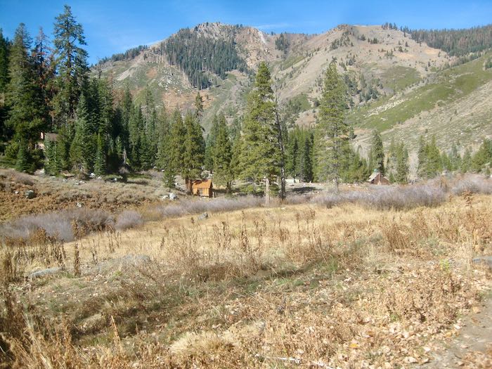
If you read my posts last week, you saw the variety of fall color in Mineral King from year to year. This week I will show you all 2025, mid-October. Not much chit-chat, just some photos. Today is a walk up the Nature Trail, which originates at the upper end of Cold Springs campground.
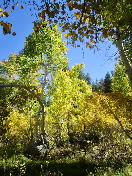
The trees weren’t all brilliant yellow, but it was a brilliant clear sunny afternoon.
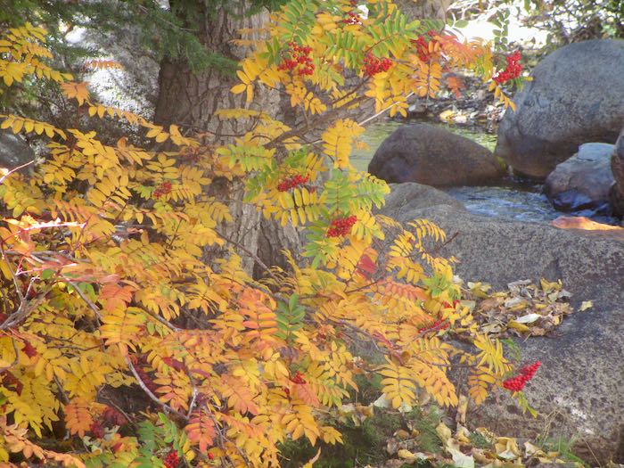
I don’t know what this shrub/tree is nor if the berries are edible. This is the only place I’ve ever noticed this in Mineral King. This just in: Greene’s Mountain Ash—THANK YOU, GC AND PICTURETHIS!
To clarify, Mineral King is still open to the public, officially closing in another week (sorry, don’t know the actual date). Trail Guy and I closed our cabin over the weekend, and just in time too. This week will be full of catching up at home and in the studio, so I’ll just fill this week of posts with Mineral King photos and chit-chat.
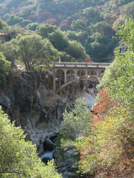
Heading up the hill, I did a quick drive-by of looking upstream from the Oak Grove Bridge. Supposedly this fall is when the county will begin tearing up the landscape upstream to prepare the way for a new bridge. The old one will become a pedestrian bridge only, not that there is any place to walk on the road. It just happens to be a beautiful historical structure in Tulare County, which doesn’t have very many of those.
How it looked on Friday, just aiming upstream into the sun. Next time we drive over it on the way up the hill (unless we make an unplanned trip) this will be all torn up.
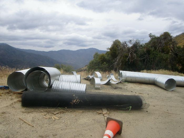
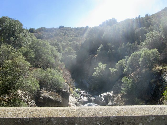
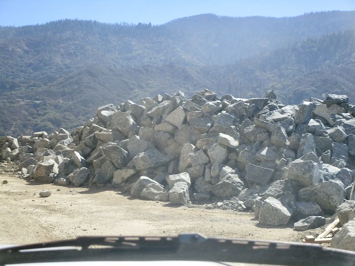
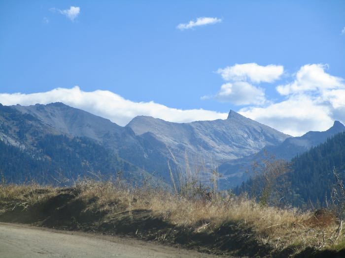
We passed these types of scenic views on the way up. The road construction continues through the fall, and I don’t know when they’ll finish this year. The project is supposed to last through 2027.
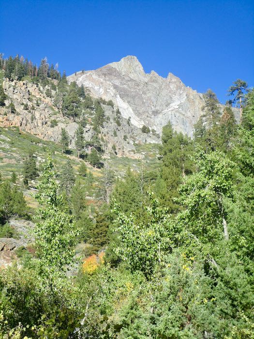
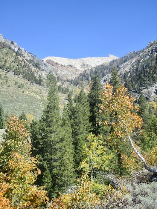
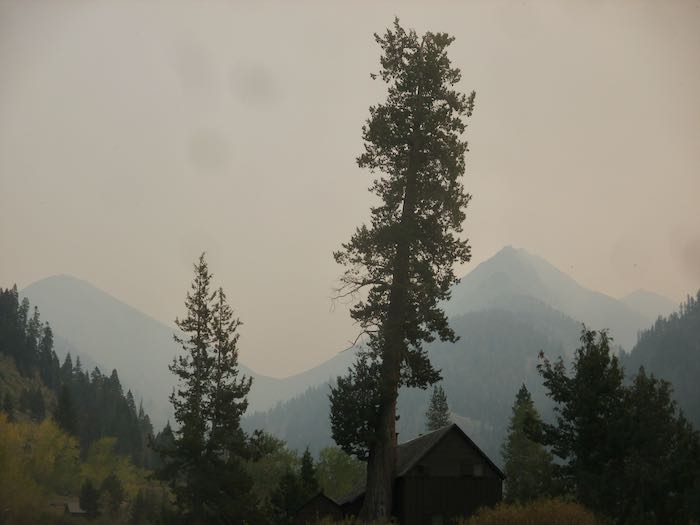
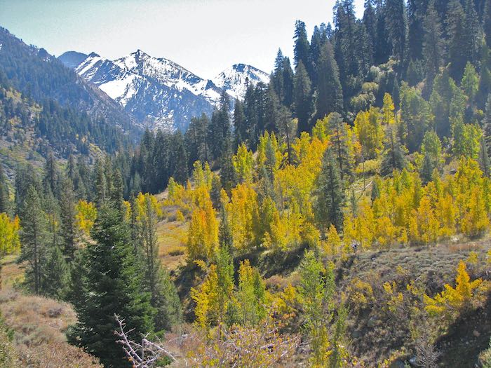
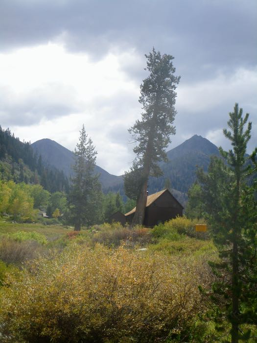
Because of the fires in 2020, 2021, and 2024, there are clear views to Sawtooth (unless it is cloudy or smoky or smoggy or. . . )
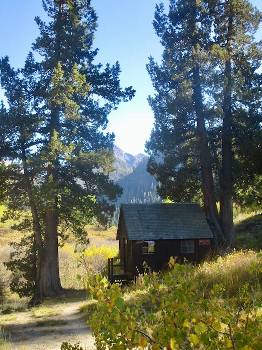
Trail Guy and the Farmer stopped at the cabin owners’ dumpster to see if it was full. Hiking Buddy and I opted to walk up the Nature Trail to our cabins. (What? Would you rather hang around the dumpster, discussing its capacity, waiting for the dudes to make a decision and then have a ride up the final mile?)
More on fall color along the Nature Trail tomorrow.
The photos from Friday and these photos today were all taken within the first 2 weeks of October each year. I just arbitrarily grabbed different ones from my very extensive photo collection (34,000? maybe 36,000 now?) so you can see the variety from year to year.
I did not choose my very best or think about an equal distribution of scenes. Instead, this is just a random selection to give you a sense of the inconsistency from autumn to autumn.
2013
2014
2015
2016
2017
2018
2019
2020
2021
2022
2023
2024 (after the fire – we were evacuated on Labor Day)
I stayed home last weekend. Our cabin is a summer residence in a summer place, and I am very ready to be home for awhile. So, I went through my photo archives, and today’s post will be random October photos of Mineral King from past years.
2007
2008
2009
2010
2011
2012
That was interesting. Let’s do a few more next week.
The weekend began with a surprise visit by a childhood friend. I knew she might be coming in the fall, but so many people tell me their potential visit dates that I don’t even try to keep track. That meant it was a wonderful surprise, and I got to spend an hour or so with her and her offspring. Since this is the World Wide Web, and because I want to experience and value life even when it isn’t documented and publicized, I took no photos (except for asking her daughter to take one of us together, which I HOPE her mom will send to me!)
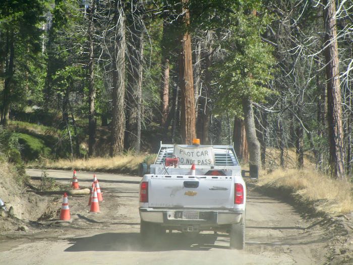
The road construction continues. We waited just below Wolverton Point for about 45 minutes for the 10 o’clock pilot car shuttle which we followed to Silver City. SEE THE NEW SCHEDULE BELOW.
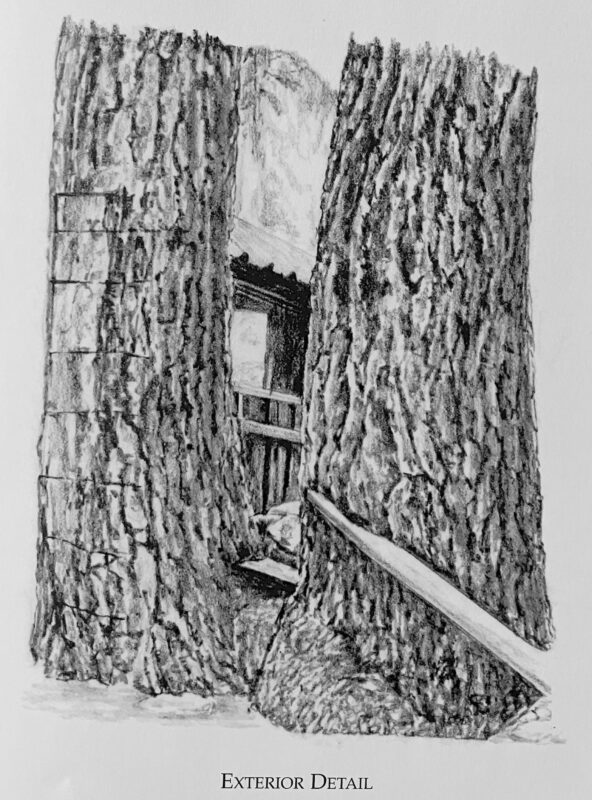
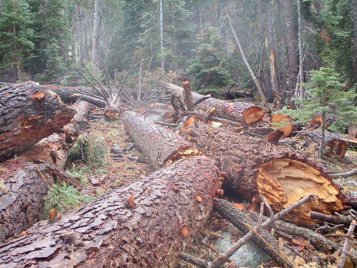
A neighboring cabin had 8-10 hazard trees threatening their place. We went snooping, and all is safe now (but the cabin is exposed), and there is a boatload of downed wood, a real mess. Here is how part of it looked as drawn for The Cabins of Mineral King and how it looks now in real life.
It rained several times and was overcast. We did not hike. People who live in Mineral King just hang out sometimes. Instead of being on vacation, we are simply experiencing cabin life.
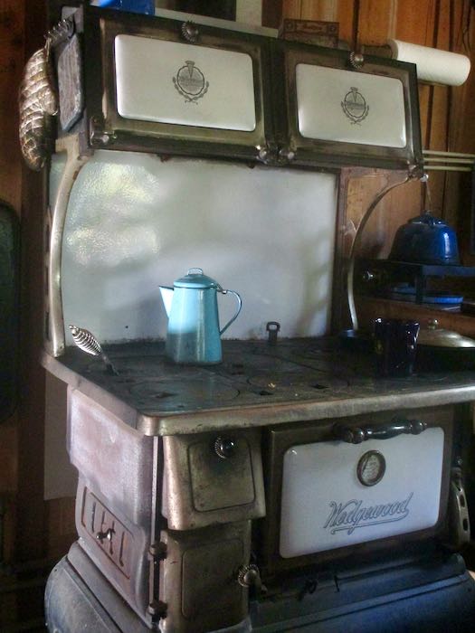
We thoroughly enjoyed the warmth from the wood stove, trying but not succeeding to keep a fire going all day. That stove wants feeding fairly often. I would have split more wood, but we kept covering the woodstack due to the rain.
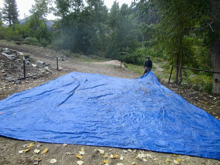
We walked to the pack station and found an enormous tarp all wadded up, and the stock was gone. Couldn’t just waste that tarp, because chances are we paid for it with our tax dollars. So we folded it up and then put it in the storage container.
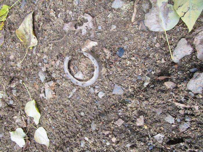
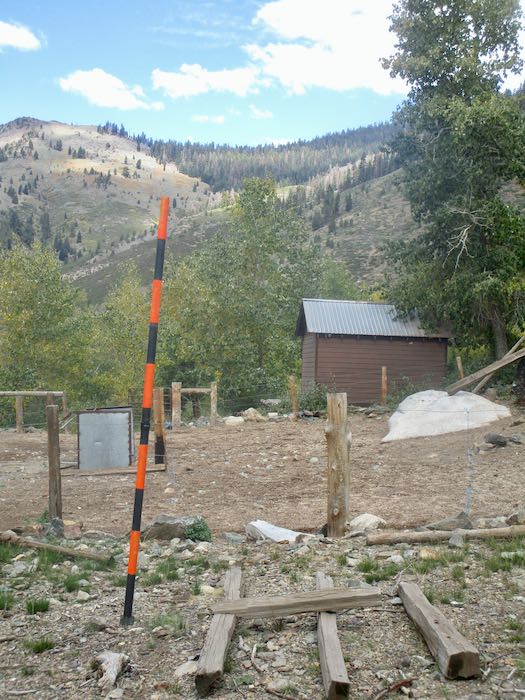
I saw this trimmed mule hoof on the ground, and the snow stake is now installed for viewing on the winter webcam.
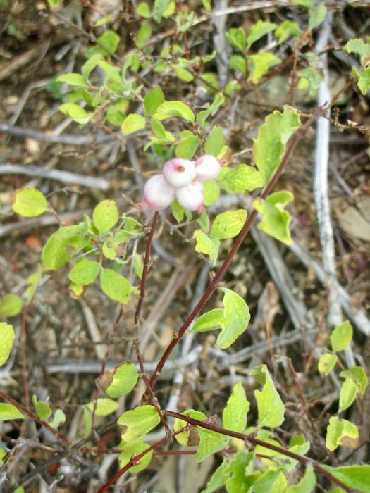
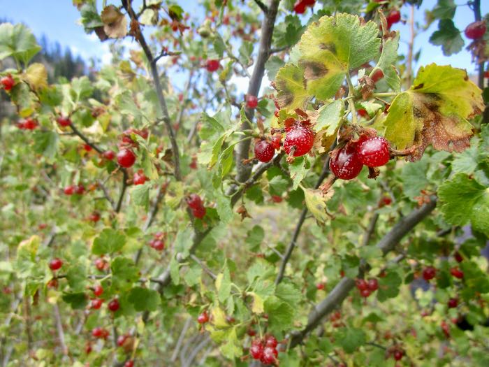
Berries are ripe in the fall. Don’t eat the white ones. Trail Guy loves the red ones, Wax Currant.
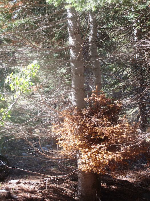
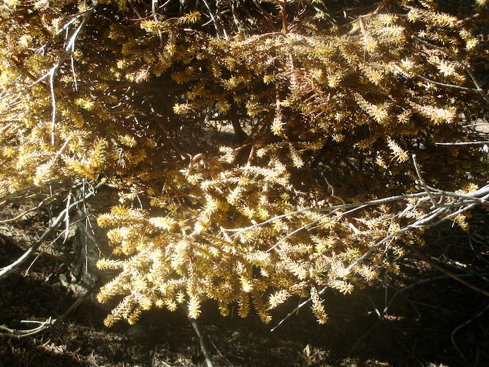
There is a specific type of mistletoe which grows in red fir trees. It is weird stuff.
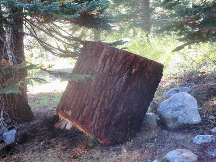
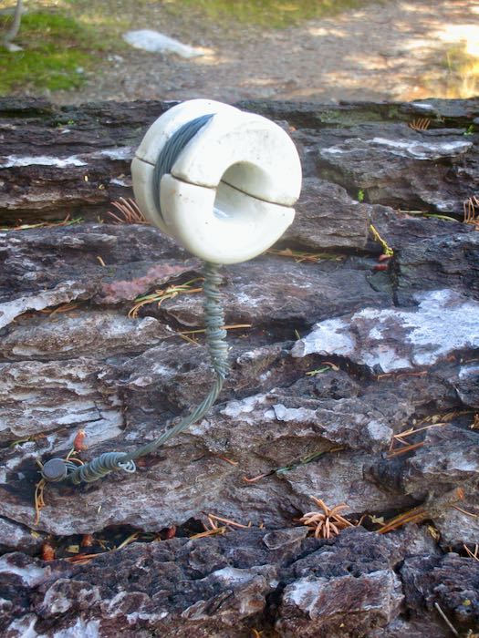
Look at these two huge chunks of the red fir that got dropped a few weeks ago. They got randomly placed in our neighborhood after being moved from the road. One has a thing attached that had something to do with phone lines. I didn’t photograph the messes from the dropped trees, but know I will be dragging brush and sawing limbs for a long time coming.
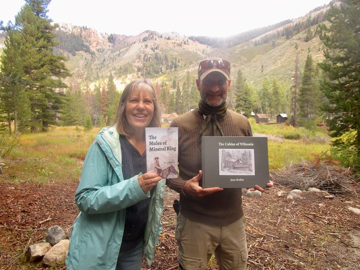
Now, the funnest of the fun things: I FINALLY* met Kevin Alltucker, author of The Mules of Mineral King, a book that I told you about back in August. He graciously accepted a gift of my Wilsonia book, and then his brother said that he (the brother) is one of my tens of blog readers. This gave me the idea to do this dorky photo (me dorky-looking, clearly too thrilled to think about posing better or controlling my grin) and remind you all who like Mineral King to BUY THE BOOK! It is so well-written. It was also fun to talk about the logistics of writing, publishing and (not) marketing one’s own books with a fellow self-published author.
The Mules of Mineral King is available through Riverfeet Press, (also at that big online store which begins with A and takes a large bite out of an author’s profits.)
Amazon is changing its terms. Now, if you want Prime, you cannot hitchhike on your sister’s account or your mom’s or your daughter’s or. . . but we are going to wait and see if this actually happens, because Amazon didn’t publicize the change. I heard it through the grapevine (Remember that song? The full-length version was 11 minutes.)
2. AT&T is so awful. I have known this for a long time, but it got driven home again when I got a letter from a collection agency saying I owe $666 for a phone number that they NEVER activated, I NEVER had or used (because how can you use something you don’t have?), and they NEVER billed me for it. I’ve wasted so much time on the phone and writing letters, and wasted money sending the letters in a manner that the collection agency cannot lie about receiving them.
3. Seeing the Supernaturalby Lee Strobel is so fascinating and weirdly believable. The premise is that there is an unseen world that DOES exist and there are countless stories which are corroborated by evidence. It’s not about UFOs; it is about real miracles, dreams, angels, deathbed wishes, and near-death experiences.
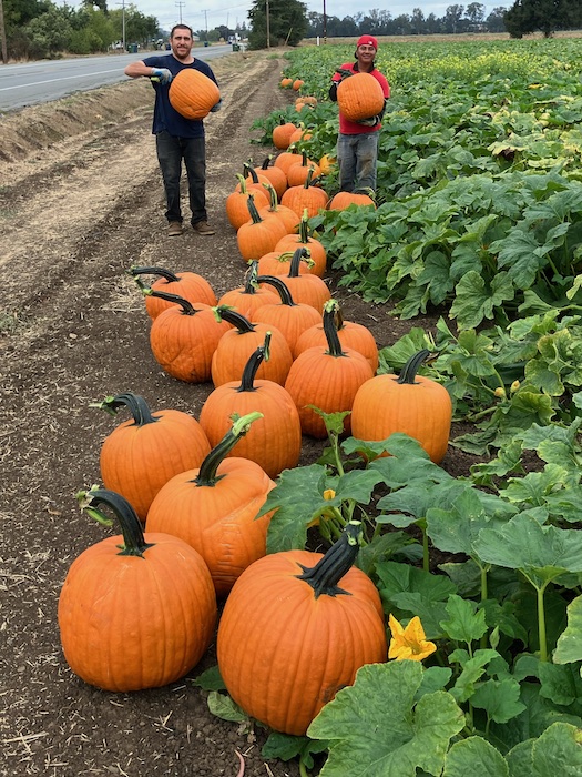
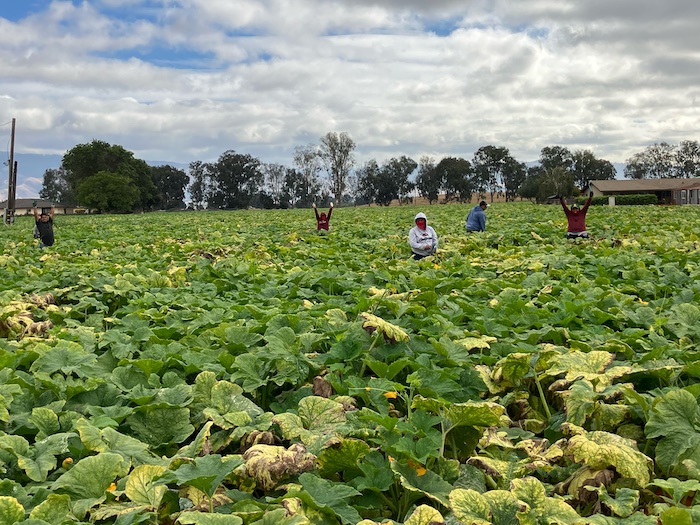
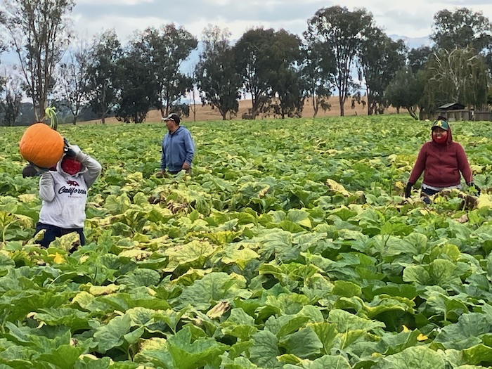
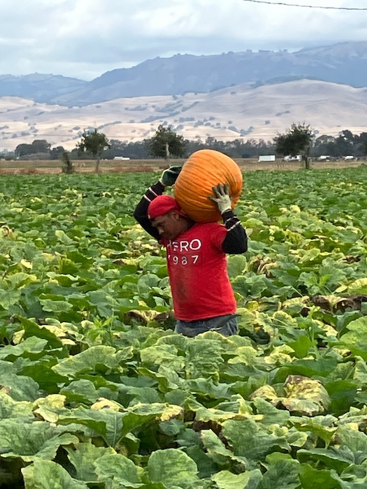
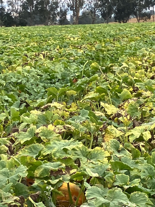
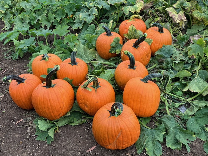
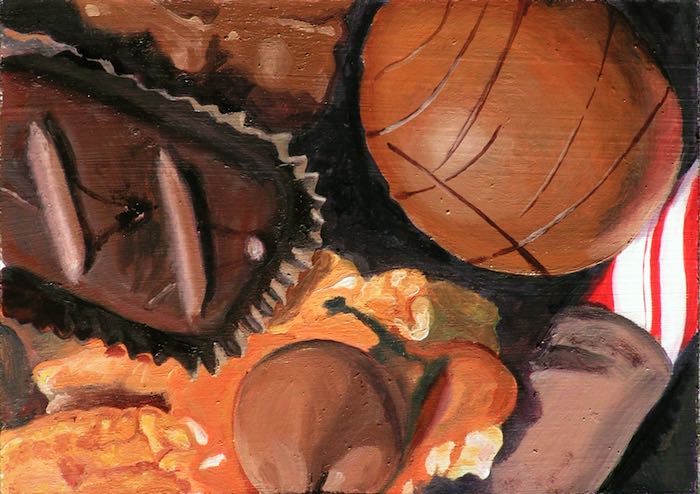
4. Check out these pumpkinharvest photos: it’s like a grown-up Easter egg hunt. (I wonder if my painting needs revision again.)
5. Tony’s Taverna in Three Riversis finally open!! It took four years to go from buying an old building to making a fabulous Greek restaurant. The food is so good that I wanted to lick the plate, but I found a little restraint and was able to maintain dignity.
6. Through an online friend I’ve never met (Hi WilliamB!), I learned about an organization called Foster Care to Success, which helps kids who have aged out of foster care. They have an annual red scarf project, which caused me to immediately abandon my severe ongoing yarn diet and order enough yarn to knit 2 scarves.
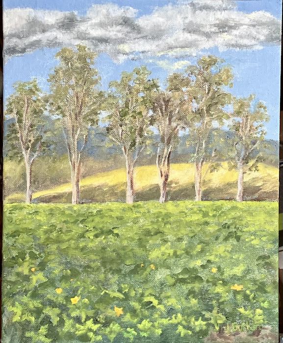
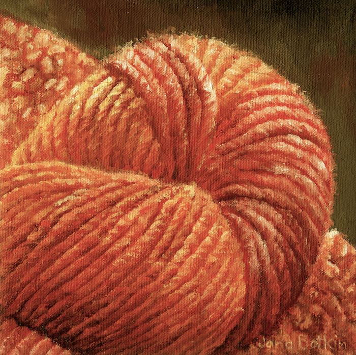
I know it’s not red. This was painted for a friend whose favorite color is orange.
This month’s list is long, many thoughts, few photos. Settle in, and enjoy!
Food
1.Intermittent fasting for three months did not work to remove me from the category of pre-diabetes. I am discouraged, disappointed, disgusted. Dis, dis, dis. Maybe it is time to accept the reality. I hear over and over that “EVERYONE” is prediabetic, but that does not reassure me. I pursue removal from that category just in case it is the cause of peripheral neuropathy, as the neurologist is so confident about this.
2. When I was with Mrs. Texas, she did something so funny that I want to share it with you. Whenever we were eating something really extra good, she held up her hands, palms out, and said in a commanding voice, “NO TALKING.” (She said when you talk, you can’t taste things as well.)
On one occasion we decided to get ice cream. We stood there awhile, deciphering and considering the flavors, and then Mrs. Texas pointed to the price for small size dish with a single scoop—$6.75. EXCUSE ME?? Nope. We left without ice cream.
Still wanting a treat, we went to Starbuck’s because I had such curiosity about pumpkin spice lattes. I ordered a 12 oz. requesting only 2 pumps of the glorious flavored substance instead of the normal 3 pumps (the employee explained it to me—I didn’t know this from experience). Holy guacamole—I had to take it back to the house and dilute it with black coffee because it made my teeth hum. HOLY GUACAMOLE — it was $6.25!
No wonder I don’t go out to eat much. (at all)
3.Serious Eats is an interesting website with tips and information about food—articles about letting meat rest, how to really clean your kitchen sponge, never cry while cutting onions. . . and that was just the first time I went exploring on the site. (Already forgot most of what I read.)
4. Some friends said they like to drizzle olive oil and then sprinkle a little salt on vanilla ice cream. At first it sounds like ice cream abuse, but they said it was delicious.
Someone seems obsessed by food in this month’s learning. Is this a result of intermittent fasting??
Work
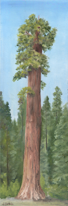
5. Sold five pencil drawings and no oils. WHAT IS THAT ABOUT?? I learned that I don’t know what I am doing when it comes to reading my customer base or understanding my market.
Since I didn’t sell any oil paintings, I will stop painting just for the fun of painting any particular subjects. Instead, I will accept commissions and paint sequoia trees or other subjects that stores sell for me.
Fun to learn
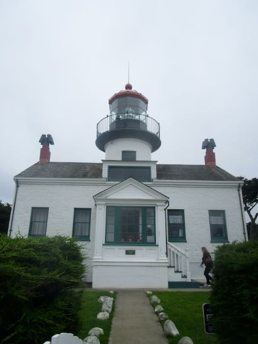
6. I finally toured the Point Pinos Lighthouse. (It ought to be Piños, but no one bothers with the tilde.) I learned so much about that lighthouse and lighthouses in general.
The late theologian and pastor Tim Keller once wrote that anger is energy spent defending what you love.. . .The next time you experience a bout of anger, be thankful that your brain has given you such a useful barometer into the things that you love. Take the opportunity to reflect on what makes you angry and whether those things accurately reflect the values you claim to treasure most. If not, it may be that the culture you live in has shaped you more than you realize, and that your loves have become misaligned.”
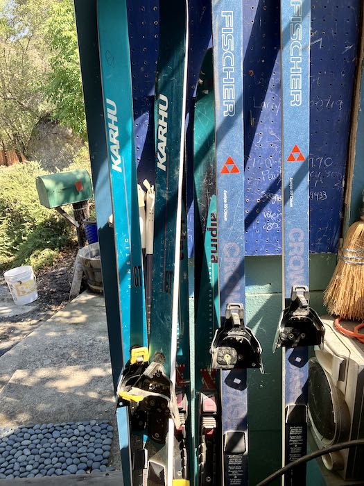
8.Getting older means loss. In the last year, I have sold my tennis racquet and my canoe, and this week I gave away my cross country skis. Tryna be realistic about my shrinking abilities to do stuff. The combination of a wrist problem and a foot problem have squeezed my limited activities even further. Never a fan of any sportsball*, the few activities I participated in didn’t require a great deal of athleticism. In actuality, I hadn’t used any of my gear for a long time. It just took awhile to face and accept this, and then figure out what to do with my unused stuff.
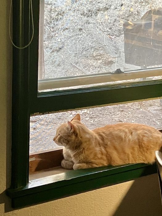
Maybe I should just join Pippin in the window, observing the outside world.
Wait a doggone minute here—why is that outdoor cat inside the house? Because Trail Guy is a pushover for this cat.
9. Clearly I need to face truth about my health, activity, business, and age. This wisdom is from M. Scott Peck. (When people use a first initial, does this mean they wish to be addressed by that initial? If not, then why even put it there?)
Truth or reality is avoided when it is painful. We can revise our maps only when we have the discipline to overcome that pain. To have such discipline, we must be totally dedicated to truth. That is to say we must always hold truth, as best we can determine it, to be more important, more vital to our self-interest, than our comfort. Conversely, we must always consider our personal discomfort relatively unimportant and, indeed, even welcome it in the service of the search for truth. Mental health is an ongoing process of dedication to reality at all costs. (M. Scott Peck, The Road Less Traveled)
A recent weekend in Mineral King in photos with commentary, as usual, from your Central California artist.
The hazard tree crew returned to our neighborhood.
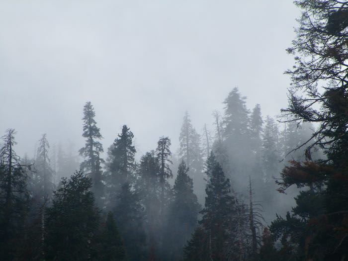
We had rain, both up and down the hill. It was overcast for a day or so after the rain. I wonder if this would make a good pencil drawing.
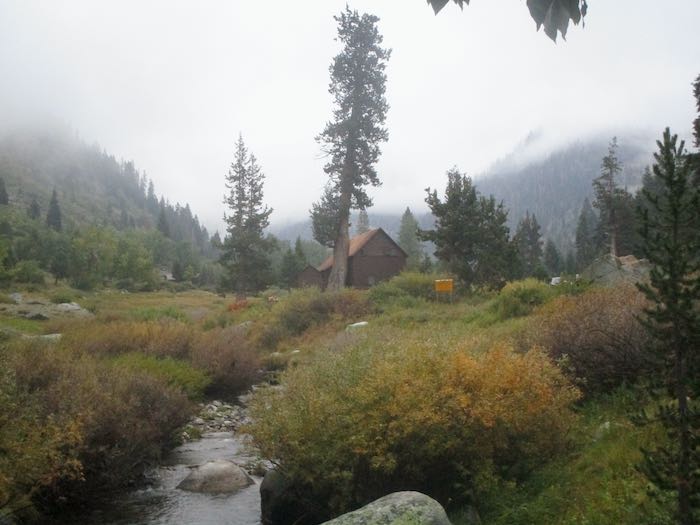
The classic view from the bridge, with Farewell Gap obstructed by the clouds.
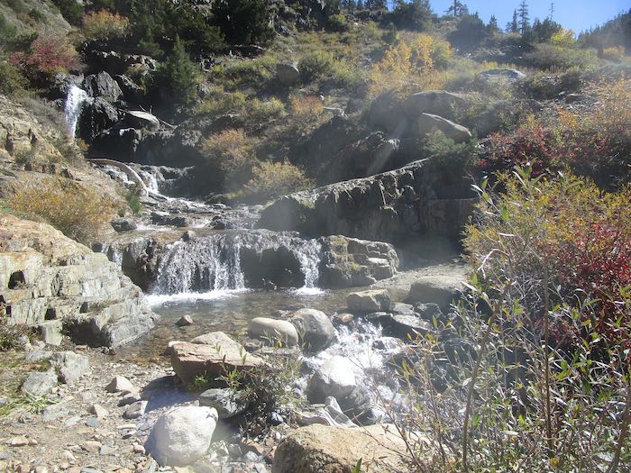
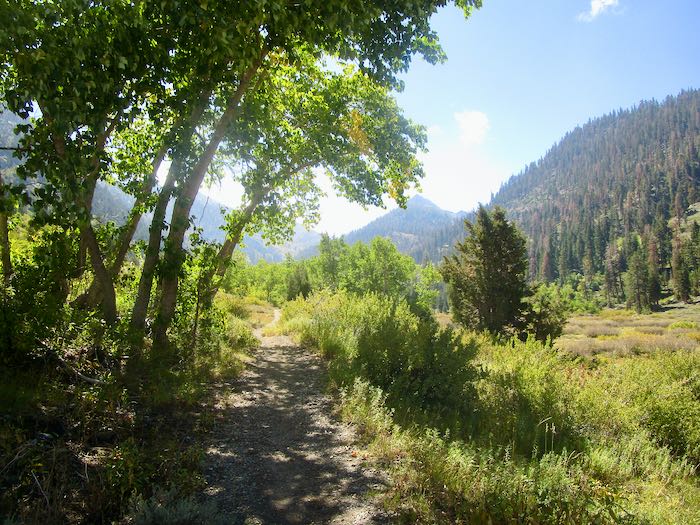
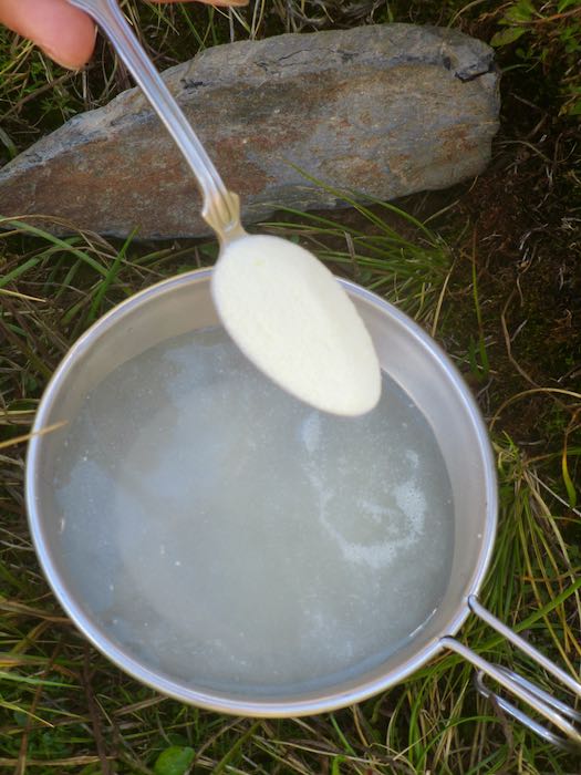
The sun shone the next day, so Hiking Buddy, K, and I walked to Soda Springs.
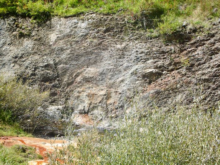
Crystal Creek is still running.
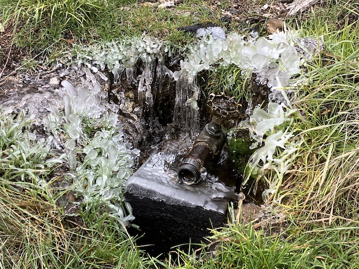
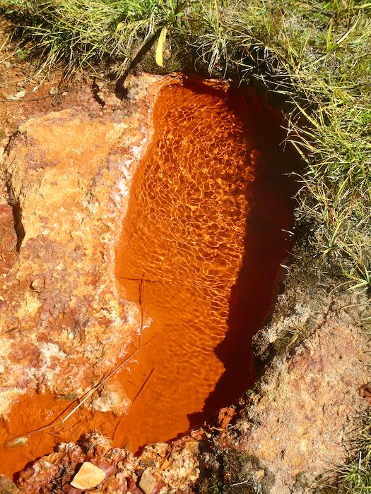
See the orange? That’s where Soda Springs runs down into the creek.
It bubbles out of the ground.
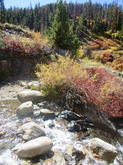
Many cabin folks have a tradition of adding lemonade powder to the water, swearing that it is fizzy and delicious. It tastes like metal to me, reminding me of the drinking fountains at church camp as a kid. Ick, no thanks. K is very traditional, complete with a Sierra cup hanging on her daypack.
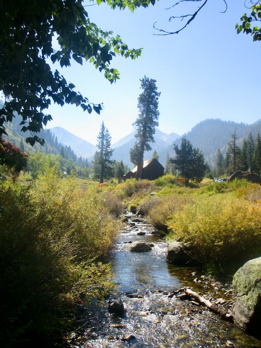
Here is the classic view in sunshine.
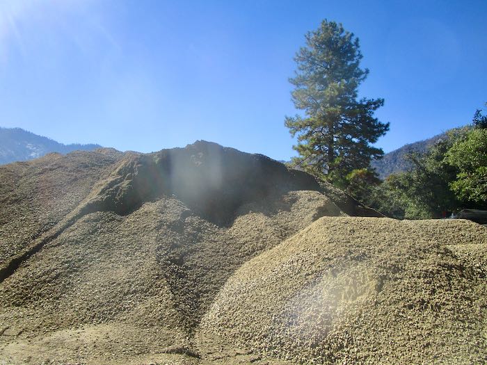
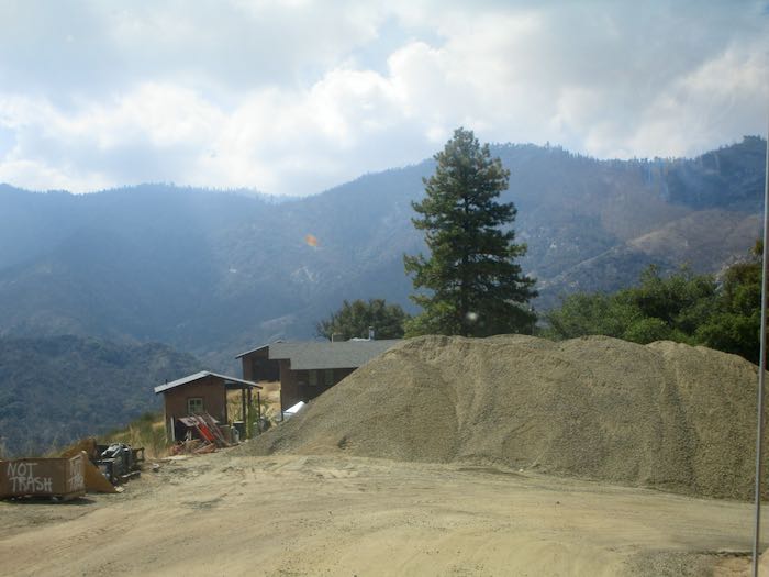
On the drive home, we were amazed by the ENORMOUS pile of road base collecting at Lookout Point for the ongoing road construction project.
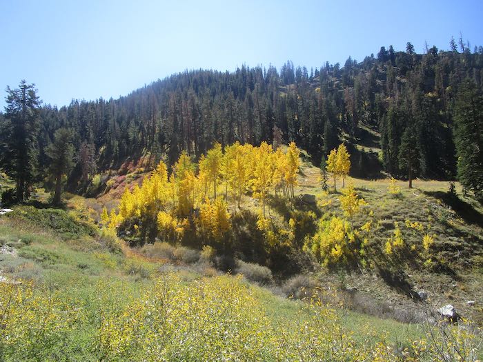
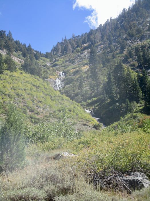
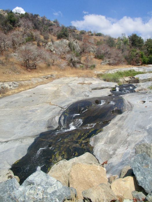
Finally, here are The Potholes, still running steady and strong in September. My theory is that all the trees which used to take up water above this stream (called Squirrel Creek) burned up, so there is more water to continue flowing throughout the season.
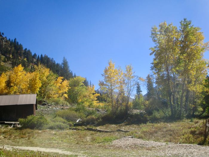
And thus we conclude another tour of Mineral King. I’ll get back to work next week.