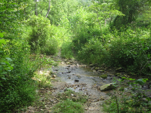
A California Artist Explores Tulare County

There are 4863 square miles in Tulare County. Really! I read it on the internet, so it must be correct, right? Although a great deal of it is un-roaded mountains, there are many roads to explore. And, there are roads to re-explore, because I forget stuff.

This summer I’ve made 4 trips to Kings Canyon National Park. Although it is in Fresno County, the bulk of the travel happens in Tulare County. Each time I have taken a different route, sometimes by choice and sometimes by accident. I wasn’t lost, because I still had my sense of direction and a working steering wheel.

On my most recent trip, I tried 245 out of Woodlake. There are a number of roads that resemble one another along the foothills. They have enough variety to make it worth the effort to change my routes. Besides, I like knowing how they connect. The traffic is usually light, and mostly I see pick-ups or out of state license plates. This is because the roads look reasonable on a map, rather than the remote serpentine almost-endless routes that they really are.

As I drove, I wondered why I couldn’t remember one road from another and why they get so intermingled in my head. In addition, I had lots of other thoughts:

1. There is the road where Bob used to live. I wonder where the sycamore that he drew is. . .

Roble Lomas, oil on wrapped canvas, 14×11″, $175

2. OH! There is that stone gate and barn I painted from a 20 year old snapshot! Shoot, wish the light was better so I could photograph it again. Either they built some new structures, or I did some serious editing!

3. Hey! There is the 2-1/2 acres of avocados that Dad used to farm. Now it has a crummy looking mobile home sitting in the middle of the property.

4. That must be Baldy. Michael and I skied there. It’s not the one that slides in the winter – that is Little Baldy.

5. When did the Badger Store close? I remember getting mail there for Hartland Camp, misidentified on the map as “Hartman”. Don’t these folks actually travel to the places they are mapping?

6. THERE’s the Badger school I remember!  I’ve passed Sierra School on my last several trips. How can an area this rural support 2 elementary schools??

7. AHA! Hogback Road. I knew if I just kept trying different routes, I’d be able to find it from the lower end.

I love Tulare County, and I love exploring! Do you explore areas around your home? Do you look for differing rural routes? Do you have any recommendations? Please share!

South Fork

Maybe March is my favorite month instead of February. It is so green and the redbud are in bloom, along with lupine, poppies and a great variety of other wildflowers. Michael and I drove up South Fork Road, which follows the South Fork of the Kaweah River (hence, the name). Something that always just twists my sense of geography is the clear view of Homer’s Nose from the upper end of that road.

We stopped 4 miles from the end of the road and unloaded our bicycles. It was a long slow pull to the campground, but oh so very pretty.

There were lots of choices.

We stashed our bikes and headed toward the water.

Clough’s Cave is on the other side of the river and used to be open to the public. I had never seen it, and Michael had described its location to me at some time in the past. We followed our noses (and a trail of litter), which led to getting sort of bluffed-up and no cave. We slid back down, thought it out, and found the abandoned trail to the cave. It is slippery with oak leaves and acorns, and several places made me question the wisdom of following it to a closed-off cave. A few cave-wreckers have caused the Park to seal the cave off from the public.

If you climb some rocks and then lie on the ground, this is what is visible. If you turn around, this is what you see:

Lots of textures, snow on the peaks, the canyon winding its way upward, and even a belt of black oaks still without leaves. Tulare County is so large in acreage, so vast in its variety of terrains, with far more to explore than I have days off!

Working from Photos

It isn’t popular in the artworld to admit that one works from photos. In fact, the closest you’ll get to reading that someone works from photos is “I use them for reference”. Brings to mind something Jack White, my painting inspiration/guru/mentor said – “All realistic painters either work from photos or they lie about it”. Me? I TOTALLY work from photos – if I just use them for reference, it is because the scene was so complicated that I just started making things up!

The other JB and I visited the Buckeye campground in Sequoia National Park over the weekend. There is a mellow little trail that leads to a picturesque footbridge over the main fork of the Kaweah River. (You can read about it in the  January 17 blog post.) When JB saw the view, she burst forth with the declaration, “If you paint that, I will buy it!” Being a hard-nosed business tycoon (snort, guffaw), I said, “Okay, I will show you some sketches first so you can see if you like it and after I paint it, I won’t hold you to buying it.” (Jack White would not be pleased with me for that!)

Here is the main view that JB was so taken with; you can barely see the bridge in the photo! This is why I will have to sketch things in advance of painting – how large can I make the bridge without distorting reality? How much rock, if any, in the foreground is actually necessary? Can I “grow” the river, because in our memories, it is The Main Event?

All these photos will be useful to create a small (“thumbnail” in Artspeak) sketch that will determine what size and where each part should be in proportion to the other parts. If I was carrying a backpack that day, a sketchbook would have been a helpful item. But I am a modern chick who uses a digital camera with tremendous gratitude for the technology.

Hospital Rock: A lesson in choosing photographs for art

In what passes for winter in Tulare County, sometimes it gets cold and gray. Count on it in the flatlands. Moan and complain about it in Three Rivers. If you’re smart, you’ll just drive up a ways and voila! Sunshine! That is what Michael and I did on Saturday. Ever been to Hospital Rock? I had, but only to the upper parts and not to the river. The interesting thing is this: I recognized the rocks because I have drawn them! As always, I was looking for light but seriously distracted by the lovely old rockwork. Under the photos, I will put my opinion of how each photo would be useful to an artist.

There was a bridge across the river (middle fork of the Kaweah) until it washed out in the ’55 flood and a wall was added for a viewing platform. This has the clear detail necessary for a pencil drawing, but probably not the best choice of subjects because it is sort of an odd structure. Those sorts of things make sense in photos but cause an art viewer to wonder what the heck it is!

There are inexplicable stairs all around. Clearly this was constructed in an earlier era before evidence of humanity was forbidden (except signs with cautions and warnings.) This has good clear detail for a pencil drawing, but not a great one because there is no visible sunlight. The person could be included or left out, depending on how much fiddly detail one wanted to do. If the face was showing, I’d say FORGET IT – NO FACES SMALLER THAN AN EGG! (ok, I might not shout, but I’d be very adamant on this point.)

I recognized this little waterfall – it had my friend’s parents standing to the left in the picture that I drew. This would make a nice pencil drawing –  great contrast but not enough color for a painting.

Would the Park allow a trail to be built beneath a rock like this now?? Would they even allow the rock to remain? There are no warning signs – amazing! This photo is good for documentation only – the subject is too weird for art.

This is the kind of light I look for. It would make an excellent painting. Also good for drawing but it would be hard to render the textures unless artist is very experienced.

The Paradise Bridge was replaced in the early ’90s (Michael worked on that project) and it washed out in the ’97 flood, which was only about 1/4 of the water experienced in the flood of ’55! I wasn’t born yet. (Just had to throw that in in case you were wondering.) This would make a drawing and maybe a painting but I’d have to think about what to do with that heavy-looking tree leaning out to the right.

Hard to imagine it washing out. This photo is good for documentation only.Too much texture and the main subject is too small for a good drawing. In case you are wondering, I learned this the hard way. 

Rockwork, light, this would make a nice pencil drawing. Maybe even colored pencil. Maybe a combo! I’d mess with the composition a tad to get the edge of the wall off dead-center.

What do you think?

Forgive Us Our Trespasses

This is 16×12″ oil on wrapped canvas. It represents 2 days of exploring Yokohl Valley last March at the height of wildflower season. I spent an inordinate amount of time on it, and almost had to break out my blow dryer to have it dry in time for the show! “Yokohl Valley Revisited” at the Tulare Historical Museum opened last night.

The title of this paintings has 2 meanings: a fair amount of trespassing was involved in gathering my photos. Number two: in the Bible “trespasses” means sin; I think it would be a sin to turn this gorgeous place into a city. I can just hear my Very Wise Dad saying in his overly calm voice meant to soothe but also a bit infuriating, “Everybody has to live somewhere.”

Grandma, what were you thinking??

img_4749.jpg

Grandma’s family had to cross this creek (called a “branch” in the local venacular) in order to reach their home. Mom and I were warned not to try to see the site (home was burned by vandals quite awhile ago) because of snakes. Creepy, hunh?

img_4761.jpg

Instead of contending with snakes, we trespassed ever so slightly on the neighboring property. I just wanted to get a feel of my G’ma’s growing up life. After seeing the incredible natural beauty and rural location, it just boggles my mind that she spent the bulk of her 94 years in Orange County, California! What were you thinking, Grandma? How could you leave this place?? Were you homesick? Were you just following your husband? Did you get stuck in a rut in the urban world? Did you consider it a groove rather than a rut, which makes for smoother traveling? (a description from my other grandmother)

More North Carolina photos

Rather than invade the privacy of my newly met distant relatives, I will show you some of my photos from the other parts of my trip.

img_4590.jpg

I love stone structures!

Iimg_4596.jpg

This was my only view of the blue ridges of the Blue Ridge Mountains.

img_4769.jpg

This is the church where the family reunions used to be.  It has no air-conditioning, so now the family reunites in other places. Guess the younger folks aren’t quite as tough as Grandma’s generation. Grandma was very tough, and I aspire to be like her in that area!

All grown up

While at the family reunion in North Carolina, I had a most interesting conversation with Cousin Don. He said his dad, Uncle Lank (derived from Langston), managed apple orchards at the Moses Cone estate. It is now a part of the Blue Ridge Parkway National Park (or is it a monument?).  There are miles of trails that used to be carriage roads. Cousin Don told me the apple orchards aren’t there any more and that it is “all grown up” so one can’t recognize where the orchards used to be. I thought about it, and asked him what he meant by “all grown up”. He  said that the orchards had reverted to the native trees and other growth. I told him that “all grown up” in California means there is now a subdivision or a mall or a freeway where an orchard used to be. Isn’t North Carolina refreshing?? Here is one of the apple barns where Uncle Lank worked:

img_4731.jpg

img_4730.jpg

(told you it was foggy!)

A Quest

My maternal grandmother, AKA Grandma, was one of 12 children born to Martha Bob and Edward Elisha in the hills of North Carolina.  Of the 7 girls, she was the only one to attend and graduate from high school, leave North Carolina, and eventually get her driver’s license! (Such a maverick, that G’ma of mine!) Last week I had the privilege and joy of spending time in the town of Blowing Rock, North Carolina, where she went to high school. The natives call them mountains because it is high and cool for NC, but as a Californian who spends much time in Mineral King, I think of them as beautiful green hills covered in deciduous trees. The town was just wonderful – a Carmel/Mendocino type place whose population swells from 1500 to 20,000 in the summer. Every yard has flowers, every porch has chairs (usually rockers), and every person is as nice as can be. I loved the architecture, the lakes, the trails, the history, the learning of where G’ma grew up, and meeting my Mom’s first cousins.

img_4606.jpg

The school that G’ma attended was only there from 1918 – 1927, so I had to be content with photos o the present structure.

img_4584.jpg

The rock gymnasium was built by the Civilian Conservation Corps in the 1930s.

img_4585.jpg

Have I mentioned that I love old buildings? 😎