In the olden days (last year), it took about 1-1/2 hour to drive to Mineral King from our house in Three Rivers. This was going slow, stopping to talk to friends encountered on the road, maybe stopping to photograph something.
On Thursday, it took almost 3 hours* to get to Mineral King. This involved a stop to visit with the crew working on the lower section of the road.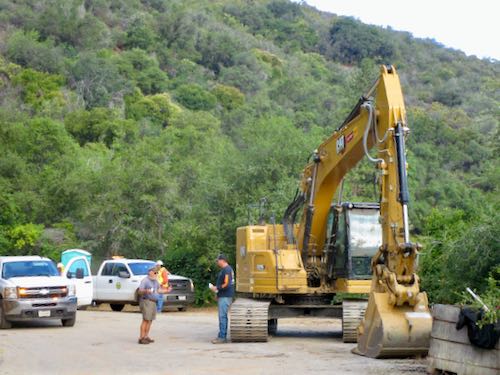
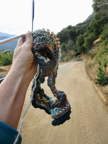
I was prepared for a long drive with knitting.
There is a lot of greenery on the way up. Lots of wildflowers too, but I didn’t want to add to the time by asking for photo stops. 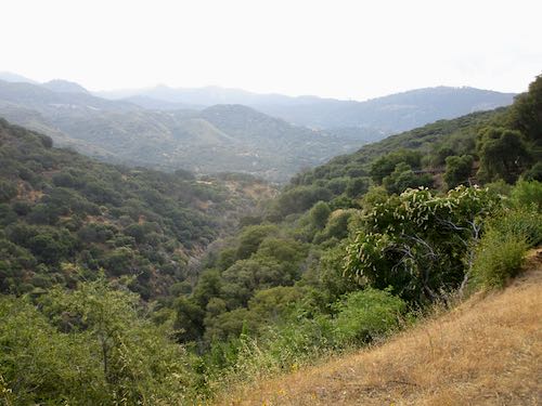
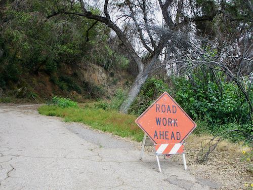
This was on the county section.
Although there wasn’t any active road work after going through the lower gate, Road Guy wants to keep this sign in place so that people who drive the road will be alert. Besides, there could be some road work. There certainly needs to be.
We stopped to talk to a couple of walkers, to rake out a few drainages, and to pick up many traffic cones. Why were so many knocked over? We don’t know. And we stopped at the maintenance barn to visit with the two guys working in MK this summer.
The knitting grew.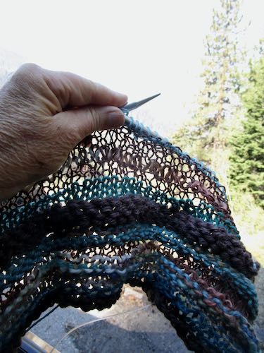
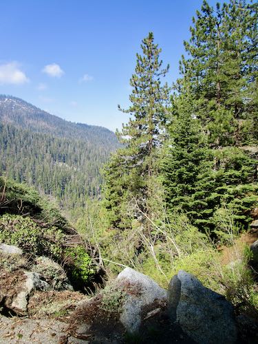
This is the background that is overexposed in the knitting photo. It is just above High Bridge, where we stopped for more raking.
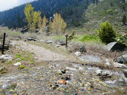
There are lots of narrow spaces along the road, but not so much in the upper sections. There is a lot of water running along, under, and across the road, just seeping from the hillsides, running down drainages that aren’t normally running at this time of year. The water is mostly on the paved sections.
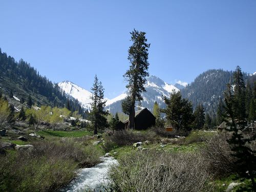
Standard photo of the Crowley cabin and Farewell Gap.
The weird piles left from the 2021 fires remain. Road Guy thought the fire crews would return to remove them last summer because they appear to be piles of kindling. Of course they didn’t return. 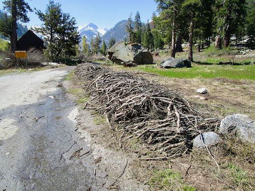
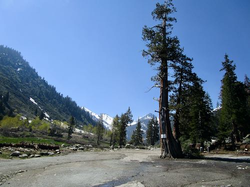
The juniper tree escaped. It appears in many old photos and was marked to be removed, but better sense prevailed, and this piece of living history remains in the last parking lot.
The daffodils I planted last fall are struggling upward.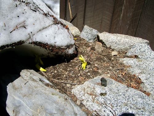
Looking alongside the back of the cabin.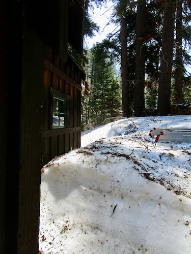
I meandered down to a neighboring cabin and was so happy to see all the green growies and flowing water.(Almost said “water flowies” to rhyme.)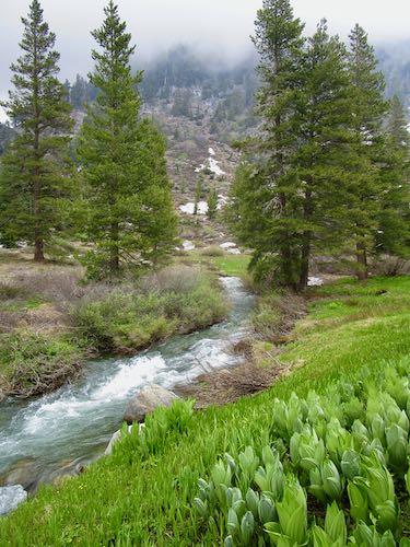
The knitting grew.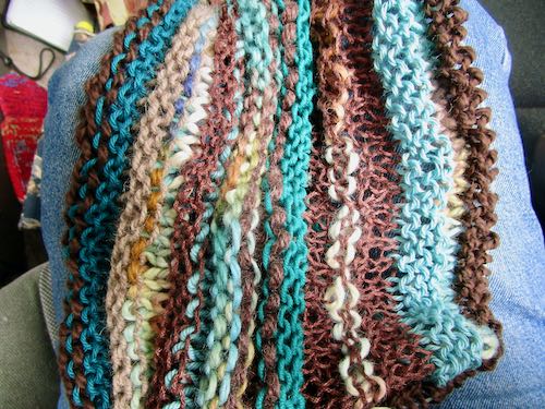
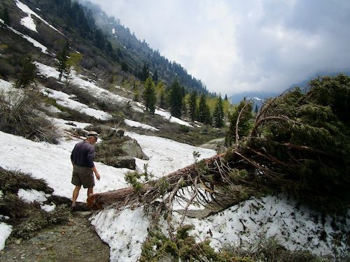
We walked up to the pack station. Clearly there had been an avalanche, with trees snapped off and bent over, along with a lot of debris on the road.
Chihuahua was running, so I did a little waterology to get it off the road.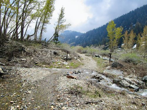
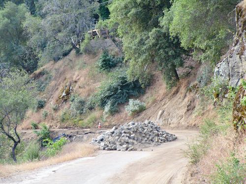
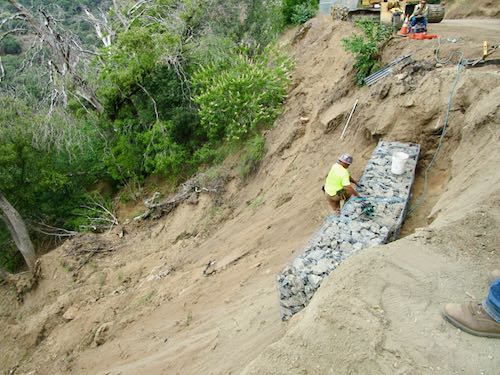
Finally, on the way back down, we stopped just above Sky Hook to see the gabion baskets begin to rebuild a major road failure. The construction crew is doing a fabulous job with temporary repairs on the county’s section of the road.
A final thought: if the Mineral King Road normally makes you nervous or jittery, this would not be the year to drive it. (And we still don’t know if/when the Park will open it to the public).
*This wasn’t actual driving time. We stopped to unlock/open/close/relock the two gates, to visit with people, to pick up knocked over traffic cones, to take a few photos, to rake a few culverts . . .
Tomorrow I will return to posting about my artwork. If more Mineral King news occurs, I’ll do my best to post the information. You can also look on the Mineral King website, although the writers there are not as chatty, opinionated, or actually taking photos (but I let them use mine whenever they ask).
8 Comments
The last photo that shows a rock wall that has slidden (slided??) down from the road. Isn’t that one of the CCC projects they did along the MK road? Or, now that I look at it more closely, a fenced in section filled with loose rocks to prevent further erosion? It just seems like an odd location for a structure like that.
Drivable, yes, but what about passing? I remember wayyyy back Granpa having to back up to a wider part of the road to allow passing–several times, when the road was a lot narrower, perhaps as it is now!
Just had another thought. Will a truck be able to get up the road to deliver a large dumpster, and deliver propane? So many questions. . . .
Sharon, that is a gabion basket, a wire basket filled with rocks that provides structure and foundational support beneath roads.
There will be quite a bit of backing up this summer. I hope people remember that uphill traffic has the right-of-way.
We will have to haul our own garbage and will need to use our propane carefully.
Jana! Thank you for these marvelous, humorous and informative missives. They are a tremendous relief and extremely entertaining. Please keep them coming. Best to you and Mike from Marcel and Britta Shain. P.S. Final picture of knitting at some point, please. Looks divine!!!
Britta, thank you for checking in! So glad you are enjoying my posts. And I didn’t photograph the wrap when I finished it, but today my friend that I sent it to sent me a picture of her wearing it. So, I emailed it to you!
Thanks so much for the pictures and update! So longing to be in our heavenly Mineral King!
You are welcome, Anonymous! Happy to be of service, even though it is just fingers on a keyboard rather than operating a big yellow machine.
Wonderful, encouraging report!
Cones down because the road, being even more narrow than it usually is, means vehicles sideswipe the edges and thus, the cones, too.
Knitting is an excellent way to kill time productively. Crochet, too!
Can someone maybe “unmark” that juniper??
I know where you can find a plethora of daffodils up there!
I’m trying to picture where Chihuahua is. Looks like up from the corral, toward Franklin trail / Iron Springs?
Oh no, is that a piece of CCC history that fell down the canyon? It’s intact–they built ’em well back then!
Thank you for the website plug. The administrator tries to give just the facts, ma’am, just the facts. And photos are at a minimum because aforementioned administrator isn’t as fortunate as some who lives in 3R and take daytime jaunts up the hill. But aforementioned administrator is very grateful that said blogger is willing to share!
P.S. Did you ever thought we would be able to drive to the end of the road this summer? Maybe was Road Guy more optimistic than we?
There is plenty of room to drive past cones without whacking them over. Maybe someone was pulling a trailer and it did the whacking.
I have been scratching at the blue paint on the juniper for several years, but it is slow going.
Chihuahua is the little seasonal stream that flows out of Chihuahua bowl, which is below Crystal Lake. It is where the pack station ends and the actual trail begins, complete with a sign about no dogs or wheeled vehicles, which is often ignored and seldom enforced.
What CCC artifact are you seeing down the canyon??
Happy to help the website administrator fortify the information with visuals.
I knew we’d be able to drive to the end of the road. Intuition, perhaps.
Comments are closed for this article!