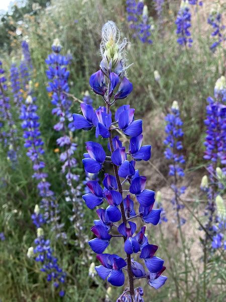
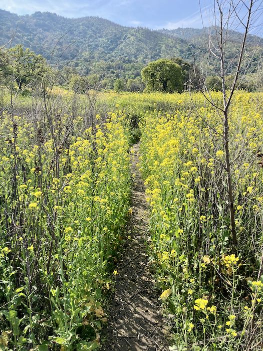
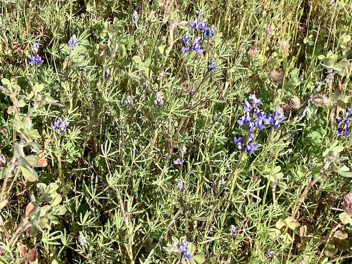
Before the sun hit the ridge across the canyon.
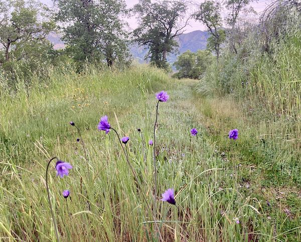
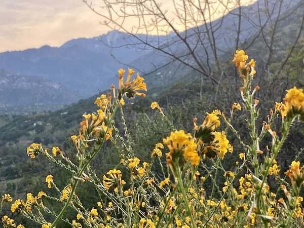
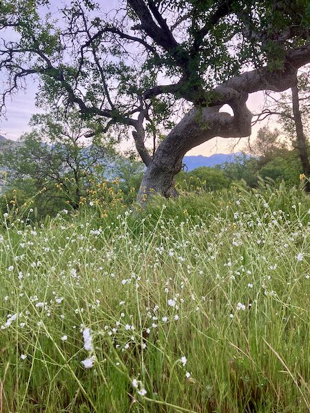
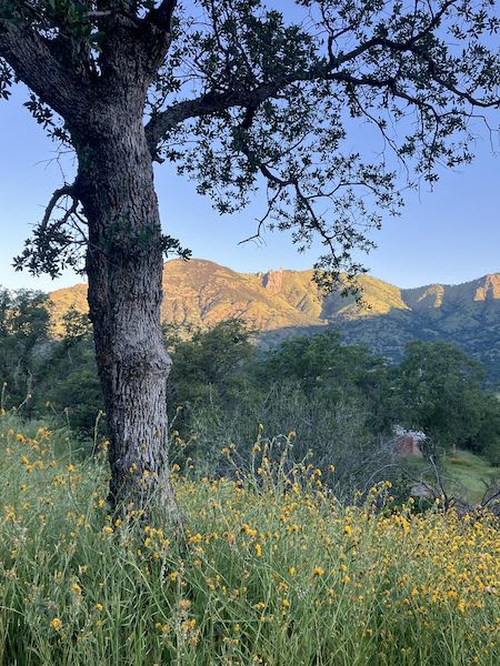
Same flowers, after the sun hit the hills across the canyon.
Comb Rocks.
Now, back to book editing, photo editing, photo captioning and placing, and book formatting.
Before the sun hit the ridge across the canyon.
Same flowers, after the sun hit the hills across the canyon.
Comb Rocks.
Now, back to book editing, photo editing, photo captioning and placing, and book formatting.
Currently I am doing a final edit, photo edit, and formatting a book that has been a long time coming (about the TB hospital in Springville, here in Tulare County). Things are a bit urgent, so here is a post about my road trip 10 days ago, because this is my blog and I can write whatever I want. Any questions? (Besides how to comment; I KNOW commenting is a pain of signing in, user names, passwords, etc. I HATE that stuff and feel grateful to anyone willing to navigate it all.)
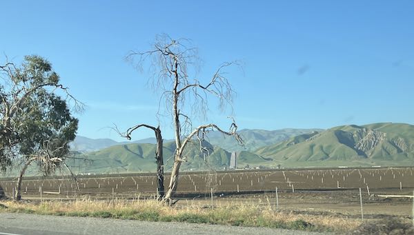
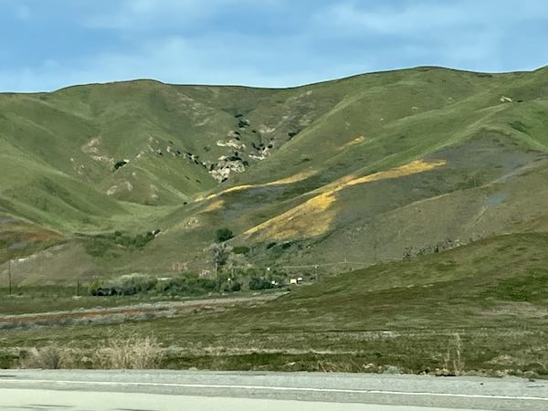
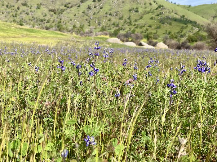
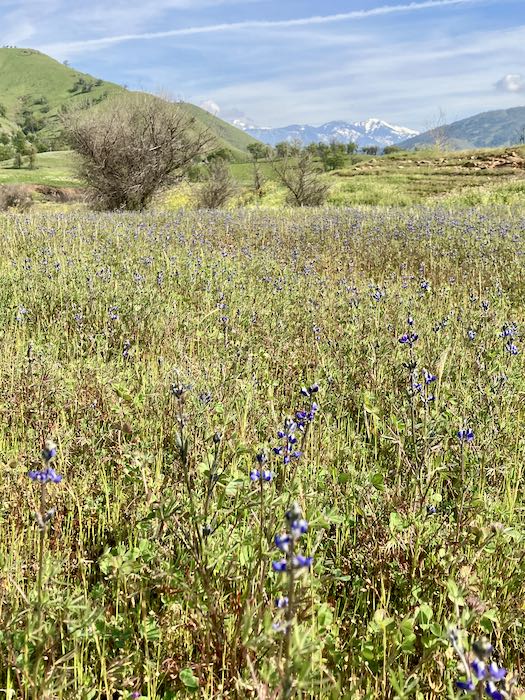
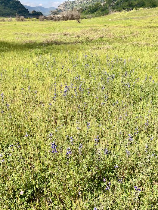
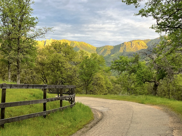
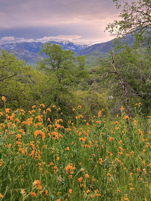
The drive was beautiful. It was green with wildflowers. I left at 6:30 a.m. and seemed to encounter cars coming up the hill about every 1/2 mile or so before getting to Highway 65, which caused me to ask, “Why all the traffic?”
This is just hilarious in view of heading to Southern California. I live in a place where we simply say “The Freeway”; everyone I went to visit has to refer to the many freeways in their lives by the numbers. Do they say “Five” or do they say “The Five”? And if they say “The Five”, do they also say “The Walmart” and “The Facebook”? I forgot to notice.
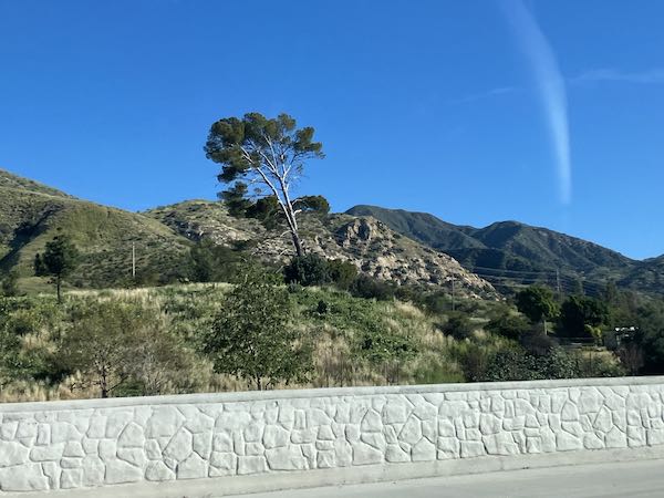
The photos never do justice to reality. Additionally, I was holding up my phone while watching the road (OF COURSE I WAS WATCHING THE ROAD!) and hoping to get lucky. (No film was wasted, but many photos were deleted after I arrived.) There were wildflowers on the hillsides, wildflowers in patches on the shoulders of the freeways. The hills over The Grapevine* were green, the hills in Southern California were green—just wonderful, looking the way i think it always should look. (God didn’t ask for my opinion when he designed the seasons in California so I’ll just trust that all is as it should be despite my attitude.)
The freeway system has changed since I was a frequent traveler along that route. Confusing stuff. I used the talking lady, until she told me to leave The Two-Ten and head west. Can’t remember. I just pantsed my arrogant way along, sure I could figure it out. Then The Fifteen became a tollway, not a freeway. WHAT?? So I took The Sixty west, and asked the talking lady to get me to Escondido again.
I ended up on The Two Fifteen (Hunh? What”s that one?) and eventually it fed back into The Fifteen (without my spending a dime other than burning gas that cost $5.99/gallon in Three Rivers), and things became familiar again.
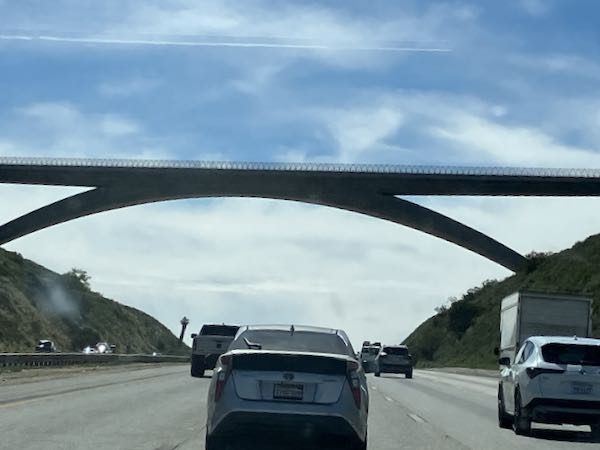
I love this bridge, which we called “Dad’s Favorite Bridge” for awhile (Was he unaware of the Oak Grove Bridge on the Mineral King Road? Nope. “De gustibus non es diputandem” as he used to say.**) It is a beautifully minimalistic bridge, spanning a huge freeway, as you can see. It is south of Fallbrook, in case you are curious.
Driving home, I decided I didn’t need the talking lady, but I asked her to take me to Fresno, just for curiosity’s sake. Yeppers, once again, she tried to force me off The Fifteen (or was it The Two Ten?) and once again I ignored her. I didn’t encounter any tollways nor did I see The Two Fifteen. Boy oh boy, do I ever need an updated map.
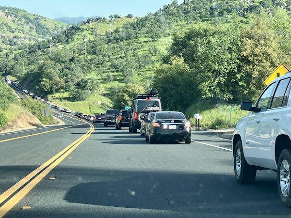
I was reminded that in order to stay on The Two Ten, one must continually exit and then merge onto another freeway, each interchange a total constipation of too many cars. I didn’t like it, being much more comfortable on a one-lane unpaved curvy road without stripes or guard rails.
However, Momscar with its 6 cylinder engine was mighty fine in several instances. People say they hate all the shifting in traffic; I never did, but often wished for more ponies under my hood back in the olden days of driving 5-speeds.
This is the first time in my life that I remember seeing so many wildflowers on the Grapevine. It was beautiful! I also had a good audio book, The Tao of Martha by Jen Lancaster (Memoir read by the author is my favorite, but why do people have to cuss so much? Sigh.)
I did finally see why a Tesla “truck” calls itself a truck—I could actually see it has a bed like a real pickup. But the ugly factor just slays me.
I was very eager to get home, and in the second passing lane around the lake, I blew around someone poking along. After getting past, I quickly came to a traffic jam. What?? I could see that cars went all the way across the Horse Creek bridge, coming downhill. What?? Eventually we crawled back into action, passing a slightly wrinkled car sitting on the bed of a tow truck.
Dorothy was right—There’s no place like home (not The Home).
*The Grapevine is what Freeway 5 (“The Five”?) is called where it crosses the Tehachapi Mountains because even until I was a little kid, it was a country road that was very twisty. Now it is multiple lanes, high speed until you catch up to someone (who should keep right) crawling uphill in one of the faster lanes. The summit is closer to Bakersfield than to Southern California—Tejon Pass, 4144’. After the summit, it feels as if we still climb, but who knows? Not me.
** Latin for “it’s useless to argue over matters of taste”.
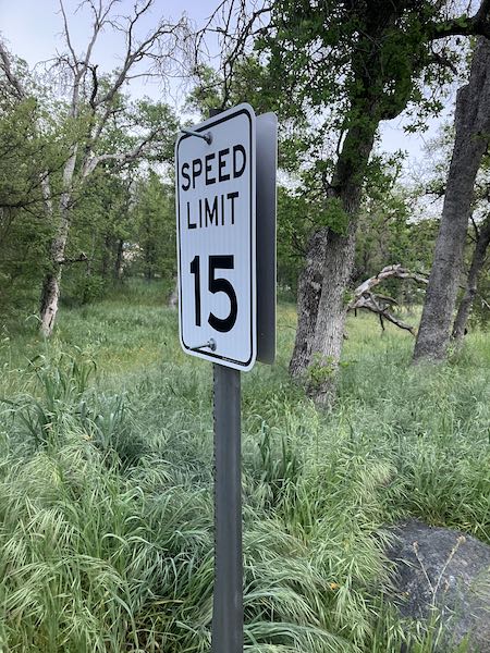
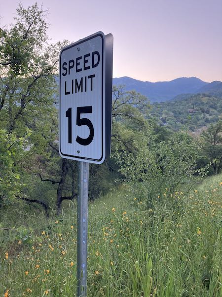
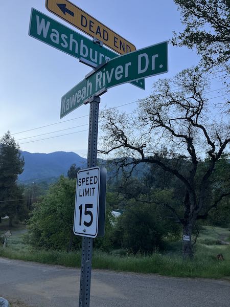
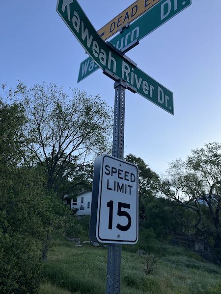
Walking Partner and I noticed something different a week or two ago here in Three Rivers: new speed limit signs on a private road.
This is one post. 15 mph heading upstream, 5 mph heading downstream. (This is along the river—could you guess that?)
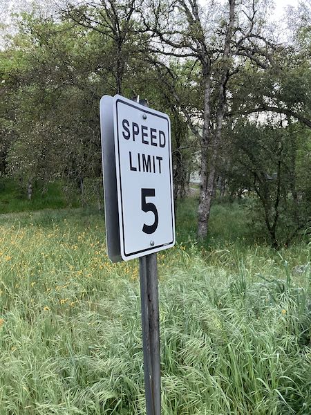
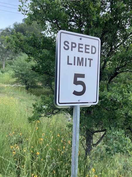
Here’s another one: This time it was 15 mph going downstream and 5 mph going upstream.
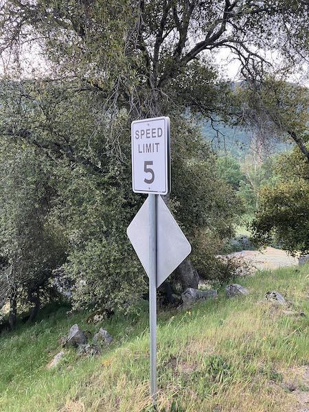
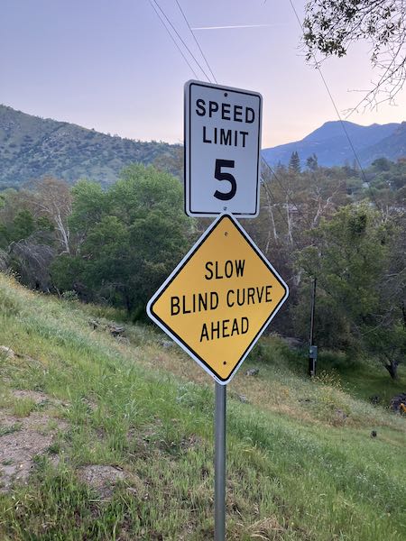
And here is another on the same road: 5 mph both upstream and downstream, but this time there is an explanation for those heading up. “Slow blind curve ahead” could apply to the bulk of the road.
And at this intersection, it is 15 mph regardless of the direction you head.
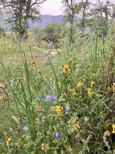
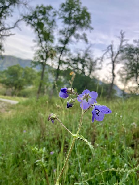
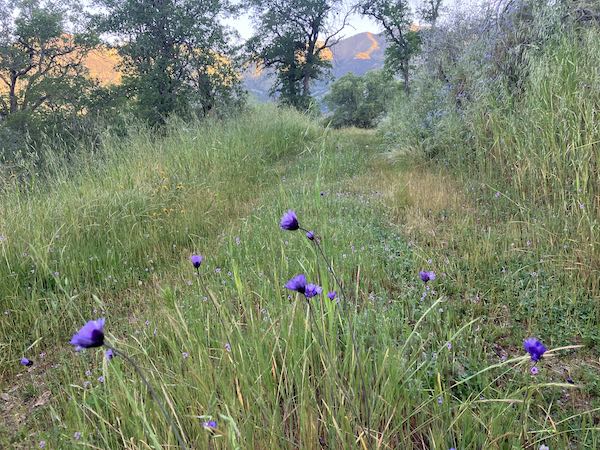
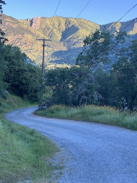
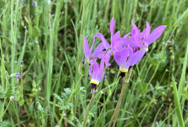
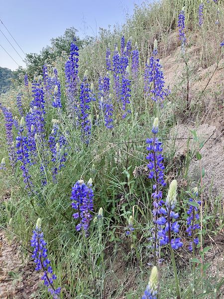
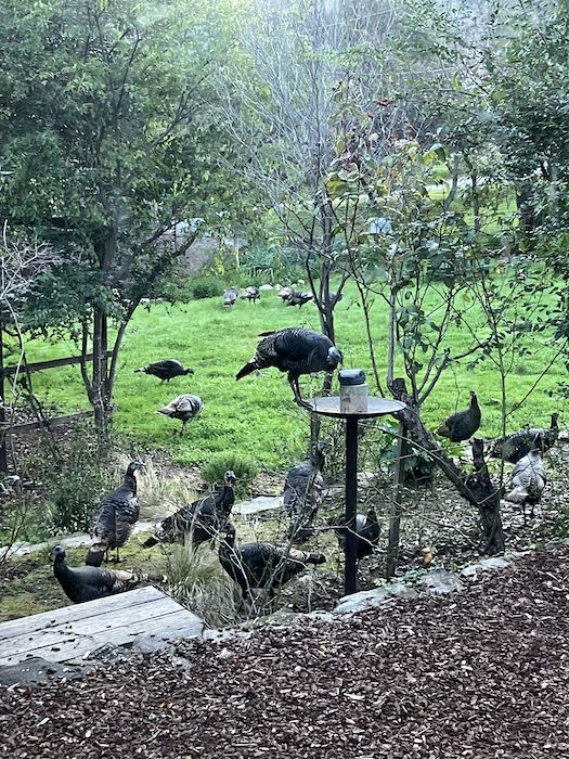
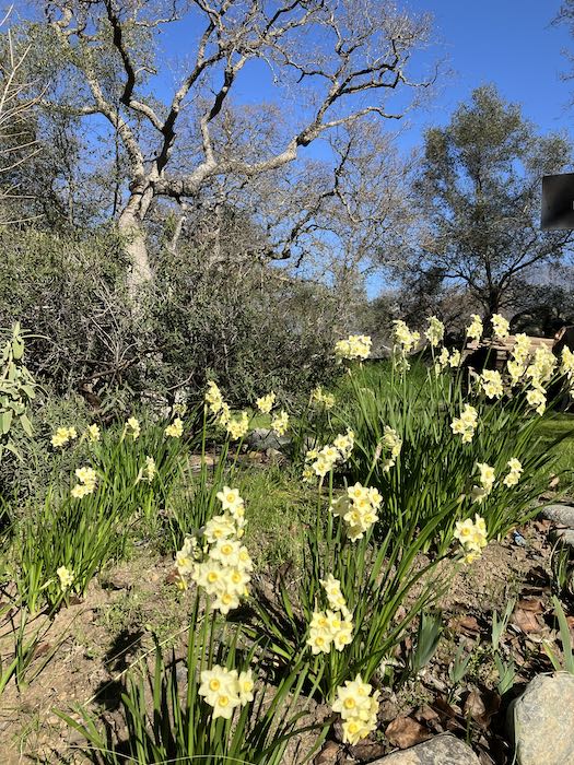
Never mind. Let’s look at some wildflowers along the walk.
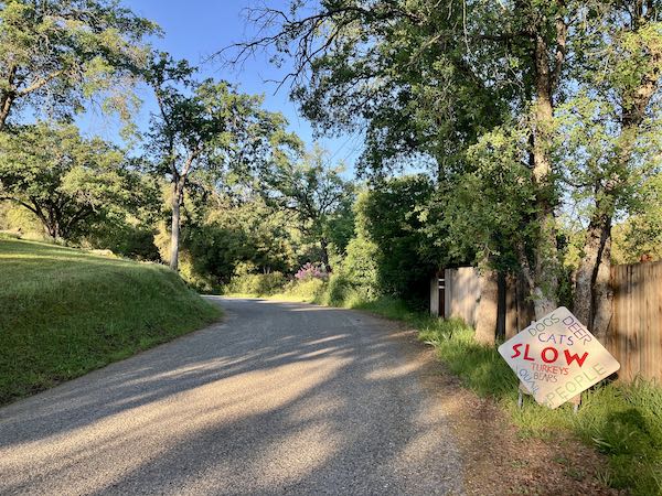
This is the kind of sign I’m used to. Custom. Interesting enough to perhaps cause someone to notice.
Walking Partner and I walk about 3.5 mph, in case you were wondering. We used to walk 4 mph, but we’ve never been this old before.
This post is almost entirely personal. My oldest cousin died, and his family and friends gathered to remember him.
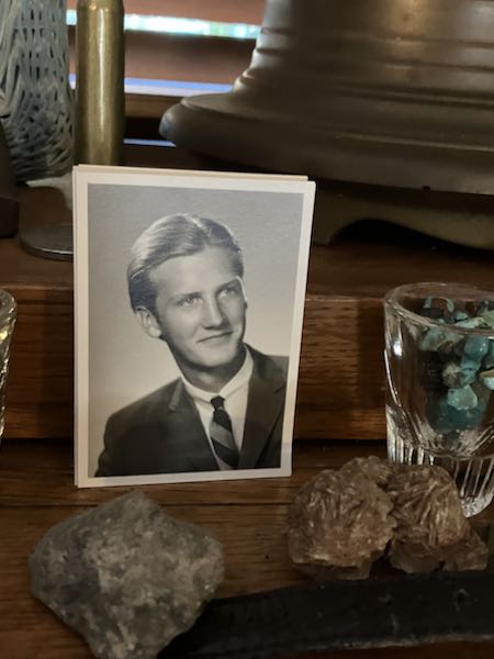
He was almost 12 years old than me. I always looked up to him, my big cousin, sort of intimidating, remote, distant. In spite of not really knowing him, I always loved his wife and felt more related to her and their kids than to him.
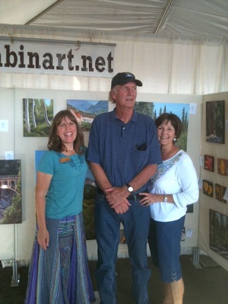
In 2012, I was doing an art show in Visalia, and out of the blue, Cousin and Mrs. Cousin appeared. I was shocked speechless—they were so out of context. Mrs. Cousin said I looked at them, and said, “Who are you??”
That’s kind of embarrassing. But we got a great laugh out of it and still are laughing.
A little while later, Cousin asked me to paint something for Mrs. Cousin. I was shocked, because family lore has always been that because of our Scottish heritage, we are all cheap. Ahem. Frugal. But more on that later.
Cousin and I had some great phone conversations, and he bought a pencil drawing that I was working on during one of those long visits. (See? All my friends and family feel sorry for me so they keep me in business.)
We saw each other a couple of more times in person, and Mrs. Cousin asked me to paint something for him as a surprise.
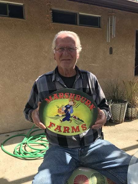
He lived 300 miles away, but I gladly made the drive recently to be with my remaining cousins for less than 24 hours. It was worth it. I decided it was a business trip, because Cousin was a customer, but I was planning to go before I figured out that little added benefit, which would have made his frugal heart proud.
Here is some documentation that it was indeed a business expense to pay my respects to a beloved customer who happened to be my oldest cousin.
About that supposedly Scottish trait of cheapness frugality: Cousin had his DNA done and learned that we have zero Scottishness. Zero! Kind of blew his joke that “We’re Scottish and Irish—we like to drink but don’t want to pay for it”. (I possibly could have some “Scotch” from other family sources, but I won’t know because I’m too paranoid and conspiracy-minded to take that test. I DO have Irish, but I don’t drink. So there.)
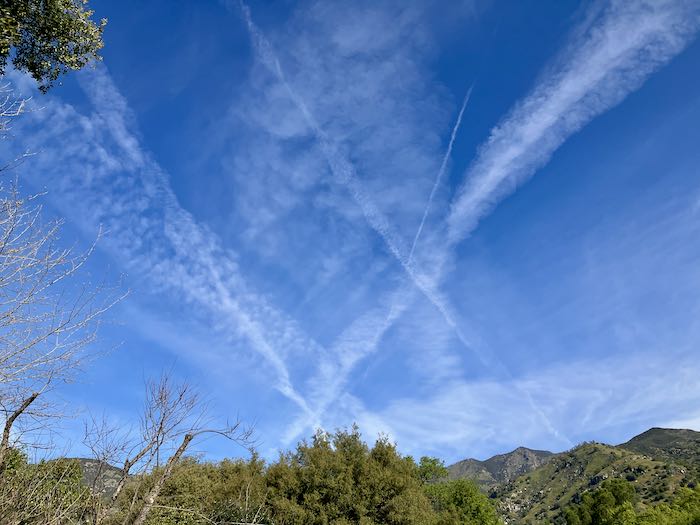
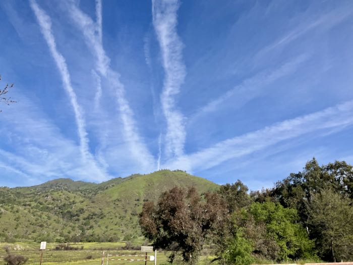
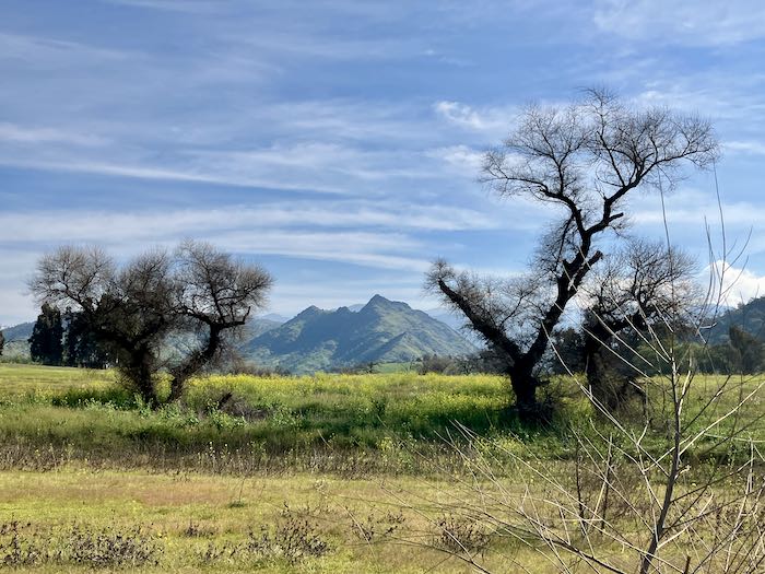
On a fabulously springlike day in February, Trail Guy tempted me away from painting: easy to do when there are wildflowers and it isn’t hot and I don’t have a tight deadline.
First, I noticed all the chemtrails. Yeah, yeah, I know, “contrails”, but I still think there are way more than we have passenger jets above. The general direction is usually south to north, or west to east. I believe something secretive and possibly nefarious is taking place. Yes, I am susceptible to conspiracy theories; often the distance between one of those theories and reality is about 6 months.
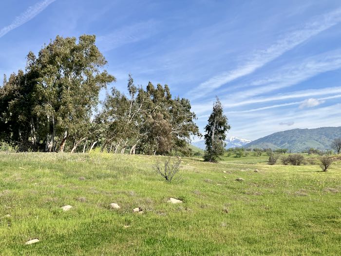
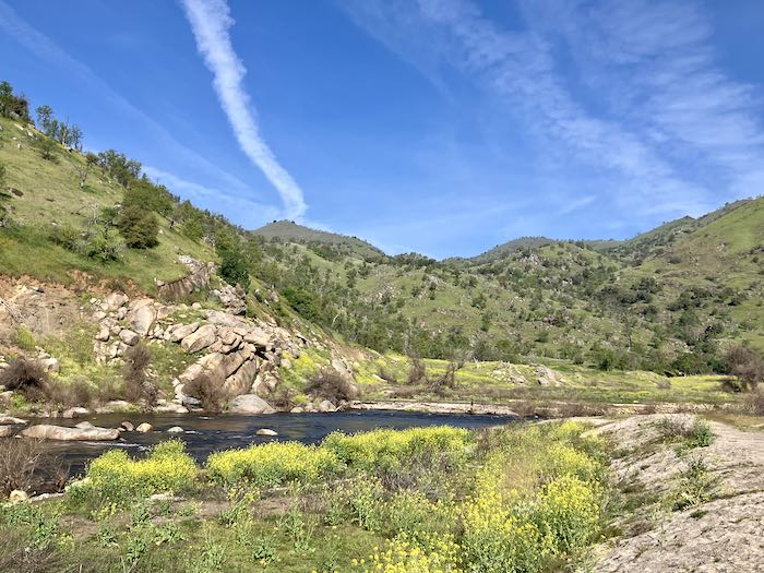
We drove down toward Kaweah Lake, parked at the upper end of the Slick Rock area and then meandered upstream along the river, with a wee bit of accidental trespassing behind the Lazy J Motel.
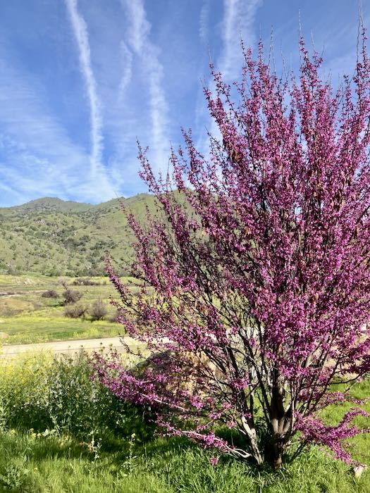
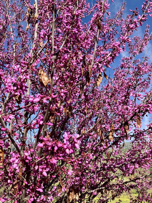
A great redbud in the parking lot!
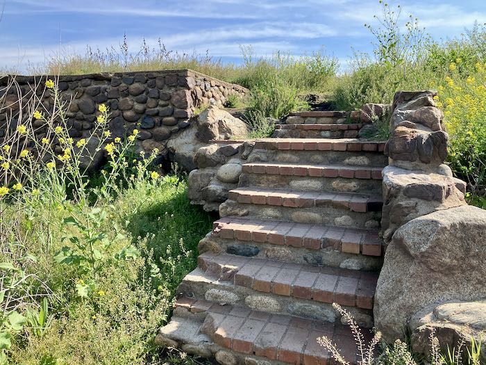
We headed toward the river, went across someone’s former foundation and down these steps to the river trail.
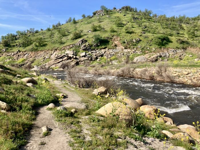
In putting this post together, I remembered WAIT (Why Am I Talking?) and decided that the photos can do the talking today.
I also decided to start looking for a new camera.
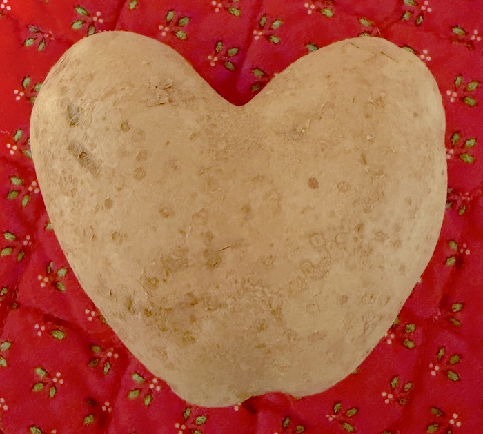
1.The most fun thing I learned is that Reader Sharon had a heart-shaped potato.
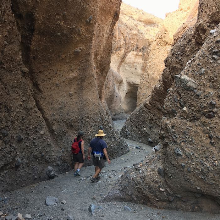
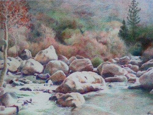
2. My friends went to Jordan and Israel, and I recognized all but one of the places just from their photos. Actually, I recognized that they were in Petra, which I knew was in Jordan, but I don’t understand the Biblical connection, having never read about Petra in the Bible. I learned that it was Edom, which was where Esau and his people lived. It shows up by that name multiple times, and it reminds me of a canyon in Death Valley. Here, look at the canyon I’m thinking of:
Okay, not totally. The rock walls in Petra are much smoother and more colorful.
3. I tried and didn’t finish three books: Pachinko by Min Jin Lee, The Next Day by Melinda Gates and My Friends by Fredrick Backman. The first one was repetitive and tiresome with people making bad decisions over and over; I couldn’t relate to Melinda’s life; the third was just full of depressing details and foul language. Since I was listening to an audio version, I decided to not get all that embedded in my brain. Life’s too short to spend time reading (and listening to) books that are not enjoyable. This wasn’t really a new thing to learn, but I seem to have been a wee bit mentally idle in February, so it made the list.
4. I learned the name of a new weed: Hedge Bedstraw. Weird. It’s also called False Baby’s Breath, which causes me to wonder if I should just let it grow. It’s kind of hard to pull, because it is so low growing.

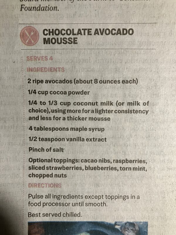
5. Have you ever heard of Chocolate Avocado Mousse? Me either, but I saved a recipe because it just looked so bizarre. Seems like it would be a waste of both avocados and chocolate.
6. Finally, I learned that the sturdier Crocs that have been working as hiking “boots” for me are no longer made: All Terrain and Off Road. I found some on Amazon. I also learned that just because they seem to be the same shape as the ones that I just walked a hole in the sole, they gave me a blister.
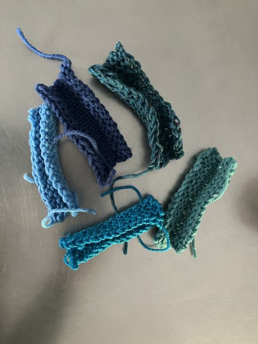
7. In addition to wearing a hole in the sole of my Crocs, a hole is developing in the sole of my slippers. Because I am frugal, I didn’t buy new yarn to make a replacement pair. Instead, I went to my yarn stash and chose 4 possible samples, knitted up swatches, and then washed them to see which felted best. It didn’t really matter if they looked great, so I did a tiny bit of mixing and matching to squeeze out enough yarn for two slippers. If one takes the same number of steps with each foot, why does one sole wear faster than the other? Hmmm, I might be walking a little bit funny since one foot is more numb than the other. So, what did I learn? Nothing, really. But the February Learned List was short, so I tossed this in. You’re welcome.
8. Cruft is a great word that wraps up clutter, junk, stuff, and porkadelia all into one little package. Here is the definition from DuckDuckGo: “Cruft is a jargon word for anything that is left over, redundant and getting in the way. It is used particularly for defective, superseded, useless, superfluous, or dysfunctional elements in computer software” (but I don’t care about computer software).
Did you learn anything new in February?
People love to ask artists what inspires them. This is kind of annoying, because generally speaking, artists just love to make their art, not sit around contemplating the reasons. An artist who helped me get going in oils said that what inspired him were the bills in his PO box. I’ve occasionally pondered the question of inspiration, and all I can ever come up with is so mundane, predictable, commonplace, and ordinary that it embarrasses me to admit such a thing.
And the answer is. . . . BEAUTY.
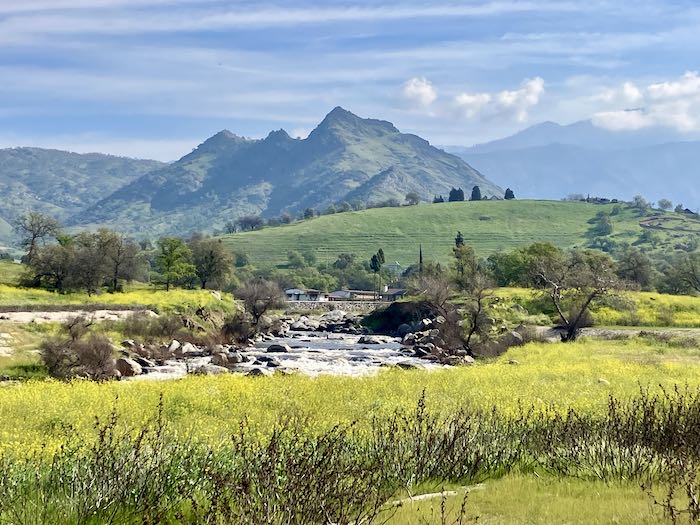
Well, duh. Of course I have to surround it with something a little more detailed, something to make it a bit more challenging, because I came here to earn a living. I am looking for the beauty of Tulare County, this poor, uneducated, rural, overlooked place in the middle of California. We do not have the Golden Gate Bridge, Hollyweird, the beach, Lake Tahoe or Death Valley. But we do have Mt. Whitney, sequoia trees, the largest oaks, the best citrus, more dairy than the entire state of Wisconsin and an enormous variety of agriculture. So, I continue to look for the beauty here in Tulare County.
Why? To generate pride (the good kind, not the sinful kind) in those of us who wonder what holds us here (No Trader Joe’s?? Who can withstand this sort of deprivation?) And, of course, to sell. We get a million or so folks (nope, haven’t looked up the numbers) passing through Three Rivers on their way to The Park (AKA Sequoia National Park) every year.
That’s it, that’s all. Beauty inspires me. God is the creator, I am the imitator. And sales, because without those, I might have to get a real job, and then I wouldn’t have as much time to appreciate beauty.
P.S. Happy Birthday, Dad. You would have been 94, and although other family members have that longevity, it ain’t pretty.
We haven’t gotten our 1099s from Social Security yet and don’t know if they will come in the mail or if we have to do something impossible online to receive them. As if doing taxes wasn’t abhorrent enough, there are so many obstacles and difficulties just getting stuff ready for the accountant.
I walked a hole into the bottom of my hiking Crocs and my new Crocs gave me a blister—how is this possible when I wear the same shoes all the time?
Several times I’ve sent a giant expensive heavy box of decent shoes we no longer wear to a place in Montana called Provision International. They gather huge containers of usable shoes and ship them to places where people need shoes.
After trying for several years to find a watch that I can change the battery on, I finally quit buying Timex and paid big money for a watch that doesn’t need a battery. But what is one supposed to do with old watches? I have five that won’t work, the nicest because something non-battery-related is wrong and 4 because the back cannot/will not/does not come off. The one time I was successful, it was impossible to replace the back. Had to take it to a jeweler who used a special clamp.

I tried to find someone on Etsy who could use them. Nada. Listed on eBay. Nada. Contacted Veterans Watchmaker Initiative several ways. Nada. FINALLY I found a place called WeRecycleOldWatches and THEY REPLIED!! Then, after silence from Veterans Watchmaker Initiative regardless of method of contact, THEY REPLIED THE SAME DAY AS WE-RECYCLE-OLD-WATCHES! Because I think Veterans often get the short end of the stick, I packaged the watches and addressed it to them. Now, to take them to the PO and PAY to send them away. . . WHY do I do all this?
What motivates me to do these things? I abhor waste, and it troubles me to just dump things. At the same time, I do NOT want to own things that don’t work or are no longer useful. So it seems that I spend an inordinate amount of time finding the right places and people for an endless supply of things. There is a continual push-and-pull between not wasting and a desire for a simple life.
My DeQuervain’s Tenosynovitis is better. Only took 16 months. . . and I don’t completely trust the current state of almost painfree activity, so I wear the brace when doing wristy things. Using Photoshop or Powerpoint are particularly challenging.
My yarn stash hasn’t been declining since the DeQuervain’s Tenosynovitis has curtailed my knitting. Yarn.com somehow reactivated my email and I almost succumbed to a sale, buying yarn after successfully being on a severe yarn diet for several years. “Almost succumbed” —saved by the fact that PayPal wouldn’t work with their site. “Try Later” —Nope, you lost a sale.
My friend and I sometimes look for rocks together. It is so fun to go to the river and just putz around, without a permit, a fee, an application, a user name or a password, the option to hear things in Spanish, or hold “music”. We get dirty and sometimes we fall down while looking at rocks and digging around. Sometimes we find ones we want to keep. Sometimes they are a big project to extract and then to get up near the road where we go back with a vehicle to retrieve them. Don’t tell anyone, okay? I’m sure someone will try to stop us. . .
P.S. None of these drawings are available for sale. HOWEVER, I do accept commissions.
These three topics are rattling around in my skull.
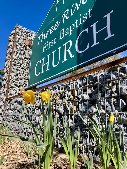
It rained and hailed rather ferociously while I was painting that indoor oak tree at my church; two days later I took this photo. Check out the first daffodils in bloom, in spite of the recent heavy cold storm.
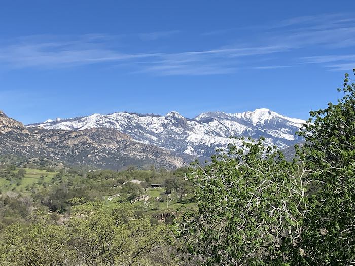
The elephant was buried in snow. “Elephant?” That’s the shape that appears on Alta Peak after a snowstorm.
Stem & Stone* asked if I had any poppy and lupine paintings hanging around for sale. Nope. We discussed sizes and prices, with Stem & Stone suggesting something similar to the popular size 6×18” sequoia paintings. I countered with the fact that sequoia trees are more popular than poppies, thinking that $195 might seem steep for someone here visiting for the purpose of seeing sequoia trees. Stem & Stone suggested a smaller size but the same proportions. I found 2 small canvases in my supplies that fit the bill, both 3×9”. This gave me pause, but I agreed to try.
The cause for my pause is that very small paintings require holding it in my hand while painting and require tighter control, taking a disproportionate amount of time to paint. If I price by size, which is how the buying public makes sense of pricing, after Stem & Stone takes its agreed upon and fair bite out of the price, I am essentially working for less than minimum wage.
I speculated that is the reason many artists choose to paint loose and fast. I could try that method, but then the people who know my work would wonder if I’d been dropped on my head, had tried to paint left-handed, or lost my reading glasses.
Sigh. Sometimes it is really hard to be a professional artist.
HOWEVER, I did a rough sketch for Stem & Stone to see if it fit the vision.
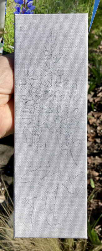
*Stem & Stone is owned by a dear friend whose retail judgement I trust completely.
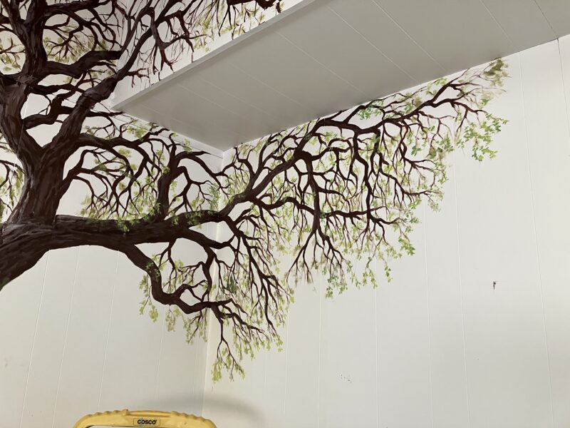
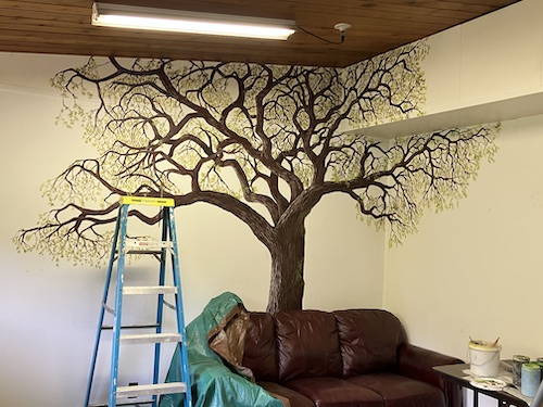
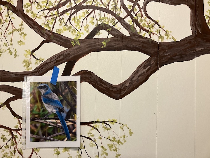
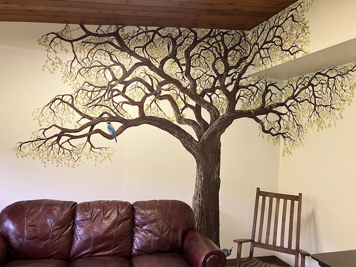
The fourth and final day’s plan was to complete leaves and add birds. So, that’s what I did, very systematically, working from right to left. Yes, that’s backward, but I chose that direction because it involved less couch moving.
After studying real oak trees for awhile, I thought I could be more realistic about the leaves than the previous days brush-tapping style. Nope. Never mind. Fast horse viewing might be a little inconvenient inside a room, but that’s what the leaves will require to be believable.
I had to move the couch to reach the left side. No big deal, because it scooted very easily on the waxed floor of hideous old linoleum squares. (I wonder how long before we view fake wood-look linoleum as hideous.)
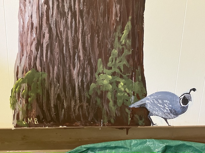
After the leaves came the big challenge, which was the gravy on top, or maybe the cherry on top, or maybe just dessert: details, drawn with my paintbrushes, using colors other than greens and browns.
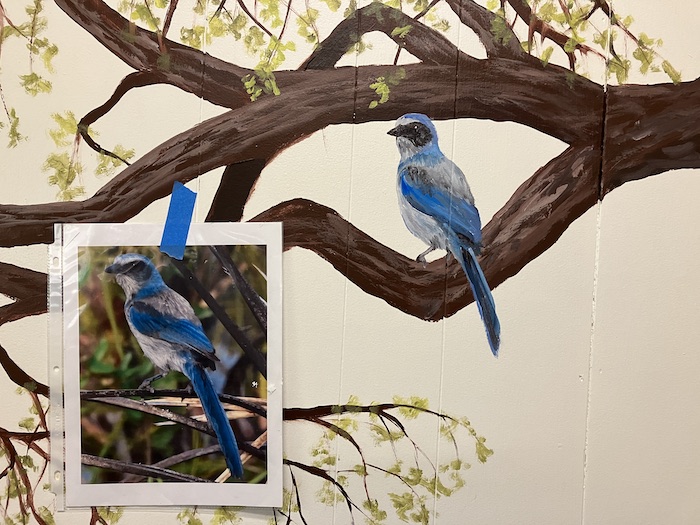
That was so fun that I did it again.
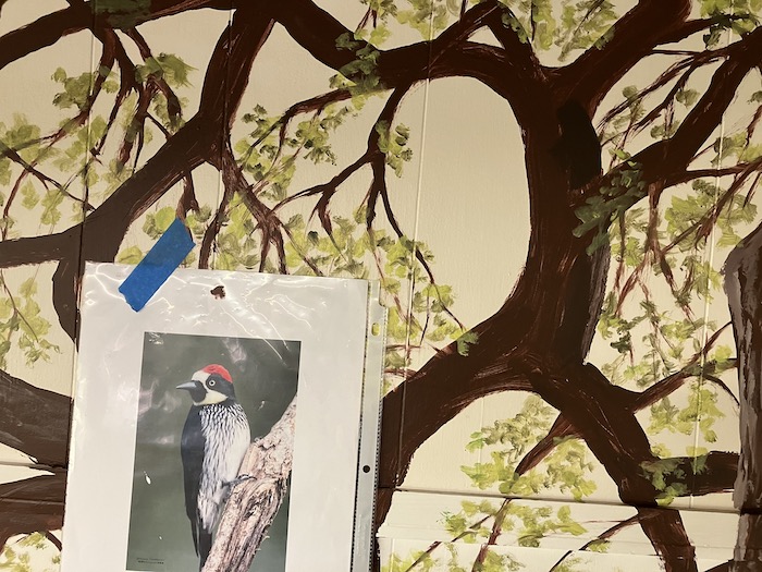
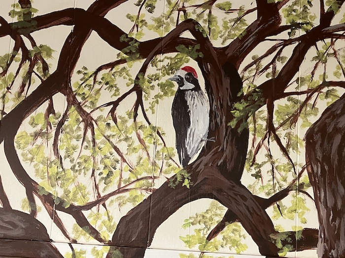
And a third time! Look, I even signed it. Not big, not my normal way. This is my church, not an advertisement for the public.

There’s the whole thing before the furniture got put back in place.
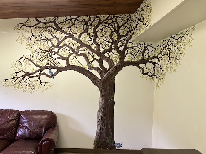
With the furniture back in place, we have an inviting gathering place in a room that used to be kind of institutional and quite junky. (Pay no attention to the institutional table and the upside down table in the center of the rug.)
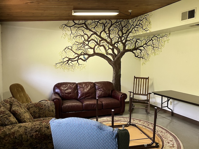
And try to disregard the 1970s bentwood rocker with the grody-looking upholstery. (This is a church without any money, so everything has been donated, which contributes to the decorating style that is a blend of Shabby Chic and Early Garage.)
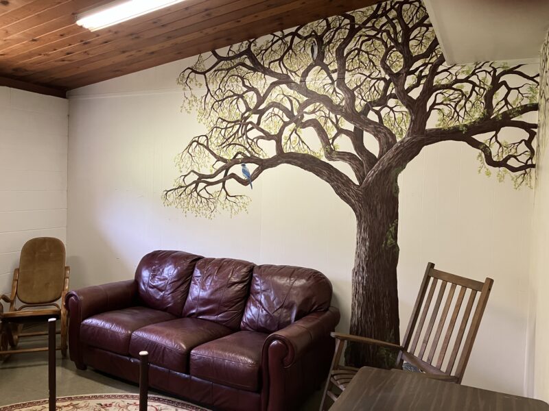
Here is a view that is fairly inviting. And that blue jay won’t poop on your head even if you sit on the couch.
I’m wishing I’d saved some of the Before photos from two years ago so you could fully appreciate the long road of decisions, negotiations, and hard work that led to this current situation.