A Trip to Oregon


There is a little bit of important Mineral King news at the bottom of this post.

People say that Oregon is green for a reason, but most of my visits have been sunny. This trip was no exception.

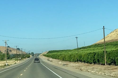
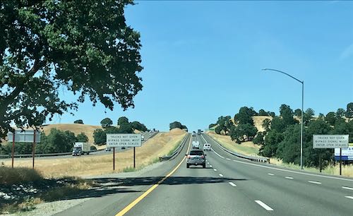
It almost causes me physical pain to leave home, but somehow I was able to pull it off. This is about 15 miles from home, looking through the windshield, remembering Lot’s wife and facing forward, looking ahead to the future, trying to be brave about all I was leaving behind. (A trip is a temporary situation, Central California Artist.)

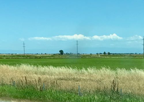
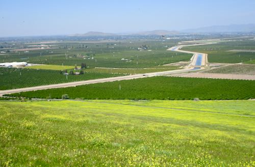
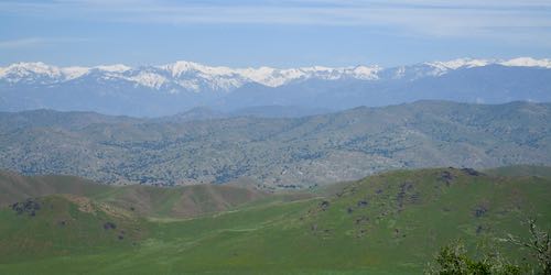
The great Central Valley of California is so beautiful when the air is clear.

This is heading to Reading. Or perhaps, hedding to Redding.

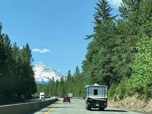
Once past Redding, Mt. Shasta is visible. Anyone out there remember Shasta soda? The logo on the cans looked just like Mt. Shasta. (Duh.)

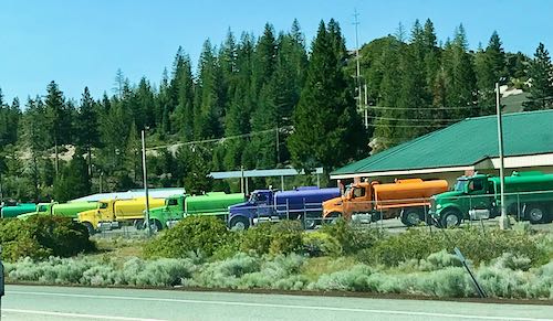
Truck Village is always something to look forward to. It is near Weed. (Don’t get your knickers in a twist–ABNER WEED was a man’s name!)

There was a long traffic jam before Weed, and I just didn’t want to stop, so I pushed through to Yreka, stopped for gas, and still felt alert. (Ice cream for dinner helped.) I called my sister to ask how long it would take to get to her place from there. The answer was 4-1/2 hours. Remembering that it was the day with the most daylight of the entire year, and I was heading north, I decided to push on. So, a day of 13 hours of driving, almost two books on CDs, some tunes, a little talk radio, some thinking, some praying, 3 or 4 stops for gas (it is expensive everywhere), some snacking (but I refused to pay $4.49 for a “sharing” size of M&Ms—ARE YOU KIDDING ME??), and no night of poor sleep in some motel with the sounds of traffic, car doors, and strangers banging around with suitcases.

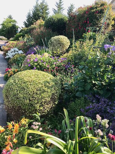
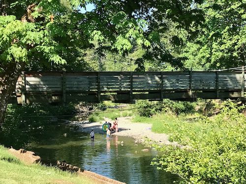
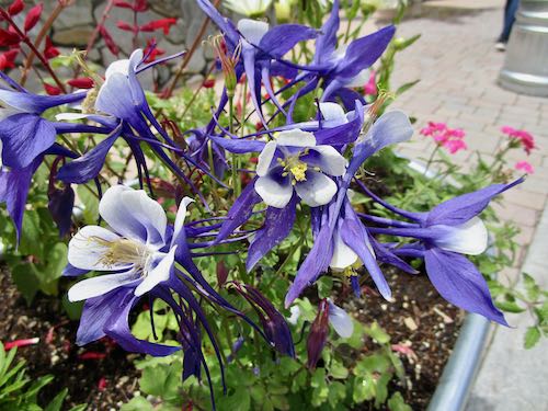
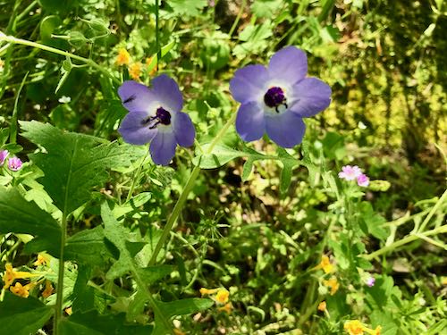
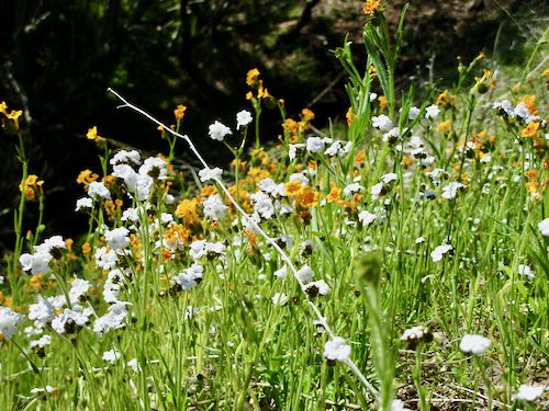
Sister and I did lots of walking. It is a thrill to see the beautiful yards (NO DEER! NO DROUGHT!) with many plants I’ve never seen in bloom.

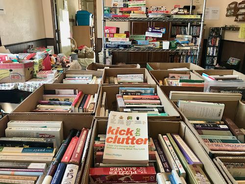
We also went to a couple of estate sales. This one took the cake.

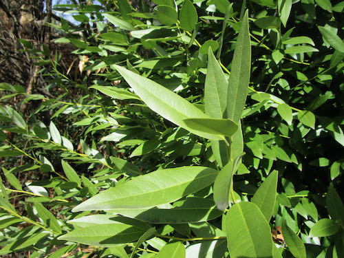
We visited an arboretum and had fun with a plant identification app on the phone (Picture This, free if you can see the almost invisible “CANCEL” in the upper right corner of the screen each time you open it.)

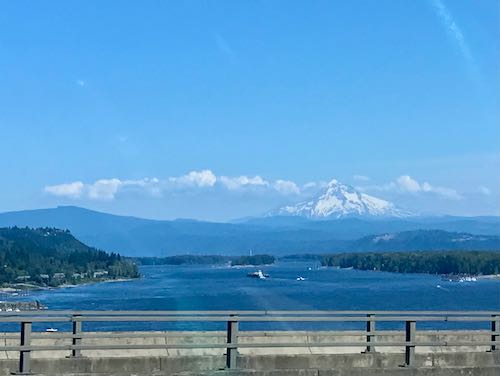
I attended a celebration of life service for a friend who used to live in Three Rivers. This photo was taken through the window of the pick-’em-up truck (Fernando stayed home) while crossing the Columbia River on the border of Oregon and Washington. That’s Mt. Hood. It looks like Shasta, because that’s just how it is with those volcanoes. 

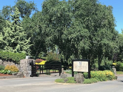
We also took an afternoon excursion to McMinnville to a store that specializes in olive oil and balsamic vinegars. I lost control. Phenomenal stuff. (I don’t need no stinkin’ Trader Joe’s!)

To be continued tomorrow. . . 

About Mineral King: (CABIN FOLKS, PAY ATTENTION!), the gate code has been changed. CALL AN MKDA BOARD DIRECTOR FOR THE NEW COMBINATION. IT CANNOT BE GIVEN OUT VIA EMAIL, VOICEMAIL OR TEXT.

Hume Lake Annual Reunion

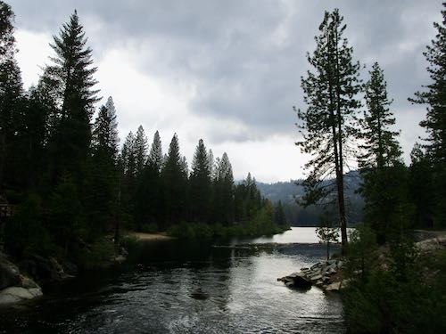
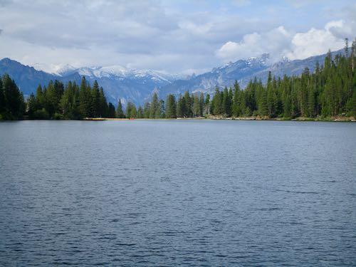
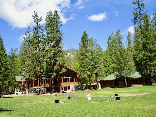
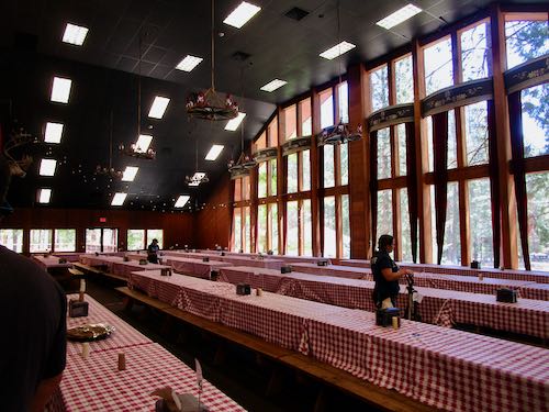
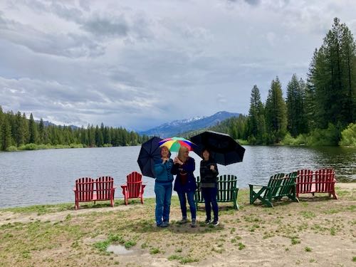
My sixth annual friend reunion at Hume Lake was a week or two ago (time flies). It was a little odd to go to someone else’s  cabin before spending time at my own. It was also the first time we didn’t rent some sort of watercraft, and the first time I actually wore long pants. Summer has been slow in arriving this year in the Sierra Nevada.

The Generals Highway is closed, but I normally don’t go that way. I went my usual route of Dry Creek Road to 245 to Hogback to 245 to 180. This is one of the iconic scenes along the classic foothill road of Dry Creek.

The Park entrance station was very backed up, because going through Kings Canyon is the only route open to Sequoia.

Then I went through Grant Grove and turned toward Hume Lake at the Princess campground by the closed Cedar Grove road. Too bad, because it would be a terrific year to see the big water in the Kings River on the road to Cedar Grove.

Walking around the lake is a tradition. We have always thought it was a 3 mile walk, but the phones (so smart, eh?) tell us 2.5 miles. Ten-mile Creek was roaring as we crossed it on the footbridge. (Incidentally, the road called “Ten-mile” is only 9 miles.)

We got caught in rain walking around the lake the first day.

The dam release was roaring.

The grounds at Hume’s conference center are beautifully landscaped. I flipped over these columbine. We saw a few deer but only away from the main activity areas. People the area get all excited about seeing deer; I try to keep my disgust for the flower-consumers to myself. (Jumped up to respray some geraniums while typing this at home.)

There was a ton of snow on the distant peaks. Hume Lake gets me geographically confused, because it drains to the east.

Here is Ten-mile Creek in sunshine, still rip-roaring along.

Someone got creative with a downed tree below the dam. 
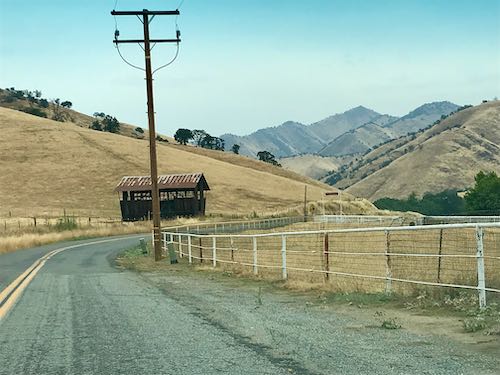
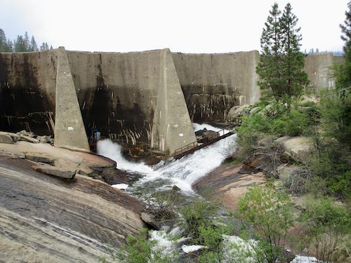
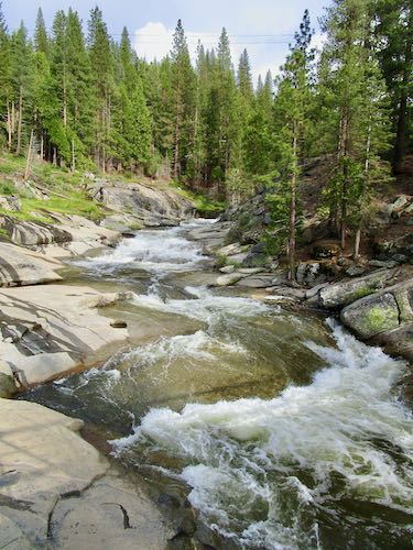
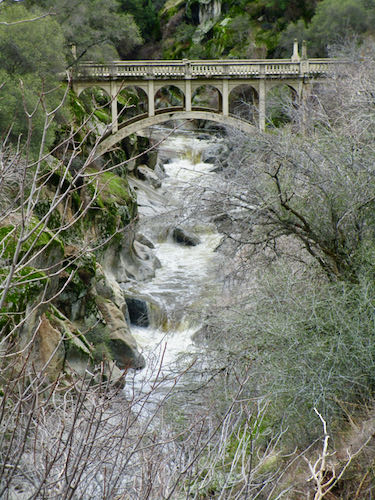
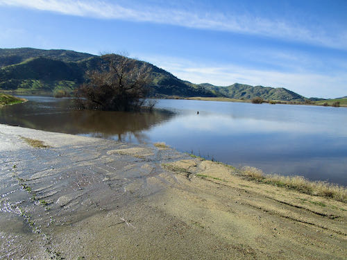
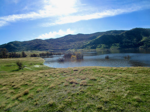
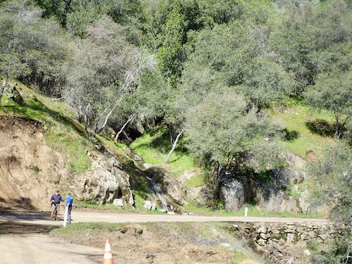
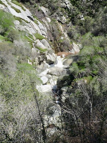
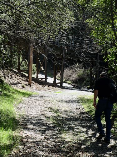
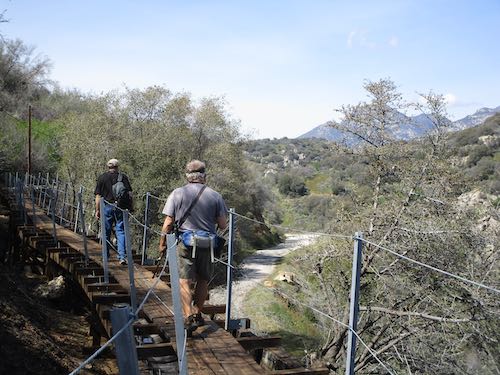
This walk was after it rained hard so the water is coming over the spillway in addition to the normal release pipes (channels? culverts? tubes?).

Every year I count on seeing wild iris around the lake. There were zillions in the meadow by the Princess campground, but no place to pull over and be a looky-loo.

We took a “back-stage” tour at Hume, where we got an in depth look at the inner workings. The place is self-contained like a city, with its own charter school (under Fresno Unified School District), auto shop, metal fabrication shop, sewage treatment, and fire department. They didn’t disclose the source of their water or discuss garbage, and I was a little short on time because I had to hustle down the hill to teach drawing lessons.

They showed us the ropes course, where apparently there are quite a few come-to-Jesus moments. (I already came to Jesus, so won’t be testing my faith on any of this stuff).

I learned that they bought their own coffee roasting equipment and in 9 months it paid for itself in savings. (I didn’t try any of their coffee because we were self-contained in my friend’s cabin). This is a photo of one of the dining halls. I was gobsmacked, since I served in the former building as the hostess of the dining room in 1978. That building burned down, and this huge elegant multipurpose structure has replaced the one I knew.

Besides walking the lake, there was a craft project. I observed and appreciated the results, but the method doesn’t work on Crocs, so I knitted instead.

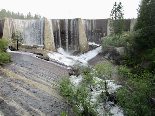
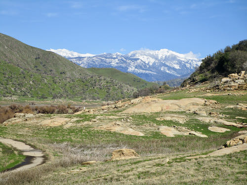
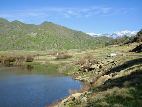
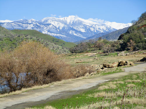
The morning I left, it was brilliant, just fabulously brilliant.

This is Ten-mile Creek from the bridge. The Google told me that Ten-mile road was the quickest way to Exeter, along with the same roads I used to get to Hume, but coming down 245 into Woodlake rather than Dry Creek. Such a beautiful drive, if one has air conditioning. Fernando’s A/C still works—thanks for your concern.

If you came here for Mineral King news and are disappointed, you can check the Mineral King website to see if anything new has been posted.


Fascinating and Ugly

If you receive these posts in email and the pictures in the post don’t show for you, tap here janabotkin.net. It will take you to the blog on the internet.

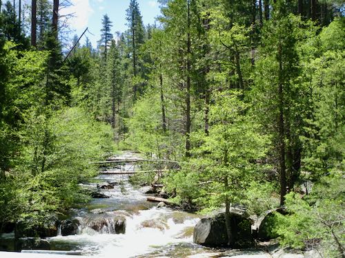
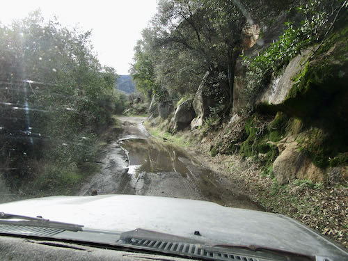
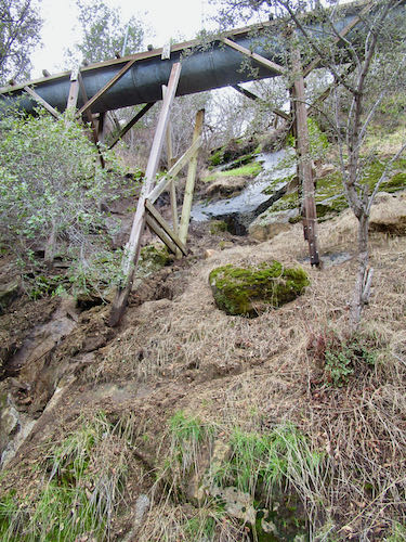
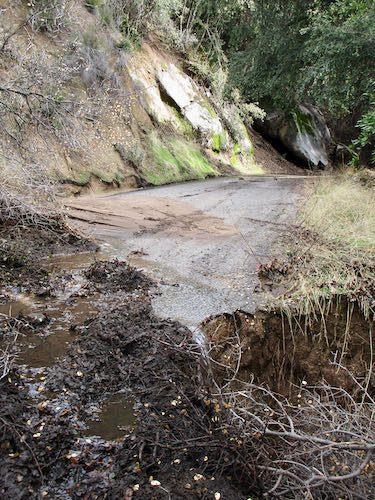
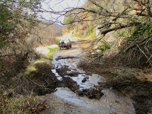
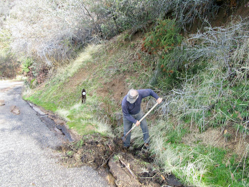
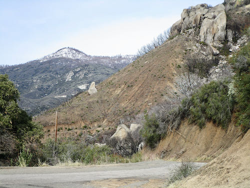
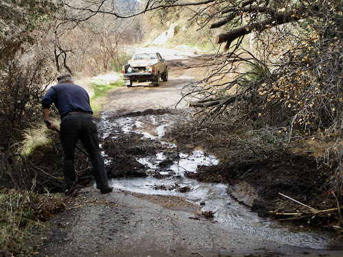
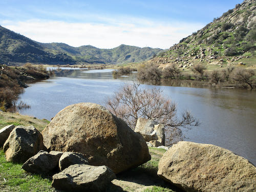
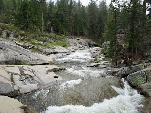
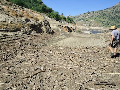
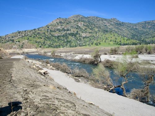
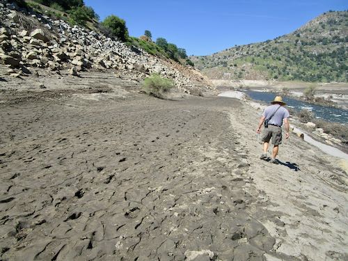
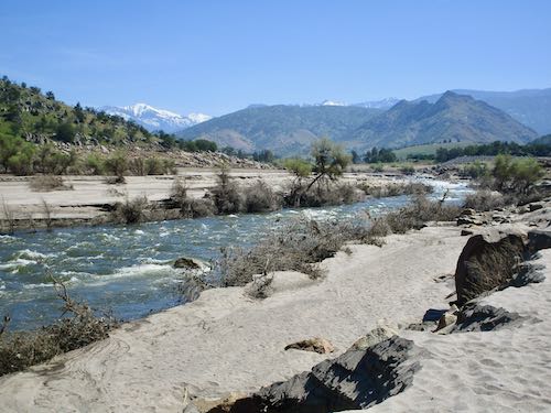
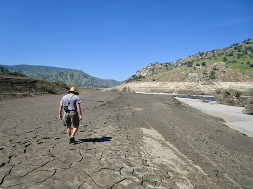
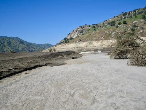
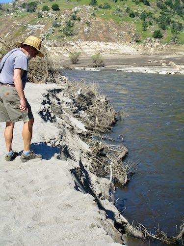
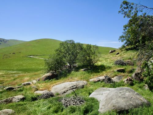
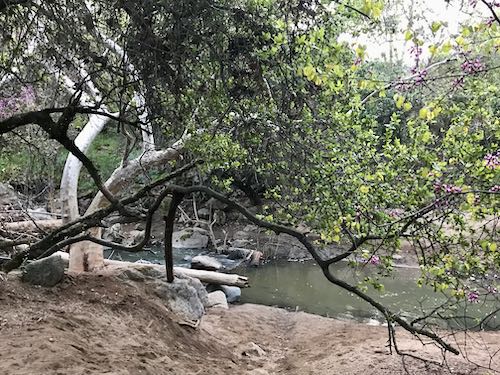
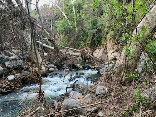
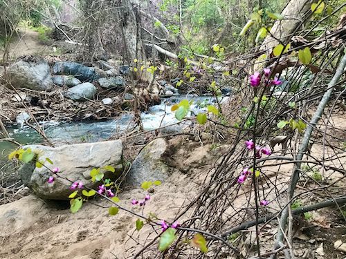
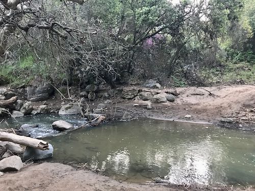
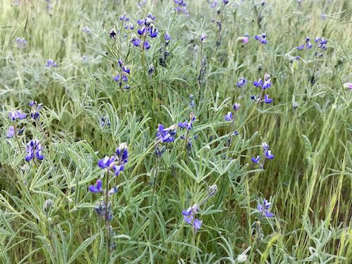
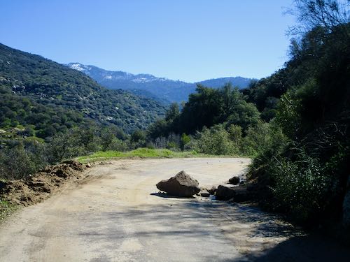
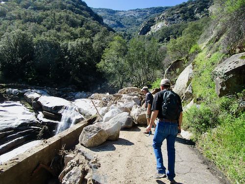
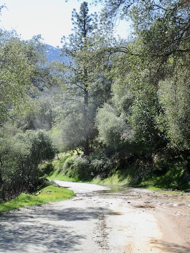
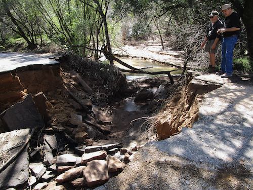
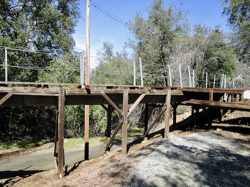
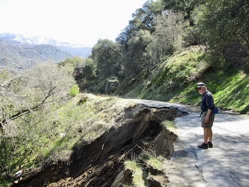
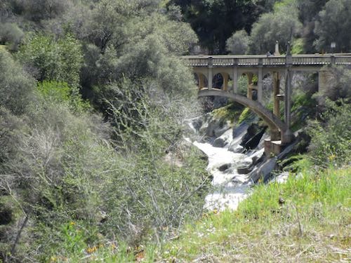
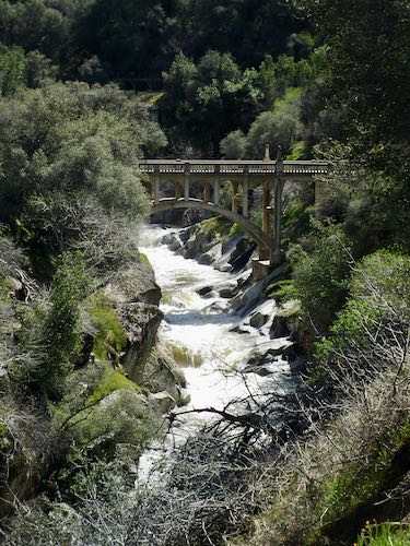
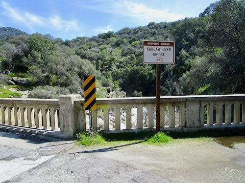
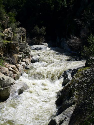
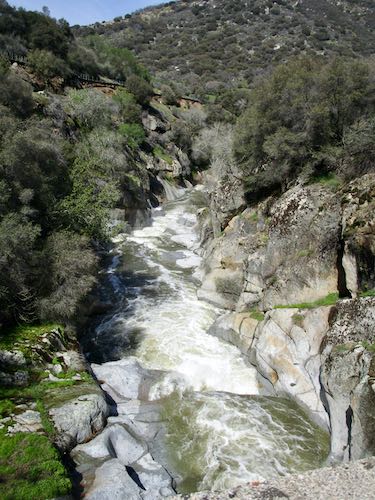
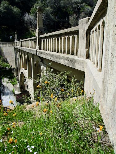
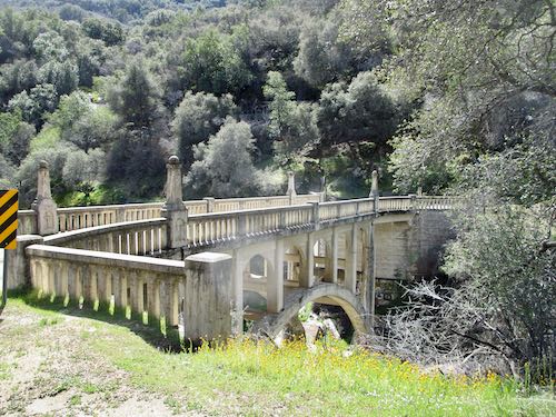
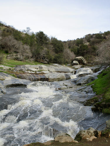
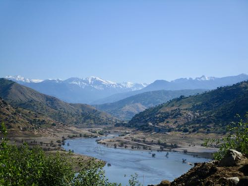
You may recall that there was some serious rain this winter in Three Rivers. I was fascinated by all the rushing water and posted a few times about it in March. March 11, March 12, and  March 13. (Probably posted in January and February too, but who wants to chase down all those links?)

One result of that enormous amount of water is that Kaweah Lake filled up very quickly. Now, the Army Corps of Engineers is letting water out as fast as possible to make room for the large amount of anticipated snowmelt. This means we can now walk down at the lake bottom again, and wow, is it ever fascinating and ugly.

Looking upstream from the Slick Rock parking area; Alta Peak is visible with snow on it and Blossom Peak has three points on the far right.

Normally when the lake is this low, this gate is open and we drive farther down. Not this time.

There’s a culvert beneath our feet here. It had to be roaring through to create this canyon.

The water is still flowing through the culvert; that is Highway 198 above.

Somebody was here when the mud was still squishy.

Driftwood galore.

So many layers of different types of dirt: silt, fine sand, coarse sand, all so thick.

It started getting a little squishy.

Look how deep this stuff is!

Too bad backhoes and trucks can’t come get this for fill on all the washed out roads, for future sandbags, and just to allow the lake to hold more water. But this is owned by the government, which isn’t exactly known for practical thinking or helpful practices.

Weirdly fascinating, definitely ugly. Life in Three Rivers can be so varied and interesting; if one must live in Tulare County, I vote for Three Rivers (although Exeter is an awfully nice town if you like town living, I dearly loved living in Lemon Cove, and Springville is quite beautiful in springtime.)

Tomorrow we will wash our eyes out with some wildflowers.

A post about walking on the lake bottom in March of 2020 is here. . . scroll down for the lake pictures.

Lunch on Rocky Hill

If you receive these posts in email and the pictures in the post don’t show for you, tap here janabotkin.net. It will take you to the blog on the internet.

Rocky Hill is private land, in the hands of several people. One of those people is a friend, and she arranged for us to go to the very top. I had asked her if we could have permission to climb it with The Farmer and Hiking Buddy, and she said she has access to the top and can take people, and yes, she would love to take us up. Then Tulare County had a flood.

After things settled down from the flood, we learned of a tour to see the pictographs on Rocky Hill. Our friend was part of the tour, and she suggested that we go to the top for lunch after the tour. You betcha!

Get this: there is a paved road to the very top of this big rocky hill, and by “big” I mean 5 miles in circumference and 3 miles in diameter (not sure where that got measured). Friend has a key, of course, and we loaded up chairs, a table, lunch, and ourselves, and headed up. And up. And up some more. 2.4 miles, specifically.

Friend had laughed to herself when I asked if we could climb it. She later told me she wasn’t having any part of climbing but was happy to drive up with us. 

It was so very very perfect. Very very very perfect. A perfect way to spend the afternoon. Perfection.

Shut up, Central California Artist and show some photographs!

At the base—the hill sloping into the frame on the right is Rocky Hill.

That blue line is the Friant-Kern Canal. The wildflowers are mustard.

This is looking west.

And this is the unparalleled view of the Sierra. (Lots of people say “the sierras”, but it is the Sierra Nevada Mountains; thus “the Sierra” is the correct shortened term. You’re welcome. P.S. My dad taught me that.)

The tiny blue piece of water is actually called “Hamilton Lake”, and only appears in wet years.

The creek in the distance is Yokohl Creek, which did some real damage during the flood. People used to be able to remove sand from beneath the bridge, but some other people made them stop (for very petty reasons). Since then, the sand has piled deeper beneath the bridge and as a result, the creek flows very close to the underside of the bridge, which means debris builds up quickly during high water and then the water finds its way around the bridge, washing out the approach. Water always finds its way. (Ever heard of “unintended consequences”?) 

The cattle were curious, as cattle can be. (Remember this? – scroll down to see)

Friend provided an excellent picnic lunch, so very generous, oh so good.

Through this tree is a black cow fixin’ to deliver a calf soon.

This was the only larkspur we saw.

What a perfect day! Thank you, Friend, for sharing your beautiful piece of Exeter and your heritage with us (and lunch!)


A Day on Rocky Hill

If you receive these posts in email and the pictures in the post don’t show for you, tap here janabotkin.net. It will take you to the blog on the internet.

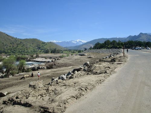
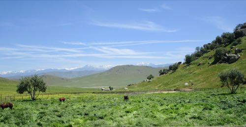
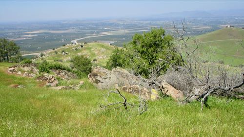
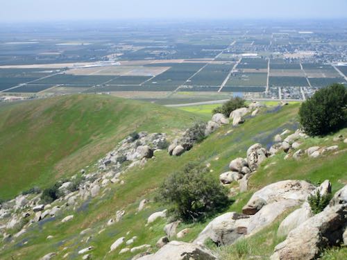
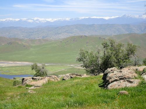
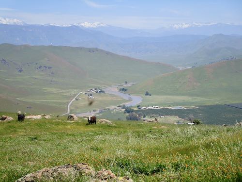
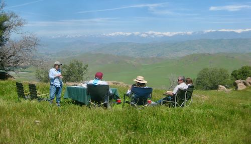
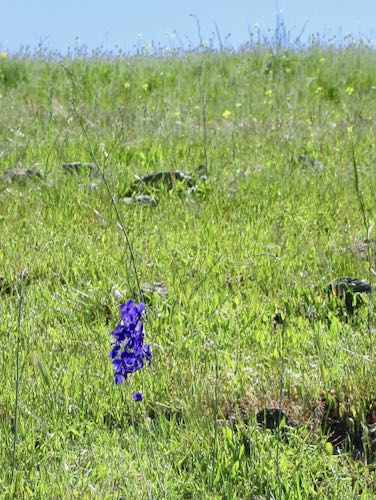
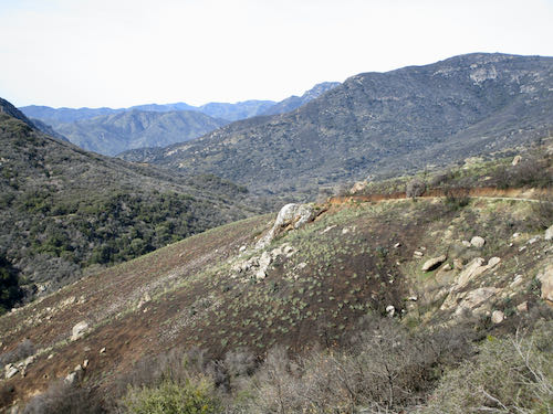
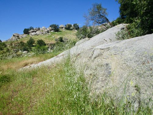
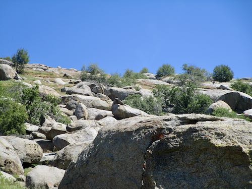
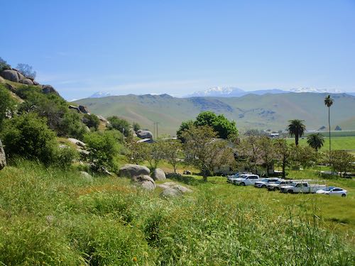
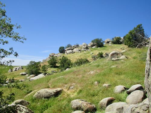
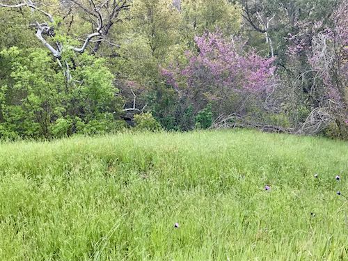
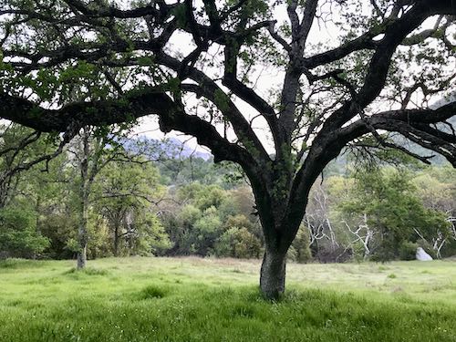
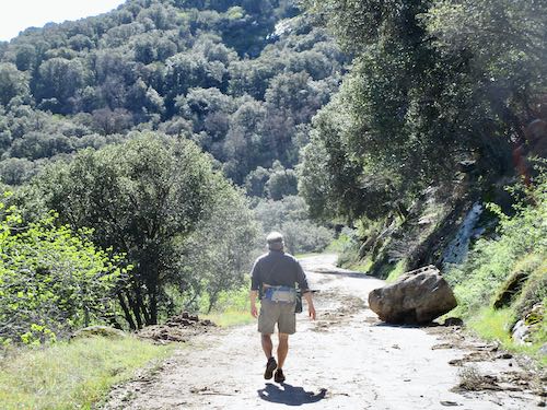
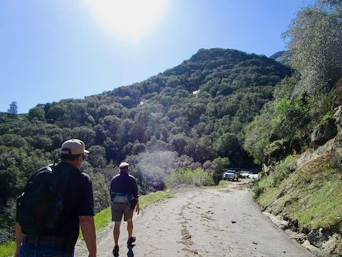
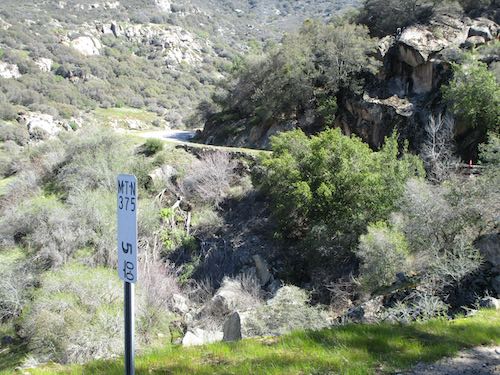
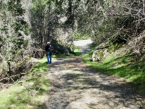
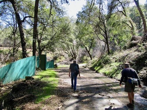
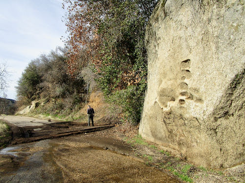
Rocky Hill is on the edge of Exeter, California, in Tulare County, a well-known, well-loved landmark. It is the only convenient non-flat place to walk, run, or bikeride in the area, and there is a perpetual stream of foot and bicycle traffic up the road. The entire hill is private property, so all the activity takes place on the county road that goes over the saddle between Badger Hill and Rocky Hill.

Rocky Hill has many many Indian pictographs (and lest you get your knickers in a twist about “Indians”, the Native Americans I know prefer to be referred to as “Indians”). On the south side of the hill, 30 acres belong to a conservancy, and occasionally there are tours to view the pictographs. We had the privilege of participating in a tour on last Thursday.

Alas, it is forbidden to post photos of the pictographs on the interwebs. So, you get to see some scenery instead.

Rocky Hill is very rocky. It could be called Boulder Hill.

These are not pictographs; they are mortars, so I am showing you. (so there)

This is the fruit of a wild cucumber. The seeds provided the binders for the pigment used to paint on the rocks.

Lichen isn’t paintings so I photographed it.

Clover. I love wildflowers.(Did you know that?)

Boulders.

The view of Moses Mountain distracted me from the paintings.

The Farmer and Trail Guy were good listeners. Or maybe they were wondering when we could go eat lunch. We are not used to traveling in a pack or being told to stay together. Hiking Buddy was there too, along with other people we know and a few we did not.

I liked this view out from one of the caves we entered.

And then it was time for lunch, which was a private party that I’ll tell you about tomorrow.


Early Morning Walk in Three Rivers

If you receive these posts in email and the pictures in the post don’t show for you, tap here janabotkin.net. It will take you to the blog on the internet.

This stunningly beautiful spring in Three Rivers isn’t over yet. We’ve had no hot days, and although it might have been warm enough one day for the rattlesnakes to emerge, I haven’t seen any or heard any reports. So, instead of blathering on about using pencils, oil paint and murals to make art that you can understand of places and things you love for prices that won’t scare you, let’s go on another walk. (See how I did that?)

This is BLM (Bureau of Land Management) property about a mile above my house. Because the two footbridges washed out, there isn’t much traffic up there, which makes it the way I remember it before people started slapping it all over the interwebs and turning it into a popular place. (Mine, mine, all mine!)

Back along the road, the brodiaea were thick. These are also called “wild hyacinth” and “blue dicks”.

These are a miniature version of lupine. They look like Texas bluebonnets which are just a variety of lupine.

This one is in my yard: fiesta flower.

A resident of Tulare County might wonder why one remains here, with all the smog, “nothing to do”, high unemployment, high welfare, low education, fat people, high teen pregnancy, lack of a Trader Joe’s. However, if one is in Three Rivers in the spring after a wet winter, one might wonder why more people don’t live here.

Don’t move here, okay? You will hate it, especially in the summer. On the other hand, if you buy a house here, please do move here because there are more than enough vacation rentals in town.

Now, I might need to go pull some weeds.

Walk on the Mineral King Road

If you receive these posts in email and the pictures in the post don’t show for you, tap here janabotkin.net. It will take you to the blog on the internet.

This is your photojournalist reporting in from an excursion taken today, Saturday, March 18, 2023. Trail Guy, The Farmer, and I drove about 4 miles up the Mineral King road, then continued on foot. There will be many many photos (I took 92 but will only show you 47—you are welcome), and a little explanation or commentary.

The Road Closed sign is barely visible here below Mile 4.

A friend was doing a similar excursion and began the same time we did. Trail Guy advised him to climb up to the flume for easier walking, because his destination was farther up the road than ours.

Common sight.

Ho-hum, another big rock.

Mud, road a little bit gone.

And yet another rock.

And another chunk gone.

Wait, are you telling me we could have driven another 1/2 mile up?? Apparently so.

Whoa. This is the big washout. I bet Mineral King folks will forever refer to this as Washout Corner, or Washout Canyon.

We had a little bit of boulder scrambling to do.

Then some water to cross.

Looking back at the mess.

About 1/2 mile farther up from the mess.

Standard mud-on-road.

Oh-oh. Are we finished? The road certainly is. This is at Skyhook.

Nope, we are not done. The Farmer scrambled up the bank to the flume, pronounced it doable, and we followed. 

Our friend caught up with us on the flume, and we pulled aside to let him pass because he was on a mission to check on a man who lives farther up the road. We were just ogling, on a mission to see things.

We climbed down.

And headed down a paved road to the real road…

…only to discover we were on the uphill side of Skyhook. The flow went right through the center of the property.

I want to go to the bridge.

In the days before the flood, this would have been considered a disaster. Now, it’s merely another blip on the screen of the Winter of Water.

Bear Canyon survived. It appears to be abandoned, so even if it got washed away, no one would care. (what a waste)

Another muddy section.

And yet another one. I waded through this one in barefeet. 

By the time I got to this muddy mess, I just walked through in my trusty hiking Crocs.

Such a beautiful flow of water in this canyon after too many dry years.

MY FAVORITE BRIDGE IS FINE!!

Rocks, mud, no big deal.

Happy Centennial, Oak Grove Bridge!

Looking upstream.

Looking downstream.

Just looking.

And looking.

Time to turn around and head back to the pick-em-up truck. 

Whoa. Is this a new disaster waiting to happen to the flume just below the bridge? Or are we seeing with new eyes, filtered for impending doom?

Here’s the abandoned Bear Canyon.

Climbing up to the flume just above Skyhook.

I really like walking the flume. Not supposed to do it.

Our friend told us that the flume had blown apart or been smashed by a tree, so he had to do some scrambling and crawling. We got to this yellow tape, and climbed down the steps to the access road.

This is the access road onto the flume, opposite the very wide spot in the road below the bridge.

We walked back without incident, happy to be alive, thankful for rain, thankful to be able to walk 5 miles, thankful for springtime, thankful for friendship, just thankful.

And looking forward to seeing repairs by the Tulare County Roads Department. But I bet the people at Skyhook and those on above are looking forward to that road work even more than we are.

Thanks for coming with me on this tour. Batten the hatches, because there is another storm coming our way tomorrow.

Chasing the Water on the Mineral King Road

Yesterday we turned around at Lookout Point after walking up the steepest section of the Mineral King Road, and headed back downhill. 

Trail Guy, formerly known as Road Guy, explained that the old road above sloughed off and caused the disturbance that stopped our forward progress. This spot is ABOVE the gate and BELOW Lookout Point.

While he was puttering in the water and mud, I photographed these bay leaves. Too bad we can’t do scratch-and-sniff here.

This weird boulder with its odd indentations is just below where we stopped driving. AGAIN: Above the gate and below Lookout.

I walked down to White Rock, formerly known as Bird Poop Rock, which I explained at the beginning of this post.

Still ABOVE the gate and BELOW Lookout.

We encountered some folks along the way back, and while the dudes were shooting the breeze, I photographed this tree with peculiar bark clusters. (I have no idea. . .)

Ahead is a typical slump of a saturated bank, and beyond that are “the potholes”. This is BELOW the gate.

This is Squirrel Creek, AKA “The Potholes” in this location; it has big holes in the slippery rock face, normally visible and very enticing to folks driving down the hill. Fantastic water flow!

This section of road could be a bit of a problem for a HumVee or other wide vehicle. The county road department certainly has its work cut out for next few weeks (months?). This is BELOW the potholes.
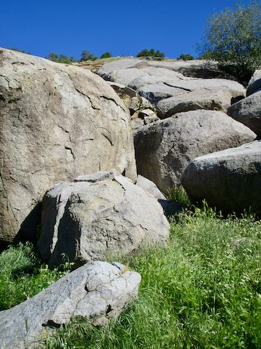
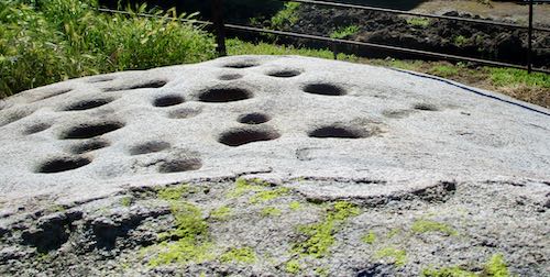
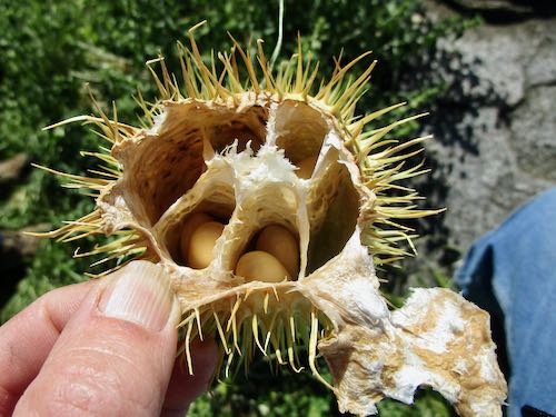
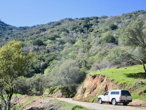
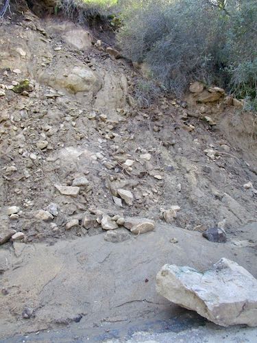
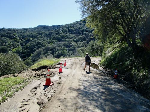
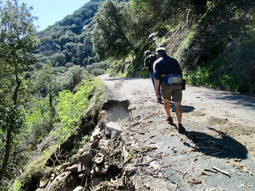
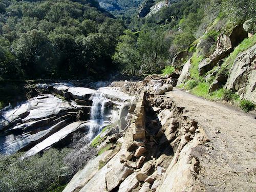
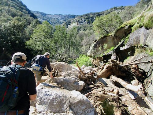
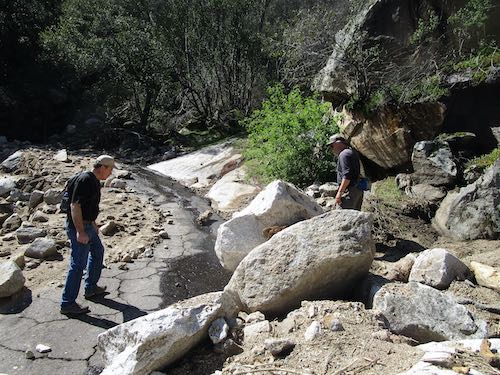
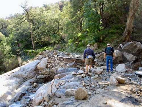
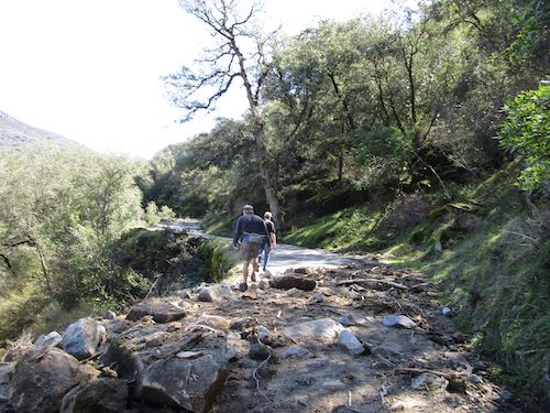
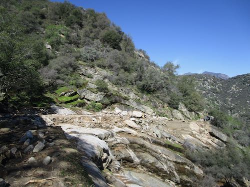
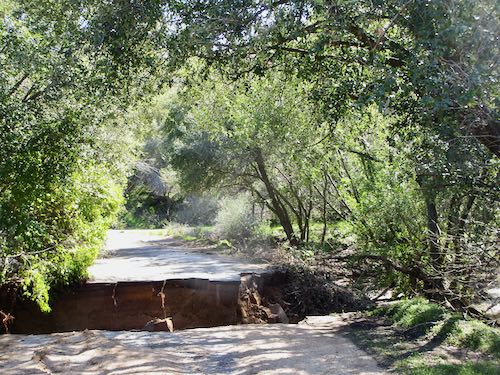
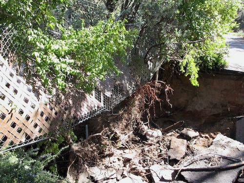
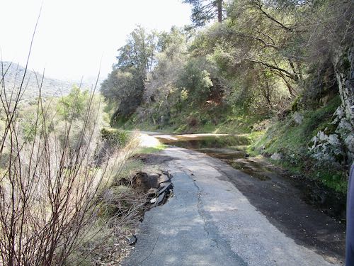
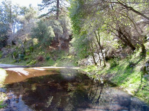
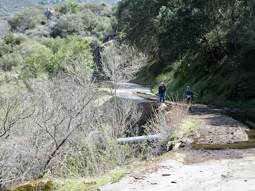
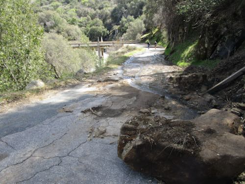
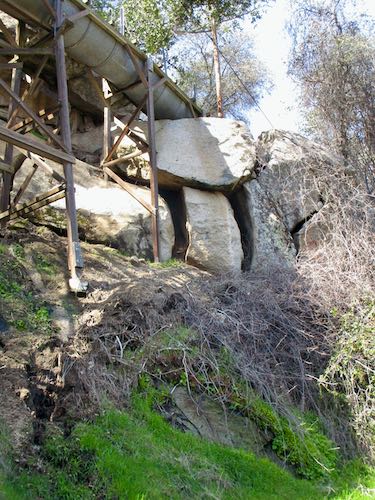
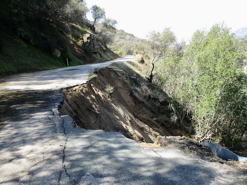
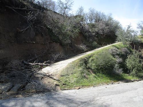
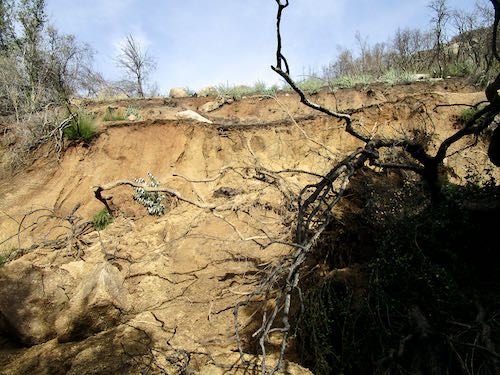
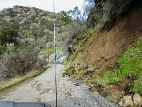
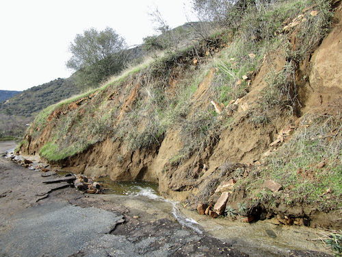
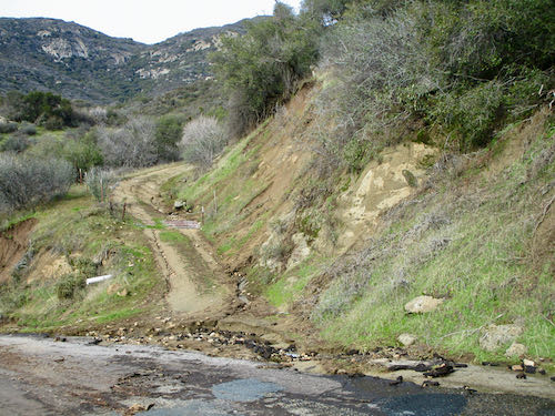
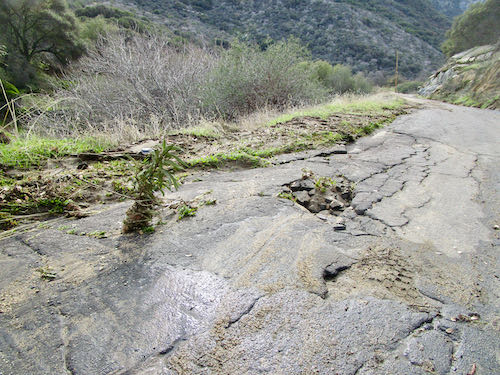
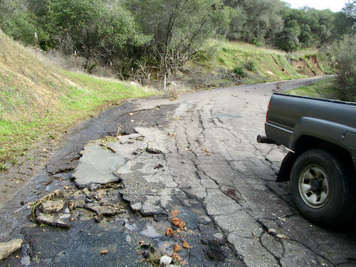
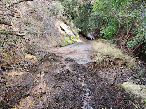
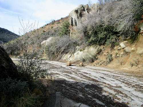
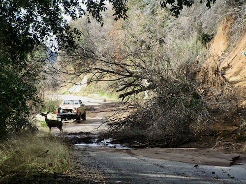
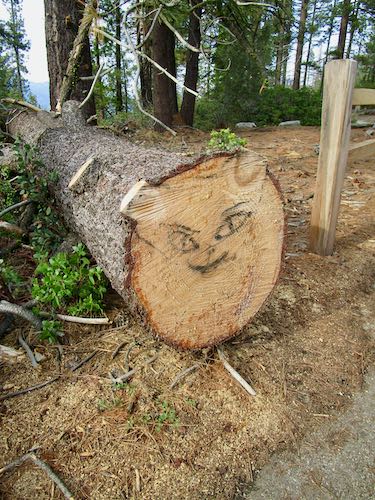
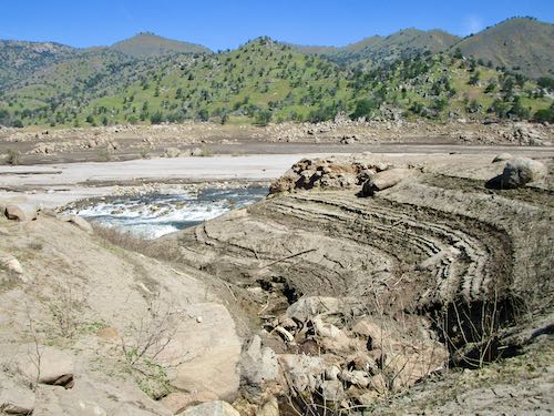
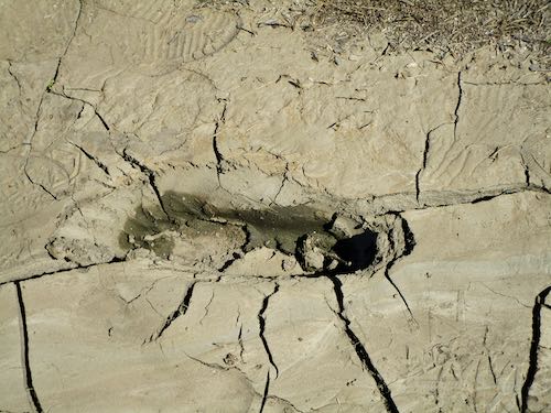
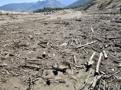
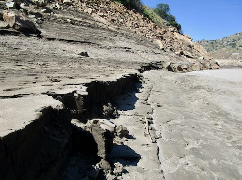
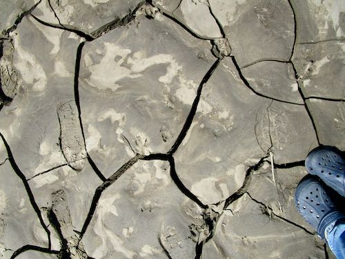
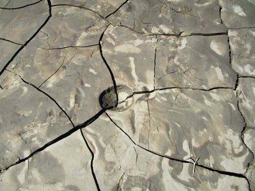
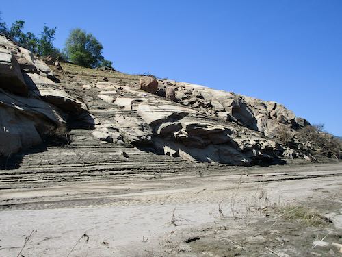
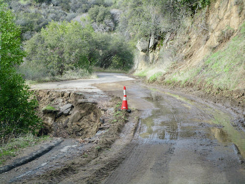
Here is another mess. Also below the potholes.

Look at what is happening along the gutter side of the road. I wanted to get out and play in the water, but we’d been gone long enough. 

All the rest of these photos are below the potholes above the Oak Grove Bridge

These folks will have some difficulty accessing their driveway for awhile. It isn’t a primary residence, the owners live far away, and I doubt if they will be too troubled or even know about it. “Whose drive this is, I think I know; his house is in the city though. He will not see us stopping here to watch his drive slide down the road.” (With apologies to Robert Frost)

What is going on here? That plant is shooting up out of the pavement. And so much for last summer’s pothole patching efforts.

Messy, messy, messy.

Let’s conclude this weird little road trip with a look at my favorite bridge. It has been quite a few years since I have been able to see the water because of all the growth obstructing the view. 

Thank you for joining us on this tour. Maybe next week I’ll get some work done and show it to you.

FOR CLARIFICATION: WE DID THIS LITTLE ROAD TRIP THE DAY BEFORE THE PARK ISSUED THEIR ROAD CLOSED DECREE.

One of the Mineral King webcams is working again: mkwebcam.

Chasing the Water in Three Rivers

We knew that the Mineral King road was closed, because it is always closed in the winter. However, we were curious as to how it fared in last week’s fierce storms. 

There were many places where mud had slumped down off the bank, but nothing photo worthy or a problem to a slow driver on an almost empty road.

Looks as if the flume needs a bit of work, just below the Oak Grove Bridge.

We crossed the bridge, went through the first gate (about 9 miles up the road), and then a mile or two later, decided we didn’t need to go any farther.

I waded across while Trail Guy put on his boots.

We then walked up the road to Lookout Point. Trail Guy was Road Guy before retirement, and he couldn’t resist doing a bit of work along the way. I asked lots of questions, trying to understand how he determined what needed to be done, and what was too much trouble for a shovel and an iron rake.

The view of Sawtooth from Lookout was very reassuring to those of us who prefer winters with a good snowpack.

This little section below Lookout is the steepest stretch of the road. Being somewhat unmotivated and definitely out of shape, walking to Lookout Point felt like enough of a walk, so that’s where we turned back.

Things are so open, so barren after the 2021 fire. It is a treat to be there when it isn’t hot and the air is clear.

A visitor, but he didn’t hang around for an introduction.

That’s enough for today. I will continue our little road trip along the Mineral King road in search of water (damage) tomorrow.

UPDATE FOR CLARIFICATION: These photos are posted in a strange order. The first ones of road collapse are BELOW Lookout Point, but ABOVE the gate. We walked up to Lookout Point, photographed Sawtooth, walked back down. I took a few photos on the way back to the Botmobile, then more photos of Trail/Road Guy doing a bit of shoveling. 

ONE MORE THING: We went the day before the Park issued their ROAD CLOSED decree.

Chasing the Sun in Three Rivers

So far, we are having a most welcome wet winter in Three Rivers. This results in Trail Guy and I chasing the sun. In the past handful of winters, we could walk around on the lake bottom (Kaweah Lake, formed by Terminus Dam on the Kaweah River when I was about 4 or 5 years old).

This year, it is flooded. The dam was built for flood control, irrigation storage, and recreation. Right now the focus is on flood control. Before it was built, Visalia, about 30 miles west, flooded. The last big flood was 1955. (I wasn’t born, so I don’t remember.)

This is looking west, walking along the road that used to be the main way in and out of Three Rivers, until the dam was built.

Looks like our short walk ends here.

Looks nice and green, but most of the ground around the lakebed is thick with cockleburs. They love socks and frayed hems and gortex shoes.

Turning back, this is the view. That’s Alta Peak, also visible from home. Yeppers, that’s the peak with an elephant in profile, visible when there is snow.

Is this lake or river? How about both. It is where the river meets and becomes lake.

Here’s one last big view of Alta. Can you see the elephant? I showed you in this post back in January last year..

Tomorrow, we will chase the water (damage) in Three Rivers and up the Mineral King Road.